Radford Semele Neighbourhood Plan - Regulation 16 Submission
(1) Appendix 3 – Community Valued Views (RS6)
The views tabled below and, shown on Policy Map 6, have been compiled using the community feedback given at two village consultations and after lengthy consideration by the Steering Group. These views represent valued landscapes which the community consider worthy of maintaining in its present format.
|
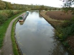
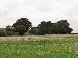
RS6/1 - View East from Canal Bridge When Entering Radford Semele From Leamington SP 33962 64930 005° to 065° View from this bridge provides a vista of the setting of the canal with fields on either side. The views change with the seasons and, on the left, lead up to the church. |
View RS6/1 |
|
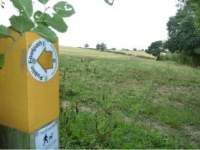
View RS6/2 |
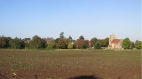
RS6/2 – View of Church and Church Fields from corner of A425/Offchurch Lane SP 34449 64565 293° to 333° View provides visitors with a sense of openness, important as so many people, whether on foot or in vehicles can enjoy the unique views of this key heritage asset. |
|
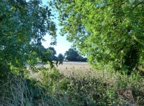
RS6/3 – View east looking from St Nicholas Graveyard SP 34335 64773 050° to 100° View provides a quiet tranquil setting for people visiting the graveyard. |
View RS6/3 |
|
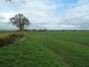
View RS6/4 |
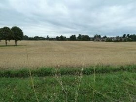
RS6/4 – View looking East from corner of Bovis Homes development SP 35010 64470 015° to 087° A high point giving a splendid vista of the Feldon landscape consisting of mainly rolling, open landscape across to parish boundary. |
|
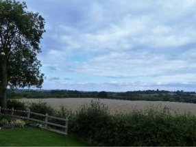
RS6/5 – View from footpath south of new Spring Lane Development SP 34282 64031 270° to 295° View of tranquil, open countryside towards the brook. with the Copse closer to the viewpoint. In Spring and Summer, birds of prey often bring up their young, giving spectacular displays to the many who use the footpath (W121) |
View RS6/5 |
|
View RS6/6 |
RS6/6 – View from Valley Woods looking South SP 34755 63658 085° to 175° Provides view of open countryside much loved for its walks, ecology, farmland and long-distance views, a contrast to the densely canopied woodland. The contrast between views across the seasons add to the richness of the views |
|
|
|
|
RS6/7 – view from Valley Road Looking south-east
SP 34289 63884 105' to 145' This view encompasses a tranquil meadow bounded by well-developed hedges with many mature oak, horse chestnut and other trees. Many benefit while using the popular walks around the outside of the field |
View RS 6/7 |
|
View RS 6/8 |
RS6/8 views from Crown Hill Trig Point.
SP 34877 62731 330' to 145' The Trig point on Crown Hill is the highest point in the parish. From this point 3600 views of the parish can be enjoyed. Three footpaths linking the Fosse with the village and farms meet at here. A sense of well-being is engendered by the panoramic views looking back towards the village.
|