Baginton and Bubbenhall Neighbourhood Plan
(3) 6.0 Bubbenhall
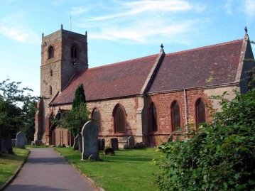
St Giles' Church
Early Historical Development
6.1 Among the main early village farms were Cross House
(now known as the Manor House) in the middle of the village
(opposite a small green, taken away about 1930), Yew Tree Farm,
the Home Farm (probably previously The Moat), Old House Farm, and
Church House Farm (probably the prebendal grange).
6.2 Parliamentary enclosure of the old open fields -
Grove Field and the Harps to the south east, Ludgate Field to the
north east and Cloud Field to the west took place in 1726 (which
was the second earliest in Warwickshire). The land was divided
among the different manorial tenants and two major new farms were
built with surrounding blocks of land belonging to them. These
were Wood Farm, built some time before 1809, and Waverley Wood
Farm, probably in embryonic form in 1809. Otherwise the old
centrally situated farm buildings were still in operation, but had
rationally organised blocks of land belonging to them; eg Yew Tree
Farm, belonging to William Paget, had land in Paget's Lane.
6.3 In the late 19th and early 20th centuries several
sales by auction took place, and farms and land changed hands.
This was an opportunity for tenant farmers to become owners of
land and farmhouses. With the breaking up of the Baginton Estate
in 1918 people were able to buy these houses and cottages for the
first time. At the same time the stability of leaseholds which
often passed from generation to generation in the old village
families ended.
6.4 In 1629 there were a fulling mill and a water mill
for corn at Bubbenhall and by 1698 there were two rye mills and a
wheat mill. The mill belonged to the Lord of the Manor, the
Bromley family of Baginton, from the early 18th century until the
manorial estate was broken up and sold in 1918. The mill house was
an old half-timbered building with extensive outbuildings, mill
dam and sluice, which lay on the other side of the field beyond
the churchyard. It burnt down in the winter of 1965-6, after
which, in 1966-67, a Coventry builder used the site to build a new
house for himself.
6.5 In the 18th century charity schools were
established at Stoneleigh and Cubbington, with some places for
Bubbenhall children. In the early 19th century the school which
was established at Baginton also took Bubbenhall children.
However, less than half of the 70 to 80 school age children of
Bubbenhall were able to go to school in the 1860s. In 1864 the
Rector managed to establish a village school in Bubbenhall, which
continued until it was closed down by the local authority in 1999.
6.6 Around 1876 a building was erected next to the
Parish Pound (which was for impounding stray animals). It started
as a private house, but in 1882 was established as the Reading
Room with money from a bazaar, public subscription, and a cheque
from the former rector, the Rev. Arthur Fanshawe (1863-77).
Thereafter it was used for many purposes, including as a library,
a meeting place for the Women's Institute, a doctor's surgery, and
a place to hold jumble sales.
Bubbenhall Today
The Three Horseshoes Public House
6.7 Today Bubbenhall is a small to medium sized village
with a population of around 600, located off the main road (A445)
from Leamington Spa to Ryton on Dunsmore. It is 5 miles south-east
of Coventry and 5 miles north-north-east of Royal Leamington Spa.
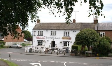
6.8 The village has several businesses, including two
public houses, one with overnight accommodation, a gardening
contractor, a bed and breakfast, a holiday let, a day nursery and
computer services. Bubbenhall quarry, on the eastern perimeter of
the village and operated by Smith's Concrete has been active since
1979. Its operating license has been extended to permit the
processing of sand and gravel from a new quarry at Wolston, off
the A45. The village hall is well booked for clubs and activities
and the recreation ground has play equipment for ages ranging from
toddlers to teenagers, a football pitch and tennis and basketball
courts. There is a local bee keeper, and privately owned
allotments are used by villagers.
6.9 A good number of historic buildings remain. The
Parish Church of St Giles dates mainly 13th and 14th centuries but
the chapel was established some time before 1153. There are six
bells in the medieval clock tower and inside the church are two
"green men", dating from the 13th century, a Norman font, and
stained glass by Kempe.
6.10 The village layout is based around a medieval
pattern, with a row of cottages and farmhouses, each with a croft
or close, extending from opposite the Spring (or "the Spout") down
to the bottom of the village. Above the Spring was the Green,
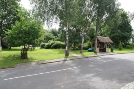
which was enclosed and ploughed up during the Second World War.
The village green was renovated in 2006-9 under the auspices of a
local committee with the help of grants raised from WREN and other
charities. The water from the spout was augmented by a new
borehole and electronic pump, and a bus shelter made of local
recycled materials was erected.
6.11 In recent times Bubbenhall has been shaped by two
developments in the 1960s. The first was the designation of part
of the village as a conservation area. Conservation area status
has protected land mark buildings and the setting in which they
sit. The second is known as the 'Bryant' Development or the 'new
estate' which was begun in 1971. This development dramatically
increased the housing stock and the population of the village and
today offers homes that are popular with young families wanting to
move into the village. Where available other small areas of land
have been developed for housing within the village at Moat Close,
Darfield Court and Spring Court.
Planning Policies – Housing
Houses on Lower End
6.12 Bubbenhall is identified as a Limited Infill
Village washed over by the green belt, and the type and scale of
development are therefore limited. In line with national green
belt policy, appropriate development includes rural affordable
housing, limited infill development, the re- use of buildings;
the redevelopment or partial redevelopment of previously
developed land and replacement dwellings.
6.13 Sites within the growth villages and rural areas
in Warwick District are expected to provide at least 1146 new
houses (Policy DS10, Modifications).
6.14 The Warwick District Appendix 5: Summary of
Housing Needs Surveys and Key Findings November 201322
identified the following housing needs for the villages:
Bubbenhall - Need identified May 2010 - 6 homes (rent x5, shared ownership x1).
A new housing needs survey is in the process of being commissioned by Bubbenhall Parish Council.
6.15 People living in Bubbenhall recognise that it is
a great place to live and appreciate the special qualities that
village life brings. The green belt protects the village from
the risk of being merged with neighbouring villages and cities.
Also natural features such as ancient woodland to the south and
the River Avon flood plain to the north constrain opportunities
for new housing developments.
6.16 The rural setting of Bubbenhall has enabled a
sense of belonging and community spirit to evolve. These
important attributes to a community's well-being are so often
lost when villages are swallowed up or face rapid growth as part
of a large scale development.

6.17 Recent experiences that emerged from the last
housing needs survey have shown that there is a great deal of
local concern over the impact that new developments can have on
the special qualities that Bubbenhall offers. It is important
that the location of any new development takes account of the
existing infrastructure, including access roads, drainage, and
parking spaces.
6.18 A thoughtful and sensitive approach to housing
development is required to ensure that any new scheme is truly
integrated into the village and not seen as a 'bolt on' estate
that will always be on the fringes of village life.
Policy BUB1 New Housing in Bubbenhall
New housing in
Bubbenhall should contribute
towards providing a
mix of new homes to meet the needs of all sections of the community.
New housing will be limited to rural affordable
housing, limited infill development, the re-use of
buildings, the redevelopment or partial redevelopment of
previously developed land, self- build schemes and
replacement dwellings.
Whilst affordable housing for local people is a
priority, larger market housing may also be acceptable where
appropriate, and subject to other planning policies. Housing
which is designed to meet the needs of older people is
particularly welcome, such as single storey accommodation.
New development should be sited and designed
appropriately in line with Policy BUB2 below.
Planning Policies – Protecting and Enhancing Local
Heritage
6.19 The Warwick District Council advice
leaflet for Bubbenhall conservation area23 describes the listed
buildings, other heritage assets and character of the
conservation area, together with special views which should be
protected. The conservation area was designated in 1969 and
extended in 2001.
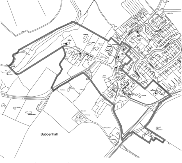
Map 8 Bubbenhall Conservation Area
Bubbenhall Parish Council (Licensee) License No. 100051733
Conservation Area Listed Buildings
The Old Reading Room from the Village Green
6.20 Listed buildings include St Giles Church and
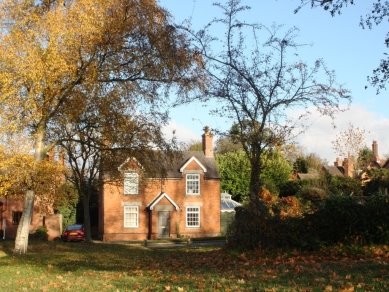
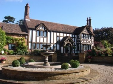
Church House on Church Road, Abbey's House and Yew Tree Farm
House and Malt Shovel Public House on Lower End, The Cottage on
Spring Hill and The Old Rectory on Ryton Road. There are pit
alignments to the north of the conservation area which are
scheduled monuments.
6.21 The character of the conservation area is the
historic core of the original village together with a series of
open spaces which link it together. The character is largely
determined by unlisted properties due to the relatively small
number of listed buildings. The road junctions also define the
character. Leading from the main road, the lane is lined by high
hedges which provide an important sense of enclosure, leading to
The Spout; this is an important junction which has been enhanced
by the Parish Council. At the junction with Lower End, further
enhancement has been carried out by the introduction of grass
verges. This junction is defined by the Manor House and Cottages
opposite and views into open countryside to the west. Important
boundaries to this area include the stone wall around The Manor
House, estate fencing to the fields and the front garden
boundary treatments to the houses on the south side.
6.22 Within Church Lane are a variety of 20th century
infill houses within their own grounds. The maintenance of
strong boundaries to these properties is important, together
with sympathetic surface treatments to access drives off Church
Lane.
6.23 The character of the conservation area is very
much a series of different spaces, the Spout, the junction of
Lower End and Spring Hill, Church Lane and the section of river
below the parish church. It is important that these areas are
maintained and enhanced. Important views include down Spring
Hill to the south, and across the junction with Lower End to the
open fields. Also significant are the views down Church Road and
across the river from the parish church to open
countryside. At the Church are significant views to the
countryside and river.
Significant views are therefore as follows:
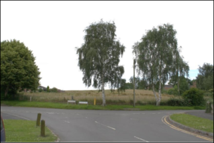
View 1. The Village Green and the triangle of
land formed by Pit Hill, Spring Hill and the A445
View 2. The view of open fields from the junction of Lower End, Spring Hill and Stoneleigh Road
View 3. The views across Church Fields
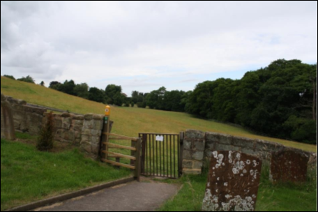
View 4. The views from Lower End across fields towards the River Avon
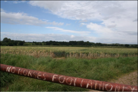
View 5. The views from Bubbenhall across open fields towards Ryton on Dunsmore
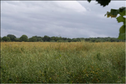
These are shown on Map 9 below.
Map 9 Bubbenhall Significant Views
Bubbenhall Parish Council (Licensee) License No. 100051733
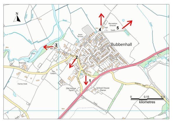
Key
→Key View
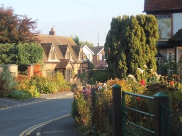
Conservation Area, Spring Hill
6.24 The older domestic buildings within Bubbenhall's
conservation area are constructed of brick, some with
half-timbered elevations, and with tiled roofs. There are
several Elizabethan cottages which have been extended, and an
early nineteenth century Rectory. Two cottages (1845) on Lower
End are built of the same brick as the village school, now a
privately run day nursery. Groups of nineteenth century
agricultural cottages on Spring Hill and Lower End have been
extended and modernised. Modern individual houses from the 1960s
through to the present day are interspersed with older
dwellings, and the planting of trees and grass verges serve to
blend the various generations of buildings.
6.25 The first section of the 'new estate' demarcated
by Cooper's Walk, Waggoner's and Home Close was built in the
early 1970s with a further phase of building (Orchard Way,
Cooper's Walk) from the late 1970s. The houses are built of
brick, and mainly two storied. The maturing of the trees and
gardens over the past 30-40 years has enhanced the estate.
6.26 Moat Close, an earlier development of council
built houses now largely owner occupied, consists of two storied
brick dwellings, together with some bungalows and terraced
houses.
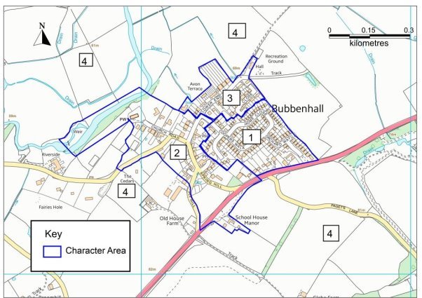
Character Areas
6.27 Several Character Areas have been identified in
the village of Bubbenhall and these are shown on Map 10.
These Character Areas are described in more detail below:
Area 1 - The 'New' Estate
Map 10 Bubbenhall Character Areas
Bubbenhall Parish Council (Licensee) License No. 100051733
Coopers Walk, Home Close, Orchard Way, and Leamington Road (part):
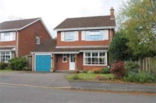
Coopers Walk
This housing estate was built in the 1970s and consists of
detached family homes in a variety of styles. The developer built
the homes on unproductive farm land that was available between the
Leamington Road (A445) road Lower End. it was the last major
housing development to take place in the village.
A curving feeder road serves the majority of the estate with two
cul de sacs branching off it. The single access point via Coopers
Walk keeps it free from excessive volumes of traffic. The
smaller part of the estate is accessed directly from the busy
Leamington Road (A445). in the main the roads have good paths.
The houses are brick built with slate roofs. Many houses on the
estate have been extended mainly to the rear of the property and
to the side where space allows. Carefully planned features such as
the diversity of building design, the open plan front gardens and
restrictions on fence/hedge heights have helped to create the
estates open and pleasant aspect.
Main design features:
Generous spacing between buildings
Open plan front gardens
Off road parking
A single point of access/exit to the main body of the estate
Grass verges at locations throughout the estate
Area 2 - The Conservation Area
Church Road, Leamington Road (part), Lower End (part), Pit Hill, Darfield Court, Spring Hill, Spring Court, Stoneleigh Road:
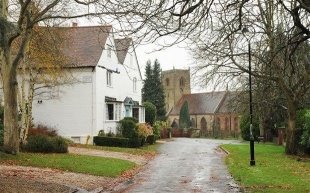
Church Road
This area forms the historic core of the village and was
designated as a conservation area in 1969 and extended in 2001.
The area contains residential buildings, two public houses, a
church and a number of these buildings are listed. There are open
spaces such as the village green along with fields which create a
link between the countryside and the village.
The roads in this area feed traffic into the village from the busy
Leamington Road (A445) via Pitt Hill and Spring Hill and from the
north west of the village via the Stoneleigh Road. The road width
reflects the age of the area and during peak times the volume and
speed of traffic can make it difficult for pedestrians to cross
safely. There are also three cul-de-sacs that branch of the main
thoroughfares. Not all roads have paths for pedestrians and those
that do the paths tend to be narrow.
As is normal for an area that developed over time there is a wide
diversity in architectural design. The general design
characteristic are brick/stone elevations with slate roofs with
some buildings having timber frames. Most houses have front doors
that open onto front gardens with brick/stone built walls marking
the boundary of the property.
The area is also populated with a number of mature trees and
hedgerows that provide a habitat for wildlife.
Main design features:
- Historic core of the village
- Listed buildings
- Buildings with interesting architectural features
- Open spaces that bring the countryside into the village
Area 3 - The 'Bottom' End
Moat Close and Lower End (part):
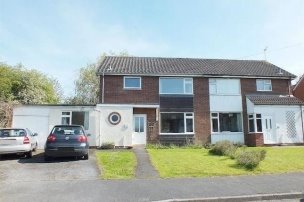
Moat Close
This residential area was mainly built in the 1960s however some
properties date back to an earlier period in the villages history.
Abbey's House for example dates back to the 1860s and is one of
the villages listed buildings. The Village Hall and playing fields
also can be found in this area.
The two roads are both 'dead ends' and the lack of off road
parking means that the road width is often restricted. Paths for
pedestrians exist although their width is variable. The capacity
of the drainage system to cope with additional properties has been
openly questioned by residents in this area.
There is a wide variety of architectural design with a listed
building, terraced houses, modern terraced housing and bungalows
all found in this area. The buildings have brick elevations with
slate roofs of varying pitches. The houses in Lower End have front
gardens with brick walls, fencing or hedges denoting the
properties boundary. Those in Moat Close have open front gardens.
Main design features:
- Listed building
- Variety of property types
- Lack of off road parking
Area 4 - Surrounding the Village
Leamington Road (part), Pagets Lane, Stoneleigh Road (part),
Weston Lane and Waverley Edge:
Weston Lane
Small clusters of residential properties can be found in areas
close to the main village within the Parish boundary. These
properties were mainly built in the 50s and 60s. They are set in
the countryside and have open fields and in some locations
woodland on their doorstep.
The roads are either busy through roads, cul-de-sacs or long dead
ends. Pagets Lane and parts of Stoneleigh Road are single track
and paths for pedestrians are few and far between. The hedgerows
and trees that border these two roads provide a habitat for
wildlife. The 'green tunnel' formed by trees over the Stoneleigh
Road is particularly attractive.
Properties vary in their size and design but the main
characteristic is the brick elevations with slate roofs. some
examples of timber framed construction can be seen. They have
front gardens with fences or hedging denoting the properties
boundary.
Main design features
- Countryside setting
- Hedgerows and trees on approach roads
6.28 New development in the village is likely to be
small scale and on infill sites, and include extensions to
existing properties. It is important that new development and
alterations respect the existing built form and respond positively
to local character.
Policy BUB2 Protecting and Enhancing Bubbenhall Village
New development within Bubbenhall, including small infill sites
and extensions to existing properties will be supported where
they are sited and designed sensitively to enhance the setting
of the conservation area and other parts of the village. New
development will be required to:
1. Beofasuitablescale,heightandmassingwhichrespondstothe builtformofsurroundingproperties.Propertiesshouldbesmall in scale and no more than 2 storeys inheight;
2. Useappropriatelocalmaterialsanddetailingappropriatetothe
localcharacterareawhereverpossible,suchastraditionalbrick,
local sand stone, tiled / slate roofs, timber frames, wooden
window frames anddoors;
3. Take into consideration the protected views
identified on Map 9 above. Theseare:
View1-ThevillagegreenandthetriangleoflandformedbyPit Hill, Spring Hill and theA445;
View 2 - The view across the open field from the junction of Lower End, Stoneleigh Road and SpringHill;
View 3 - ChurchFields;
View 4 - The view from the public footpath towards the river Avon;
View 5 - The view across open fields behind Orchard Way towards Ryton onDunsmore.
4. Include suitable landscaping and boundary
treatment which is appropriatetothecharacterofaruralWarwickshirevillageand
whichdoesnotintroduceunsuitableurban,andsuburbanforms
of treatment. Grass verges should be provided wherever possible;
5. Provide sufficient car parking for
residents andvisitors;
6. Street furniture, signage and lighting must be designed and
sited to enhance local character and distinctiveness.
Planning Policies - Protecting Local Services, Assets and Local
Amenities
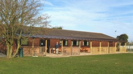
Bubbenhall Village Hall
6.29 The playing fields in Bubbenhall are owned by the
Parish Council and the land is designated as common land. In the
past the village hall was built on this site and subsequently
extended to improve the facility. The hall has a large central
room which can be used for meetings, functions and indoor
activities as required. The management committee that runs the
village hall have implemented a programme of refurbishment to
bring the hall up to modern day standards and user expectations.
Regrettably for economic reasons the Doctors Surgery and the Post
Office that used to be available from the village hall have
recently been closed.
6.30 The playing fields also contain numerous pieces of
play equipment for young people of all ages. The outdoor play
equipment consists of the traditional swings and slides as well as
a themed multi play unit for children. For young people aged 10+ a
multi-use games area, mini skate park and a shelter have recently
been installed. Future developments centred on the playing fields
could see the installation of a fitness trail and a wild flower
garden.
6.31 The village green is designated as common land. On
the edge of the green is the recently renovated water spout from
which spring water constantly runs.
6.32 Bubbenhall has also lost bus services in recent
times. These cut backs have resulted in a dependency on cars for
transport which in turn has led to the social isolation of young
people as well as the elderly.
Policy BUB3 Provision and Protection of Facilities and
Services
Developmentwhichcontributestowardstheimprovementofexisting
or provision of new community facilities and services such as
education, health or other
social provision will
be supported provided
that:
6.33 The playing fields in Bubbenhall are the centre
for most recreational activities within the village. The
facilities consist of a village hall that can be used for fitness
classes, an outdoor multi use games area, a mini skate park, a BMX
ride and open grass land that can be used for team games such as
football, cricket, rounders etc.
6.34 Outside the village the network of public
footpaths over land designated as green belt and the Ryton Pools
Country Park offer the opportunity for recreational walking for
people of all ages.
Policy BUB4 Sports and Recreation Facilities
Development which contributes to the provision of new sports
and recreation facilities will be supported provided that the
proposal:
A. Meets the needs of the current and future
population of all ages;
B. Is appropriate in terms of scale and design;and
C. Is accessible to
all.
22 http://www.warwickdc.gov.uk/downloads/file/2386/v10_-_summary_of_housing_needs_surveys_-_november_2013
23 http://www.warwickdc.gov.uk/downloads/download/151/conservation_advice_leaflets