Baginton and Bubbenhall Neighbourhood Plan
(12) 4.0 General Neighbourhood Development Plan Policies
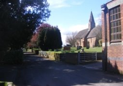
Church at Baginton
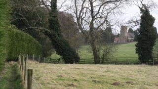
Church Fields, Bubbenhall
4.0.1 This section sets out the main planning issues and
planning policies of the Neighbourhood Development Plan for each
of the Parishes. These will be used to help determine planning
applications in the Parishes and so shape the future of the
Parishes as places to live and work in, and to visit. The Policies
have been prepared by the Steering Group on behalf of the Parish
Councils.
4.0.2 Neighbourhood Plans are required to be in general
conformity with extant (ie existing adopted) local planning
policies and to have regard to national planning policies. The
Policies have been prepared taking account of the National
Planning Policy Framework (NPPF) and planning policies in the
adopted Warwick District Local Plan 1996 – 2011 Saved Policies.
4.0.3 Further information about the relevant aspects of these
policies in relation to Baginton and Bubbenhall NDP can be found
in the published background document Planning Policy Assessment
and Evidence Base Review provided on the neighbourhood plan
websites:
http://www.baginton-village.org.uk/parish-council/80-neighbourhood-plan and
http://www.bubbenhall.info/nplan.php
.
4.1 General Policies - Natural Environment
4.1.1 The Warwickshire Landscape Guidelines14 divides Warwick
District into 4 broad character areas. The Baginton and Bubbenhall
Neighbourhood Plan area falls into Dunsmore character area. This
area includes an area to the north and east of Leamington and
includes much of the upper reaches of the River Leam valley. The
area extends as far north as Baginton and Bubbenhall, and south to
include Radford Semele. The Dunsmore landscape is characterised by
a range of historical and ecological associations which are
strongly influenced by the underlying geology of the region. The
widespread occurrence of glacial sands and gravels is reflected in
the strong association with common and heath. The Dunsmore
landscape has a well-wooded appearance characterised by mature
hedgerow oaks, ancient woodlands and historic parklands.
4.1.2 The Warwick, Coventry and Solihull Sub Regional Green
Infrastructure Strategy – November 201315 provides evidence for
plans and policies. Its recommendations include the following
proposals for enhancing local landscape character:
Hedgerows and Field Boundaries
- Enhance the structure of the landscape through replanting and regeneration of primary hedgerowboundaries.
- Reintroduce mixed native species hedgerows along primaryboundaries.
- Enhance the age structure of hedgerow tree cover, particularly hedgerowoaks.

Woodlands
- Conserve and enhance the biodiversity of Ancient Woodlandsand
- Identify opportunities for restoring Ancient Woodland on formersites.
- Identifyopportunitiesfornewtreeplanting,tostrengthenthesenseoflandscapecohesion andconnectivity.
Grasslands
- Conserve neutral grasslands and enhance speciesdiversity
- Maintain and restore areas of older permanent pasture, including ridge and furrow meadows.
- Conserve the ecological character of wetgrasslands.
- Identify opportunities for sensitive grassland management, to strengthen the sense of landscape cohesion andconnectivity.
Wetlands
- Maintain the special character and continuity of river and canalcorridors.
- Enhancetheunityandwetlandcharacterofrivervalleywetlands,throughhabitatcreation andmanagement.
Rural Character
- Maintain strong ruralcharacter.
- Conserve pastoralcharacter.
- Restrict and, where possible, reverse the sub-urbanisation of the landscape.
- Identify opportunities to strengthen 'local distinctiveness' and a 'sense of place'.
- Identify opportunities for new tree planting to soften the impact of buildings and 'grey'
4.1.3 Green Infrastructure provision and development should
strengthen landscape character, reflecting locally distinctive
natural and cultural landscape patterns, and integrating with
natural processes and systems and land-use change, contributing to
their long-term protection, conservation and enhanced management.
Policy G1 – Protecting and Enhancing Local Landscape
Character
Development proposals should include landscaping schemes which
aim to protect and enhance the distinctive rural landscape
character of Baginton and Bubbenhall. Schemes should support
the aims and objectives of the Princethorpe Woodlands Living
Landscape project where possible.
Landscaping schemes should be designed to incorporate the following landscape design principles wherever possible to ensure opportunities are maximised for supporting local biodiversity, and to ensure new development responds positively to this high quality local environment:
1. Species selection along woodland
edges should include native trees and shrubs and tree cover
should be enhanced on and
around development sites through the planting of new woodlands
and belts oftrees.
2. Existing parkland should be
retained and enhanced and where opportunities arise,
consideration should be given to restoring areas of formerpark.
3. Primary hedgelines should be conserved and enhanced by reintroducing mixed native species hedgerows along primary boundaries.
4. Tree cover within and around rural
settlements should be conserved and enhanced and large scale
woodland planting on rising ground isencouraged.
5. Schemes should protect and enhance the
internal open spaces and the irregular outline of villagesettlements.
6. The re-creation of riverside wetland
habitats isencouraged.
7. The sinuous hedgerows defining river
floodplains and the wooded character of river corridors should
be retained and enhanced.
Overall, landscaping schemes should be designed to maintain the strong rural character, conserve pastoral character, restrict and, where possible, reverse the sub-urbanisation of the landscape, and strengthen local distinctiveness and a sense of place.
4.1.4 There is a need to protect existing green infrastructure
within the boundary of the Plan area and to promote creation of
new green infrastructure if new development proposals come
forward. Multi-functional green infrastructure is important to
underpin the overall sustainability of a development by performing
a range of functions including flood risk management, the
provision of accessible green space, climate change adaptation and
supporting biodiversity. An example of a green infrastructure
provision is sustainable drainage systems. These can deliver
benefits for people and for wildlife and make a valuable
contribution to the local green infrastructure network. Actions
such as re-naturalising watercourses can also bring
multifunctional benefits, including benefiting flood attenuation.
Woodland planting can also help mitigate flooding. Proposals may
present opportunities to incorporate features such as roosting
opportunities for bats, the installation of bird nest boxes or the
use of native species in the landscape planting.
4.1.5 The Parishes include several areas of Ancient Woodland and a
Site of Special Scientific Interest (SSSI) as well as a number of
other important habitats such as the River Avon. There should be
continued protection and enhancement of this area to benefit local
residents, and provide for a healthy and diverse wildlife.
Bubbenhall Wood located between Pagets Lane and Weston Lane and
the previously quarried meadows off Pagets Lane are managed by the
Warwickshire Wildlife Trust (WWT). In particular, this is a site
where the Great Crested Newt, a protected European species can be
found. Some of the other wildlife and habitats found in our area
include Muntjac deer, fox and badgers, grass marshes and a wide
range of bird species.
Policy G2 – Protecting and Enhancing Local Biodiversity
Protecting and Enhancing Local Wildlife and Habitats
Any proposals for new development will be encouraged to
demonstrate how the design has taken into account its potential
impact on local habitats and species. The neighbourhood area
supports a range of protected and vulnerable species and new
development should have a positive impact on local wildlife and
habitats.
Developers will be encouraged to ensure that appropriate
measures are put in place to protect wildlife and enhance
biodiversity and important habitats. Appropriate measures may
include for instance use of swift bricks, bat and owl boxes, and
ensuring that new and converted buildings provide nesting and
roosting spaces for bats and birds. A mixture of native species
typical of this locality should be incorporated in landscaping
schemes including oak, hazel, birch, ash and holly.
Wildlife Corridors and Stepping Stones
Wildlife corridors and stepping stones are protected and
development which is likely to have an unacceptable adverse
impact on wildlife corridors (eg hedgerows,
woodland and streams) and stepping stones (eg unimproved meadows
and ponds) will not be permitted.
New development will be required to demonstrate measures which
support and enhance the wildlife value of the wider
countryside area, for example through the provision of ponds
or of hedges where these will link existing features together.
Green Belt
4.1.6 The preservation of Green Belt is of crucial concern to both
local communities. The recent Joint Green Belt Review has
highlighted several key Green Belt parcels, notably numbers 9
& 10 located to the south and west of Coventry which are
serving to check the sprawl of the city into the Warwickshire
countryside. This area is key to maintaining a natural boundary
between Coventry and towns to the south in the same way that the
Green Belt between Coventry and Solihull checks the sprawl of
Birmingham into Warwickshire.
4.1.7 In addition the new Local Plan proposes that Bubbenhall is
'washed over' by Green Belt and Baginton is 'inset' within the
Green Belt although in the adopted Local Plan both are washed
over. Both villages form part of a swathe of countryside between
Coventry to the north, Kenilworth to the west and Leamington Spa
to the south. Both villages, each with a conservation area and
green spaces within as well as on their perimeters act as natural
buffers against the encroachments of the towns and the city of
Coventry.
4.1.8 Changes to green belt boundaries, including the removal of
sites from the green belt, should only be undertaken as a last
resort and through the auspices of an appropriate Local Plan
review process.
Policy G3 Green Belt
Inappropriate development in the Green Belt in the Parishes
will not be permitted unless very special circumstances can be
demonstrated.
Appropriate proposals within, or conspicuous from the Green
Belt, must not be detrimental to the visual amenity of the
Green Belt, by virtue of their siting, materials or design.
4.2 General Policies - Managing Traffic and
ImprovingAccessibility
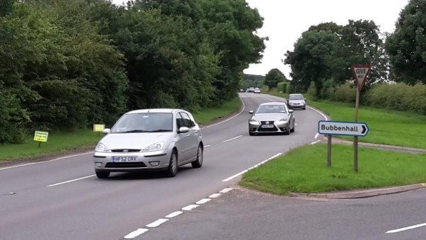
A445 Leamington Road, Bubbenhall
4.2.1 The intent of policies relating to traffic should be to
reduce the impact that new highways and developments have on
residential areas within each of the Parishes. Also, there is a
need to work with other agencies to manage the speed, weight and
frequency of vehicles especially HGVs travelling through
residential areas which is a major issue in Bubbenhall and
Baginton.
4.2.2 The Parish Plan for Baginton identified significant concerns
amongst residents about issues such as speeding, the numbers of
vehicles which are unsuitable for village roads and damage to
verges, curbs and footpaths etc. Current concerns include:
- Increased frequency of LGVs using rural unclassified roads and the consequences this has for road safety and damage to hedgerows, trees, roads and verges
- The speed of traffic travelling through villages and the risk of road traffic collisions
- Bubbenhall was recently classed a priority for speed checks by the Warwick Rural East Neighbourhood Team. This Police led initiative found a significant issue with speeding motor vehicles using Spring Hill Bubbenhall. A Community Speed Watch Team made up from volunteers from Bubbenhall village working in partnership with the Police has also been started. There is a plan to resurrect a similar team in Baginton. Bubbenhall residents have also been monitoring and reporting the frequency of LGVs using roads within the village. This information has been collated and is available.
- Highways England submitted detailed comments concerning local traffic issues for inclusion in the Plan at Regulation 14 consultation stage. These comments advised that Highways England recognises the potential impacts of development on the Parishes given the vicinity of A45 and A46 and works closely with applicants during the planning application stage to reduce the impacts of development. Highways England takes environmental impacts of development seriously and will work with applicants, such as the proposed Land at Oaklea Farm development, to identify the appropriate assessment and mitigation, where required.
4.2.5 The temporary traffic impacts from the Toll Bar End
improvement works are significant. This scheme is due to be
completed in early 2017 and this should a have major benefit for
the A45. Warwickshire County Council are responsible for
developing local highway strategies to reduce traffic levels.
Improvements to Binley Woods and Walsgrave junctions on the
Coventry Eastern Bypass are currently committed within Highways
England's Road Investment Strategy 1 (2015-2020). These will have
temporary and permanent implications for the A45 and A46. Public
consultation events will be held to discuss proposals.
Policy G4 Traffic Management and Transport Improvements
Proposals for improvements in road safety and traffic management
and the provision of or improvements to public transport will be
fully supported by the Neighbourhood Development Plan.
Developer contributions and Community Infrastructure Levy
payments will be sought towards the following within the two
Parishes:
1. Highway improvement schemes which improve
the safety of pedestrians and cycleusers.
2. Traffic calming measures, pedestrian
priority schemes and the reduction of traffic speeds on routes
through villagecentres
3. Increasing public and community transport
to and from the designated area to local towns, supermarkets etc
and supporting the school busservice.
4. Supporting safe new pedestrian and cycle
routes to / from Coventry,KenilworthandWarwicksuchasincreasingthewidth
of pedestrianfootpaths.
5. Provision of adequate public parking within
the villages, especially near to communityfacilities.
6. Any development should contain measures to
minimise traffic flows through thevillages.
4.3 General Policies - Commercial / industrial
development and employment
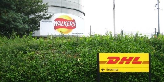
Two local businesses
4.3.1 There is a recognition that there is a need to support small
scale employment provision which is appropriate to the rural
character of the area, as part of promoting sustainable
communities and reducing the need to travel. The Baginton Parish
Plan identified widespread support for promoting existing heritage
related and other tourist attractions and support for improved
facilities to assist with homeworking opportunities.
Policy G5 Additional Business Premises and Employment
Opportunities
The development of new local employment opportunities will be
supported within Baginton and Bubbenhall providing that:
1. They maintain the surrounding residential
amenity;and
2. Open space or green infrastructure is not
lost;and
3. There are no severe impacts from traffic
and there is adequate provision of parking for employees and
visitors;and
4. Theyarelocatedwithinthesettlementboundaryofthevillages,
or comprise the redevelopment of or small scale expansion of
existingsites,orinvolvethesympatheticre-useofexistingrural
buildings;and
5. There are no adverse impacts on the
naturalenvironment.
Proposals for mixed use development which provide a mix of
office andbusinessaccommodationor"live/workunits"withinandinclose
proximitytoproposednewresidentialunitswillbesupported,subject
to the abovecriteria.
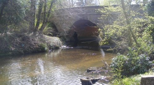
4.4 General Policies – Reducing Flood Risk
River Sowe, Baginton Bridge
4.4.1 At Regulation 14 consultation the Environment Agency advised
that the NDP should include a new policy to ensure that all
development is located outside the floodplains of the Rivers Sowe
and Avon. The area is at risk of flooding from the main rivers
Sowe and Avon and the surface water drains are at capacity in
Bubbenhall. There is a need to safeguard land from fluvial
flooding and the provision of sustainable management of surface
water from windfall sites. Up to date Environment Agency flood
maps can be viewed at: http://apps.environment-
agency.gov.uk/wiyby/37837.aspx.
4.4.2 New housing development is classified as a "more vulnerable"
use (see Planning Practice Guidance16) and is therefore considered
appropriate in flood zones 1, low or very low risk and flood zone
2, medium risk. Proposals in flood zone 3, high risk, and sites
over 1 ha would have to submit a Flood Risk Assessment with any
planning application which also includes a sequential test of
alternative sites in lesser flood zones. If following the
sequential test, it is not possible to locate the development
within a lower probability of flooding i.e. flood zone 1 or 2 then
the Exception Test should be applied. For the Exception Test to be
passed:
● it must be demonstrated that the development provides wider sustainability benefits to the community that outweigh flood risk, informed by a Strategic Flood Risk Assessment where one has been prepared; and
● a site-specific flood risk assessment must demonstrate that the development will be safe for its lifetime taking account of the vulnerability of its users, without increasing flood risk elsewhere, and, where possible, will reduce flood risk overall.
Both elements of the test will have to be passed for development
to be allocated or permitted.
4.4.3 The Environment Agency recommended measures to protect and
enhance the river corridors of River Sowe and River Avon which are
located in the NDP Area and these have also been included in new
Policy G7.
Policy G6 Managing Flood Risk
Floodmitigationmeasureswillberequiredtoprotectandenhancethe
river corridors of River Sowe and River Avon. Theseare:
- Setting back development 8m from watercourses to allow access for maintenance and restoring the natural floodplain; and
- Ensuring all SuDS features are located outside of the 1 in 100 year plus climate change flood extent;and
- Opening up culverted watercourses and removing unnecessary obstructions.
14 https://www.warwickshire.gov.uk/landscapeguidelines
15 http://www.warwickdc.gov.uk/downloads/file/2397/g03_-_warwick_coventry_and_solihull_sub_regional_green_infrastructure_strategy_-_november_2013
16 http://planningguidance.communities.gov.uk/blog/guidance/flood-risk-and-coastal-change/