Baginton and Bubbenhall Neighbourhood Plan
(10) 5.0 Baginton
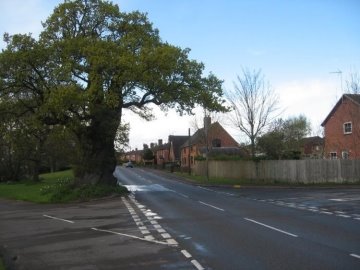
The Baginton Oak
Early historical development
5.1 There is an early record of the village in the
Domesday survey, which records Baginton under the name of
"Badechitone". Although there is an indirect reference in a grant
of land about 1150, the church is first mentioned specifically in
the reign of Henry II (1154-1189) as a chapel attached to the
church at Stoneleigh, when that church was given to Kenilworth
Priory.
5.2 Nothing of this chapel (or earlier buildings)
remains and the present building was built (or reconstructed) in
the 13th century. At that time the manor included 12 villeins and
12 freeholders; that is 24 families excluding the castle.
5.3 By 1730, there were 27 houses in the village, and 5
on the "waste" (or common). In the 19th century Baginton was
typical of many South Warwickshire villages and derived its income
mainly from agriculture. Baginton Hall was home to the
Bromley family which had included a former Speaker and
Secretary of State and hosted a visit by Queen Anne.
5.4 Lucy Price was the last of the Bromleys and her
death in 1822 meant that continuity came to an end. However, the
Hall continued with to a succession of tenants. These included the
younger brother of the Prime Minister Robert Peel. The brother and
members of his family are buried in the churchyard.
5.5 In 1889 Baginton Hall was destroyed by an enormous
fire. Thus, by the end of the century the Hall had gone and with
it the focal point of the community. The village had also lost
what had once been its main employer. Only the Church and Corn
Mill remained to give evidence of what was a distinguished and
ancient community. To replace it, the only significant new
building that took place during the century was the School Hall
(now the old School House) built in 1873 and the Row built for
Agricultural Labourers in 1877.
5.6 With the hall ceasing as a major employer and with
the growing industrialisation of Coventry where wages tended to be
higher, it is unsurprising that over the course of the century the
population declined from 300 at the time of the first census in
1801 to just 174 people 100 years later.
5.7 The sale of the Bromley estate in the 1920s led to
much of the land being bought up by property developers and
ensured that a steady supply of new housing came on the market
over the remainder of the century. In addition, it provided
employment in building, quarrying and industrial development.
5.8 During the second half of the century Baginton
started to lose many of the services that were fast disappearing
from most small rural communities. The school closed in 1976. The
last rector at Baginton Church left in 1960 and the village
policeman left soon after. Baginton currently continues as a
community proud of its past and secure in its future. It has
ceased to be the isolated rural community of former centuries but
it has remained an identifiable community and looks set to remain
so in the 21st century.
Baginton Today
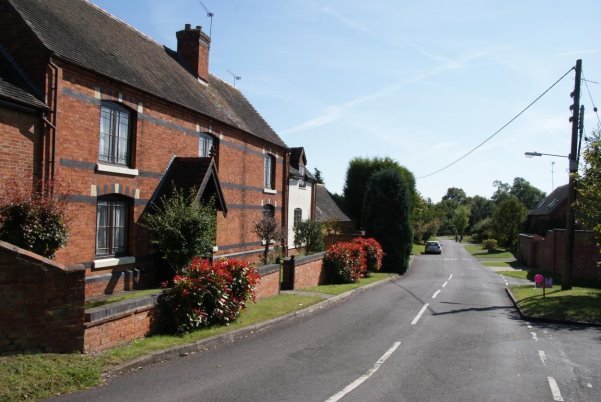
Church Road, Baginton
5.9 Baginton is a thriving community of around 600
people. There are a number of active groups including walkers,
junior football, gardeners, WI, artists, church groups, RSPB
events, car enthusiasts, thriving allotment association etc. and
regular events, including an annual 'Party in the Park,' summer
and winter fairs, cycling events, Guy Fawkes night etc.
5.10 To keep villagers informed there is a monthly
newsletter which is delivered free to every house in the parish as
well as a website.
5.11 Local businesses which serve the villagers, as
well as visitors and provide employment include two public houses,
a shop / post office, takeaway, five nurseries, a dog grooming
business and the Royal British Legion. There is a unique quarry
garden within one of the garden centres.
5.12 There are no formal educational or medical
services in the village so all the children and anyone wanting to
consult a doctor have to go out of Baginton. There is a village
hall used for a range of village events and there is a
highly-regarded air museum and an electric railway museum in the
Parish.
5.13 There is a children's playground and also the
Millennium field which is used for village events, football,
picnics, walking and includes a community orchard. Adjacent there
is the village green and ancient Baginton Oak tree, spinney, pond
and operational Smithy.
5.14 The village enjoys the openness of its rural
surroundings within the greenbelt, which provide an effective
buffer against urban sprawl. There are adequate road links and
cycle routes connecting Baginton to the industrial heartland of
Coventry and the rest of Warwickshire and the West Midlands. The
539 bus goes through the village 5 times each way, per day. In
recent years, there has been a huge increase in both vehicles and
cyclists passing through the village. Baginton has also lost bus
services in recent times. These cut backs have resulted in a
dependency on cars for transport which in turn has led to the
social isolation of young people as well as the elderly.
5.15 The village is rich in history, including the
Grade I listed church, the Roman Lunt Fort, ice house, ancient
mill [now one of the pub / restaurants] and Baginton Castle which
is now becoming a popular visitors centre after years of neglect.
The largest building in the village is the Exclusive Brethren
Meeting Hall. A large part of the village is within a conservation
area and the village enjoys variety of large and small dwellings,
varying widely in age and design.
5.16 Villagers accept the need for additional housing.
5.17 The Parish also includes the Middlemarch Business
Park and Coventry Airport, both of which provide employment for
large numbers of local people.
5.18 The village depends on the greenbelt designation
to maintain its residential village feel and all recent surveys
and consultations show villagers are determined to that Baginton
should remain washed over by greenbelt.
5.19 The Village Hall is a centre of local activities
and is frequently utilised for village and private events. It
attracts dog club shows from all over the country.
Planning Policies – Housing
Roman Way, Baginton
5.20 Warwick District is subject to significant pressure for new housing development, but the designated neighbourhood area is largely within the green belt. The emerging Warwick District Local Plan identifies Baginton as a growth village, with an allocated housing site (H19) on land north of Rosswood Farm for 80 new houses, and there is a green field site (H08) identified within the Parish on the edge of Coventry at Oaklea Farm, Finham for 20 houses. These proposals are not accepted by Baginton Parish Council, who prefer the H19 allocation to be for no more than 35 houses as originally proposed. Land would have to be removed from the green belt at these locations to support this new development. Baginton village is currently washed over by the green belt and the remainder of the green belt should be retained.
5.21 The public consultation for the Baginton Parish
Plan 201117 demonstrated widespread support for more housing for
local people, housing for the elderly and young people. There
was also support for housing to be designed to be "in keeping
with the surrounding houses" and of eco- friendly design. The
Baginton Housing Needs Survey of 2015 identified the local need
for only one new house based on the sample of respondents
received.
5.22 The Warwick District Appendix 5: Summary of
Housing Needs Surveys and Key Findings November 201318
identified the following housing needs for the villages:
Baginton - Need identified Feb 2008 - 17 homes (rent x12, shared ownership x5).
This was supported by Baginton Parish Council. This is now
superseded by the survey of 2015 identifying only one housing
need. Nevertheless, Baginton Parish Council supports sustainable
development of new housing in the village.
5.23 The identified housing sites at Land north of
Rosswood Farm and Oaklea Farm, Finham offer opportunities for
new housing in the Parish to meet housing need.

There is a requirement for more affordable smaller family units and housing for people looking to downsize from larger units. New housing should be integrated within the current built up area. The Rosswood Farm site will require a high level of environmental screening but would help reinforce or clearly define the entrance to the village.
5.24 Comments submitted by the Environment Agency at
Regulation 14 consultation noted that following two allocated
housing sites are located within the NDP Area:
H19 Baginton – Land north of Rosswood Farm:
The site is located in Flood Zone 1 (low risk) as shown on our
Flood Map for Planning (Rivers and Sea).
H08 greenfield site:
The River Sowe flows through the southern boundary of the site
and is located partly within Flood Zone 2 (medium risk). The
Environment Agency suggested that a policy should be included to
ensure all development is located outside of the River Sowe
floodplain and this is addressed in a new Policy G7 Managing
Flood Risk.
5.25 The Landscape, Sensitivity, and
Ecological and Geological Study, 201319 provides a detailed
review of landscape, ecology and considerations for site options
within the growth villages. In Baginton 13 sites were
assessed in terms of landscape sensitivity including proposed
housing site H19 in the emerging Warwick Local Plan. These areas
are shown on Map 3 below:
Map 3 Baginton Landscape Sensitivity to Housing
Development
Bubbenhall Parish Council (Licensee) License No. 100051733
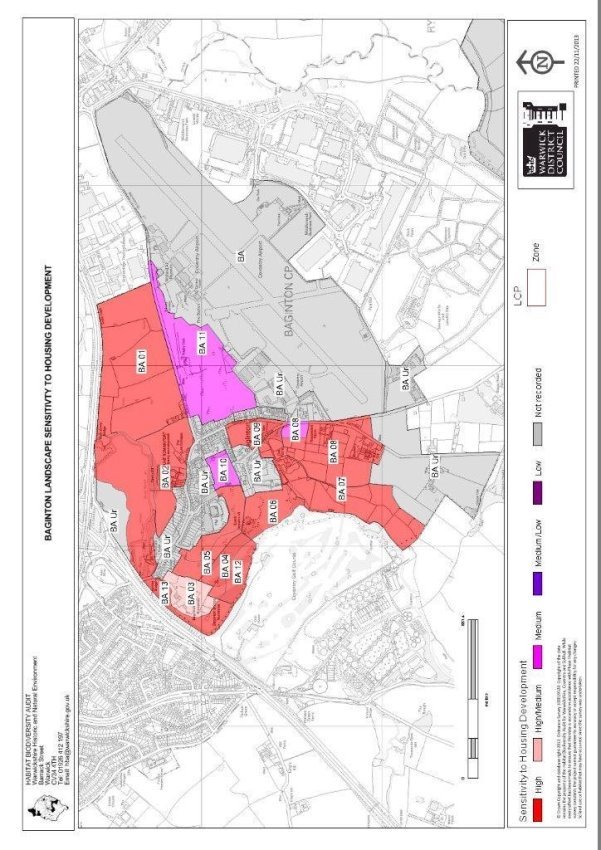
5.26 The village is set within the Dunsmore
Plateau Fringe landscape with its undulating topography of low
rounded hills and narrow meandering river valleys. Local Plan
housing site H19 is identified as site BA08 which has high /
medium landscape sensitivity to housing development. The report
advises that it is part of the Dunsmore Plateau Farmlands
and as such is more elevated than the surrounding area and has
a flat topography which also continues over the Coventry
Airport area to the east. It is an open landscape comprising
small to medium scale fields of pasture / paddocks. Internal
field boundaries have largely been replaced by post
and wire/tape fencing, although
the road side hedge still remains
intact. Due to the high visibility of this
zone, and its proximity to the Conservation Area and area of
designated Open Space to the north, development should be
restricted to roadside only, with a landscape buffer
of native tree planting to
the west. Any development should
not extend any further south than the pub.
5.27 Potential for landscape enhancement
includes replacing fences with native hedgerows and planting a
landscape buffer of native woodland around any new development.
Policy BAG1 - Land north of Rosswood Farm
Appropriate new development will be supported on Land north of
Rosswood Farm (as shown on Map 2), provided that:
1. Development comprises smaller family
units (1-3 bedrooms) and housing for people looking to
downsize from largerunits to small units,
including housing designed for olderpeople;
2. 40% of new housing will be affordable
housing. Affordable housing provision should be provided on
site and be fully integrated into the scheme, with units
designed to be "tenure blind";
3. 9% of market demand housing should be for
specialist housing for olderpeople.
4. Development is restricted to roadside
only, with a landscape buffer of native tree planting to the
west and fences should be replaced with nativehedgerows;
5. Development is designed and sited to
promote integration into the existing village and
accessibility to village services and facilities is
strengthened through footpath and cycle way enhancements;
6. A contribution to local village amenities to be made
under S106 agreements or community infrastructure levy on
any developments.
5.28 Land at Oakleigh Farm has been identified
for new housing in the new Local Plan as Site H08 as shown on
Map 2. The site is identified as CO4 in the SHLAA Assessment
Tables 201420. It is located on the edge of Coventry
urban area. Finham has a range of services and facilities and
is well connected to the wider urban area. The site is located
within the Green Belt. The majority of the site is within the
Stoneleigh and Ashow Neighbourhood Plan Area. There is a large
domestic property (OakLeaFarm)
on the site and a
steep slope rising to
south‐east. There are a large number of significant
trees on site. Development could have a potential impact on
nearby residential amenity. There is noise and air pollution
from A46. Considerable noise pollution is notable
from the site.Potentially
suitable in part, subject to
alteration of the Green Belt
boundary, the protection of important trees and a significant
buffer along the boundary of the A46.
Development is achievable subject
to designing a suitable
scheme to overcome the
configuration of the site and appropriate tree and vegetation
cover/buffering.
Policy BAG2 Land at Oaklea Farm, Finham
New development for at least 20 new houses will be supported
on Land at Oaklea Farm, provided that:
1. Importanttreesonthesiteareprotectedandasignificantbuffer
of appropriate trees, hedgerows and landscaping is provided
along the boundary of theA46.
2. Development is designed and
sited to promote integration into the existing village and
accessibility to village services and facilities is
strengthened through footpath and cycle way enhancements;
3. A contribution to local
village amenities to be made underS106
agreements or community infrastructure levy on any
developments.
Planning Policies – Protecting and Enhancing Local Heritage
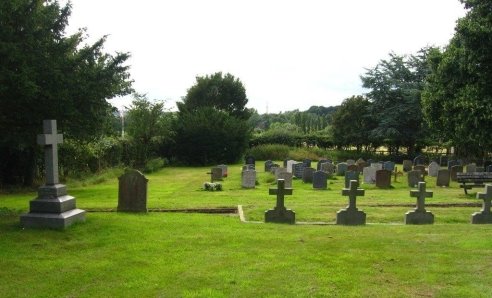
5.29 Warwick District Council has published a detailed description of the conservation area, the listed buildings within it, and its character in a conservation area advice leaflet21. The conservation area was designated in 2007. Other significant heritage assets outside the conservation area include the site of a former Roman military camp (Lunt Fort which is open to the public) and the remnants of a medieval castle Baggotts Castle. These are scheduled monuments.
Map 4 Baginton Conservation Area
Bubbenhall Parish Council (Licensee) License No. 100051733
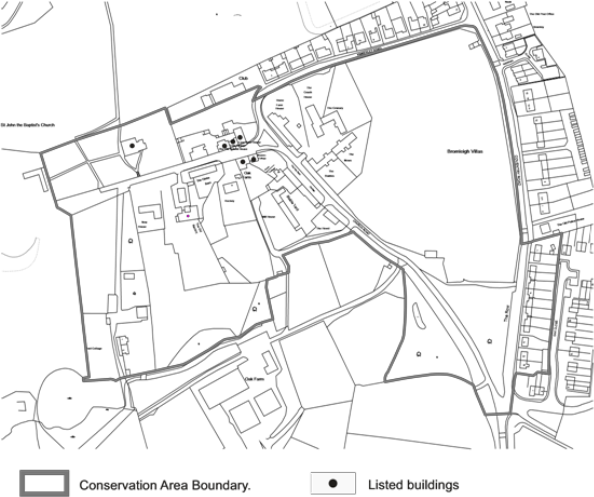
5.30 The village is on an elevated position looking
towards Coventry. The character of the conservation area is
defined by the former Baginton Hall. The Green is at the
junction of Coventry Road which to the east is linked to a
terrace of late 18th century cottages The Row. The Smithy is an
interesting part timber framed building at the top of The Green.
To the south west is an extension to The Green with a pond and a
series of trees. Church Lane continues to the junction with
Kimberley Road where there is a group of buildings at the
historic core of
the village including the Church of St John the Baptist, Link
Cottage, Lucy Price House, Oak Farmhouse, No.2 and the Old
Rectory. To the south of the Old Rectory are Pool Cottages and
the stream which forms the boundary of Oak Farm. This is an
attractive area adjacent to open countryside.
5.31 The historic core around Church Road
and The Green contains much of the original fabric of the
village and there is a cohesiveness to the group. To the north
of The Green is the Millennium Field, a large area of
agricultural land, leased to Baginton Parish Council from
Coventry City Council for open space and amenity provision. Any
development of these areas must be sympathetic to the
conservation area status.
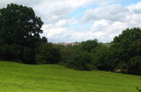
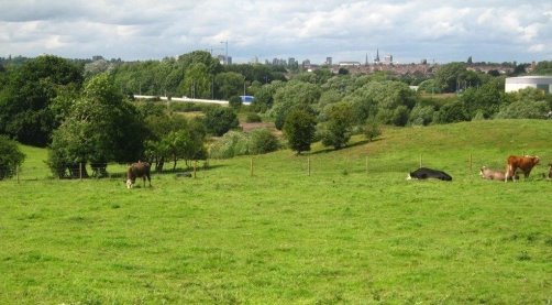
5.32 There are important views in the
easterly and westerly direction along Church Road of the
buildings which form the historic core. There are good views
both inside and out of the conservation area from The Green.
There are attractive views towards Pool Cottages and the stream
within and outside the conservation area. There are broader
views from The Row across the open field to the historic core
and Oak and Home Farms. In addition, the views from the village
to Coventry are a particularly pleasant vista and these
unspoiled fields offer a natural buffer against urban sprawl,
which must be maintained. Map 5 below identifies the views which
are considered significant.
Map 5 Baginton Key Views
Bubbenhall Parish Council (Licensee) License No. 100051733
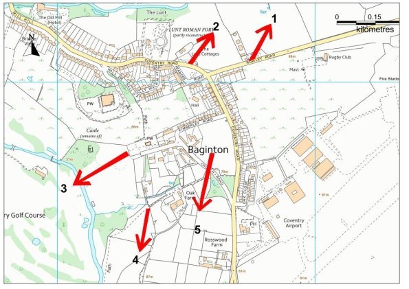
Key
→Key View
The key significant views are illustrated below:
View 1. View towards Coventry from Lunt Cottages
View 2. View towards Coventry from Rowley Road
View 3. View West from Churchyard
View 4. View south from Church Road
View 5. View South-West from Millennium Field
5.33 The conservation area comprises a wide variety
of buildings and amenities, including
The Grade I listed Church of St John the Baptist,
The Village Green with ancient Oak tree,
A working brick built Smithy and the Millennium Field
Sympathetically converted farm buildings, developed into dwelling houses of great character,
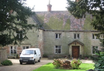
The Old Rectory with 17th century house set back in acres of land
A variety of other buildings constructed over the centuries including centuries old timber framed buildings, masonry buildings of different ages and more modern buildings constructed in late 20th century.
Character Areas
5.34 Baginton village has several character areas
which have been identified and described by members of the
Steering Group. These are shown on Map 6 below.
Map 6 Baginton Character Areas
Bubbenhall Parish Council (Licensee) License No. 100051733
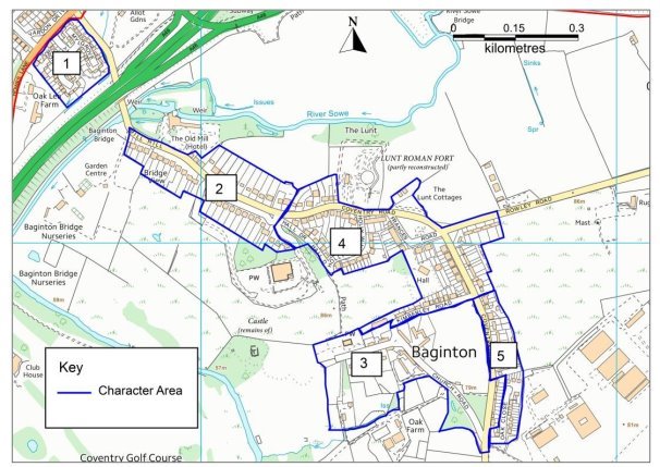
5.35 The built form therefore comprises a great variety of dwellings of various forms and dates, and the different identified character areas are summarised as follows:
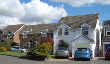
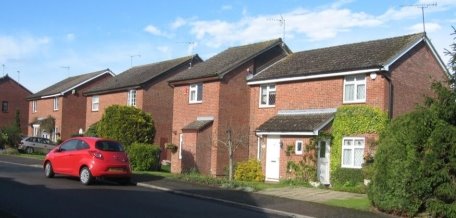
1. Roman Way
This area of the village comprises a variety of detached homes
constructed in the late 20th century of modern brick, rendered
brick and tiled roof construction.
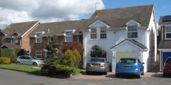
View of typical housing in Roman Way
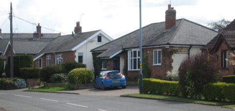
2. MillHill
There is a wide variety of houses on Mill hill, with
predominantly semi-detached houses to the south and detached
bungalows and houses to the north. Construction varies but is in
the main traditional masonry with tiled roofs.
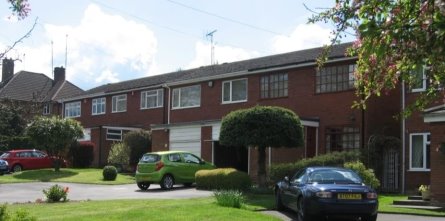
Typical housing stock in Mill Hill
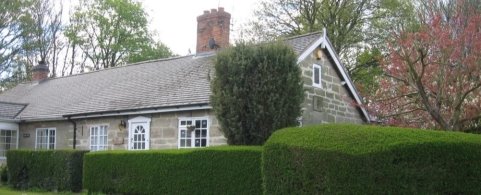
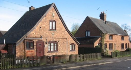
3. ConservationArea
This is a large part of the village with a great variety of
houses of varying construction including centuries old stone and
timber built dwellings, brick and rendered brick cottages, farm
buildings, barn conversions and a variety of homes build in the
19th and 20th centuries. The conservation area is particularly
pleasant and any development of this area must be in keeping
with its surroundings.
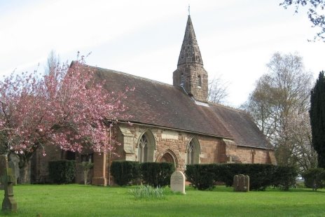
St John the Divine Listed Church, Baginton
The Rectory, Church Road
The Old Smithy, Church Road
The Baginton Oak and the Row
4. Coventry Road, Kimberly Road, Rowley Road
and FrancesRoad
Houses and business in these areas again comprise a wide variety
of forms, including flats, bungalows, terraced homes,
semi-detached homes and detached homes. These are mainly of
brick or rendered brick with tiled roof construction.
Coventry Road housing
Housing in Holly Walk
The Lunt Cottages, Coventry Road
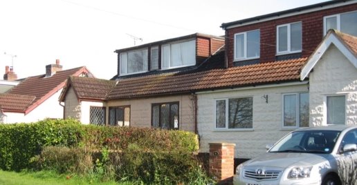
Frances Road
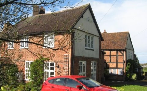
5. Oak Close, The Row, Andrews Close and
outlyingareas
This area of the village comprises a variety of predominantly
semi-detached houses, workman's' cottages, detached houses and
dormer properties build in the 19th and 20th centuries.
Construction varies and in the main comprises brick or rendered
brick with tiled roofs. There are also various houses within the
village but in outlying areas, again of varying construction.
The Row
Oak Close
Coventry Road
5.36 New development in the village in addition to
the sites identified above is likely to be small scale and on
infill sites, and include extensions to existing properties. It
is important that new development and alterations respect the
existing built form and respond positively to the style,
materials and scale of the different local character areas.
Policy BAG3 Protecting and Enhancing Baginton Village
New development within Baginton, including small infill sites
and extensions to existing properties will be supported where
they are sited and designed sensitively to enhance the setting
of the conservation area and other parts of the village.
Schemes for well-designed self-build housing will be
encouraged on small infill sites.
New development will be required to:
1. Beofasuitablescale,heightandmassingwhichrespondstothe
builtformofsurroundingproperties.Propertiesshouldbesmall
in scale and no more than two stories inheight;
2. Use appropriate local materials and
detailing wherever possible, sympathetic to the design of
properties in each identified characterarea;
3. Take into consideration the protected
views identified on Map
5. These include all views towards Coventry
where the Green Belt protects against urban sprawl and other
views, as listed below:
- View 1 View towards Coventry from LuntCottages;
- View 2 View towards Coventry from RowleyRoad;
- View 3 View West fromChurchyard;
- View 4 View south from Church Road;and
- View 5 View South-West from MillenniumField.
4. Include suitable landscaping and boundary
treatment which is appropriatetothecharacterofaruralWarwickshirevillagesuch
as provision of low brick walls andhedges.
5. Designs should protect and enhance the setting of Lunt
Fort and other built heritage assets.
Overall development should be sympathetic to the varied
nature of each of the character areas within the village,
which differ significantly.
Planning Policies – Protecting and Enhancing Green Spaces
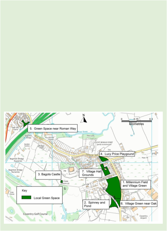
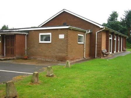
Baginton Village Green
5.37 The playing fields in Baginton are owned by the
Parish Council. The playing fields contain numerous pieces of play
equipment for young people of all ages. The village hall sits on
separate land also owed by the Parish Council, with a large
amenity field. The hall has a large central room which can be used
for meetings, functions and indoor activities as required, with a
separate smaller committee room. The management committee that
runs the village hall has implemented a programme of refurbishment
to bring the hall up to modern day standards and user
expectations.
5.38 The village green and spinney is also owned by the
Parish Council and is designated as common land. The pond is in
need of refurbishment and the Old Oak needs attention.
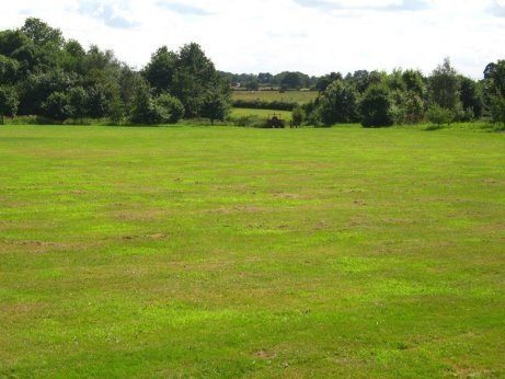
5.39 The Millennium Field is rented by Baginton Parish
Council for Coventry City Council for a peppercorn rent with over
80 years remaining on the lease. It is used for activities in the
village including the football club, Bonfire and Party in the
Park.
5.40 The green field between Baginton and Coventry,
south of the A45/46, must be maintained as local green space to
prevent urban sprawl.
5.41 The NPPF sets out in paragraphs 76 – 78, that
subject to certain criteria, local communities can identify and
protect local green spaces.
Para76. Local communities through local and
neighbourhood plans should beableto identify
for special protection green areas of particular importance to
them. By designating land as Local Green Space local communities
will be able to rule out new development other than in very
special circumstances. Identifying land as Local Green Space
should therefore be consistent with the local planning of
sustainable development and complement investment in sufficient
homes, jobs and other essential services. Local Green Spaces
should only be designated when a plan is prepared or reviewed,
and be capable of enduring beyond the end of the planperiod.
Para77. The Local Green
Space designation will not be
appropriate fo rmost green
areas or open space. The designation should only beused:
● where the green space is in reasonably close proximity to the community it serves;
● where the green area is demonstrably special to a local community and holds a particular local significance ,for example because of its beauty, historic significance, recreational value (including as a playing field), tranquillity or richness of its wildlife;and
● where the green area concerned is local in character and is not an extensive tract of land.
Para78. Local policy for managing development
within a Local Green Space should be consistent with
policy for Green Belts.
5.42 Table 1 below sets out the justification for the
identified local green spaces in Baginton.
Table 1 Local Green Spaces
|
Local Green Space |
Close Proximity to LocalCommunity |
Demonstrably Special |
Local in Character |
|
1. Millennium Fieldand VillageGreen |
Sited within the old village centre which is now located at one end of the extended village. The field and green is roughly triangular is shape surrounded by roads. Housing is sited on the opposite side of the road on two sides with the third opens out |
The Millennium field is a large field for community use, including dog walking, football club, Party in Park and Bonfire Night. Available to all the community for various events, it includes a working Farriers forge in current use. |
The field is enclosed by natural hedges, whilst the "open field area" is bordered on two sides by a fledgling orchard.
The Green is bounded by Coventry Road, Church Road and the Millennium Field. |
| |
onto open farmland currently occupied by horses. |
Village Green has the famous Baginton Oak, centuries old and protected, along with many other species. |
|
|
2. Spinney and Pond near Baginton Oak |
Located within the old village centre. This area is currently maintained as a rough natural area with the pond at its centre. Again, its located a one end of the extended village. |
Pretty area of village, much valued by residents. Together with village green area it forms part of the natural setting and backdrop for the historic Baginton Oak Tree. |
Pond and Spinney 0.49 ha The area is open and natural, set between on one side a small rural road and open fields on the other. |
|
3. Bagots Castle |
Located on the outer edge of the old village. It is remote to the mainstream village, sitting beyond the 14th century listed church. The narrow lane which leads to the Church and Bagots Castle is bordered by mixed housing, siting within a preservation area. |
Unique attraction. While the site forms part of local history its value and relevance is a debated subject. |
0.04ha The castle is sited at the end of a gravel path leading on from Church road, the ruins look out over the local river and golf course and open farm land. |
|
4.Lucy Price Playground |
Centrally located within the village, at the junction of the three main access roads within Baginton. It is set back from the main road on a small triangle of land, bounded on two sides by a small access road with housing (bungalows) on the opposite side. |
Pleasant facility used both by local children and families from the surrounding areas. A child play area providing play equipment within this a fenced off separated from the open ground provided for group games (football, cricket etc.) played by older children. It is seen as a safe environment for children. |
0.42 ha The area is bounded on two sides and overlooked by a small development of semidetached bungalows. Providing a good open central setting for a children's play area. |
|
5. Green Space near Roman Way |
Close to all Roman Way residents, to the south of Roman way and to the rear of properties, forming an enclosed pleasant space with tress and the river to the south. |
Local open space used by local villagers, for general amenity. |
0.08ha This green space is bounded by the river to the south and by the housing to Roman Way. |
|
6. Village hall andgrounds |
Centrally placed in village, the village hall and ground are |
Used for many community events throughout the year, |
0.49ha |
| |
located off Francis Road, near the Lucy Price Playing Field |
including Dog Shows, May Fair, Christmas Party, evening meetings for community activities, Parties, celebrations and Weddings. |
The Field is bounded by scrubland to the West and by village housing stock to the West and South. |
Planning Policies - Protecting Local Services, Assets
and Amenities
Baginton Village Hall
5.43 The Baginton Parish Plan of 2011 identified the
need to enhance and maintain the Baginton Small Services Directory
annually, with details of local facilities and services providers.
The Baginton Emergency Plan is also revised annually and recent
new service included the provision of a public use defibrillator.
There are many clubs in the village, such as the Baginton
Gardeners, Dog Club, Parent and Toddler group, Art group,
Children's Swimming Club, Coffee Circle, Baginton Walkers and
others. It is intended to ensure these clubs are nurtured to
ensure they survive in the long term. At this time there is no
medical services provision in the village. Consideration could be
given to the provision of a visiting medical service if this can
be justified.
5.44 The Parish Council is therefore committed to the
following actions:
Services – Actions for the Parish Council
1. To promote the increased use of village
community clubs via means of communication and meetingplaces.
2. To ensure the Small Services Directory
and Emergency Plans and maintained andenhanced.
3. Toenableincreasecommunityengagementtotheprovisionofservicesfor
villagerssuchastrainingfornewskills,carsharingandvoluntarytransport
service for theelderly.
4. To enhance security via Neighbourhood
Watch with voluntary patrols and reportingmechanism.
5. To aim at provision of a visiting medical
service if this can bejustified.
5.45 Baginton village has many assets and amenities,
including the old Oak tree, village green, pond and spinney, Lucy
Price playground, Millennium Field, village hall and grounds,
village website & notice boards, old smithy and other open
spaces, the Church and grounds, the Lunt Fort and the Castle
ruins. Other amenities include the facilities provided by the Old
Mill Public House, The Oak Public House, and the British Legion as
well as other businesses.
5.46 The 2011 Parish Plan recognised these amenities
and sought to maintain and develop these in order to gain value
and enhance benefits. Ideas included refurbishing the playground,
adding new sporting facilities to the Millennium Field such as
tennis courts, cricket pitch and bowling green. It also identified
the need to consider and provide facilities for young people
within the village, looked at how use of the facilities could be
better communicated and how the amenities could be better utilised
for the benefit of villagers and neighbouring communities.
5.47 The Parish Council is therefore committed to the
following actions:
Assets and Amenities – Actions for the Parish Council
6. To increase residents awareness of the
opportunities available via village newsletter, website and
noticeboards,
7. To sustainably enhance educational,
amenity sporting opportunities within the village to make
better use of existing facilities such as the Millennium Field
andothers.
8. TopromotevillageeventssuchasthePartyInThePark,VillageBonfireand
other communityevents.
9. To actively share use of village
amenities by surrounding communities though improvedcommunication.
Policy BAG5 Protecting Local Services, Assets and Amenities
The following local recreational facilities are protected:
- Village hall andgrounds;
- Oldsmithy;
- The LuntFort;
- MillenniumField;
- VillageGreen.
There will be a presumption in favour of the re-use of such
facilities for recreational, health, community type uses. The
change of use of existing facilities to other uses will not be
permitted unless the following can be demonstrated:
1. The proposal includes alternative
provision, on a site within the locality, of equivalent or
enhanced facilities. Such sites should be accessible by public
transport, walking and cycling and have adequate car parking;or
2. There is no longer
a need for the facility, and
this can be demonstrated to the
satisfaction of the ParishCouncil.
Developmentwhichcontributestowardstheimprovementofexisting,
or provision of new recreational facilities will beencouraged.
A Green Infrastructure (GI) approach will be promoted for all
new publicopenspaceproposalsinordertosupportcommunityaccessand
protect and enhance the natural and historic environment.
Proposals must be designed to provide open space, sport and
recreation uses which:
Are accessible toall;
Safeguard and enhance the natural and historic environment; and
Protect priority species and enhance habitats and sites of special biodiversityinterest.
Planning Policies - Road Traffic
5.48 The Parish Plan and Neighbourhood Plan
consultations in Baginton identified significant safety and
nuisance concerns amongst residents about issues such as vehicle
volumes, speeding, noise, fumes, large numbers of HGV's and buses
etc. Another safety issue is the lack of pavements around the Lunt
and Millennium field which force people to cross the road adjacent
to some blind bends. The Baginton Bridge pavements are very narrow
particularly for parents with children and / or prams. Therefore
either a separate footbridge similar to the one in Stoneleigh is
required or the existing pavements need to be widened and the
bridge made one way with traffic lights at either end. NOTE. If
the Bridge was made one-way the chicane adjacent to the allotments
would need to be removed.
5.49 There has been large increases in traffic volumes
through the village in recent years as a result of the ongoing
problems with the A46 / A45, the growth if the In-Transit business
based on the Bubbenhall Road, increasing numbers of commuters from
the Leamington Spa area, the JLR park and ride scheme based in
Rowley road etc. While the completion of the Toll Bar End project
may reduce traffic volumes in the medium term proactive efforts
need to be made to ensure this happens in practice to deliver
progressive reduction. Once the Toll Bar project is complete the
large number of "not in service" buses currently using Mill Hill
to access their base in Rowley Road should be actively encouraged
to use the A45 – A46.
5.50 Twelve or so years ago the In-Transit business was
entirely devoted to light weight commercial vehicles. They were
then granted a licence to operate the 40 Ton articulated trucks.
Since then there has been frequent damage to verges and bollards
along Coventry Road towards Bubbenhall. The road is completely
unsuited to high frequency use by large articulated HGV's and ways
of mitigating the ongoing damage need to be addressed. Objective 6
is to reduce current traffic levels therefore any additional
housing or businesses proposed for the area must address the
traffic issue and define how traffic control promises will be
enforced. Warwick District Council has already approved [outline
planning permission] for Close Brethren School in Baginton and the
traffic increases associated with this development have not been
clearly addressed.
5.51 The 7.5 tonne limit on the Baginton Bridge over
the River Sowe is poorly signposted and rarely enforced. The
County Council are working to improve signage so that the rule is
clear and that any transgressions will therefore be deliberate.
The speed bumps in Baginton which were replaced recently are
ineffective and continually have to be repaired because of their
poor design and construction. There are many examples of effective
speed reduction methods in other parts of Coventry and
Warwickshire and around the UK. Baginton needs effective solutions
to speeding and many think a 20mph limit should be introduced.
Overall it is appropriate that developer contributions and other
funding should be sought to improve traffic management and
therefore enhance local quality of life in the Parish.
Policy BAG6 Traffic Management and Transport Improvements
Traffic measures which improve local road safety and the health
and wellbeing of residents will be supported.
Developer contributions, Community Infrastructure Levy (CIL)
payments and other funding will be sought towards the following
initiatives within the Parish:
1. Joint working with Warwick District
Council, Warwickshire County Council and the police to measure
traffic flows and speeds inBaginton;
2. Development of a comprehensive long term
plan for managing safety, volumes, speed, HGV's etc including
such measures as effective speed humps, speed measurement,
chicanes, speed limits, Community Speedwatch, adequate parking
arrangements, enforcement of the parking regulationsetc;
3. Improvements in public transport and
working with the Councils and providers to meet theseneeds;
4. Making Baginton a safe and attractive route
for cyclists and pedestrians. In addition to vehicle traffic
management this includes for example, roads and pavements free
of pot holes, pavements of adequate useable width and additional
pavements in some areas. New / improved cycle routes to
surrounding towns, villages and places of employment are also
needed.
Planning Policies - Commercial / industrial development and
employment issues
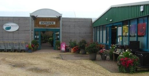
Smiths Nurseries, Baginton
5.52 Baginton has SME (small and medium sized)
businesses located in and around the village and the airport. In
addition, there larger manufacturing and service enterprises
located in the Middlemarch Business Park. Middlemarch Business
Park has over 70 business including a major Royal Mail depot, food
manufacturing, packaging manufacture, distribution depots etc.
There are a wide range of engineering and business support
companies as well as a children's soft play business.
5.53 In the village there is the village shop and Post
Office, two pub / restaurant / hotels, bed and breakfast, four
garden centre businesses, a takeaway, the Royal British Legion,
tree and garden services and a range of services based in
residents' homes. The airport has a number of businesses including
air freight, executive jets, helicopter training and services,
flight simulator, aero club, air museum, electric railway museum,
DC6 restaurant, granite processing etc. In the Parish around the
village there are farms, livery, pet boarding, an aero products
company, transport company and others.
5.54 In consultations villagers have been clear that
they want Baginton to remain as primarily a residential area.
Villagers will support any sustainable business that provides
employment and fits in with the residential nature of Baginton.
Policy BAG7 Commercial and Industrial Development and
Employment
Employment related development appropriate to Baginton's
location will be supported to ensure the Parish remains a
sustainable and attractive residential area.
Investment which supports local job creation at Middlemarch is
encouraged, in terms of expansion of existing businesses and
attractingnewenterpriseswishingtolocateinandaroundthevillage.
New employment related development should contribute
positively to the local community in Baginton and should not
impact adversely on residential amenity and the quality of
life enjoyed by residents or the built and natural environment
of Baginton and its surroundings.
17 http://www.baginton-village.org.uk/parish-council/60-parish-plan
18 http://www.warwickdc.gov.uk/downloads/file/2386/v10_-_summary_of_housing_needs_surveys_-_november_2013
19 http://www.warwickdc.gov.uk/downloads/file/1549/appendix_7_-_landscape_sensitivity_and_ecological_and_geological_study
20 http://www.warwickdc.gov.uk/downloads/file/1585/assessment_tables
21 http://www.warwickdc.gov.uk/downloads/file/478/baginton_conservation_area