Draft Kings Hill Masterplan and Design Code Supplementary Planning Document
8 Appendices
8.1 Glossary
A
Active Frontage: Building frontage that provides visual interest and interaction with the street, often including entrances, windows, and retail uses.
Amenity: The positive features of a place, including open space, views, sunlight, or facilities that improve quality of life.
Aspect: The direction a building or window faces, affecting sunlight, wind, and views.
B
Built Form: The shape, size, and arrangement of buildings in an area.
Building Line: The line beyond which a building cannot extend, often defined by planning policy.
Buffer Zone: A transitional area between two different land uses to reduce conflict, e.g., landscaping between housing and industrial areas.
C
Character Area: A part of a town or neighbourhood with distinct architectural or historical identity.
Conservation Area: An area designated for its special architectural or historic interest, with protections to preserve its character.
Context: The physical, social, and cultural setting in which development is situated.
D
Design Code: A set of illustrated rules and guidance describing how development should be designed to achieve high-quality outcomes.
Density: The number of dwellings or people per unit of land area, often expressed as dwellings per hectare (dph).
Development Envelope: The area within which building and development can take place on a site.
E
Environmental Impact: The potential effect of a development on natural resources, ecosystems, or local climate.
Entrances and Thresholds: Points of access to buildings and spaces, influencing legibility and safety.
F
Façade: The front or external face of a building.
Form and Massing: The three-dimensional shape and scale of a building or group of buildings.
Framework: The overall structure or strategy that guides detailed design and development.
G
Green Infrastructure: A network of natural and semi-natural spaces that provide environmental and recreational benefits.
Grid Layout: A street pattern with regular, often orthogonal streets, promoting connectivity.
H
Heritage Asset: Buildings, monuments, sites, or landscapes with historical, architectural, or cultural significance.
Height Parameter: Maximum allowable building heights in a design code or planning guidance.
I
Inclusive Design: Designing environments accessible and usable by all people, regardless of age or ability.
Infrastructure: Physical services and facilities necessary for development, including roads, water, energy, and telecommunications.
L
Land Use: The function or purpose of land, such as residential, commercial, or recreational.
Layout: The arrangement of streets, buildings, and open spaces on a site.
Local Character or Distinctiveness: Features that give a place its unique character, often influenced by materials, scale, and architectural style.
M
Materials Palette: The range of materials recommended for buildings and surfaces to ensure visual cohesion.
Mixed-Use: Development combining multiple land uses, e.g., residential and commercial.
O
Open Space: Publicly or privately accessible green or civic areas, including parks, squares, and play areas.
Orientation: The positioning of buildings in relation to the sun, wind, and surroundings.
P
Permeability: The ease with which people and vehicles can move through an area, emphasizing connected streets and paths.
Public Realm: Areas accessible to the public, such as streets, parks, and squares.
R
Regeneration: The renewal of urban areas to improve quality of life, economy, and environment.
Rhythm and Repetition: Regular spacing of architectural elements like windows, doors, and columns, contributing to visual harmony.
S
Setback: The distance a building is positioned from a boundary, road, or another structure.
Streetscape: The visual character of a street, including buildings, trees, lighting, and paving.
Sustainability: Designing developments to minimize environmental impact and promote social and economic well-being.
T
Threshold: The transition between public and private spaces, often marked by gates, fences, or landscaping.
Typology: The classification of building forms or layouts based on function, design, or structure.
V
Views and Vistas: Key sightlines or framed views that enhance the character and legibility of a place.
W
Wayfinding: Features that help people navigate a place, including signage, landmarks, and spatial organization.
8.2 National Planning Policy
A planning policy review has been undertaken to identify the relevant national, regional and local planning policies applicable to the masterplan and its context. The review is summarised on the following pages and reflects the policy position at the time of writing. Any future development proposals will be required to undertake their own planning policy review to ensure that the most up-to-date policy guidance is used to inform and support planning applications.
National Planning Policy Framework, December 2024
The National Planning Policy Framework sets out the Government’s planning policies for England and how these should be applied. It provides a framework within which locally-prepared plans can provide for housing and other development sustainably. The report was first published in March 2012 and most recently revised in December 2024.
The report sets out the purpose of the planning system as contributing to the ‘achievement of sustainable development, including the provision of homes, commercial development and supporting infrastructure in a sustainable matter’, and goes on to highlight the three objectives (economic, social and environmental) as being interdependent and required to be pursued in a mutually supportive way.
The following sections of the NPPF, of relevance to this exercise, are identified below:
- 2: Achieving sustainable development
- 3: Plan-making
- 5: Delivering a sufficient supply of homes
- 8. Promoting healthy and safe communities
- 9. Promoting sustainable transport
- 12. Achieving well-designed places
- 14. Meeting the challenge of climate change, flooding and coastal change
- 15. Conserving and enhancing the natural environment
- 16. Conserving and enhancing the historic environment
The NPPF supports the ambitions of the King’s Hill Lane Masterplan and Design Code, stating ‘Good design is a key aspect of sustainable development, creates better places in which to live and work and helps make development acceptable to communities. Being clear about design expectations, and how these will be tested, is essential for achieving this.’ (para 131, p 39). The NPPF highlights the importance of Design Codes to enhance the quality of development and points developing codes in line with guidance in the National Model Design Code.
Future Homes Standard
The Future Homes Standard (FHS) is a UK government initiative designed to make all new homes “zero-carbon ready” by significantly improving energy efficiency and eliminating reliance on fossil fuels. Its core aim is to reduce carbon emissions by 75–80% compared to 2013 Building Regulations, aligning with the UK’s legally binding net-zero target for 2050.
FHS ensures new homes are energy-efficient, low-carbon, and future-ready, reducing long-term retrofit costs and supporting climate goals. Following a period of consultation and review, the legislation will likely come into effect at the end of 2026.
All new homes on the King’s Hill Lane site will need to comply with the Future Homes Standard once legislated. Whilst the key requirements (low carbon heating, fabric first approach, ventilation and overheating mitigation) relate to individual homes, rather than at a masterplan level, it will be important for Developers to be aware of the requirements during the planning application and building control stages.
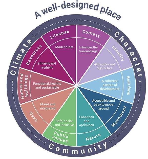
National Design Guide, January 2021
The guide sets out 10 characteristics of well-designed places to ensure developments are beautiful, sustainable, and functional, supporting the National Planning Policy Framework (NPPF).
The ten characteristics of good design are set out below:
- Context
- Understand and respond to the site’s local and wider context.
- Respect heritage, local history, and culture.
- Identity
- Create distinctive, attractive places that reflect local character.
- Ensure high-quality architecture and placemaking.
- Built Form
- Promote a coherent pattern of development.
- Encourage compact, walkable neighbourhoods with clear destinations.
- Movement
- Provide a connected network of routes for all modes.
- Prioritize active travel (walking, cycling) and well-integrated parking.
- Nature
- Deliver green infrastructure, biodiversity, and sustainable water management.
- Include varied landscapes and play spaces.
- Public Spaces
- Design safe, inclusive, and sociable spaces that encourage interaction.
- Uses
- Support a mix of uses and housing types for social inclusivity.
- Homes & Buildings
- Ensure healthy, comfortable, and adaptable homes.
- Provide attention to detail (storage, waste, servicing).
- Resources
- Follow the energy hierarchy (reduce demand, use renewables).
- Select sustainable materials and construction techniques.
- Lifespan
- Design places that are well-managed, adaptable, and foster ownership
- The NDG reiterates the importance of good design for new development, which the King’s Hill Lane Masterplan and Design Code will seek to facilitate.
National Model Design Code, June 2021
The National Model Design Code (NMDC) sets out the Government’s framework for creating local design codes to ensure high-quality, beautiful, and sustainable places. It was introduced in July 2021 to support the National Planning Policy Framework (NPPF) and the National Design Guide
The NMDC provides a tool for understanding the key design principles relevant to the King’s Hill Lane Masterplan site and what items could and should be coded through the Design Code.
Draft for consultation Design and Placemaking Planning Practice Guidance, January 2026
Currently within consultation period, The consultation seeks views on the Draft Design and Placemaking Planning Practice Guidance, which sets out national guidance on achieving high-quality, well-designed places, and will run from January 2026 to 10 March 2026, future proposals must reference the latest policy issued by the Ministry of Housing, Communities and Local Government.”
Building for a Healthy Life, 2020
Building for a Healthy Life (BHL) is the updated version of Building for Life 12, endorsed by Homes England, NHS England, and the Urban Design Group. It is the UK’s most widely used design quality assessment tool for new residential and mixed-use developments. Structured around 12 considerations, it integrates health, sustainability, and placemaking principles, informed by the Healthy New Towns Programme.
The 12 core principles are grouped under three themes and include:
- Integrated Neighbourhoods
- Connections: Safe, direct walking and cycling routes, good public transport.
- Facilities & Services: Easy access to schools, shops, healthcare.
- Public Transport: Well-connected stops integrated into the layout.
- Distinctive Places
- Character: Respond to local context and identity.
- Working with the Site & Its Context: Respect topography, landscape, and heritage.
- Homes with Character: Variety in design, tenure-neutral layouts.
- Streets for All
- Healthy Streets: Prioritize active travel and social interaction.
- Parking: Well-integrated, not dominating streetscape.
- Green & Blue Infrastructure: Trees, SuDS, biodiversity, and play spaces.
- Cycle & Walking Infrastructure: Safe, attractive routes.
- Public & Private Spaces: Clear definition, safety, and inclusivity.
The guide provides a traffic light assessment tool for new development and should be used to ensure the King’s Hill Lane Masterplan is designed in accordance with the 12 core principles.
Manual for Streets, 2007
Published by the UK Department for Transport in 2007, MfS provides national guidance for the planning, design, and maintenance of residential streets in England and Wales.
It replaces Design Bulletin 32 and Places, Streets and Movement, shifting focus from vehicle-dominated design to people-oriented streets.
The key principles set out in the MfS include:
- User Hierarchy
- Pedestrians first, then cyclists, public transport, then motor vehicles.
- Place Function
- Streets should foster social interaction and sense of place, not just vehicle movement
- Inclusive Design
- Accessible for all ages and abilities, reduce barriers for disabled users.
- Connectivity & Permeability
- Networks should provide multiple route choices and link key destinations.
- Context-Specific Design
- Move away from rigid road hierarchies, design streets based on local character and combined movement/place roles.
- Safety Through Design
- Risk managed by clear objectives rather than over-standardization.
The guidance applies mainly to residential streets, but principles extend to urban streets and mixed-use areas. It is not intended for trunk roads (covered by separate guidance) and there is a companion guide: Manual for Streets 2 (2010) for busier streets like high streets and town centres.
This guidance will help determine the design of streets across the King’s Hill Lane Masterplan.
8.3 Regional Planning Policy
West Midlands Growth Plan, August 2025
The West Midlands Growth Plan is a a £17 billion regional economic strategy launched by the West Midlands Combined Authority and Mayor Richard Parker.It aims to grow the economy by £17bn, create 100,000 skilled jobs, and deliver 120,000 new homes by 2035. Key themes include:
High-Growth Sectors:
- Advanced engineering (EVs, battery tech)
- Clean tech and energy
- Health and medical technology
- Digital and creative industries
- Professional and financial services
Infrastructure Investment:
- £2.4 billion for transport upgrades (Metro extensions, HS2 integration).
Improved connectivity for jobs and housing growth.
Social & Environmental Goals:
- Reduce poverty and accelerate progress toward net zero.
- Affordable housing and greener homes.
Relevant to the King’s Hill Lane Masterplan, the Gigapark development, outlined in the growth plan, is located 3km east of the site. This development may have an impact on transport infrastructure locally, but there is also an opportunity to enhance connections to it from within the scheme, as a major employment site in the local area:
Coventry & Warwick Gigapark
- £23 million investment at Coventry Airport for land remediation and infrastructure.
- Anchored by a battery giga factory and advanced manufacturing cluster.
- Expected to attract £5.5 billion investment and create 30,000+ jobs over 25 years.
- Designed to boost Coventry’s automotive and green tech industries heritage.
Emerging South Warwickshire Local Plan
The South Warwickshire Local Plan (SWLP) is a joint plan by Stratford-on-Avon and Warwick District Councils, covering the period 2025–2050. Its purpose is to guide sustainable development across South Warwickshire. It seeks to create a unified vision for the area, ensuring sustainable growth, meeting housing needs, providing necessary infrastructure, and creating employment opportunities while addressing climate goals.
Following the public consultation which took place on a “Preferred Options” draft of the South Warwickshire Local Plan between January and March 2025, work has been continuing to prepare the next draft of the Local Plan for public consultation. This is the “Publication” version which is due to be launched in 2026.
Key elements of the plan, which are relevant to the masterplan site are summarised below:
Spatial Growth Strategy
- Urban Brownfield First: Prioritizing redevelopment of existing urban land.
- Strategic Growth Areas: Concentrating greenfield development into fewer, larger areas.
- New Settlements: Considering one or more new towns.
- Efficient Land Use: Higher densities where appropriate.
- Connectivity: Locating growth near existing facilities or providing new ones.
- Preferred Strategy: “Sustainable Travel and Economy” – focusing on transport links and economic hubs.
Housing & Employment
- Significant housing delivery to meet national targets.
- Employment land allocations to support economic growth.
- Mixed-use developments to integrate jobs and homes
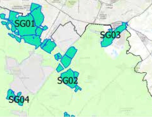
The Preferred Options consultation for the South Warwickshire Local Plan identifies SG01, SG02 and SG03 as potential growth options. These sites reflect the plan’s “Sustainable Travel and Economy” strategy prioritising locations that reduce car dependency, support economic growth, and deliver infrastructure alongside housing.
The approach favours larger, well-planned growth areas over scattered development to achieve climate and sustainability goals.
The map shows these sites in relation to the masterplan site at King’s Hill Lane:
If these are allocated in the Local Plan and removed from the Green Belt, there is an opportunity to consider them in the design of the King’s Hill Lane Masterplan, for example future site access and active travel connections.
8.4 Local Planning Policy
Warwick District Local Plan, September 2017
The Warwick District Local Plan was adopted 20th September 2017. It replaces the policies of the Warwick District Local Plan (adopted in September 2007) and covers the period between 2011 to 2029.
There are a number of key policies within the Local Plan, which are relevant to the design of the King’s Hill Lane Masterplan. These have been listed below, with further detail provided regarding policies relevant to the masterplanning and design code exercise:
Policy DS3: Supporting Sustainable Communities
Policy DS11: Allocated Housing Sites.
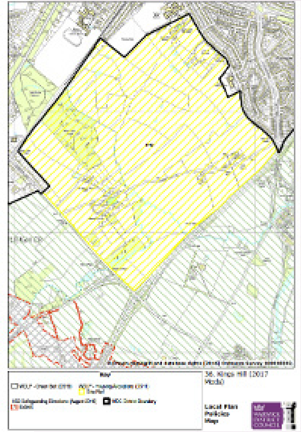
The King’s Hill Lane site is identified as a ‘Greenfield Site – Edge of Coventry, under ref. H43. The wording identifies that King’s Hill Lane can accommodate 1,800 dwellings with a total capacity of up to 4,000 dwellings, with the balance to come forward beyond the plan period. It further identifies potential for some employment land, land for secondary school provision, new primary schools, local centre, community facilities and a health centre.
Wording lifted from the Local Plan is provided below:
Policy DS18: Green Belt
Identifies that the King’s Hill Lane site has been removed from the Green Belt. The policies map shows that the southern and eastern edge of the site is bounded by land still within the Green Belt and so it will be important to treat the edge appropriately through design.
At King’s Hill Lane an area of 269ha has been identified for a residential-led, mixed-use development. The site has an overall capacity of c. 4000 dwellings, with c.1800 dwellings being deliverable by the end of the current plan period. The mixed-use development may also deliver opportunities for employment provision. Land will be made available for open space, leisure and amenity uses and a green infrastructure network will link to the wider countryside and north to the conurbation. A local centre will be provided at an appropriate scale, incorporating a range of local community facilities and services including meeting space / community buildings, emergency services infrastructure, youth facilities / play areas and local retail provision for convenience shopping. Land for education will be required to serve the development, which will need to be expanded as the site develops over time.’ (Para 2.50, p 26).
Policy DS20: Directions for Growth South of Coventry.
This policy addresses strategic growth in the area including and surrounding the King’s Hill Lane Masterplan site, identifying the need for a new link road, improved transport connections, safeguarding of the HS2 route and future expansion plans at Warwick University. The policy touches on the major upgrade to the A46 / Stoneleigh Road junction and further improvements to the A46 Link road.
Policy SC0: Sustainable Communities
Policy BE1: Layout and Design
Policy BE2: Developing Significant Housing Sites
Policy HS1: Healthy, Safe and Inclusive Communities.
The policy sets out that support will be given for proposals which provide homes to meet the needs of the elderly and disabled people, have a design and layout to minimise crime and improve community safety, facilitate movement on both foot and bicycle, improve access to green spaces and provides good access to local jobs, services and facilities.
Policy HS6: Creating Healthy Communities
permits development where they provide good access to healthcare facilities, they provide opportunities for healthy exercise and community cohesion, the ensure high-quality housing outcomes to meet the needs of all age groups in society, they provide access to high quality safe green or open space and access to opportunities for indoor and outdoor sport and recreation.
Policy HS7: Crime Prevention
sets out that the layout and design of development should limit the potential for crime and anti-social behaviour. Proposals should orientate and design buildings to enable natural surveillance of public spaces and parking areas, create a sense of ownership, define public and private spaces, and make provision for appropriate security measures including lighting, landscaping and fencing.
Policy CC1: Planning for Climate Change Adaptation
states that all development is required to be designed to be resilient to, and adapt to the future impacts of, climate change through the inclusion of adaptation measures where appropriate which include using layout, building orientation and construction techniques and materials to mitigate against rising temperatures, optimising the use of multi-functional green infrastructure for urban cooling, incorporating water efficiency measures and minimising vulnerability to flood risk by locating development in areas of low flood risk.
Policy FW2: Sustainable Urban Drainage
sets out that appropriate SUDs are required on all developments and should be designed to sensitively integrate with green infrastructure, promote enhanced biodiversity, increase landscape value, and provide good quality open spaces.
Residential Design Guide SPD , May 2018
The Residential Design Guide sets out the general approach to design principles for those proposing new residential development in Warwick District and covers whole estates. It reiterates the concept of Garden Cities, promoted through the NPPF and supports this approach for larger scale developments within the district, which is relevant for the King’s Hill Lane Masterplan site, which is both a large scale development site but also on the rural edge.
Key design principles are set out, which provide guidance for the high level masterplanning process at King’s Hill Lane, these are identified below:
1. Context and Local Distinctiveness
- Analyse the character of the area: street patterns, building forms, materials, and landscape.
- Respect heritage assets, conservation areas, and listed buildings.
- Incorporate local architectural identity while allowing for innovative, high-quality contemporary design.
2. Layout and Design Principles (Policy BE1)
- Harmonise with existing settlement patterns and topography.
- Reinforce urban character of streets and spaces.
- Respect scale, height, massing, and adopt appropriate materials.
- Integrate with existing paths, streets, and movement networks.
- Provide natural surveillance and design out crime.
- Ensure accessibility and inclusion for all users.
3. Density and Scale
- Minimum 30 dwellings per hectare on greenfield sites (higher near town centres/public transport).
- Balance density with Garden Suburb principles: tree-lined streets, green spaces, and varied housing mix.
4. Housing Mix and Community
- Comply with Policy H4: provide a mix of house types and sizes for different age groups.
- Include community facilities, parks, and play areas to support healthy lifestyles.
5. Open Space and Amenity
- Adequate private gardens (e.g., 40–60 sqm for houses, 10 sqm per bedroom for flats).
- High-quality public open spaces integrated into the design.
- Avoid awkwardly shaped or steeply sloping amenity areas.
6. Movement and Connectivity
- Safe, convenient walking and cycling routes linking to wider networks.
- Public transport access and roads designed for buses and emergency vehicles.
- Minimise car dominance, consider parking standards and permeable surfaces.
7. Sustainability and Climate Resilience
- Incorporate SUDS, green infrastructure, and water management.
- Design for energy efficiency, orientation, and natural ventilation.
- Use native landscaping for biodiversity and urban cooling.
Distance separation guidance is also of particular relevance to the design of the masterplan as it affects the size of the urban block. Key separation distances are provided below:
- 22m between front/back of 2 storey properties
- 27m between front/back of 3 storey and 2 storey properties
- Opportunity to reduce 22m separation distance across public streets to 15m, to enhance design, but 22m would need to be provided at rear.
Parking Standards SPD, June 2018
The Parking Standards SPD sets out detailed policies for vehicle and cycle parking for all developments, supplementing Local Plan Policy TR4. It moves away from restrictive maximum parking standards (previous national approach) to ensuring sufficient provision based on local car ownership and accessibility and recognises that limiting parking alone does not reduce car ownership.
It identifies the following provision for major developments:
Vehicle Parking (Allocated + Unallocated)
- 1-bed dwellings: Allocated: 1 space, Unallocated: 20% of total allocated spaces across the site (for developments of 10+ dwellings)
- 2-bed dwellings: Allocated: 2 spaces
- 3-bed dwellings: Allocated: 2 spaces
- 4+ bed dwellings: Allocated: 3 spaces
- Unallocated provision: Typically on-street or shared areas for visitors and overflow parking.
Cycle Parking
- Minimum: 1 space per dwelling (including flats and apartments).
Electric Vehicle Charging
- Allocated spaces: 1 charging point per dwelling with dedicated parking.
- Unallocated spaces: 1 charging point per 10 spaces.
Space Dimensions
- Standard bay: 2.5m (W) × 5.0m (L)
- Against wall: 3.0m (W) × 5.0m (L)
- Between two walls: 3.5m (W) × 5.0m (L)
- EV bay: Minimum 2.8m wide
- Garage (if counted): 4.0m (W) × 6.5m (L)
Public Open Space, April 2019
The Public Open Space SPD sets out guidance for the provision, enhancement, adoption and future maintenance of Public Open Spaces (POS) required in conjunction with new residential and commercial development across Warwick District. It replaces the previous Open Space SPD that was produced and adopted by this Council in 2009.
Of particular relevance to the King’s Hill Lane Masterplan Site are the requirements for green/open space per 1000 population. The report states the following:
5.47 ha per 1,000 population (plus 0.42 ha per 1,000 population for allotments on sites over 100 dwellings).
Breakdown by Typology:
- Parks & Gardens: 35%
- Natural Areas: 35%
- Amenity Green Space: 17%
- Allotments: 7%
- Children/Youth Areas: 6%
Kenilworth Conservation Area
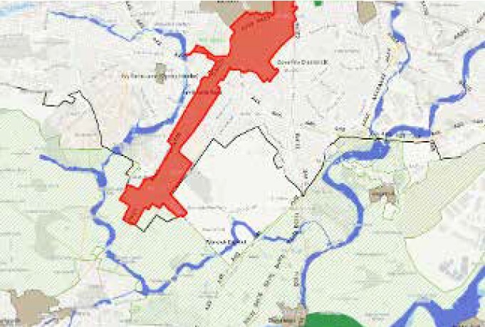
The Kenilworth Conservation area lies directly west of the King’s Hill Lane site, identified in red on the plan on the following page.
The Kenilworth Road Conservation Area is a designated area in Coventry, UK, known for its fine approach to the city, characterized by the mature “Spinney” woodland lining the road and large, detached houses set back with extensive gardens. Designated in 1968, it extends from the city boundary along Kenilworth Road, maintaining a green and leafy character with open spaces like the War Memorial Park and Stivichall Common. The area is subject to certain rules, such as those governing the management of the woodland and the appearance of buildings, to preserve its character.
Key features:
- The main feature is the “Spinney,” a woodland that runs for nearly 3 miles along the road. The woodland is publicly owned and maintained by the Coventry City Council.
- The area features a continuous green landscape with wide verges and mature trees that merge into other woodlands and open spaces like Stivichall Common and the War Memorial Park.
- Behind the tree belt, there are large, detached houses with extensive gardens, contributing to the area’s leafy and exclusive feel.
- It was designated a Conservation Area in December 1968, along with other Coventry areas like Allesley Village and Stoke Green.
- Management practices for the woodland include coppicing, ride, and glade management, aimed at maintaining its ecological health and appearance. Rules also exist to ensure that any attachments to roadside posts are low-key and blend with the natural environment.
There is opportunity for the conservation area to influence the design of the masterplan for King’s Hill Lane.
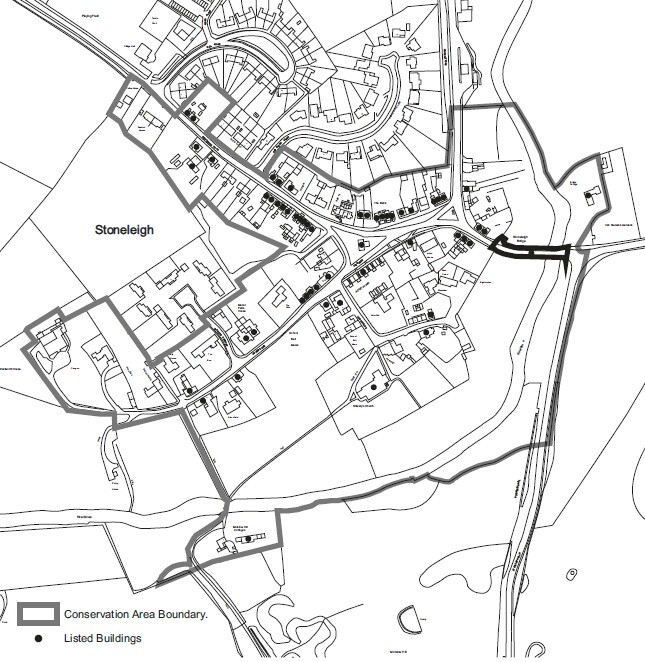
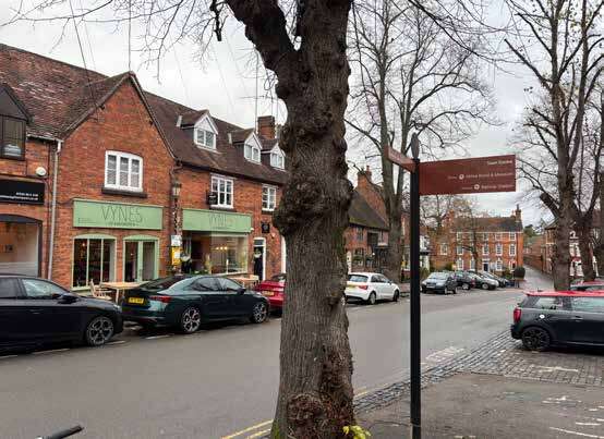
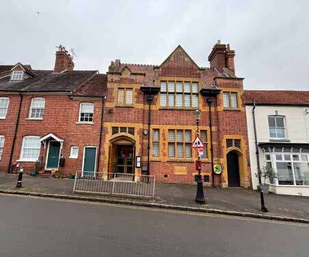
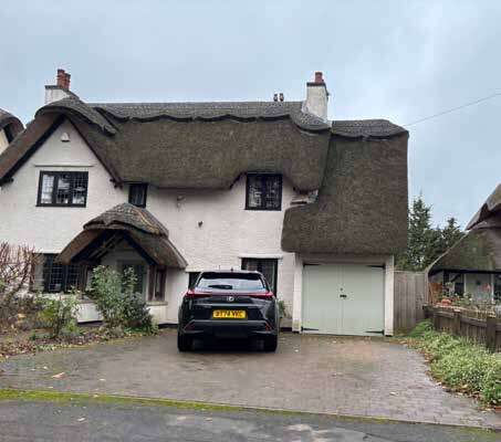
Stoneleigh Conservation Area
The Stoneleigh Conservation area lies 1.5km to the east of the site. It was designated in 1969 and extended in 2001.
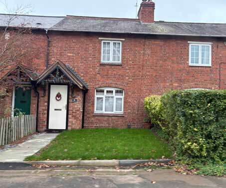
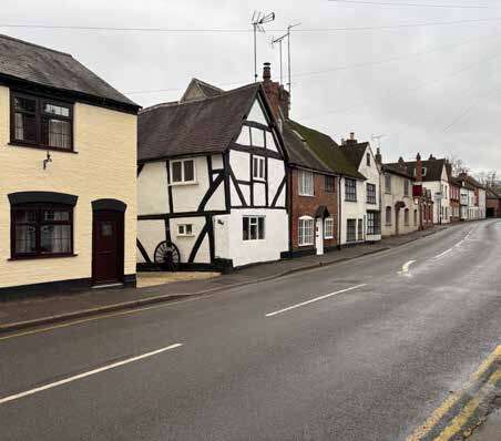
Originally known as Stanley, the Stoneleigh village once lay within the Forest of Arden. The manorial estate continued as crown property after the Conquest, until 1154, when the Cistercian Order of monks at Radnor petitioned Henry II to move them to the manor of Stoneleigh, where they built the Abbey.
Stoneleigh Village has a clearly defined centre around The Green with the Old Forge in the centre There are a number of heritage buildings, of predominantly brick cottages, some timber-framed with brick infill, and sandstone properties.
There is opportunity for the conservation area to influence the design of the masterplan for King’s Hill Lane, with regard to:
- Materials - brick, timber framing with brick infill, and sandstone.
- Layout and setting - distinct village around the Green
- Boundary treatments – soft landscaping and hedges, rather than hard fencing
- Open space - small open spaces, framed by buildings and the provision of a community orchard
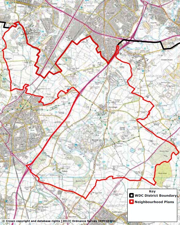
Stoneleigh and Ashow Neighbourhood Plan
The Stoneleigh and Ashow Neighbourhood Area was designated in 2014 and includes the King’s Hill Lane site. Consultation began in March 2023 but there is not currently a Neighbourhood Plan Area designated for Stoneleigh and Ashow.
8.5 Planning History
8.5.1 Planning Application History
There are several live and extant planning applications on the King’s Hill Lane site, which have been used to inform production of the illustrative masterplan for the site. Key applications are detailed below:
|
Site and Status |
Applicant |
Details |
Commentary |
Influence on the masterplan and design code process |
Masterplan image |
|---|---|---|---|---|---|
|
King’s Hill Lane Park Submitted: March 2018 Status: Granted December 2019 Ref: W/18/0643 |
Lioncourt Strategic Land Ltd. |
Outline planning permission for the development of up to 2,500 dwellings, 4,000m2 of mixed-use floorspace (A1, A2, A3, A4, A5, B1, C2, D1 and D2), primary school, secondary school, open space and associated infrastructure. Number of conditions since discharged, S106 signed. |
|
Illustrative masterplan, parameter plans and S106 phasing strategy have been used to inform the allocation site masterplan and also elements of the design code. |
|
|
Land off Stoneleigh Road Submitted: November 2023 Status: Live Ref: W/23/1722 |
RCA Regeneration Ltd |
Demolition of 3no. existing stables and construction of 20.no dwellings with associated infrastructure.
|
|
Scheme included within the illustrative masterplan, and taken into consideration when reviewing access requirements off Stoneleigh Road. |
|
|
Southern parcel – landholding promoted south and east of Finham Brook Submitted: N/A Status: Pre Planning Ref: N/A |
TBC |
Vision masterplan discussed with WDC in November 2017 for its land south of the Finham Brook. Demonstrates the case for a mixed-use development. Principles:
|
Local Plan, in particular potential new employment areas to south east.
|
Masterplan principles incorporated into the design of the masterplan . |
Not in the public domain. 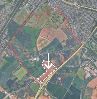 |
|
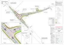
Coventry City Council planning application - FUL/2018/0842 |
Coventry City Council |
Installation of two new highway access junction, as amended by PL/2023/0000875/NMA |
Application submitted for detailed design of Stoneleigh Road and King’s Hill Lane junction, |
Access highway junction design should be considered as part of the masterplan and movement framework, and for all future reserved matters applications |
|
8.6 Townscape Character
A high level townscape character study has been undertaken to understand the history of development on and around the site, the character of buildings and places in the local area and key features which are distinct to the site. This information provides design cues for future development and influences the form and layout of the masterplan.
Site History
Maps from the mid to late 1800s show agricultural fields across the site, with some field boundaries aligning with the present-day ones, but most fields broken up into smaller parcels. The Coventry and Leamington Branch railway line is visible along the western edge of the site. There are several farmsteads off King’s Hill Lane (as they exist today), and the surrounding area is made up of similar agricultural fields with small parcels of woodland.
To the north of the site, Coventry is an established city, built around a historic medieval core, and expanding out. New development is beginning to be laid out in Earlsdon, Lower Stoke and Cheylesmore, roughly 2km from the northern edge of the site.
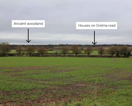
The surrounding historic village/settlements of Baginton, Stoneleigh, Kenilworth and Canley can be identified, surrounded by agricultural fields.
Maps from the 1940s to 1960s show the expansion of the Coventry suburbs right up to the northern edges of the site, with new housing along Green Lane and a new highway north of the site called Stonebridge Highway.
Maps from the 1970s-1980s show the development of the A46 highway (completed in 1974) along the eastern edge of the site and crossing the Finham Brook watercourse. By the 1980s, the suburban areas between Coventry city centre and the site had been developed out, with new neighbourhoods in Stivichall and Finham and accompanying schools, churches and parks.
The University of Warwick was established in 1965) to the west of the site, with further development and expansion over the next four decades.
Recent mapping from the 2020s, shows the setting of the surrounding historic villages/settlements affected by new development in the following ways:
- Baginton - retains village setting, but significant industrial/commercial development around the Coventry Airport to the east.
- Stoneleigh - retains village setting but major earthworks for HS2 to the west of the village
- Kenilworth - major expansion of settlement with new housing
- Canley - consumed by suburban development, present-day Cannon Park
Site Context Today
Today, the local townscape character comprises suburban Coventry and its agricultural hinterland.
Much of the surrounding 20th-century residential development does not reflect the area’s historic character and contributes to an urban fringe feel, particularly where visible from the site’s northern slopes.
The south western boundary is defined by the busy Stoneleigh Road, with conservation area housing to the north west and rising agricultural land beyond, while the remainder meets King’s Hill Lane and the wooded Finham Brook valley.
To the south-east, undulating, well-treed Arden parkland aligns with typical enclosed, rolling landscapes, though urban fringe elements such as the sewage works, golf course, and Stoneleigh Park intrude.
Local Character Areas
A site visit took place in November 2026, and key areas within and around the site have been assessed over the following pages.
The map opposite highlights the local areas discussed on the following pages.
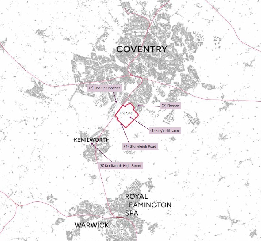
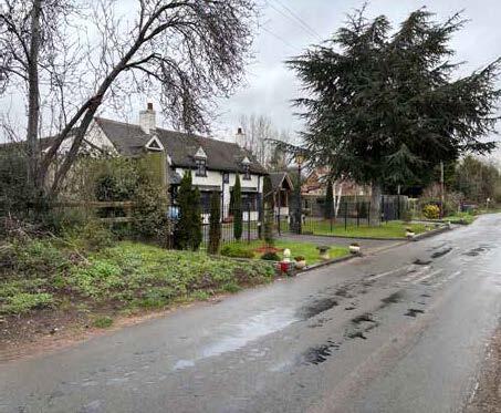
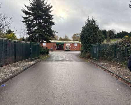
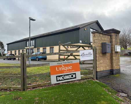
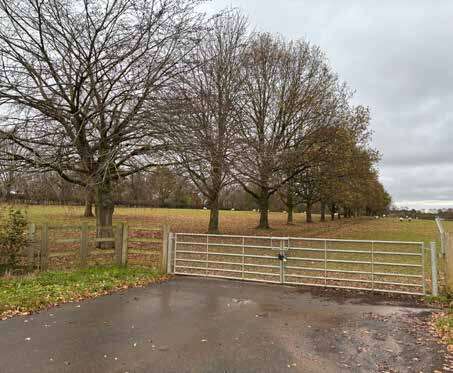
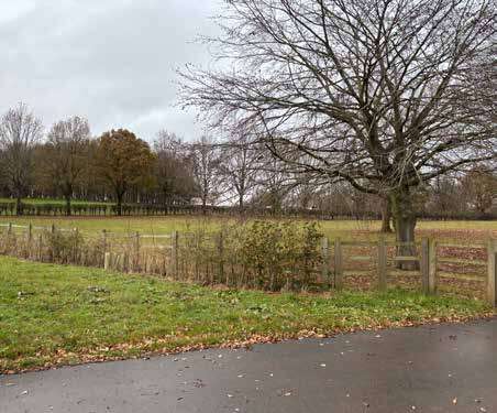
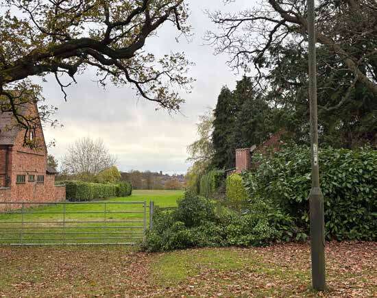
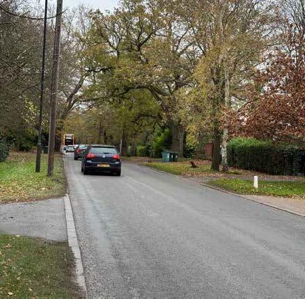
8.6.1 King’s Hill Lane (1)
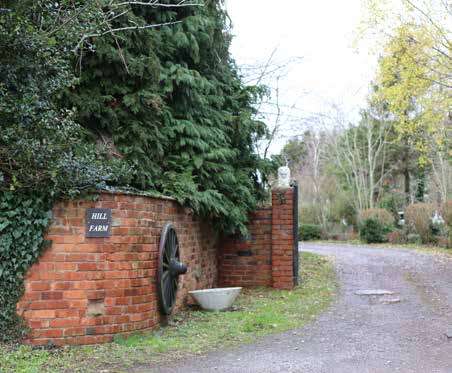
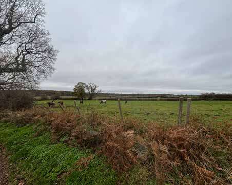
Rural in character with boundaries defined by hedgerows, trees and foliage. Mostly providing access to agricultural fields, there are several dwellings/farmsteads and commercial buildings along King’s Hill Lane.
The older and more historic buildings are predominantly red brick or white rendered, and properties are stepped back from the street and screened from view by trees and foliage in some areas.
More modern developments, for example, the King’s Hill Lane Nurseries group of buildings, include large sheds, and buildings are screened from the road by a hedgerow along the boundary.
There is a modern commercial building, part render, part wooden cladding, which contains several different businesses and has been designed in a barn/agricultural shed style.
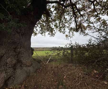
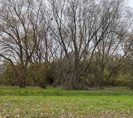
Landscape
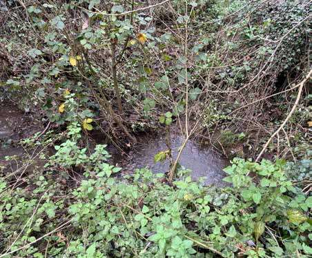
Mature and veteran trees, dense woodlands, hedgerows and watercourse also visible.
Variation in the transition from open fields to tree-lined patches.
The field boundaries are well defined with mature hedgerow and there is a substantial mix of seasonal and evergreen trees, rendering seasonal variation.
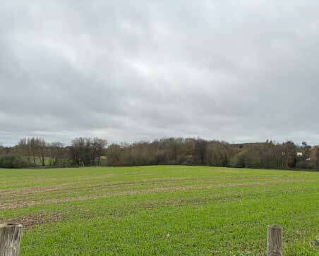
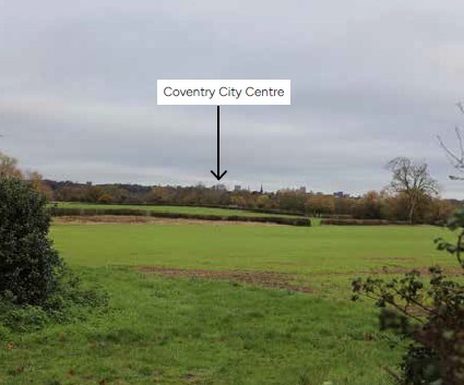
Views
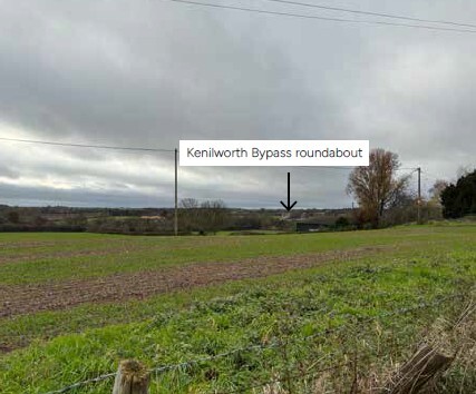
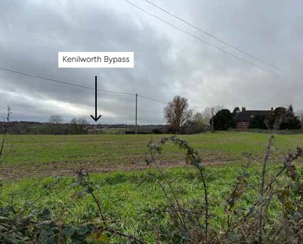
Long-range views from the highest topographic point through a break in the treeline on King’s Hill Lane provide views of Coventry city centre skyline and the Kenilworth Bypass roundabout.
The Coventry skyline creates a distinctive identity marker, reinforcing place character.
The topography and landform allow for long-distance views across fields within the site.
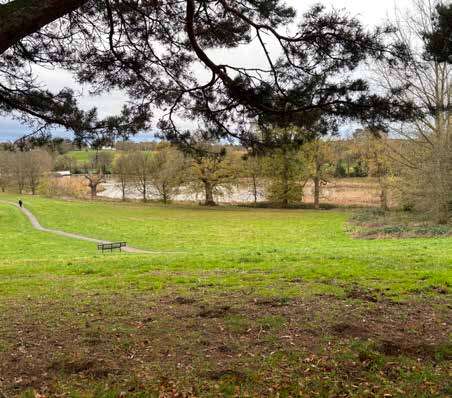
8.6.2 Finham (2)
The Finham neighbourhood lies directly north of the site and forms the existing edge of the Coventry urban area.
Built form
A strong neighbourhood character with linear streets and long rows of housing, predominantly semi-detached and terraced properties, built around the 1930s-1950s.
Character is defined by a consistent architectural approach, which includes a consistent roofline, use of bay windows and symmetry between windows and roof elements.
Subtle changes in architecture influenced by different builders or scarcity of labour/materials during periods of war/ inter-war years.
A large proportion of homes feature side extensions, roof extensions and porch modifications, visible from the street. Positive and negative contributions to the street scene and original architectural rhythm.
Public Realm and Landscape
Uniform pedestrian footways on both sides of the road. Green verge with tree planting along key link roads, helping to define street hierarchy.
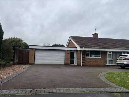
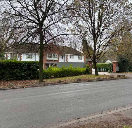
8.6.3 The Shrubberies (3)
Residential area to the west of the site. Low-density neighbourhood, predominantly detached 1960s/1970s bungalows with wide plots and generous offsets from the street. Transitions to larger semi-detached and detached housing further north along Cannon Park Road. Properties here are 1930s-40s Arts and Crafts style.
Public Realm and Landscape
Stronger edge of settlement character here with bungalows fronting onto open space.
Gilbbet Hill Wood is a natural woodland buffer between the residential neighbourhood of The Shrubberies and the adjacent cul-de-sac developments. It is an accessible green space with walks and trails, connected to the Vale open space to the north.
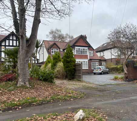
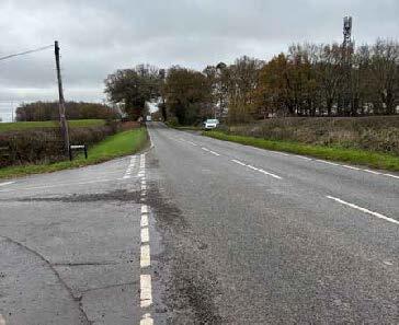
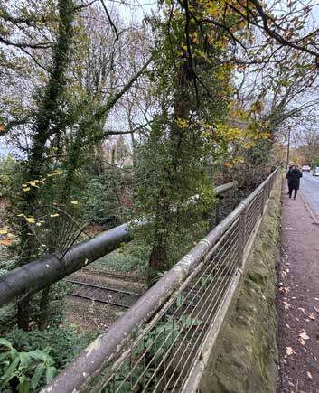
8.6.4 Stoneleigh Road (4)
Stoneleigh Road is located to the west of the site. It stretches from Kenilworth Road, crosses through the Kenilworth Bypass and continues towards Stoneleigh.
Built form
Large detached and semi-detached properties and mansions, which fall within the Kenilworth Road Conservation Area. Wide driveways and approach to properties through hedged boundaries.
A wide range of architectural styles and periods, ranging from Modern, Mock Tudor, Arts and Crafts Styles and Mid-Century architectural designs.
Public Realm and Landscape
Footway separated by a wide planted verge. Mature trees line the property boundaries, which provide enclosure to the road. The pedestrian link crosses over the rail bridge. Discontinuous segregated pedestrian way beyond the houses as the road approaches King’s Hill Lane.
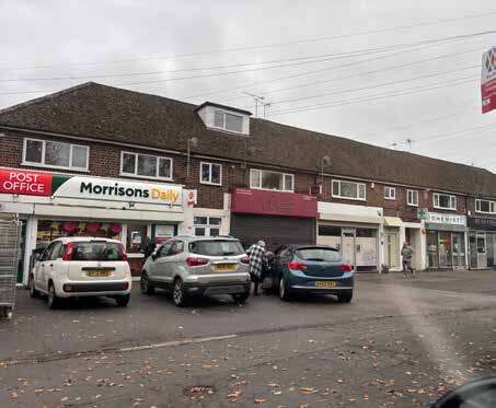
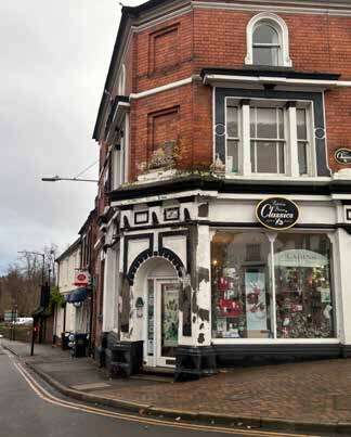
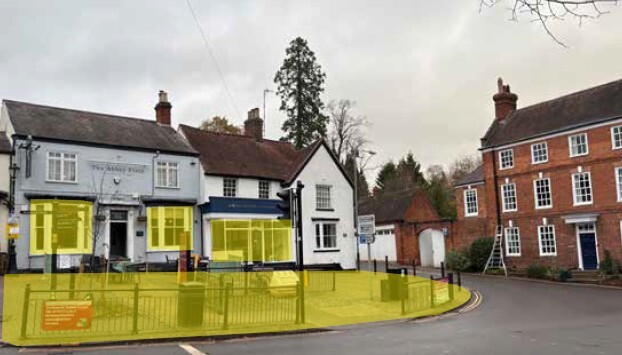
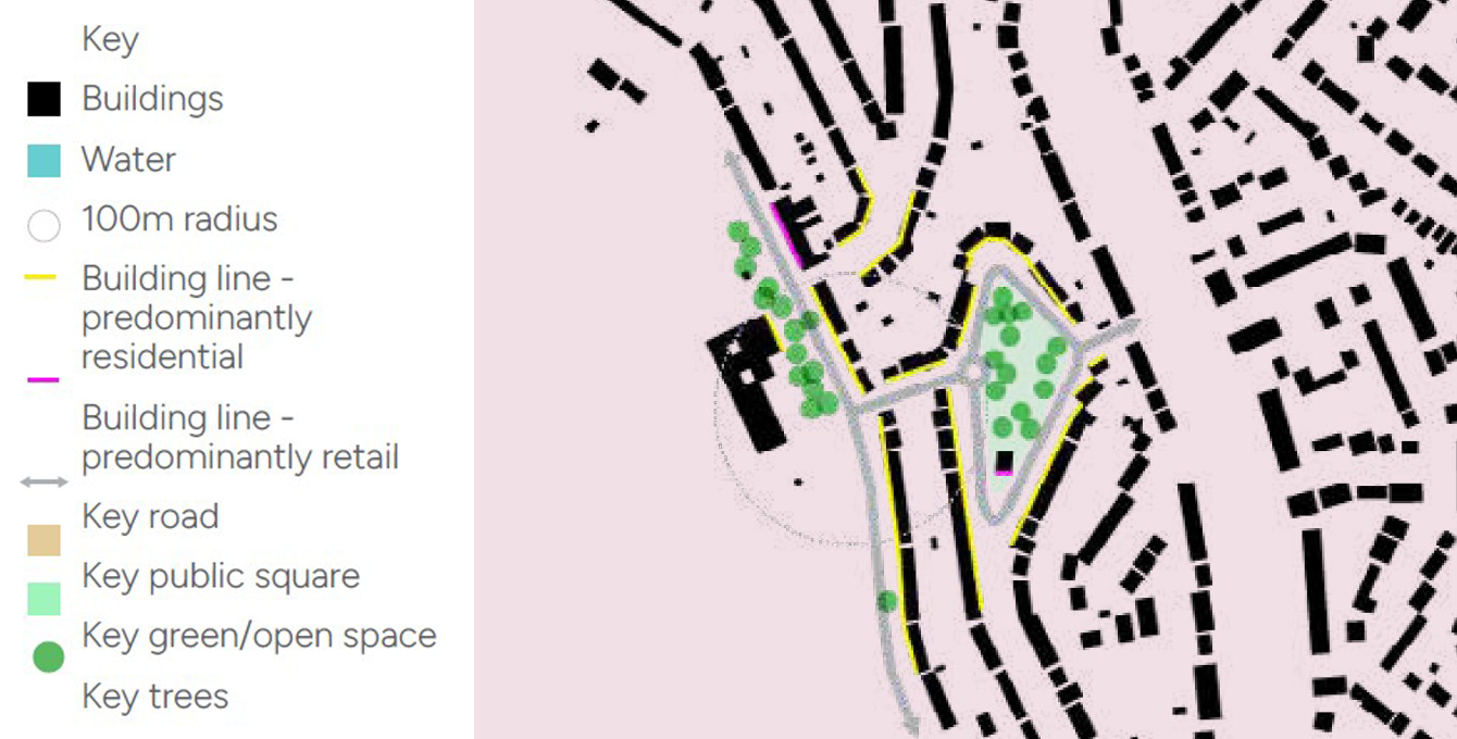
8.6.5 Kenilworth High Street (5)
Market town located within 2.5km of the southern edge of the site. historic market‑town character shaped heavily by the presence of Kenilworth Castle and the remains of St Mary’s Abbey, which continue to dominate the town’s visual identity and sense of place. The settlement lies around Finham Brook, a tributary of the River Sowe, and retains a traditional town centre with a mixture of historic buildings, open green spaces and established residential neighbourhoods.
Built form
Variety in traditional architecture lines the High Street from historic cottages and Victorian houses of brick and stone. Densely lined historic high street with commercial, retail and community use. Unique detailing on arches, cornices and pediment highlight local identity. Traditional courtyards connecting multiple cottages are connected through a driveway to the street.
Public Realm and Landscape
High quality environment around the medieval high street, with strong sense of enclosure, heritage buildings, street trees and cobbles adding to character and identity. Mix of period architectural styles, and range of shops and uses add to interest and experience of the street.
8.6.6 Key Character Influences
The maps illustrate key features from the local area to identify the positive townscape characteristics which could influence the design of new development at King’s Hill Lane, and create a place which is local to its context, with a strong identity:
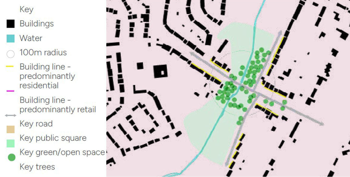
Finham Green, Green Lane
- Linear streets, permeable street network
- Strong building line with consistent placement of bay windows, doorways, roofline and gables.
- Houses front onto Finham Green, creating a pleasant, overlooked neighbourhood park.
- Row of shopping facilities in Green Lane, opposite school, promotes activity.
- Trees along Green Lane strengthen the hierarchy of street, however, large driveways to housing reduces cadence of street trees.
- Sample density approximately 27dph.
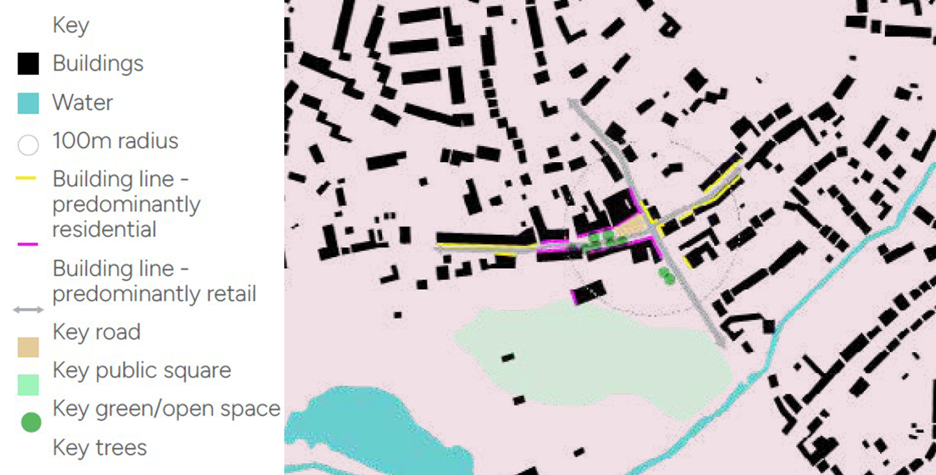
Stoneleigh Village Centre
- Medieval street network with strong building line enhancing the arrival into the village.
- Redbrick and timber framed historic buildings evoke a strong sense of identity, with terraced front gardens, stone steps and walls adding to character.
- Other successful boundary treatments include picket fences and hedgerows.
- Grass banks provide a softer edge to the street scape and enhance rural character of the village.
- Community orchard to the south east of the centre.
- Sample density approximately 17 dph.
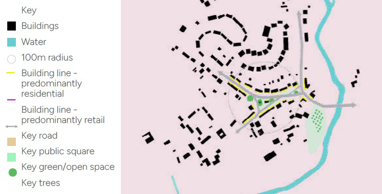
Kenilworth Village Centre
- Strong sense of history with a range of buildings from different periods, adding to the character of arrival.
- Strong building frontage with a mix of town centre uses (shops, pubs, bars) providing active frontages onto the high street and enclosing a small public square at the cross roads.
- Redbrick and timber-framed historic buildings evoke a strong sense of identity, with terraced front gardens, stone steps and walls adding to character.
- Large street trees add to the character and provide shading in the summer months.
- Parking is provided but not overly dominating the space due to the use of cobbled materials and the location of street trees in the carriageway.
The Shrubberies
- Good transition from urban area to settlement edge, with lower density ad houses overlooking open space.
- More informal building line, helps to break up rigidity of urban area and signal transition to edge of settlement
- Street trees signalling arrival into open/greenspace.
- Sample density approximately 10 dph.
Conclusion
The local townscape character study has drawn out a number of key recommendations:
- In more urban areas in the north of the site, there is an opportunity for a uniform building line along streets, with architectural elements such as doorways, windows and roof features repeating across houses to signal arrival in a suburban environment
- In more rural edge areas, there is opportunity for a more informal building line, and greater set-back form the street for front gardens, to signal the transitional from urban to rural and better interact with the open and natural spaces being provided
- Use of green spaces and village greens to help frame nodes and key junctions and soften the more urban nature of housing areas
- Use of street trees to help signal street hierarchy
- Provision of local square within key local centres, to help strengthen the arrival, and allow space for people to congregate.
- Parking areas could be enhanced through landscape design, e.g. with cobbles and tree planting in the carriageway
- Architecture and local building materials, used in local historic areas such as Kenilworth and Stoneleigh can influence design of landmark buildings on the site, to create a strong, contextual identity