Draft Kings Hill Masterplan and Design Code Supplementary Planning Document
1 Introduction
1.1 Introduction
The King’s Hill Lane site is set to provide up to 4,000 new homes by 2050. It presents a significant opportunity for a well-designed neighbourhood which respects and enhances the natural environment, promotes active and sustainable travel choices and fosters a genuine sense of community.
1.1.1 Purpose of the design code
The King’s Hill Lane Masterplan and Design Code SPD will provide supplementary guidance to Local Plan policies such as DS11 and DS15, in addition to providing guidance to future South Warwickshire Local Plan policies. It can assist with the discharging of conditions such as the requirements for site wide and phase wide masterplans and design codes.
This design code seeks to encourage quality placemaking at King’s Hill Lane, through:
- Channelling guidance and policy objectives at local and national level, including for example the approach advocated by the National Model Design Code (which sets the structure of this report).
- Establishing principles for good design that are specific to the site and respond to its context and the wider Warwickshire/Coventry areas.
- Providing a foundation for common ground between Council officers and developers, prior to the approval of future planning applications.
- Presenting design information and key principles in a clear and concise manner and in a user-friendly report.
The scale of the site, number of homes to be delivered and various landowners present several challenges for the future delivery of the site.
This design code, which has been informed by a high-level masterplan for the site, seeks to ensure that key design elements of the masterplan, such as road layout, location of open space and the provision and protection of biodiverse areas, can be delivered in a strategic and consistent manner across the site.
At the same time, it is understood that a degree of flexibility is required, to ensure that future development can respond to changes such as climate resilience, market demand, technologies and best practice.
1.1.2 Purpose of the masterplan
The aim is to provide a comprehensive masterplan for the King’s Hill Lane site, identified as ‘Greenfield Site Edge of Coventry’, under ref. H43. The masterplan will provide an overarching framework for the application of the design code. The masterplan includes:
- The landscape strategy, taking account of existing natural features and new structural elements.
- The amount and position of open space and play provision.
- The number of homes and other uses (from the local plan allocation).
- The points of access and connection to the wider street network.
- Movement framework and street hierarchy.
- The positions of local centres and schools.
- Positions of frontages, gateways and urban squares.
1.1.3 Production of the design code
The production of this design code has been led by Warwick District Council (WDC), complemented by a core group of consultants with project planning, engagement, urban design and architecture and engineering skills.
The design code has been produced in line with national guidance on design and sustainable development. The code follows a high-level masterplanning process, which involves:
- A review of existing and live planning applications for the site
- A technical review of existing information for the site
- Opportunity and constraints mapping
- Exploration of a site wide vision and objectives to drive future development and design principles to guide spatial design
- Production of an illustrative masterplan for areas of the masterplan not covered by existing/live planning applications
- Stakeholder engagement on the site wide masterplan
- Development of coding principles, based on the agreed masterplan for the site
Once adopted/approved, the Design Code will act as a site-specific Supplementary Planning Report and sit within WDC’s suite of Local Plan reports.
The Design Code focuses on positive planning and design. It does not seek to highlight poor design and implementation, on the understanding that developers and design teams are aligned with the broad aims and Vision for King’s Hill Lane site and appreciate the value of good design.
1.1.4 Relationship with Existing Planning Permissions
Where planning permission has already been granted within the Masterplan area, future planning applications will be expected to have due regard to the principles established through those permissions, including approved parameters relating to land use, layout, scale, access, and landscape. The Masterplan and Design Code should be applied in a way that complements and does not undermine extant permissions.
|
Who Uses the Design Code |
Why They Use It |
What They Need to Do |
|---|---|---|
|
Developers and landowners |
To understand what is expected for their land and make sure their plans fit with the overall layout |
Follow rules on building placement, height, style, materials, streets, and open spaces. Coordinate with neighbouring sites to keep the area consistent |
|
Architects and designers |
To guide the design of buildings, streets, and public spaces in line with the vision for the area |
Make sure building shapes, materials, and streets match the plan. Keep streets, parks, and key views connected |
|
Planning officers and council |
To check planning applications and make sure new development fits the masterplan |
Look at proposals against the design code and regulating plan. Ensure buildings, streets, and public spaces follow the rules |
|
Landscape architects and engineers |
To design parks, streets, and green spaces that work with the masterplan |
To design parks, streets, and green spaces that work with the masterplan. Make sure parks, planting, and paths are in the right place and linked to the wider area |
|
Community and Local People |
To understand how the development will look and affect the area |
Give feedback and comments. See how design choices will affect streets, parks, and local services |
1.2 Using the Design Code
This document has been produced to inform future planning applications and assist with decision-making.
1.2.1 Using the Design Code
This report sets out a strategic design rationale that will ensure comprehensive delivery in accordance with the overall vision for the site. The plans contained within this report are intended to provide a spatial representation of how the written requirements can be achieved. Specific locations and arrangement of uses demonstrate opportunities to achieve the delivery of sustainable neighbourhoods and quality placemaking. Plans are therefore to be considered as guidance. The structure of this Design Code is set out below.
Understanding the site and context
- 02 Vision - Sets our vision and objectives for the site
- 03 Context - Provides information on key features on the site and in the local area, which can drive design
- 04 Constraints & Opportunities - Summarises key technical constraints and key opportunities which could influence new development
Guidelines for design and delivery
- 05 Design Codes - Sets out design codes across the masterplan area, covering built form, movement, nature and public spaces, uses, homes and buildings and Resources and lifespan
- 06 Phasing and Infrastructure - Sets out the key phasing and infrastructure objectives
- 07 Checklist - Acts as a toolkit for determining applicants’ adherence with the design codes and guidance
Further information
- 08 Appendix - Summarises the baseline assessments which have been produced to inform the masterplan and design codes
Figure 02 Design code structure
1.2.2 Implementing the design code
As part of future planning applications, developers and their designers will need to clearly demonstrate how they have applied the principles of the Code and complied with their requirements. Applicants will need to provide evidence to demonstrate how the requirements within this design code have been met through their proposals alongside a narrative regarding the adoption or exceeding of the recommended standards. Please refer to section 7 for the design code compliance checklist. Below are overarching design considerations for proposals:
- Movement network
- Materials
- Boundary treatments
- Character areas
- Building design
- Adoption and management
- Sustainable design, construction and energy efficiency
In addition, Warwick District Council will expect applicants to provide more detailed information and policy-specific requirements at neighbourhood/site details.
1.2.3 Comply or Justify Approach
This Design Code provides a framework to guide high-quality residential development in line with relevant planning policies and SPDs. It is to be applied using a “comply or justify” approach.
Proposals are expected to comply with the requirements of the Code. Where this is not possible, a clear and robust justification must be provided to demonstrate how an alternative approach meets the underlying objectives of the Code and achieves an equal or better design outcome.
Any justified departure must be supported by site-specific considerations and must not compromise overall design quality or residential amenity.
1.2.4 Further design quality controls
The Council will continue to promote high-quality design across the site and will encourage and draw on a range of tools that can integrate with and benefit the planning application process. The use of these tools will be established through dialogue between the Council and prospective applicants and used where appropriate:
Planning Performance Agreements (PPAs), when used positively and proactively, should create a framework in which parties come together to agree the design ethos and approach to an application and how they are going to take a development proposal through the planning process.
PPAs can be used to agree on the vision and objectives for development, as well as setting timescales, actions, and resources for handling particular applications. They can also be used as part of the pre-application and application stages and potentially extended to the post-application stage.
PPAs should encourage joint working between an applicant and the Council, and can also help to bring together other parties such as statutory consultees. This can provide a basis for a more efficient, joined-up and less adversarial way of working based on the principles of development management.
A PPA is agreed voluntarily between an applicant and Council, most commonly prior to an application being submitted, although it can also be applied at any stage in the planning process, including managing post-determination aspects such as pre-commencement conditions and reserved matters.
1.2.5 Stakeholder Engagement
Engagement has taken place with several specialists across Warwick District and Warwickshire County Councils, including housing, adult social care, highways and transport (including Coventry City Council), education, sports and leisure, green spaces, ecology, heritage, landscape, climate change, community provision and environmental health. Engagement has also been undertaken with promoters of land within the King’s Hill Lane allocation area. The comments received have helped inform you of this version of the SPD.
1.3 Planning Background
1.3.1 Planning Policy Summary
National, regional and local planning policy confirms support for new residential-focused development at King’s Hill Lane. Elements which are particularly focused on design that could influence new development, include:
- Creation of sustainable development.
- 20-minute neighbourhoods, which allow easy access to local services, such as schools, local amenities and facilities, by walking and cycling.
- Designing for multi-generational living, with housing and spaces designed with safety, sustainability and access in mind.
- Protection of biodiversity, through protecting habitats or species of value from development and exploring opportunities for creating or enhancing green corridors.
- Prioritising active travel gateways, to encourage people to choose to walk and cycle over car use, and reduce the
- health impacts of sedentary lifestyles and carbon emissions.
- Placemaking driven by context creates new places which are tailored to their environments and are recognisable as their own place.
- Landscape-led approach, which understands the location of the development as an edge of settlement, needs to respond to the neighbouring countryside area, as well as the established urban area adjacent to the site.
- Integrated design, which fully connects with the surrounding area, whilst also maintaining future connections to new growth opportunities in the local area, as promoted by the South Warwickshire Local Plan.
The guidance and principles set out in this Design Code should be read in conjunction with the national, regional and local planning policy review contained in Section 8 (Appendix) of this report. The planning policy review reflects the policy context at the time of writing. Any future development proposals must undertake their own planning policy review to ensure that the most up-to-date guidance is referenced in support of planning applications.
The King’s Hill Lane site has been accounted for as a commitment as part of the emerging South Warwickshire Local Plan. With the expectation that King’s Hill Lane will continue to be allocated as part of the South Warwickshire Local Plan, the SPD is intended to provide supplementary guidance to future development plan policies addressing the continued allocation of the King’s Hill Lane site.
1.3.2 King’s Hill Lane Allocation and Future Development Proposals
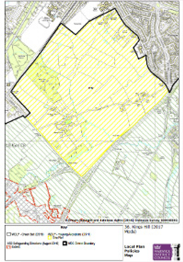
The key driver for development at King’s Hill Lane and the requirement for the masterplan and design code SPD is the allocation for residential-led development outlined in the Warwick District Local Plan, which was adopted on 20th September 2017.
The Local Plan identifies King’s Hill Lane as ‘Greenfield Site – Edge of Coventry’, under ref. H43. The policy identifies that the King’s Hill Lane site could accommodate the following uses:
- 1,800 dwellings with a total capacity of up to 4,000 dwellings, with the balance to come forward beyond the plan period.
- Secondary school provision,
- New primary schools,
- Local centre, community facilities
- Health centre
- Potential for some employment land
Since the allocation, several planning applications and proposals have been received and discussed for the site, including:
- Land at King’s Hill Lane (Ref: W/18/0643) Submitted, March 2018. Planning permission was granted on 24/12/2021. Outline planning permission for the development of up to 2,500 dwellings, 4,000m2 of mixed-use floorspace (A1, A2, A3, A4, A5, B1, C2, D1 and D2), primary school, secondary school, open space and associated infrastructure. Number of conditions since discharged, S106 signed.
- Land off Stoneleigh Road (Ref: W/23/1722) Submitted: November 2023 Status: Live
- Southern parcel – landholding promoted south and east of Finham Brook. Discussed with WDC in November 2017
Further details of the above can be found in the appendix of this report and on Warwick District Council’s website.
1.4 Strategic Context
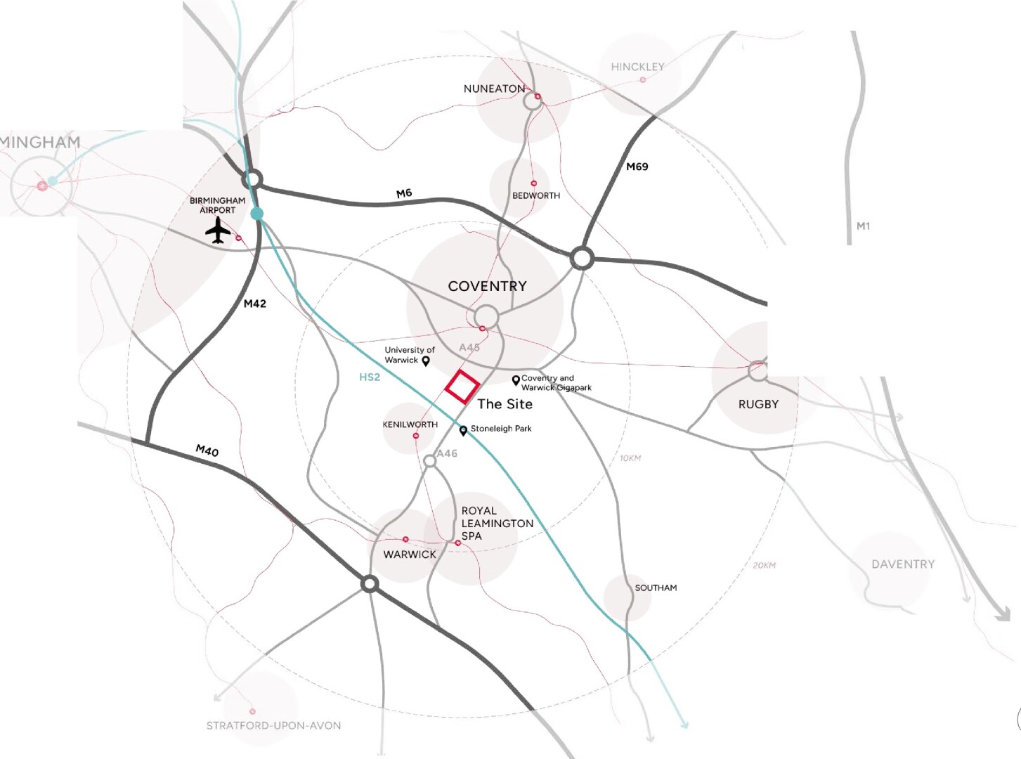
The site is situated within the Warwick District Council administrative area and lies on the southern edge of the Coventry urban area.
1.4.1 Strategic Context
The Coventry City Council administrative area is located to the north of the site. It is well connected to the wider region, with convenient access to the M40, M6 and M42 motorways, providing strong links to surrounding towns and cities.
The nearest major airport is 16.5 km from the site at Birmingham International Airport, while Coventry Railway Station (2.5km to the north), located in the city centre, provides access to the national rail network.
The site is in proximity to several key settlements, such as the historic town of Kenilworth, which lies approximately 3km to the south, and Warwick and Royal Leamington Spa are approximately 8km to the south. The University of Warwick is situated close to the site to the north-west, supporting the area’s educational and employment profile.
There is significant development proposed in the local area set through the adopted Local Plan, which covers growth requirements up to 2029. The site also falls within the South Warwickshire Local Plan area (SWLP) whereby the SWLP will identify future growth up to 2050.
Key developments in the local area include:
- Coventry and Warwick Gigapark Investment Zone is located 2.25 km to the east of the site. A major employment site with a focus on green technology and automotive manufacturing.
- Stoneleigh Park employment site is located 1.9km to the south.
- University of Warwick campus centre is located 1.8km west. They adopted the Campus Framework Masterplan in 2024 and support a £700 million capital investment plan.
- The new HS2 rail line is under construction and located within 1km of the site’s southern boundary. It will improve journey times between Birmingham and London. The closest HS2 station to the site will be located at Birmingham International Airport, located 12 miles from the site.
- Coventry and Warwickshire Gateway sub-regional employment site is located 1.9km east.
- Future plans for Coventry’s Very Light Rail (CVLR), the project is building the case for affordable, low-cost urban rail, connecting key areas and routes to the University of Warwick and the Gigapark/ sub-regional employment site. The current plans focus on a city centre demonstrator line to the University Hospital and Tech Park, with broader network expansion dependent on funding and trials.
The above highlights the pivotal location of the site, near a range of expanding job opportunities, as well as proposed new public transit routes.
1.4.2 Stakeholder Engagement
Engagement has taken place with several specialists across Warwick District and Warwickshire County Councils, including housing, adult social care, highways and transport (including Coventry City Council), education, sports and leisure, green spaces, ecology, heritage, landscape, climate change, community provision and environmental health. Engagement has also been undertaken with promoters of land within the King’s Hill Lane allocation area. The comments received have helped inform this version of the SPD.
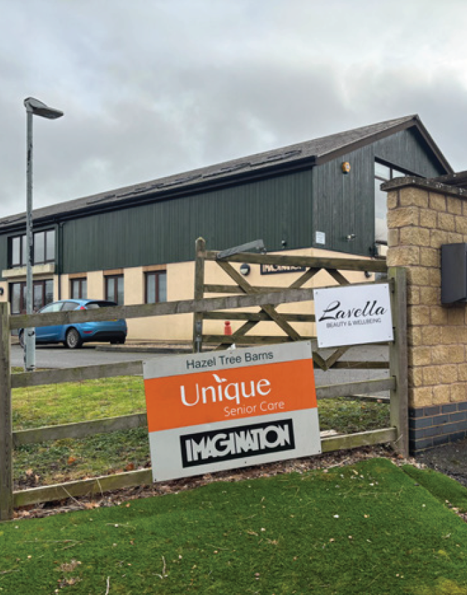
1.5 King’s Hill Lane
1.5.1 Site Location
The King’s Hill Lane site, comprising 269 hectares, is located south of the urban area of Coventry and north of the market town of Kenilworth. It is situated within the administrative area of Warwick District Council. Figure 05 illustrates the extent of the site area in red.
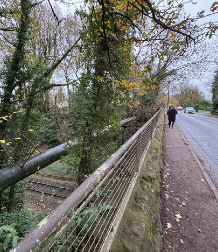
Green Lane binds the north-eastern boundary, and the A46 Kenilworth Bypass borders the south-eastern edge of the site. Stoneleigh Road binds the site to the south-west. The Leamington Spa and Coventry Railway Line run to the west of the site.
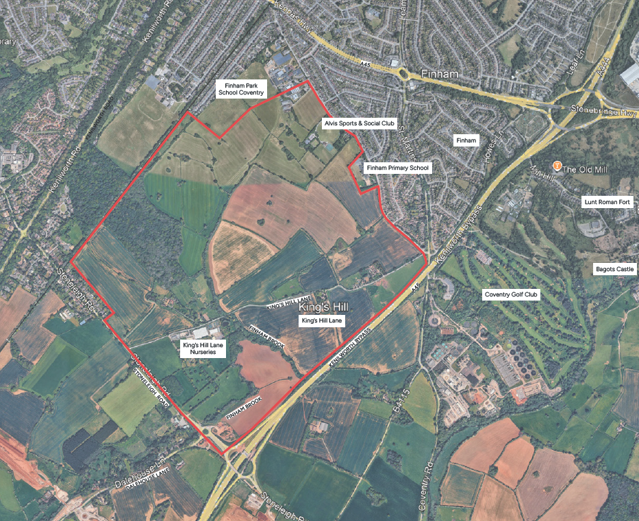
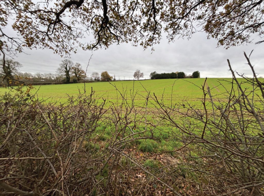
Key Features include:
- Long-range views to Coventry city centre (north) and to Kenilworth Bypass (A46, south).
- Natural features include Wainbody Wood, Finham Brook, existing mature trees and hedges.
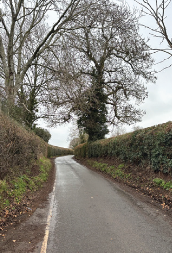
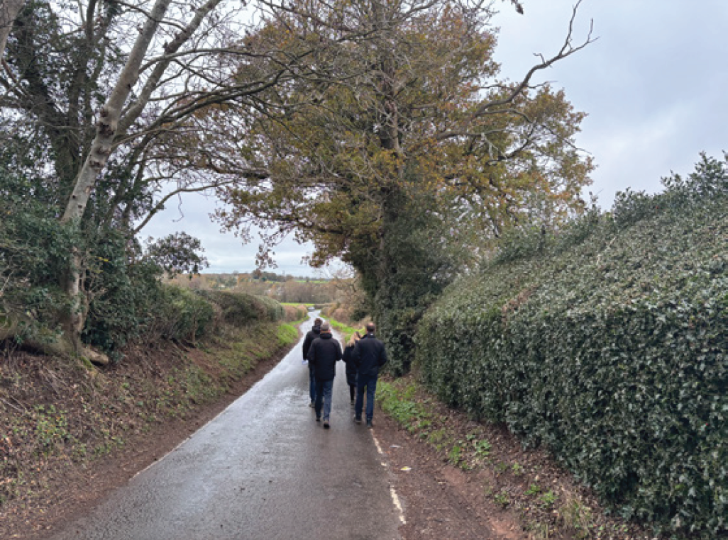
- Main entry is via King’s Hill Lane.
- A new roundabout has been delivered south of Finham Brook on Stoneleigh Road as part of the A46 Stoneleigh Junction improvement scheme.
- Rural dwellings and farmstead buildings, including listed buildings along King’s Hill Lane.
- King’s Hill Lane Nurseries is located to the south of King’s Hill Lane.
- Finham Park Secondary School and Finham Primary School are located at Green Lane.
- Alvis Sports and Social Club at Green Lane.
- King’s Hill and the Scheduled Ancient Monument off King’s Hill Lane.