Draft Kings Hill Masterplan and Design Code Supplementary Planning Document
5 Strategic Codes and Guides
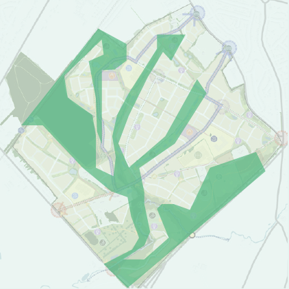
5.1 Regulating Masterplan
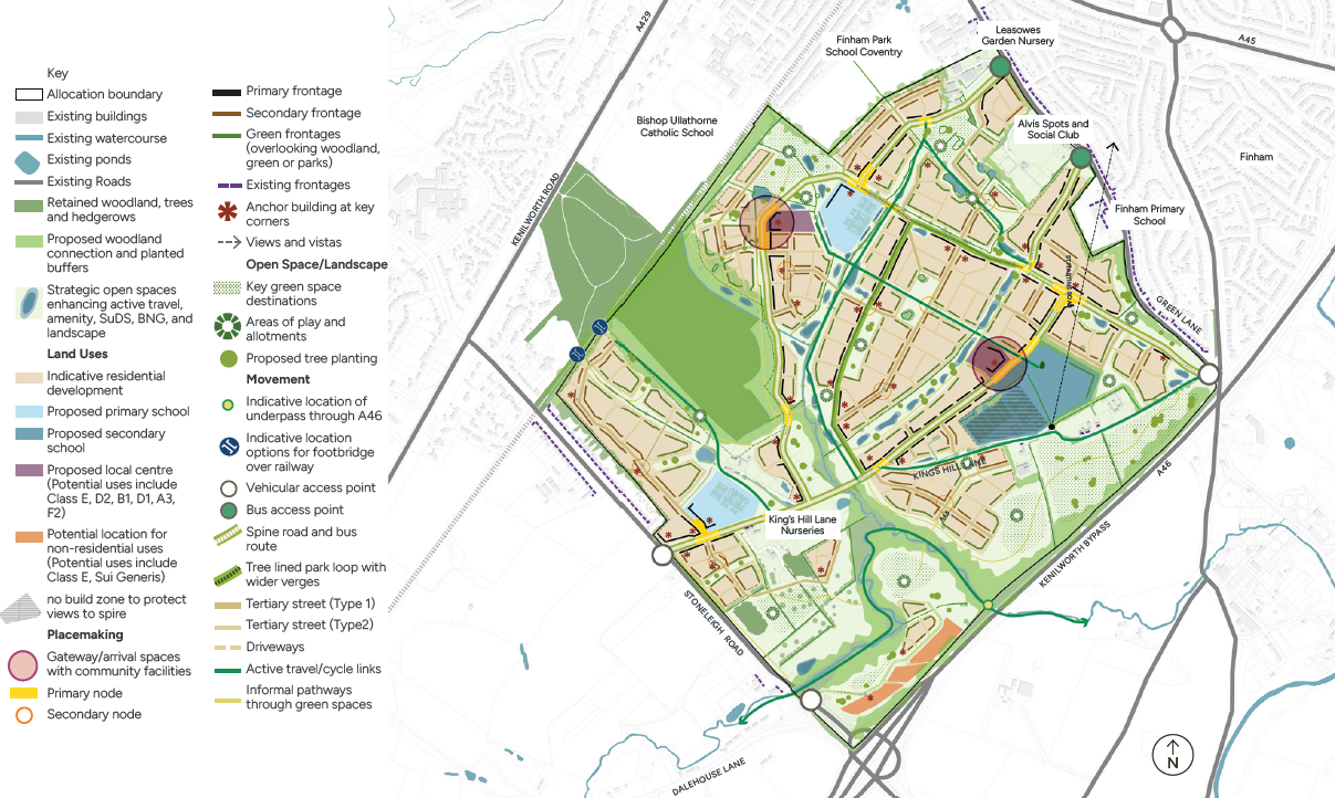
5.1.1 Regulating Masterplan
The regulating masterplan provides a spatial framework that translates the masterplan into specific, implementable structuring principles.
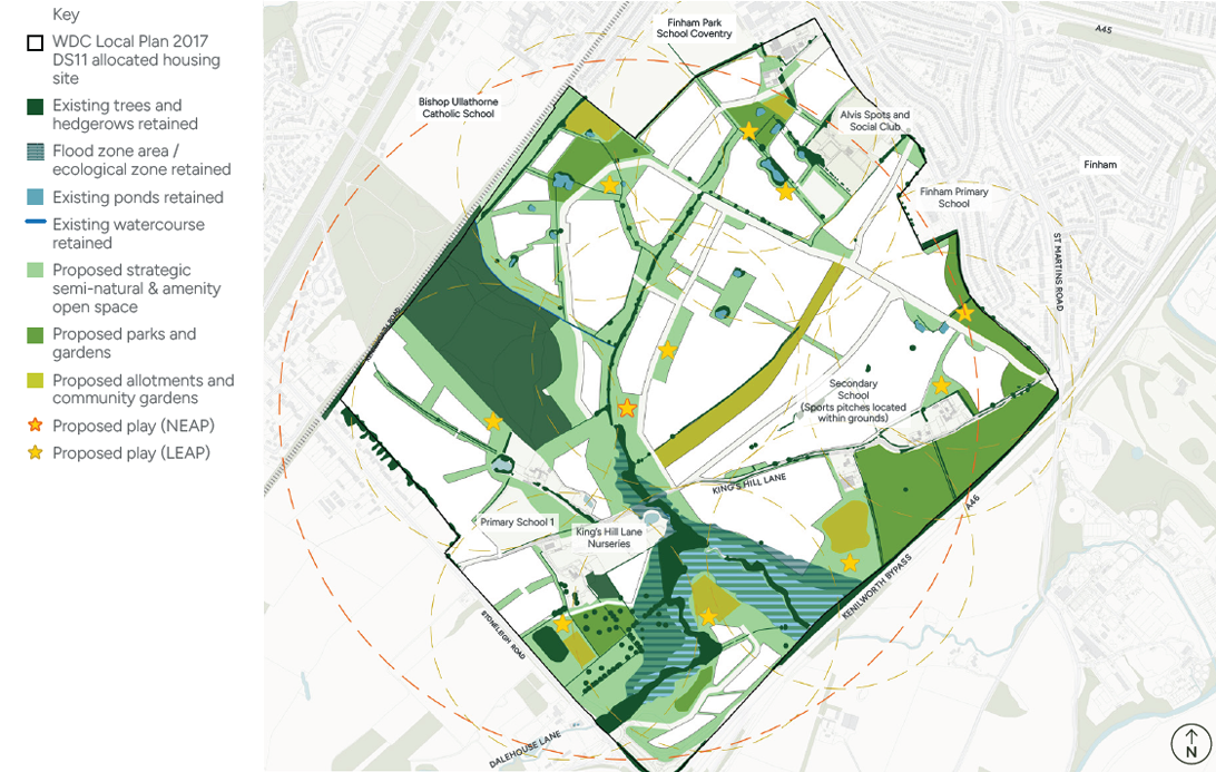
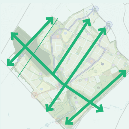
The regulating masterplan, figure 31, defines the:
- Location of land uses
- Access and connectivity
- Street hierarchy and layout
- Arrangement and scale of blocks
- Frontages and edge treatments
- Location and integration of open spaces
- Protection of key vistas and focal points
The regulating plan ensures consistency in form and layout across the development, setting out principles that must be adhered to throughout the design and construction process to maintain the overarching objectives of the masterplan.
5.1.2 Purpose of a Regulating Plan
The regulating plan plays a critical role in ensuring that development is delivered in a coordinated and coherent manner, particularly when land is brought forward by multiple owners or developers. By providing a clear spatial framework, it reduces the risk of misalignment between different parcels of land and ensures that the overall objectives of the masterplan are achieved. It ensures that open spaces are designed to be connected and located to serve the broader community, that facilities are positioned appropriately, and that streets are consistent, legible, and well-aligned. It also helps to avoid awkward juxtapositions in the built form, particularly where boundaries of different ownerships meet, ensuring that building plots, frontages, and edges are seamless. By setting out structuring principles for land use, access, and layout, the regulating plan provides certainty for developers, the local authority, and the community, supporting the delivery of a high-quality and connected urban environment.
5.1.3 Relationship to Design Codes
The regulating plan underpins the design codes by establishing the spatial context in which detailed design rules apply. The design codes guide the appearance, scale, and quality of development, covering standards for built form, density, public spaces, materials, frontages, and the treatment of streets and open spaces. By defining where and how these rules should be applied, the regulating plan ensures that the design codes are implemented consistently and effectively.
5.1.4 A Joined-Up Approach
Together, the regulating plan and design codes create a joined-up approach, ensuring that the development is coherent, legible, and fully aligned with the masterplan vision. This integrated framework ensures that all elements of the development, from streets and buildings to open spaces and the public realm, are delivered to a high standard, resulting in a coordinated, high-quality, and sustainable built environment that reflects the intended character, functionality, and long-term objectives of the masterplan.
The regulating masterplan should be read with the active travel network plan (figure 42), movement framework (figure 43), public open space framework (figure 60), green and blue infrastructure plan (figure 86).
5.2 Introduction to the Design Codes
The following sections expand on the themes outlined in the regulatory plans, providing specific coding and supplementary illustrative material. The following themes are set out:
Identity
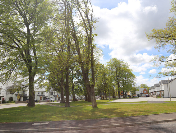
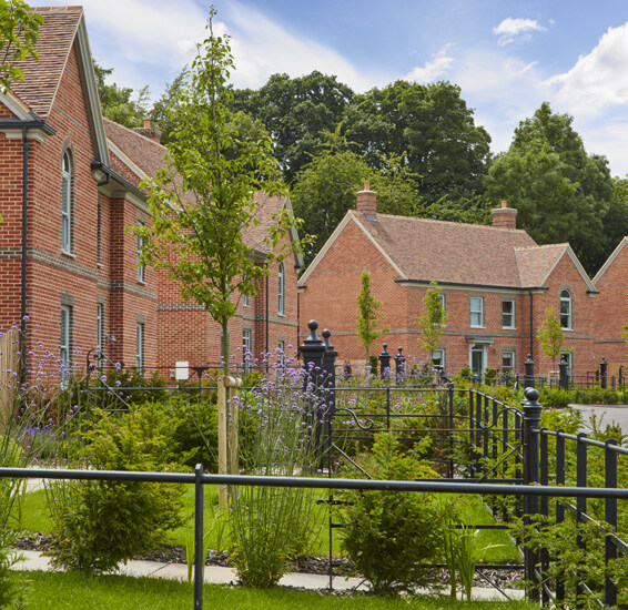
Required design response in relation to the local character of the area to ensure development at King’s Hill Lane strengthens local character, landscape quality and heritage sensitivity. The theme encompasses elements such as urban grain, boundaries, setbacks and key views. New development must reinforce its rural edge setting, drawing on historic lane patterns, contextual urban grain and clearly defined character areas. Design should respect heritage assets through appropriate scale, buffers and assessment, use locally inspired materials and boundary treatments, respond to topography and views, and create legible, varied neighbourhoods with a strong sense of place and identity.
Built Form
Requirements for three-dimensional arrangements of buildings, blocks, streets and spaces. The theme encompasses elements such as land use, density, heights, landmarks, arrival features and edge conditions. The code establishes strategic built form areas to locate higher intensity and community activity, supported by varied densities, heights and active frontages. Development must respond to landscape, infrastructure, noise constraints and existing context, creating permeable layouts, strong gateways, nodes and landmarks for legibility and placemaking. Clear edge conditions ensure sensitive transitions to countryside, heritage routes and ecological corridors while maintaining distinctive, well-connected neighbourhood
Movement
Requirements for an accessible and easy to navigate place based on the principles of a 20-minute neighbourhood. The theme encompasses elements such as pedestrian and active travel routes, public transport, street types and functions, integration of street trees, SUDS and parking into street corridors. Development must prioritise active travel and public transport, with all homes having safe, accessible routes to facilities, schools and bus stops. A dense, permeable movement network should encourage low speeds and avoid cul‑de‑sacs. Streets must be legible, inclusive, tree‑lined and integrate SuDS. Clear street hierarchies, well‑designed gateways, and sensitively integrated parking should create high-quality public realms.
Public Open Space
Requirements for public open space that are proportionate to the size of the new population and conveniently located. The theme encompasses types and functions of open space, play and sports provision, community uses and interfaces with surrounding land uses. Development must deliver policy-compliant open space, evenly distributed and easily accessible, including amenity greens, parks, natural areas, allotments, play spaces and sports facilities. Public spaces should be inclusive, safe and well overlooked, with strong ecological value and clear character. Sports and play areas must meet national standards, integrate buffers to protect residential amenity, and be managed to ensure long‑term quality and usability.
Nature
Requirement for ecology to be a primary structuring principle for the development, delivering a landscape‑led green and blue infrastructure network with measurable Biodiversity Net Gain (BNG). The theme encompasses principles relating to BNG, protection and integration of existing habitats, character and context, SUDS and key strategic landscape spaces. Development must consider high‑value habitats such as Finham Brook and Wainbody Wood and existing ponds, hedgerows and ancient woodland must be protected, buffered and enhanced, with strong north–south ecological connectivity. Development should integrate SuDS, native
Uses
Land uses, facilities and education provision should be distributed to create accessible, safe and socially cohesive neighbourhoods. Principles relate to specific land uses, including mixed-use, education and community facilities, and the expected interfaces between uses. Development must prioritise active, well‑overlooked frontages and compatible interfaces between uses. Mixed‑use centres should deliver varied building typologies and optimised density. Community facilities must be centrally located and accessible. Education provision must deliver appropriately sized, expandable primary and secondary school sites, safely integrated with surrounding streets, housing and community infrastructure.
Homes and buildings
Requirements to deliver healthy, adaptable and inclusive housing that supports long‑term wellbeing. The theme encompasses principles relating to required space and design standards, housing types and specialist housing requirements. Homes must meet national space standards, provide good daylight, ventilation and acoustic comfort, and include usable private and communal outdoor space. Development should be accessible and adaptable for lifetime living, comply with Part M and Secured by Design principles, and integrate storage, refuse and cycle facilities sensitively. A balanced housing mix, including affordable, specialist and older persons’ housing, must respond to local needs, with varied typologies and densities integrated throughout the site.
Resources and Lifespan
Sustainability requirements and resources to ensure a comprehensive, place‑led approach to delivering a low‑carbon, climate‑resilient and socially inclusive development. The theme encompasses principles relating to net zero carbon, social value health and wellbeing, all within the framework of the United Nations Sustainable Development Gaols (SDG). Development at King’s Hill Lane must align with national policy,
5.3 Identity Design Codes
5.3.1 Identity Design Codes
Identity is clearly defined in the National Design Guide as a key characteristic for a well-designed place. The future development should be complimentary to its surrounding context.
5.3.2 Local Character and Identity
I01 Rural Edge Character
Development must reinforce the sites role as a rural edge to Coventry, with softer built edges, generous planting and lower perceived density adjacent to open countryside and strategic buffers.
I02 Urban Grain
Urban grain should be influenced by the surrounding context. Design proposals must demonstrate how the layout and arrangement is complementary to the surrounding grain and street pattern, by demonstrating enclosure, street widths, and pattern.
I03 Distinctive Character Areas
In future applications, Character Areas should be defined by location and context to ensure new developments maintain a coherent identity.
To create legible neighbourhoods with a strong sense of place, each character area should define:
- Typical building heights and roof forms
- Frontages and streets widths
- Landscape typologies
- Boundary treatments
- A unified material palette
I04 Heritage Design Principles
Development affecting the setting of the Scheduled Monument, listed buildings or conservation areas must demonstrate that it preserves or enhances that setting in the following ways:
- Scale & Proportion - Buildings near heritage assets must respond to historic plot widths, eaves heights, roof pitches and orientation.
- Landscape as Mitigation - Parkland, open space and green buffers must be used as primary tools to protect heritage settings.
- Heritage Impact Assessment (HIA) required where development lies within proximity of designated or non-designated heritage assets.
- Buffers and open space dimensions to be informed by Heritage Impact findings.
- Ensures heritage assets remain legible and meaningful within the evolving landscape.
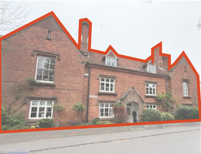
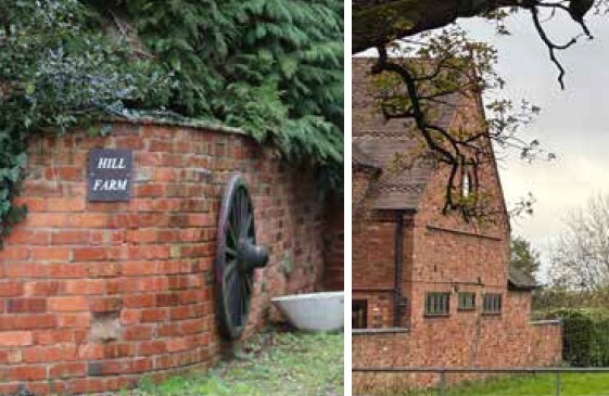
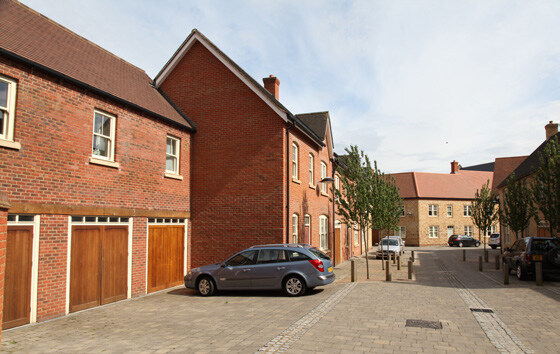
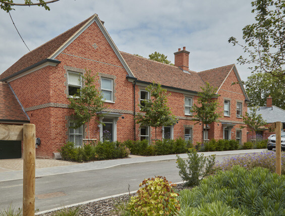
Kenilworth Example of a varied roof line and typologies clustered to create a varied and rich façade, using red brick and traditional architectural details
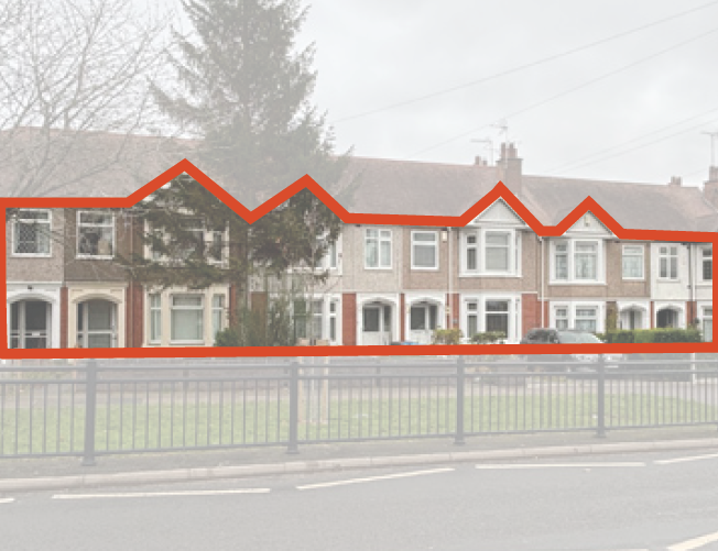
Finham Cohesive inter-war terrace characterised by red brick and render facades, tiled pitched roofs, strong eaves line and repeated gables, forming a consistent and legible street frontage to the green
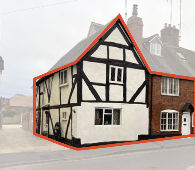
Kenilworth Tudor house creates corner feature, combining white render and black timber, with gable frontage
Figure 32 Above: King’s Hill Lane and surrounding areas characteristic materials and architectural features
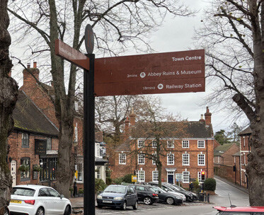
Wayfinding Context-sensitive signage using complementary colours to the surrounding historic townscape
Red Brick boundaries and facades Historic red brick entrance wall and detached homes at King’s Hill Lane form a distinctive rural character along King’s Hill Lane
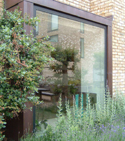
Complimentary Modern
architectural details complements heritage and nature
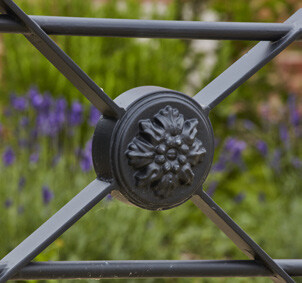
Details reflects heritage
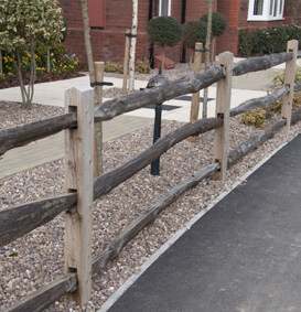
Natural Materials Timber fencing complements nature
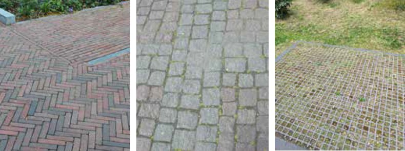
Textured and permeable surfaces Herringbone and granite sets create texture. Permeable surfaces help surface water run-off.

Indicative colour palette
Figure 32 Above: King’s Hill Lane and surrounding areas characteristic materials and architectural features
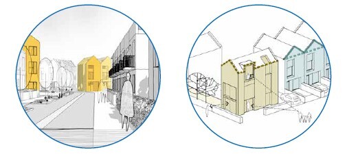
I05 Clusters and Grouping of Buildings
- Built form should be designed to add interest and variety to the street, including a range of housing typologies.
- Buildings should be arranged and combined sensitively and inspired by local character studies i.e. cottages and barnsteads at King’s Hill Lane.
I06 Materials, Architecture and Detail
The choice of materials and architectural detailing must reinforce local distinctiveness and contribute positively to the character of King’s Hill Lane. Including:
- Sympathetic material palette.
- Complementary architectural details.
- Consistent proportions, generous window proportions.
Developments must:
- Use a locally inspired material palette, including appropriate brick tones and roof materials, with contemporary interpretations supported where they respond to local proportions and rhythms.
- Apply a coherent material palette across the site, with variation used to distinguish character areas rather than create visual clutter.
- Proposals should demonstrate compatibility with locally prevalent materials and finishes.
- Materials should reinforce local distinctiveness while allowing architectural innovation.
I07 Boundaries and Set-Backs
Boundaries should respond to frontages and edge conditions (as set out in the Built Form section) and will vary based on street type and use (e.g. residential or mixed-use centre).
The local character can be reinforced through boundary treatments and setbacks on certain streets. New development fronting onto these streets should consider the following:
- 1. King’s Hill Lane: Buildings should be well set back from the road. Boundaries should be native hedges, or low timber fencing, with occasional red brick walls.
- 2. Green Lane: Boundaries should consist of low red brick walls, combined with hedges and planting.
- Brick wall boundary’s should connect to buildings where feasible.
- Close-boarded fencing to streets and public spaces will not be supported.
- 3. Stoneleigh Road: Buildings should be set back from the street behind large rear gardens.
- Boundary treatments should be native hedges, planting and trees.
- Direct access should not be taken from Stoneleigh Road, access to buildings should be from the rear or sides.
- A footpath should be provided to enhance pedestrian connectivity along Stoneleigh Road. A footpath should be sufficiently offset to the east of the existing hedge.
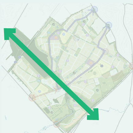
I08 Topography, Views and Skyline
Future development must:
- Respond positively to the site’s landform and reinforce important views and visual relationships.
- Safeguard long-range views towards Coventry skyline and Cathedral spire,
- Step building heights and rooflines with topography, particularly along King’s Hill Lane and other elevated locations,
- Use layout and building orientation to frame views of woodland, parkland and watercourses.
- Where development may affect ridgelines or key viewpoints, visual impact should be assessed through verified views.
Green Lane dwellings set back behind a front garden, defined by low brick wall, forming a clear boundary. Car parking within drive and set back behind boundary
Kenilworth Urban frontage with consistent setbacks, buildings facing the open space, largely unbounded frontage and a narrow planted margin
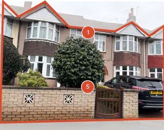
Green Lane 1930’S Semi-detached homes set behind low brick walls
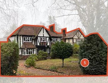
Stoneleigh Road Buildings set well back within landscaped plots, with informal, planting-led boundaries creating a soft and green street frontage
Figure 34 Above: King’s Hill Lane and surrounding areas characteristic boundary treatments and set-backs
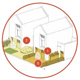
Illustration of building line set backs
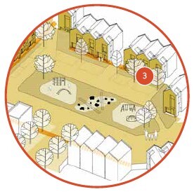
Illustration of built form framing key space and park
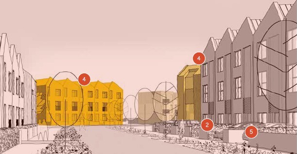

Illustration showing possible frontage arrangement for higher-density areas, incorporating a contemporary buildings, whilst responding to the established pattern of building lines and setbacks and in-plot parking
Figure 35 Illustration of identity design code principles
5.4 Built Form Design Codes
5.4.1 Built Form Design Codes
Built form refers to the three-dimensional arrangements of buildings, blocks, streets and spaces. Elements related to the built form will play an important role in shaping the look and feel of the urban area across the development.
To allow for flexibility in the delivery of the site, we have not identified neighbourhood character areas. Rather we have identified strategic built form areas, to highlight areas where intensity could be located, such as at key activity destinations, including schools and local centres.
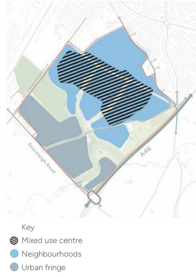
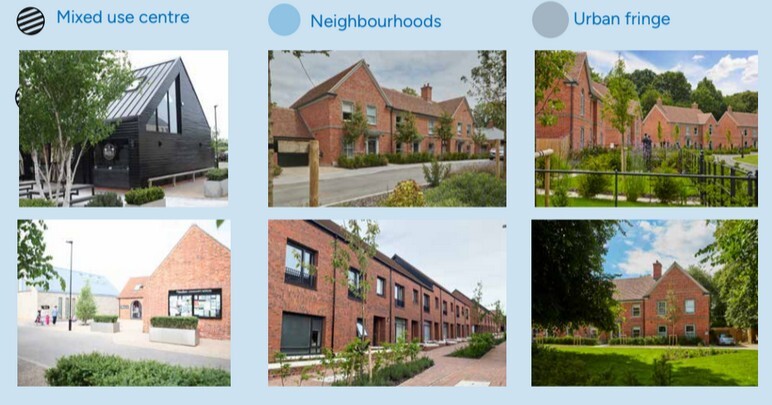
5.4.2 Built Form Areas
The plan opposite (figure 36) identifies the strategic built form areas across the site. These areas have been defined by location, surrounding environmental, landscape features and proposed land uses. The designated built form areas identify zones where a higher level of community activity is required which has influenced the following design codes.
BF01 Built Form
Development in the following areas will need to correspond to the built form characteristics:
1. Mixed-use centre
Highest levels of community activity with a concentration of schools and local centre uses.
2. Neighbourhoods
Predominantly residential areas, with occasional non-residential uses at the A46 Gateway/corridor located at the southwest of the site. (For potential uses at the A46 Gateway/corridor refer to section 5.8.1 Uses Design Codes, U02 Uses at A46 Gateway and Corridor).
3. Urban Fringe
Mostly residential with a strong relationship to the surrounding natural landscape.
Future development must follow the principles established below:
- Development must respond to the proposed strategic infrastructure and movement network and non-residential uses. It must feel more urban in core areas that do not interface with the surrounding landscape context.
- All built aspects of residential development, including house types, materials, height, street enclosure, rear garden dimensions should be influenced by characteristics of existing built environments throughout the local area.
- Development must establish a permeable layout which encourages the use of perimeter blocks orientated towards streets and open spaces.
- All homes located on corners will be dual aspect, with habitable room windows facing streets / spaces on both sides at ground and first floor.
- Built form and existing trees must be considered together to avoid restricting tree growth. Buildings should avoid root protection zones and adhere to stand-off distances.
5.4.3 Noise Mitigation
BF 02 Layout design to mitigate noise, odour and lighting.
Built form should be arranged to minimise exposure of noise-sensitive uses to unacceptable levels of noise, odour and lighting.
- Noise-sensitive development, including residential uses, shall not be in areas where acceptable living conditions cannot be achieved through design-led mitigation.
- Land adjacent to the A46 should incorporate appropriate buffer zones, with development set back to reflect road noise constraints (subject to technical advice).
- The design of buildings and their relationship to environmental buffers should be consistent with the masterplan strategy.
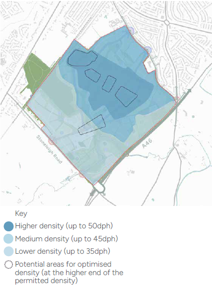
5.4.4 Density
Objective: Density is an indicator of how compact new development will be and how intensively it will be developed. Variation in density across the neighbourhood would create a variety of built form which contributes to characterful and memorable places. Density can support key nodes, legibility, a sense of arrival, terminating vistas, and creates a natural centre to each neighbourhood.
The proposed densities align with the broad densities reflected in the National Model Design Code.
BF02 Density
Optimised Density
Higher-density development should generally be delivered within the mixed-use centre and within internal development parcels, with limited relationship with the surrounding landscape context.
Development could be optimised at key locations, such as mixed-use community hubs, gateways, key junctions and primary routes.
Higher-density development should be avoided at locations adjacent to sensitive ecological habitats such as Wainbody Wood or Finham Brook.
Lower-density development should be concentrated at the southern edges of the development and at locations interfacing the wildlife corridors. Development should be designed to transition gradually between high and low densities, to avoid jar-ring changes in character and to create a cohesive environment.
Figure 38 identifies high, medium and low-density zones within the site:
- Higher density zone: Development in this zone, should be up to 50dph.
- Medium density zone: Development in this zone should be up to 45dph.
- Lower density zone: Development in this zone must be up to 35dph.

5.4.5 Building Heights
To ensure appropriate building heights across the development, it is anticipated that the majority of homes will be built up to an eave’s height of 2 - 2.5 storeys (room in the roof space and dormer windows), with occasional 3-storey buildings at primary routes and key junctions. Mixed-use local centres could accommodate up to 4 storeys.
There is potential to accommodate increased building heights at key locations, such as at noise constraints (A46 corridor and gateway); however, this is subject to further technical assessment i.e. LVIA).
Areas which are well screened from views and situated within less prominent positions, such as lower ground levels, could accommodate three-storey buildings. Permitted building heights across the scheme are defined below:
BF03 Building Heights
- Mixed-use centre: Up to an eaves height of 4 storeys.
- Neighbourhoods: Up to an eaves height of 2.5 storeys.
- Urban fringe: Up to an eaves height of 2 storeys. Occasional increase of heights at gateways and movement corridors (e.g. rail line edge/ A46 edge) of up to an eaves height of 3 storeys.
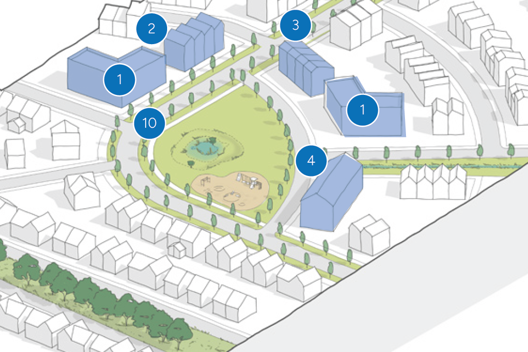
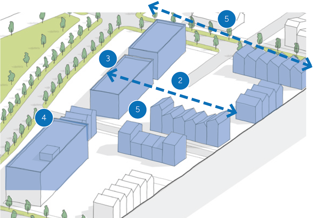
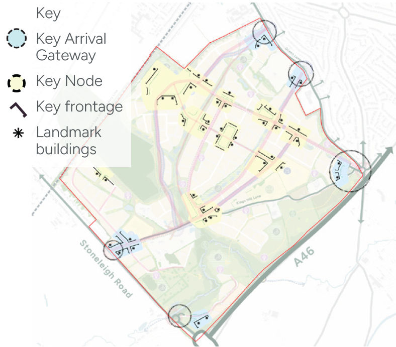
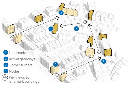
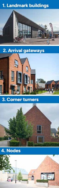
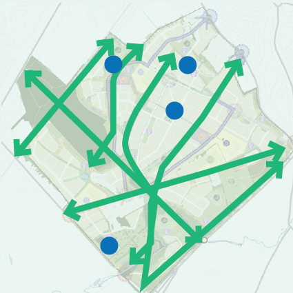
5.4.6 Arrival Gateways, Nodes and Landmarks
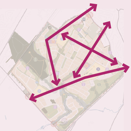
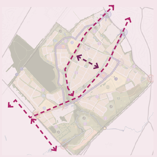
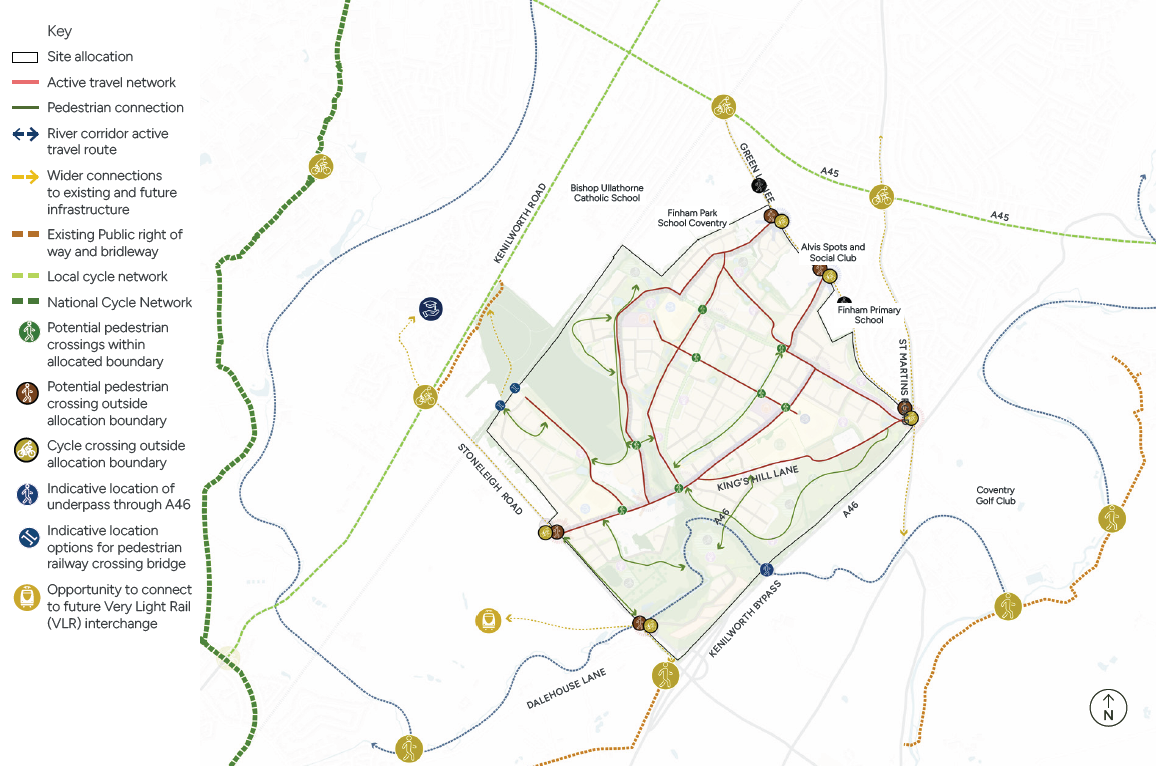
Arrival gateways, nodes and landmark buildings help contribute to a development’s identity and a users sense of place, and they allow users to navigate more easily through the site. Arrival Gateways, key nodes and landmark buildings are defined on the plan opposite (figure 42). The following principles should be observed through the new development:
BF04 Arrival Gateways
Significant arrival gateways are primary access points that form thresholds between built environments or between new built environments and the surrounding landscape.
New built form and landscape spaces within these gateways must create a positive visual impact, welcoming pedestrians, cyclists and vehicles.
Built form and landscape design must create distinctive local spaces, through subtle changes in character to reinforce the threshold.
BF05 Key Nodes
Nodes are defined as areas where significant junctions, open spaces, key buildings, internal views combine. They play an important role in creating localised areas of interest and reinforce the street hierarchy.
Internal nodes should be emphasised by distinctive built form, creating distinctive features within the urban structure which contribute to wayfinding and placemaking.
Internal nodes should be emphasised by individual or groups of landmark buildings and create a unifying character to either side of the associated streets or spaces.
BF06 Landmark Buildings
Landmark buildings should be used to reinforce important local nodes, street hierarchy and wayfinding. These should:
Be positioned in visually prominent locations, such as corners of development, at primary streets and/or terminating internal view corridors.
Form part of the composition of arrival gateways and be singular landmarks
Buildings should be expressed with contrasting differences to the form and appearance of their surrounding buildings. Variances in the expression of landmark buildings could include:
- Differing ridge and eaves line.
- Greater scale and massing
- Buildings which sits proud of the surrounding building lines.
- An altered building orientation.
- Sensitive and considered variations to façade detailing and materiality and colour.
5.4.7 Frontages
Objective: To ensure active streets, with natural surveillance and active frontages, key requirements are defined below:
BF07 Frontages
- Frontages must be active and animated with front door access and windows.
- Frontages must be coordinated and have common characteristics (including either side of streets and open spaces) to reinforce street hierarchy and character.
- Rear gardens facing onto streets and open spaces must be avoided
- Frontages (including positioning of doors, windows, driveways) must be designed to respond to adjacent trees and tree-lined streets.
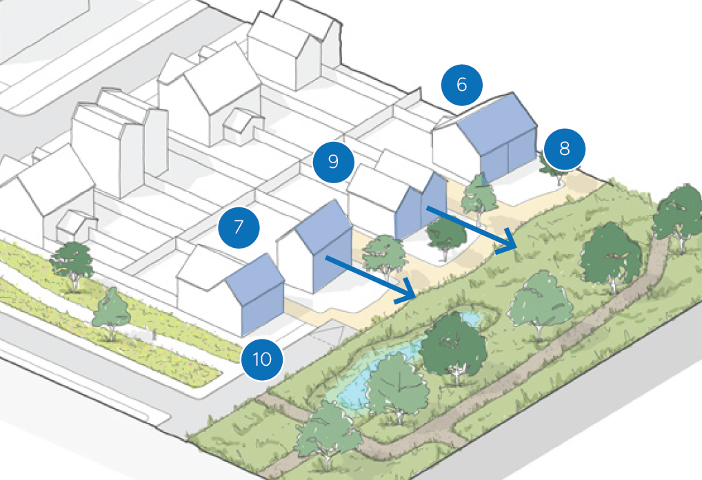
5.4.8 Edge Conditions
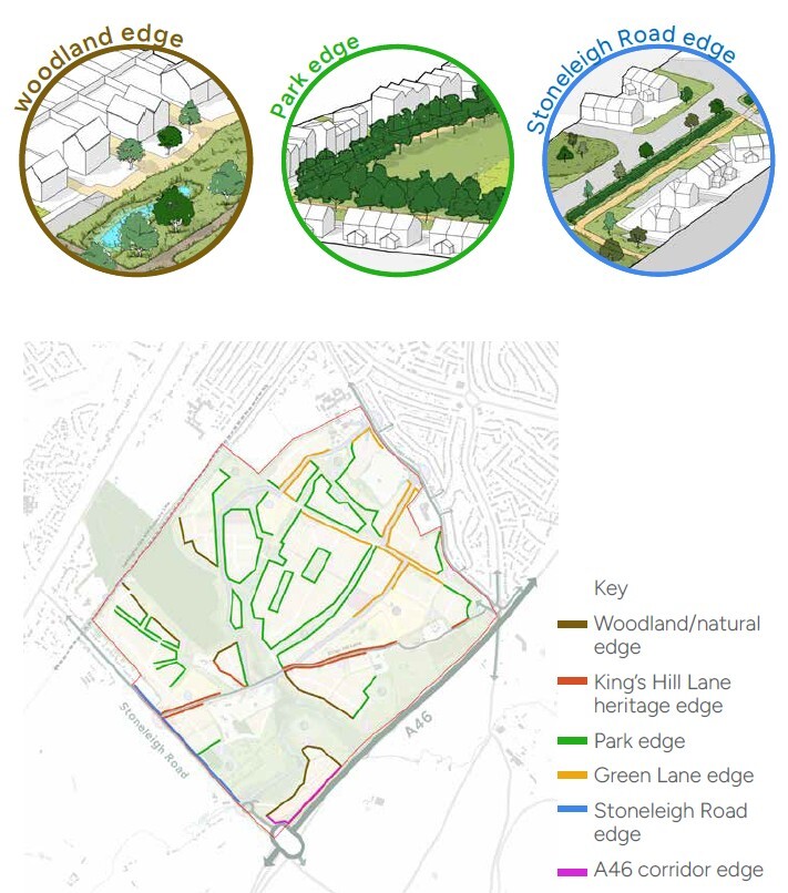
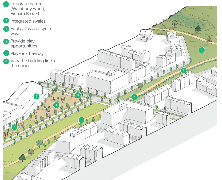
As an edge of settlement development, regulating edge conditions will ensure new development best interfaces between the existing urban edge of Coventry, the open countryside to the south (which provides a settlement break between the Coventry urban area and the town of Kenilworth to the south), and the existing ecological corridors (Wainbody Wood and Finham Brook), which we want to preserve and enhance.
BF08 Edge Conditions:
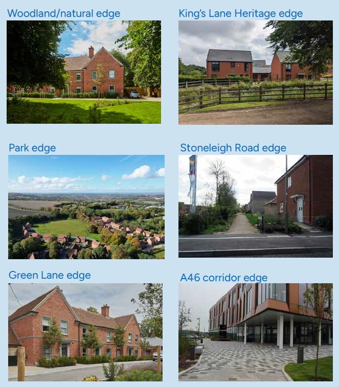
Built form edge conditions are categorised on the plan opposite. New development should follow the following principles:
1. Woodland/natural edge: Frontages which overlook the woodland, or protected wildlife corridors.
- Built form placement and orientation to be comparatively irregular to reflect the more informal character at the periphery of blocks.
2. King’s Hill Lane Heritage edge: Frontages which front onto King’s Hill Lane.
- Built form placement and orientation to be comparatively irregular to reflect the more informal character at the periphery of blocks, taking design cues from the existing houses and farmsteads along King’s Hill Lane.
3. Park edge: Frontages which overlook the key strategic open spaces that permeate neighbourhoods.
- Buildings must form generally continuous built frontages, providing good enclosure to frame spaces and reinforce vistas.
- Some gaps between buildings will be appropriate in response to less formal streets and spaces.
- Key views to be terminated by landmark buildings
4.Green Lane edge: Key frontages that interface with existing settlement edge along Green Lane.
- Built form must mimic from and character along existing settlement edge, to ensure a continuous urban development.
- Regular architectural form and rhythm, in keeping with existing vernacular in Finham neighbourhood.
5. Stoneleigh Road edge:
Frontages interfacing with the countryside, existing villages or conservation settlements.
- Buildings must form generally broken frontages, with a higher proportion of gaps between buildings, to create a visually permeable edge.
- Built form orientation to be irregular to reflect the more informal character at the periphery of blocks.
5. A46 edge:
Frontages interfacing with the A46 should respond to noise and air quality constraints, with the orientation of buildings used to mitigate impacts.
Built Form Policy and Guidance
Future development proposals should consider the following policy and guidance in relation to Built Form:
- The Building Regulations 2010
- National Planning Policy (NPPF), Section 12 and 16.
- National Design Guide, Section 3
- Building for Healthy Life, Distinctive Places
- Warwick District Council Local Plan, Policy BE1, HS1, HS7
- Residential Design Guide SPD, Policy BE1
- Stoneleigh Conservation Area
- Kenilworth Road Conservation Area
5.5 Movement Design Codes
Well-designed places should be accessible and easy to move around. This can be achieved through a connected network of streets, good public transport, the promotion of walking and cycling and well-considered parking and servicing.
1. Supporting a 20-Minute Neighbourhood
The movement strategy for the site has been developed to align with Warwick District Council’s objectives for creating sustainable 20-minute neighbourhoods, where day-to-day needs can be met within a short walk, cycle, or public transport journey. The approach prioritises active travel, legibility, and accessibility, ensuring movement networks support healthy lifestyles, social interaction, and reduced reliance on private vehicles.
2. Active travel first
Vehicular movement is managed to support, rather than dominate, the public realm. Street design promotes low vehicle speeds through geometry, surface treatment, and enclosure, creating places that are safe for pedestrians and cyclists. Car routes are secondary to the movement needs of people, with parking integrated sensitively to minimise visual impact and encourage more sustainable travel choices.
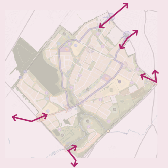
3. Tap into wider connections
Desirable routes to wider strategic connections, such as the University to the north, plans for Very Light Rail (VLR) Interchange, which is planned to run through the site. The Coventry Way Long Distance Walking Route to the south east of the site should be safeguarded and enhanced, promoting permeability.
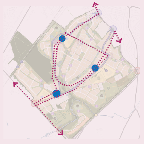
4. Accommodate the bus
Primary routes through the site from Finham in the north and onto Stoneleigh Road in the south should be designed to accommodate future bus travel. New bus stops should be placed at appropriate walking catchments across the site, to encourage new residents to use public transport over private vehicles.
5.5.1 Movement Design Codes
Objective
To ensure that all homes are accessible to local facilities, within reach with safe, walkable streets and cycle-friendly routes that make active travel the natural choice.
5.5.2 A Connected Network
At King’s Hill Lane, a well-connected hierarchy of routes for all modes - walking, cycling, public transport, and vehicles, will ensure safe, convenient movement throughout the site. This design approach will make it easy for residents to access key destinations and seamlessly link to wider public transport connections, supporting sustainable travel and an inclusive, well-integrated settlement. In addition, mitigating traffic related air quality impacts will create a healthier place to live.
The nature of the site offers a key opportunity to devise an efficient street network which is dense and permeable, particularly for pedestrians and cyclists. Whilst there are existing constraints which impact the layout, such as utilities easements and at existing junctions, new streets through the site should provide a clear and connected street hierarchy.
Vehicular traffic should be accommodated in a manner that supports, rather than undermines, these priorities. Street design should discourage unnecessary through-traffic, manage vehicle speeds and minimise the visual and environmental impact of cars.
5.5.3 Public Transport
Public transport, along with active travel, will be prioritised as the primary means of movement, supporting healthy lifestyles and reducing reliance on private cars, and helping to reduce traffic and congestion in Coventry and the wider area. Public transport accessibility will be integral to the layout of the development. Bus routes, stops and supporting infrastructure should be conveniently located, well overlooked and integrated into the street network to encourage regular use. Development density and land use should support viable and frequent public transport services.
M01 Public Transport
- Future new homes must have safe and convenient access to community facilities and bus stops.
- The design and layout must ensure accessibility for wheelchair users and people who are less ambulant.
- Future development must integrate plans for Very Light Rail. The proposed routes, and any associated land take, will need to align with the latest published specification or standards for Very Light Rail, the Railways and Other Guided Transport Systems (Safety) Regulations 2006
5.5.4 Active Travel
Active travel will be prioritised as the primary means of movement, supporting healthy lifestyles and reducing reliance on private cars. Streets and spaces should be designed first and foremost for pedestrians and cyclists, with safe, direct and attractive routes that connect homes to local facilities, public transport stops and the wider network. High-quality walking and cycling infrastructure should be continuous, legible and inclusive, accommodating users of all ages and abilities.
M02 Active Travel
- The local centres and all schools, including the secondary school, must be positioned to ensure convenient access via dedicated active travel routes.
- Traffic management schemes such
- as Low Traffic Neighbourhoods and School Streets are encouraged and should be designed into the street network at the masterplan stage.
- Active travel routes should connect to the wider network of routes.
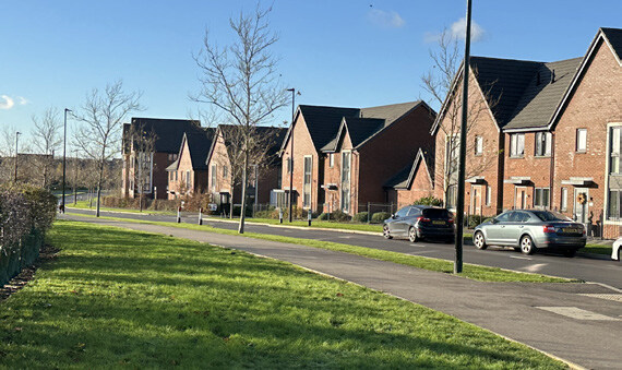
5.5.5 Streets
A series of street types will be provided which work as part of a legible and connected network to provide safe, characterful and convenient links between new homes, green spaces and community uses.
Design of streets must balance technical requirements and functionality and make a positive contribution to the envisioned character. The requirements and guidance set out below and on the following pages describes envisioned character of streets:
M03 General Guidance on Streets
- The street network must prioritise pedestrian and cycle movement before vehicles.
- The design and alignment of access roads and movement corridors shall minimise noise, air quality and lighting impacts on existing and proposed sensitive receptors.
- All streets must be dementia-friendly and legible by all.
- Streets must not form ‘dead-ends’ for pedestrians and cyclists. Footways and cycleway links must be provided to adjacent streets or open spaces.
- Cul-de-sacs should be avoided as they create indirect vehicular and active travel networks which result in disorientating environments.
- The street network must demonstrate a consistent character and be uninterrupted when passing between development parcels or ownership boundaries.
- All streets to be designed for two-way traffic.
- All streets must be tree-lined and designed to accommodate trees within verges or adjacent open spaces
- No trees to be planted in visibility splays.
- Access to private drives must be via dropped kerbs.
Geometry:
- To be determined by refuse vehicles and public service vehicle tracking or swept path analyses.
- Minimum carriageway width 4.5m.
- Minimum carriageway width for shared bus corridors is 6m.
M04 Materials
- Materials must be adoptable standard for all adopted routes.
M05 SuDS
- A range of SuDS must be incorporated into the design of streets.
- All streets must ensure that above ground SuDS are prioritised over oversized pipes and underground storage tanks.
M06 Lighting
- Street designs must be accompanied by a lighting strategy and agreed with Warwickshire County Council .
- Lighting columns and ducting must be reviewed alongside proposed street trees planting, with no columns within 5m of trees.
M07 Street Furniture
- Street furniture must not detract from
- the character of streets or impede access or sight lines.
- Benches should be provided along active travel routes to allow opportunities for rest.
- Litter/dog waste bins should be provided at main junctions, entrances and gathering spaces along active travel routes.
5.5.6 Street Types
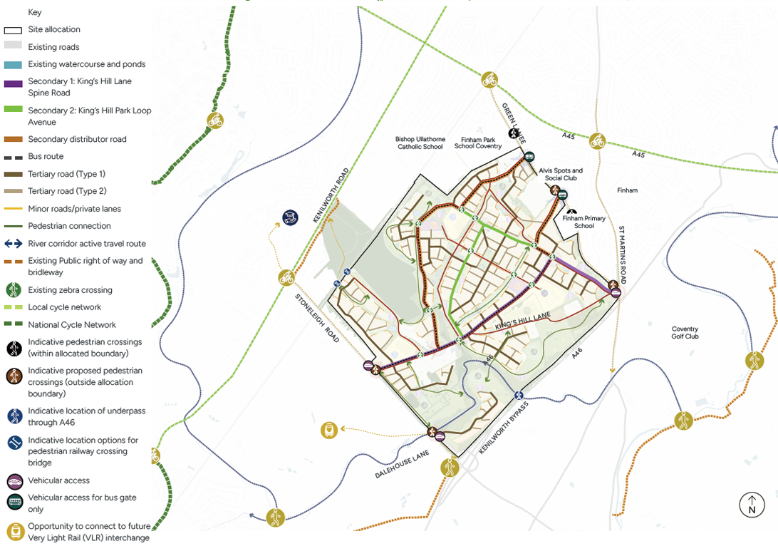
The plan on the opposite page provides an example of the street hierarchy network across the site, in line with County Council categories. There are three overarching street types which will be delivered, with further detail on the composition of each street type defined over the next few pages:
- Secondary streets
- Tertiary streets
- Minor streets
M08 Street Types
The design of all streets is to comply with the principles set out in the table below:
Secondary Streets
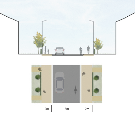
Secondary Streets will serve as the main connective spine of the development, linking the site to the existing street network. Designed to accommodate buses, cyclists, pedestrians, and cars, these routes will carry the highest traffic volumes and provide direct connections to surrounding neighbourhoods and tertiary streets.
Street geometry is intentionally designed to moderate vehicle speeds through subtle angled bends that respond to building lines and open spaces, avoiding wide, sweeping curves. Generous planted verges and formal avenue-style street trees on both sides will reinforce the prominence of these streets and frame key views across the site. The adjacent street section diagram illustrates the various elements that define the character and function of these routes.
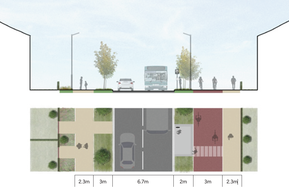
M09 Secondary Streets
Secondary 1 streets must comply with the following:
- Minimum carriageway width: 6.7m
- Minimum footway width: 2m each, on either side of the street
- Minimum cycleway width: 3m two-way cycleway
- Minimum verges: 2m each, on either side of the street
- SuDS: Rain gardens, urban swales and informal swales within verges
- Planting: Avenue street trees (1 every 8m subject to driveways and access) on both sides of the road within the verges
- Secondary 2 streets must comply with the following:
- Minimum carriageway width: 6.7m
- Minimum footway width: 2m each, on either side of the street
- Minimum verges: 3m each, on either side of the street
- SuDS: Rain gardens, urban swales and informal swales within verges
- Planting: Avenue street trees (1 every 8m subject to driveways and access) on both sides of the road within the verges
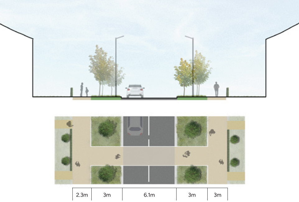
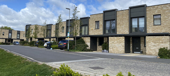
Tertiary Streets
Tertiary streets extend from secondary routes, providing direct access to development parcels and connecting to lower-order streets. They create loops within and between neighbourhoods, forming a clear and well-connected network.
These streets will primarily serve residential areas while also supporting movement to community facilities and local centres. Their design should reflect the intended character of each neighbourhood, ensuring consistency with the overall vision.
Typically, tertiary streets will be strongly defined by built form on both sides, reinforcing their importance and contributing to an urban character. Avenue planting will frame views along the streets and into adjacent open spaces, enhancing legibility and navigability.
M10 Tertiary Streets
Tertiary 1 streets must comply with the following:
- Minimum carriageway width: 5.5m
- Minimum footway width: 2m each, on either side of the street
- Minimum verges: 3m, on at least one side of the street
- SuDS: Rain gardens, urban swales and informal swales within verges
- Tertiary 2 streets must comply with the following:
- Minimum carriageway width: 5m
- Minimum footway width: 2m each, on either side of the street
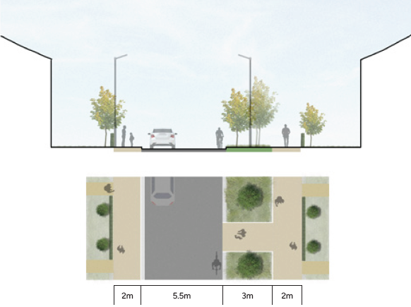
Minor Streets
Minor streets provide access to the outer areas of the site and may feature frontage on both sides of the carriageway or a single frontage facing public open spaces. Building lines along these streets can adopt a more organic and informal arrangement, with varied garden depths.
These streets will prioritise pedestrian and cycle movement, with narrower carriageways designed to slow traffic speeds. Opportunities to introduce alternative surface materials should be explored to emphasise shared use and enhance the sense of place.
Minor streets often serve homes overlooking open spaces and will be characterised by flexible manoeuvring areas that accommodate vehicles, cyclists, and pedestrians. The use of shared private drives should be kept to a minimum.
M11 Minor Streets
Minor 1 streets must comply with the following:
- Minimum shared carriageway width: 5.5m
- Minimum footway width: 2m on one side of the street
M12 Lanes and mews
These should be incorporated to add a finer grain of character, courtyards introduce a sense of enclosure, lanes offer a rural character at the sites edges or surrounding open spaces.
|
WCC Street Category |
Secondary Streets |
Tertiary Streets |
Minor Streets |
||
|---|---|---|---|---|---|
|
Street Type |
Secondary 1 (King’s Hill Lane Spine |
Secondary 2 (Park Loop Avenue) |
Tertiary 1 |
Tertiary 2 |
Minor 1 |
|
Assume general design speed (mph)* |
20 - 30 |
10 - 20 |
5 - 10 |
||
|
Bus services |
Yes |
No |
No |
||
|
Adopted |
Yes |
Yes |
No |
No |
|
|
Footway |
Minimum 2.3m wide to both sides |
Minimum 2m wide to both sides |
Share carriageway |
||
|
Cycleway |
Minimum 3m two-way wide on one side |
Within carriageway |
Within carriageway |
||
|
Verge to carriageway edge |
Minimum 2m to both sides |
Min 3m on at least one side |
No requirements |
No requirements |
|
5.5.7 Parking
All spaces and garages must conform to the stated dimensions, unless otherwise agreed with the council. All car parking should be sensitively designed and integrated so that it does not visually dominate the streetscape and detract from the quality of
the public realm. Parking and electric vehicle charging provision will need to be delivered in accordance with the Council’s latest published standards
M13 General Parking
The following regulations apply to parking space provision:
- Design of all parking must be in accordance with the Warwickshire Design Guide (2022)
- Electric vehicle charging points must be provided in domestic properties and communal and on-street parking areas
Resident Parking:
- Resident parking will be off-street, predominately on-plot
- Parking spaces will be delivered in either a linear or tandem layout to the side or front of houses
- Tree planting and landscaping will be encouraged to improve the overall aesthetic and to provide visual breaks
- Where strong containment to streets is required, resident parking will be primarily provided in rear parking courts
- Excessive frontage parking will not be acceptable due to its likely negative impact on the streetscape
Visitor parking;
- Visitor spaces will be primarily on-street, in formal bays, or in parking courts to the rear of apartments or terraces
- On Avenues and Neighbourhood Streets the visitor spaces will be in formal bays adjacent to the defined carriageway
- On shared surfaces, the spaces will be in defined bays either adjacent to the carriageway or informally by localised widening of the carriageway. Such spaces will be in block paving to improve the aesthetic and reduce the proportion of asphalt surfacing across the site
Cycle parking:
- Cycle parking provision will be incorporated across the site with particular focus at key public spaces and community facilities
- Cycle parking will be well located, safe and secure
- Covered cycle parking will be required for all residential dwellings (including apartments) in garages, secure sheds or designated cycle stores
Movement Policy and Guidance
Future development proposals should consider the following policy and guidance in relation to Movement:
- National Planning Policy (NPPF), Section 8 and 9
- National Design Guide, Section 4
- Building for a Healthy Life
- Manual for Streets 1
- Manual for Streets 2
- Warwickshire’s Local Transport Plan
- Warwickshire Local Cycle Walking and Infrastructure Plan
- Warwickshire Design Guide
- Warwick District Council Local Plan, Policy TR1-4, DS20
- Parking Standards SPD
- The Railways and Other Guided Transport Systems (Safety) Regulations 2006
Stoneleigh Road Access Junction
- Refer to section 8.5. Planning History ,for highway access junction proposals at Stoneleigh Road and King’s Hill Lane (Coventry City Council planning application - FUL/2018/0842, Installation of two new highway access junction, as amended by PL/2023/0000875/NMA)
5.6 Public Space Design Codes
5.6.1 Public Spaces Design Codes
The preparation of the masterplan has been guided by a network of blue and green infrastructure, both existing and proposed.
5.6.2 Open Space Requirements
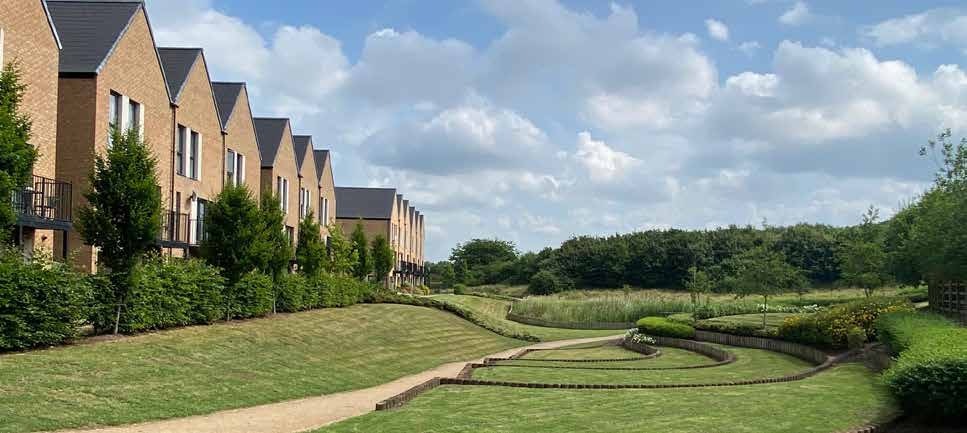
Open space provision at King’s Hill Lane is informed by the Warwick District Council Public Open Space SPD (2019) and is summarised in the opposite table. While the quantum of open space for the outline application is known and set out in the table, the original masterplan was prepared before the adoption of the SPD and therefore did not assess requirements against current policy. Nevertheless, both the outline masterplan and the additional 1,500-home masterplan individually exceed policy standards and together deliver a comprehensive green infrastructure strategy across the wider 4,000-home site.
Population assumptions are based on an average household size of 2.55 persons, drawn from the Coventry and Warwickshire Joint Strategic Housing Market Assessment (2013), and an indicative housing mix of 5% one-bedroom, 35% two-bedroom, 50% three-bedroom, and 10% four-bedroom dwellings.
Walking distances and access to facilities have been assessed as part of the baseline assessment. Sports pitch provision will accord with the latest Playing Pitch Strategy and sports facilities calculations (see Section 5.6.4: Sports Design Codes).
While the SPD sets out overarching principles, detailed matters such as art trails and play area design will be addressed through Public Open Space plans submitted at the Reserved Matters stage.
On this basis, the additional masterplan generates an open space requirement of 22.53 ha, which is fully accommodated within the emerging design. In total, combined open space provision across both the outline and additional masterplan phases exceeds 100 ha, significantly above the estimated requirement of 60.08 ha, demonstrating compliance with current policy both individually and cumulatively.
Future development should refer to the guidance set out on figure 64 and 65.
|
Type |
% of total standard |
Quantity Standard (ha / 1,000 population) |
Total no. of dwellings |
No. of people within total development (assumed 2.55 average household) |
Estimated total masterplan provision requirement (ha) |
Approx. standard per dwelling (sqm) |
King’s Hill Outline Planning Application provision (ha) |
King’s Hill Additional Masterplan provision requirement only (ha) |
King’s Hill Additional Masterplan provision (ha) |
Estimated total masterplan provision |
|---|---|---|---|---|---|---|---|---|---|---|
|
Parks and Gardens |
35 |
1.91 |
4,000 |
10,200 |
19.53 |
48.8 |
14.74 |
7.32 |
7.5 |
22.24 |
|
Natural and Semi- Natural Areas |
35 |
1.91 |
19.53 |
48.8 |
18.18 |
7.32 |
17.2 |
35.38 |
||
|
Amenity Green Space |
17 |
0.93 |
9.48 |
23.7 |
10.07 |
3.56 |
18.23 |
28.3 |
||
|
Allotments and Community Gardens |
7 |
0.38 |
3.91 |
9.8 |
6.2 |
1.46 |
1.51 |
7.71 |
||
|
Children & Youth Play Areas |
6 |
0.33 |
3.35 |
10.7 |
4.08 |
1.26 |
1.26 |
5.34 |
||
|
Allotments / Community Gardens extra provision for > 100 dwellings |
Additional |
0.42 |
4.28 |
8.4 |
- |
1.61 |
1.61 |
1.61 |
||
|
Total |
5.89 |
60.08 |
150.2 |
53.27 |
22.53 |
47.31 |
100.58 |
|
Open Space Typology |
Purpose |
Key Opportunities and Considerations |
Key Characteristics |
Typical Location & Relationship |
Primary Users |
Proportion of Open Space (%) |
|---|---|---|---|---|---|---|
|
Amenity Green Space |
Provide everyday green relief within residential parcels and soften built form along streets |
Opportunity to break up linear street layouts Must respect utility easements and avoid heritage-sensitive areas |
Informal landscaped areas, grass, trees, seating, multifunctional, well overlooked. |
Must be distributed throughout housing areas, not concentrated at edges only. Should front streets and be overlooked by active frontages Should incorporate trees, seating and informal play opportunities,
|
Local residents of all ages |
17% |
|
Parks and Gardens |
Act as key community destinations and transitional spaces between development, heritage assets and infrastructure |
100m A46 buffer requirement
|
Formal paths, planted areas, focal features, seating, areas for relaxation and informal recreation |
Strategically located, connected to main pedestrian and cycle routes. Primary parkland should form part of the buffer between development and the A46 . Parks adjacent to heritage assets must reinforce openness and long views |
Wider community and visitors |
35% |
|
Natural and Semi-Natural Areas |
Protect and enhance biodiversity while contributing to landscape character. Form the ecological backbone of the site and protect key habitats |
50m minimum buffer to LWS and ancient woodland
|
Woodland, meadows, wetlands, watercourse corridors, native planting, informal paths |
Must prioritise habitat protection along Finham Brook and Wainbody Wood Public access should be carefully managed via informal paths Native planting only, reflecting existing woodland and wetland character |
Walkers, nature users, wildlife priority |
35% |
|
Allotments and Community Gardens |
Allotments and Community Gardens Provide productive landscapes supporting wellbeing and community cohesion |
Opportunity to address lack of local facilities
No existing equipped play nearby |
Defined plots or shared growing areas. storage, secure access |
Should be located within walking distance of housing but outside sensitive ecological buffers Must include water supply, storage and accessible paths Community gardens may be integrated with parkland or school-adjacent spaces |
Local residents, community groups |
7% |
5.6.3 Public Spaces Design Codes
Objective
Public spaces need to be functional, high-quality, safe and inclusive, and meet the specific needs of the community, whilst enhancing nature.
Figure 68 sets out the open space framework for the masterplan, which future development should adhere to. The plan should be read with figure 88, green and blue infrastructure plan.
P01 Amenity Green Spaces
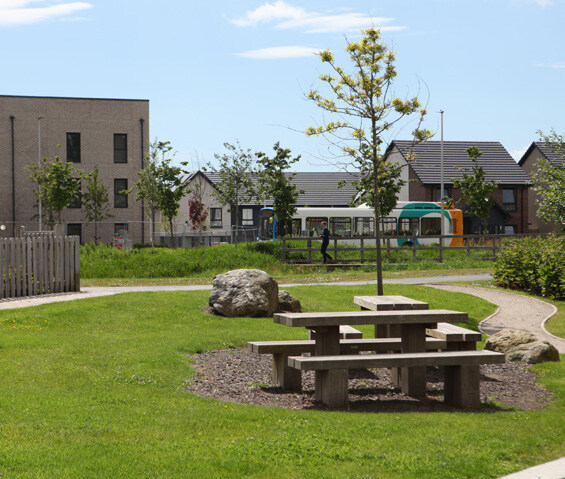
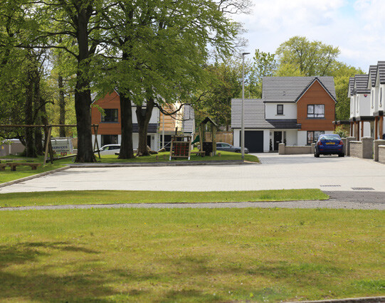
Small-scale, informal green spaces provide everyday recreation and visual relief close to homes.
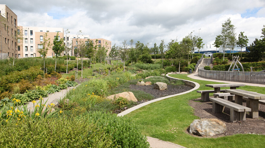
Amenity Green Space should consist of informal landscaped areas within residential neighbourhoods, typically located adjacent to housing, streets or movement routes. These spaces are intended for casual use such as sitting out, informal play, dog walking and social interaction, and contribute positively to the setting of development. They should be well overlooked, easily accessible and designed to be multifunctional, often incorporating seating, trees and grassed areas. Amenity Green Spaces also play an important role in softening-built form, providing visual breaks in development and contributing to local character.
P02 Parks and Gardens
Larger, more formal public open space serve a wider catchment and act as key community destinations.
Parks and Gardens should be strategically located public spaces designed for a range of recreational, social and landscape functions. They should typically include formal paths, planted areas, seating, focal features and areas for relaxation and informal recreation.
These spaces should form a central component of the green infrastructure network, providing opportunities for social interaction, events and active lifestyles. Parks and Gardens should be highly accessible, legible and integrated with pedestrian and cycle routes, and designed to reflect the character and identity of the wider area.
Parks and Gardens are strategically located public spaces designed for a range of recreational, social and landscape functions.
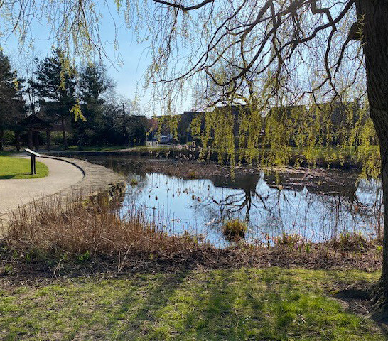
P03 Natural & Semi-Natural Areas
Landscape-led spaces protect, enhance and connect habitats while allowing low-impact public access.
Natural and Semi-Natural Areas should include woodlands, meadows, wetlands, watercourse corridors and other areas managed primarily for biodiversity and landscape value.
These spaces should form the ecological backbone of the development and contribute to wider green corridors and wildlife networks.
Public access could be provided where appropriate through informal paths and board walks, but the primary function of these areas is habitat protection, ecological enhancement and landscape character.
Design should prioritise native planting, natural land form and long-term ecological management.

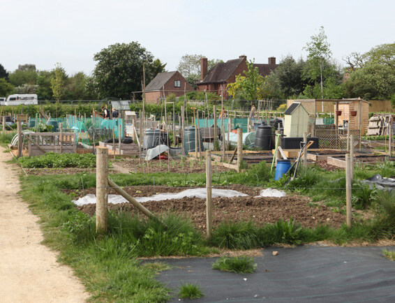
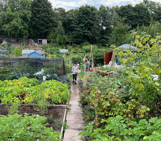
P04 Allotments and Community Gardens
Productive landscapes support food growing, community interaction and wellbeing.
- Allotments and Community Gardens should provide spaces for residents to grow food, engage in outdoor activity and foster social cohesion.
- These should be conveniently located, accessible on foot and cycle, and designed to be secure, well-drained and functional.
- Provision should include defined plots, water source, storage facilities and communal areas where appropriate
- Community gardens may be more flexible in form, allowing shared growing, education and social uses, particularly where traditional allotment layouts are not suitable.
- Allotments should be screened from main circulation routes.
- Community and school participation should be encouraged for educational purposes.
- Community orchards, fruit bushes, and edible landscaping could be provided.
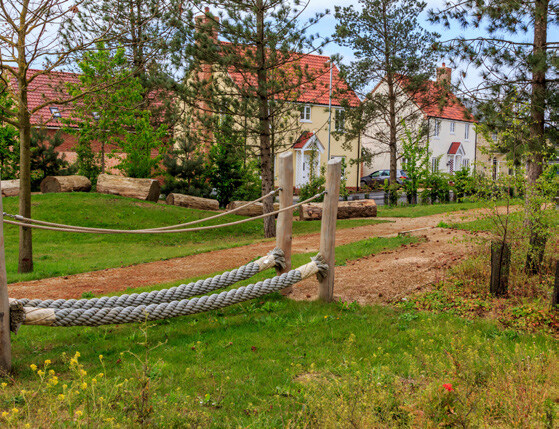
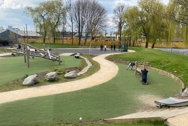
P05 Children’s and Youth Play
Inclusive, safe and engaging spaces that support play, social development and physical activity for all age groups.
Children and Youth Play Spaces should be:
- Designed to accommodate a range of ages and abilities, from early years through to teenagers, with consideration of ‘Make Space for Girls’ guidance.
- Include a mix of equipped and natural play features, opportunities for informal recreation and spaces for social interaction.
- Well overlooked, safely accessible and located within walking distance of homes.
- Encourage imaginative play, physical activity and social inclusion, while minimising conflict with nearby residential uses through careful siting,
- Designed in accordance with Fields in Trust guidance.
- Include LEAPs, NEAPs, trim trails, outdoor gyms, informal kickabout areas, and MUGAs (1–2).
- Feature safety surfacing, multi-coloured and texturally diverse, rubber mulch could be used, while grass mats should not be used.
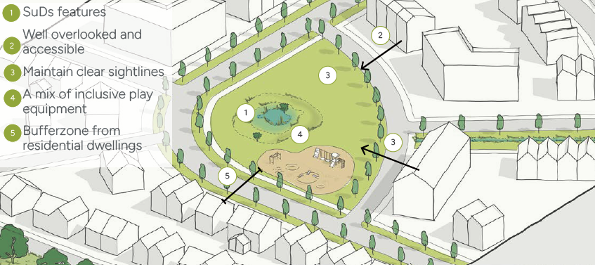
P06 General Guidance on Public Open Space (POS)
- POS should be evenly distributed across the site rather than clustered in a few areas. All dwellings could have visual and physical access to POS.
P07 Safety and Access
- POS should have clear sightlines with principal elevations of buildings fronting open space.
- Paths should be wide and open to reduce potential antisocial behaviour.
- POS could include maintenance access points while restricting unauthorised vehicular access (cars, scooters, scramblers).
- Utilities & Infrastructure - Play areas and hard POS surfaces should not be located above pipelines. SuDS features should not contain pipelines beneath them.
P08 Inclusive and Accessible
- Play areas should be suitable for all users, including neurodivergent and physically disabled individuals.
- Teen-oriented facilities could include outdoor chess, calisthenics equipment.
P09 Play Setting and Character
- Earth contouring (bunds, mounds) could be used to create challenges and interest.
- Sensory planting should stimulate all five senses.
- Each play space could have at least one unique feature to differentiate it.
- Boulders and logs should not be assumed as “natural” play unless safely designed.
- Play areas could integrate informal learning opportunities
P10 Management and Maintenance
- POS, SuDS, MUGAs, and play areas should be offered to WDC for adoption, including on affordable housing parcels.
- Leftover or fragmented POS should be avoided.
- Consortium coordination between developers could be encouraged if parcels are sold piecemeal.
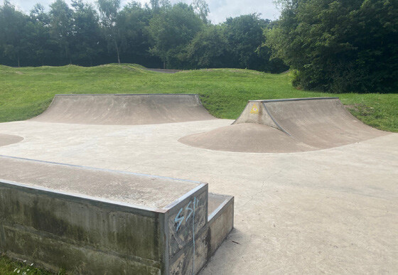
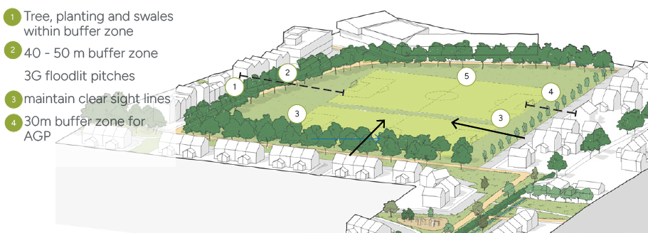
5.6.5 Sports
Objective
Sports provision should promote active lifestyles, community wellbeing, and inclusive access, serving both new residents and the wider community.
S01 Location
Sports pitches and facilities shall be:
- Located to maximise accessibility by walking and cycling.
- Integrated with green infrastructure and open space networks.
- Appropriately separated from residential development to manage noise and lighting impacts.
S02 Edges and Interface Design
Where sports use adjoins housing:
- Landscape buffers shall be provided.
- Buildings and spectator areas shall be oriented away from dwellings.
- Lighting and operational impacts shall be mitigated through design.
S03 Pitch Design and Orientation
Natural grass football and rugby pitches shall:
- Be designed in accordance with Sport England and relevant National Governing Body (NGB) standards
- Be oriented north–south where practicable to minimise glare
- Include appropriate safety run-offs and drainage
S04 Size and Configuration
Full-size pitches shall be prioritised where space allows:
- Provision for junior and mini pitches shall be made to reflect local demand.
- Pitches shall be grouped where possible to enable shared facilities.
- 3G Artificial Grass Pitches (AGPs).
S05 3G Pitch Specification
3G pitches should:
- Meet FA and Sport England standards
- Be suitable for competitive football and community use.
- Include appropriate shock pads, drainage, and surface performance standards.
- Floodlighting shall be designed to minimise light spill and glare.
- Lighting shall comply with relevant environmental and residential amenity standards.
- Hours of use shall be controlled where close to housing.
S06 Management and Security
- 3G pitches shall be enclosed with robust, anti-climb fencing
- Access points shall be controlled and well overlooked.
- Design shall align with Secured by Design principles.
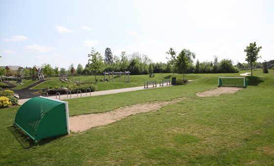
S07 Kickabout and Informal Play Spaces
Kickabout spaces should:
- Be distributed across the development to ensure easy access.
- Support informal play for children and young people.
S08 Design Quality
Kickabout spaces should:
- Use durable grass or artificial surfaces.
- Be overlooked by surrounding development for safety.
- Avoid fencing where possible, or use low, permeable boundaries.
S09 Residential Buffer Zones
A minimum buffer distance of 20 metres shall be provided between residential dwellings and:
- Natural turf football pitches.
- Natural turf rugby pitches.
- Kickabout and informal play spaces.
- A minimum buffer distance of 30 metres shall be provided between residential dwellings and:
- 3G artificial grass pitches (AGPs) without floodlighting
- Formal training areas with frequent use.
- A minimum buffer distance of 40–50 metres shall be provided between residential dwellings and:
- Floodlit 3G pitches
- Spectator areas, changing facilities, and car parking associated with formal sports use
- Buffer distances shall be measured from:
- The edge of the pitch or playing surface
- To the nearest residential habitable room or private garden boundary
S10 Buffer Design and Treatment
Buffer zones should:
- Be designed as usable green infrastructure, not leftover land
- Incorporate landscape planting, paths, and drainage features where appropriate
- Buffer treatment may include:
- Tree belts and native planting.
- Landform or swales.
- Informal recreation or biodiversity areas.
- Buffers should:
- Mitigate noise, lighting, and activity impacts
- Maintain clear sight lines and passive surveillance
- Avoid creating concealed or unsafe spaces
- Where reduced buffers are proposed, these shall be:
- Fully justified through a technical assessment
- Supported by mitigation measures such as enhanced planting, orientation, or lighting controls
- Relationship to Layout and Phasing
S11 Sports uses should be located and phased to:
- Minimise conflict with residential amenity
- Ensure buffers are delivered alongside pitch provision
- Residential development shall not encroach into identified buffer zones at later phases.
Public Spaces Policy and Guidance
Future development proposals should consider the following policy and guidance in relation to Nature and Public spaces:
- National Planning Policy (NPPF), Section 12, 14, 15, 16
- National Design Guide, Section 5, 6
- National standards for sustainable drainage systems (SuDS)
- Biodiversity Net Gain
- Building for a Healthy Life: Streets for All
- Warwickshire Design Guide, Annex 8
- Warwickshire Local Nature Recovery Strategy
- Flood Risk Guidance for Development
- Warwick District Council Local Plan, Policy NE1, NE2, NE3, NE4, NE7, CC1, FW1, FW2
- Residential Design Guide SPD
- Public Open Space SPD
- Biodiversity Action Programme
- Make Space for Girls
|
Pitch Type |
Typical Use |
Key Standards |
Minimum buffer to housing |
Key Design Requirements |
|---|---|---|---|---|
|
3G Artificial Grass Pitch (Unlit |
Training and competitive football |
FA & Sport England AGP standards |
30m |
Enclosed with anti-climb fencing, controlled access, surface and shock-pad to approved standards |
|
3G Artificial Grass Pitch (Floodlit) |
Intensive training and match use |
FA, Sport England & lighting standards |
40–50m |
Floodlighting designed to minimise spill and glare, hours of use controlled, enhanced landscape buffering |
|
Training Areas (Natural or Artificial) |
Club and community training |
Relevant NGB standards |
30m |
Frequent use areas to be separated from housing, robust surfaces, lighting carefully managed |
|
Kickabout Space/Informal Play Area |
Informal youth and community play |
Local standards / best practice 20m |
20m |
Overlooked locations, minimal fencing, durable surface, distributed within walking distance of homes |
|
Spectator Areas/ Changing Facilities |
Support facilities |
Sport England guidance |
40–50m |
Orientation away from housing, noise mitigation, landscaping, integrated parking and cycle provision |
5.7 Nature Design Codes
5.7.1 Nature Design Codes
Five Key Moves for Nature
Nature runs through every street, connected green corridors bring wildlife, wellbeing, and everyday moments of calm to your doorstep
1. Ecology Is a structuring principle
The emerging masterplan is being shaped around ecology and landscape, not fitted around it.
2. Finham Brook Is a key natural element with high ecological value
Any paths, bridges or changes within the corridor must be sensitively designed, as watercourse units are the most difficult to replace. Best way to gain an increase in gain is to enhance the brook which will bring more than biodiversity benefits but would add to the people and place element of the design.
3. Nature connectivity is a strategic opportunity to enhance ecological connectivity across allocation.
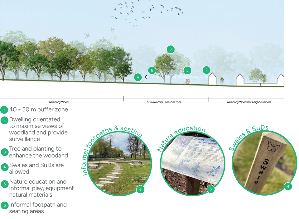
A continuous north–south green corridor linking Wainbody Wood and Finham Brook should be included to connect wildlife habitat.
4. Ponds and hedgerows are retained and enhanced where Possible
Northern ponds, hedgerows and mature trees are critical to biodiversity and connectivity and should be retained wherever feasible.
5. The site has the space to get nature right
With around double the required open space, the site has sufficient flexibility to protect high-value habitats and deliver meaningful BNG largely on site.
5.7.2 Ecology and Biodiversity Design Codes
Objective
To protect, enhance, and connect King’s Hill Lane’s ecological assets through a landscape-led Green and Blue Infrastructure (GBI) framework, delivering measurable Biodiversity Net Gain (BNG) in accordance with national policy and site specific ecological conditions.
E01 Policy Compliance and Biodiversity Net Gain
- Apply the mitigation hierarchy of avoid, minimise, mitigate, and compensate.
- For unpermitted areas, development proposals must comply with the National Planning Policy Framework (NPPF), the Environment Act biodiversity net gain requirements, the Wildlife and Countryside Act, the Habitats Regulations, and relevant Natural England guidance. Development must:
- Deliver a demonstrable and measurable Biodiversity Net Gain, with a clear preference for on-site habitat retention, enhancement, and creation,
- Embed biodiversity enhancement within the spatial layout, landscape structure, and GBI network, rather than treating it as residual mitigation,
- Be informed by up-to-date ecological surveys prepared by ecologists.
E02 Protection of Designated Sites and Priority Habitats
- Areas accessible to the public should be clearly distinguished from protected wildlife zones.
- Existing ecological assets shall be a primary design parameter in the masterplan and detailed design stages. Key assets include Wainbody Wood, Finham Brook, ancient semi-natural woodland, ponds, hedgerows, and grassland habitats.
- Minimum buffer requirements include:
- A minimum 50m buffer to Local Wildlife Sites and ancient woodland,
- Naturalised buffers to Finham Brook informed by ecological and flood risk assessments.
- Buffers must be landscaped using native, locally appropriate species and managed to enhance ecological function.
E03 Ecological Network and Connectivity
- A site-wide ecological network shall be delivered as part of the GBI framework to maintain and enhance habitat connectivity and resilience.
- Development proposals must:
- Deliver a continuous north–south ecological corridor linking Wainbody Wood to Finham Brook,
- Retain and reinforce existing hedgerows, tree lines, grassland, woodland, and water features to facilitate species movement,
- Avoid severance of established wildlife routes by roads or built development,
- Integrate pedestrian and cycle routes only where compatible with ecological function, with appropriate buffers and planting.
E04 Landscape-Led Biodiversity Design
Landscape design shall be biodiversity-led, prioritising:
- Planting should enhance ecological connectivity and Green Blue Infrastructure network features.
- Retention of mature trees, hedgerows, ponds, and watercourses wherever feasible,
- Native, locally appropriate planting, including fruiting and pollinating species, across public open spaces, streets, SuDS features, and private landscapes,
- Compensation and enhancement where tree or hedgerow loss is clearly justified.
- Existing ponds shall be retained and enhanced with buffer zones and strong connectivity to surrounding habitats and corridors.
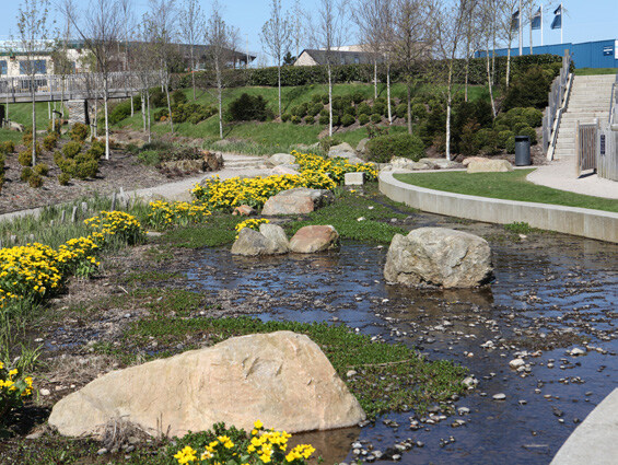
E05 Watercourses, Wetlands, and SuDS
Finham Brook shall function as a primary ecological corridor and landscape asset. SuDS shall:
- Be integrated as multifunctional landscape and ecological features,
- Protect and enhance water quality, aquatic habitats, and biodiversity,
- Be designed in a naturalistic manner to create diverse wetland and marginal habitats.
- Species Protection and Disturbance Management.
- Otter holts, wetlands, swales, and rain gardens could be integrated for ecological benefit.
5.7.3 Landscape Design Codes
The codes below should be read alongside the Public Open Space design codes in section 5.6.
L01 Ancient Woodland
- Protect and enhance ancient woodland while allowing adjacent residential development that is sensitive to ecological, visual, and heritage value.
- Woodland should be protected by new planting within the buffer zone to form robust protection and enhancement.
- Buffer & Setback - Residential development should be set back from the ancient woodland edge by a minimum of 50m to prevent root damage, light pollution, noise, air quality, visual screening and encroachment.
- Development could be located further away to provide additional visual and ecological buffer if feasible.
- Informal seating or educational features could be placed in clearings outside the woodland canopy but within the buffer.
L02 Woodland Protection Measures
Existing woodland should be retained with additional trees and planting, to be protected during construction.
- A continuous buffer zone should be retained around the woodland to protect soil, hydrology, and wildlife habitat.
- Protective fencing should be installed around the buffer and woodland edge prior to construction.
- No soil stripping, storage of materials, or machinery access should occur within the 50m buffer.
- Tree and hedgerow species within the woodland could be supplemented with native planting in gaps to strengthen structure and biodiversity.
L03 Uses within the Buffer
The buffer zone should be predominantly woodland habitat, natural green space, or informal open space.
- Features that could be included within the buffer.
- Pedestrian and cycle routes (informal, low-impact surfaces)
- Wildlife-friendly paths and boardwalks
- SuDS features (swales, rain gardens) that do not interfere with tree roots or hydrology
- Educational or interpretive signage.
- Features that should not be located within the buffer:
- Buildings, garages, or hard-surfaced parking.
- Play areas, MUGAs, or formal sports pitches.
- Vehicle roads or vehicular access
- Services, pipelines, or utility infrastructure that could damage roots or soil structure.
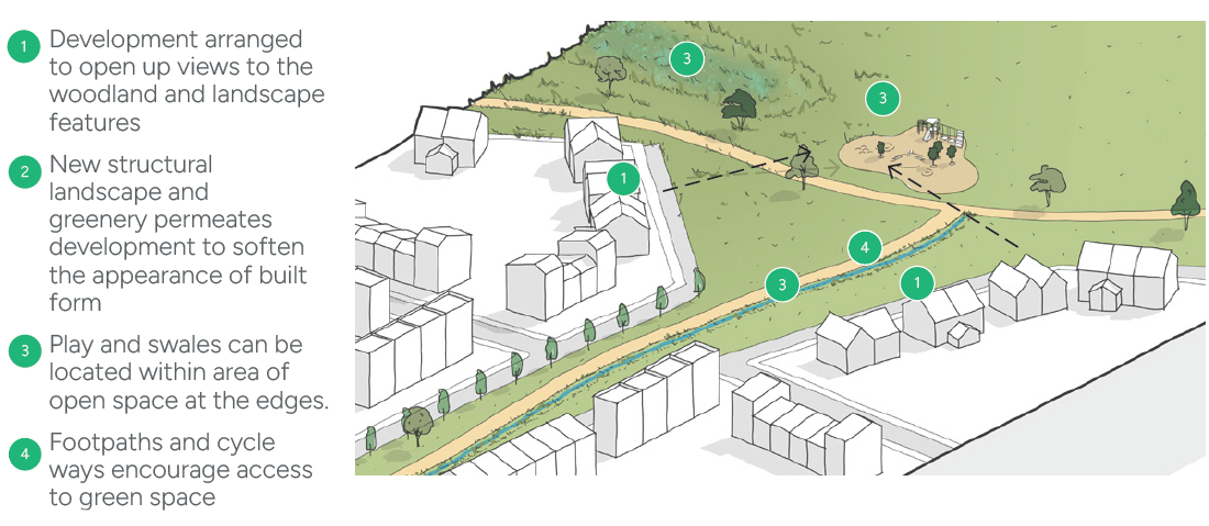
L04 Green Corridors
Strategic green corridors should act as multifunctional linear spaces that combine connectivity, ecology, drainage, and recreation.
- They should underpin a Green Infrastructure Network, linking communities, providing habitats, managing water sustainably, and enhancing the landscape character.
- Corridors should reflect the natural character of the site, integrating existing woodlands such as Wainbody Wood, Finham brook, existing hedgerows, and topography.
- Corridors could incorporate land form features such as bunds, mounds, or wetland terraces to create visual interest, support biodiversity, and provide play opportunities.
- Materials for paths, bridges, and street furniture should be low-carbon and climate-resilient while complementing the natural environment.
L05 Character and Context
- Tree-lined lanes, mature hedgerows, and hedgerow trees such as King’s Hill Lane, should be retained and protected, gapping up could be undertaken where needed.
- Sensitive ecological and historic features (Finham Brook, native woodland, ancient monuments) should be buffered and protected.
L06 Integrating Views
- Views to notable features (Coventry Cathedral spire, ancient woodland) must be incorporated into the layout to strengthen the sense of place.
- Glimpse views to Wainbody Wood and Finham Brook should be maintained from key points within the development.
- Views into the site from the surrounding context must be considered, and a Landscape Visual Impact Assessment is recommended to inform design.
- Strategic landscape buffer planting should be integrated into the green and blue infrastructure strategy and overall landscape proposals. Structural landscape should be designed to permeate the development, reducing the impact on views.
L07 Tree-lined Streets
- Street trees should be planted in highway verges, not private curtilage.
- Full-maturity canopy coverage could be considered to provide shade and visual identity.
- Street trees should be deciduous high tree canopies to allow for sight lines.
L08 Safe Spaces and Streets
- Streetscape and building orientation should harmonise with POS, play areas, and ecological features.
- Sustainable travel corridors could improve public realm and safety.
- Green corridors should be designed with open sightlines and avoid hidden areas to reduce potential antisocial behaviour.
- Planting could be layered to provide ecological and visual interest while maintaining passive surveillance opportunities.
- Paths should be lit in key areas to encourage safety. Sightlines should be wide and unobstructed.
- Lighting, trees, and layout could be designed to enhance perception of safety.
- Protected ecological areas should be fenced or buffered to avoid disturbance.
L09 Heritage and Culture
- Scheduled monuments and historic buildings should be integrated into the landscape design.
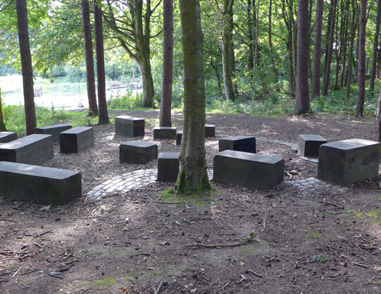
- Open space design could reflect the heritage character and cultural significance of the site, such as the ‘erratic boulder’, could become a centre piece of an open space.
L10 Public Art
- Art trails or installations could be included within open spaces to encourage community engagement.
- The SPD sets out broad principles, but p matters such as art trails, design of play areas will need to be set out in
L11 Planting and Species
- Species selection should follow WDC Landscape Guidelines: prioritise local native, climate-resilient, and pollinator-friendly species.
- New woodland, groves, copses or thickets could be created.
L12 Tree and Hedge Retention
- Trees and hedges should be retained where possible. Important hedgerows (under the Hedgerow Regulations 1997) require a separate application to remove, as they are vital wildlife corridors.
- Major applications require an AIA (following BS5837 guidelines) with the planning submission, detailing tree quality, root zones, and protection plans.
- Development should refer to WDC’s policy for tree and woodland strategy.
- Two trees must be replaced for each tree lost.
- Development, hard surfacing such as roads and parks must not be proposed within tree canopy or root protection zones. A 5m metre stand off/buffer must be adhered to.
- New developments must demonstrate how existing mature trees and boundary hedges will be retained, protected during construction (using BS5837 guidelines), and integrated into the design.
L13 School Landscape and Boundary Treatments
- The design of school boundaries shall accord with Secured by Design (SBD) principles. School perimeter fencing should:
- Be a minimum of 2.0 metres in height.
- Increase to 2.4 metres where adjoining: public highways, public footpaths or cycle routes, public open space or informal recreation areas.
- Fencing shall be of a robust, anti-climb design. Free of footholds or features that facilitate scaling. Constructed of durable, low-maintenance materials.
L14 Safe and Attractive Boundary Planting
- All school boundary fencing visible from public or residential areas shall be accompanied by landscape planting that enhances visual quality without compromising security.
- Planting should:
- Follow Secured by Design guidance by avoiding dense or tall planting immediately adjacent to fencing
- Maintain clear sight lines and passive surveillance.
- Avoid creating concealed areas or climbing opportunities.
- Planting shall comprise:
- Low or medium-height shrubs closest to fencing.
- Native hedgerows and specimen trees set back where space allows.
- Species selected to discourage access and loitering, where appropriate.
- Where space is limited, green walls, trellis planting, or climbers fixed to secondary structures may be used, provided they do not enable access over the fence.
- A minimum landscape buffer of 2 metres should be provided where possible between fencing and public areas, unless otherwise agreed with the Local Planning Authority.
- All planting should be:
- Implemented at the earliest available planting season.
- Maintained for the lifetime of the development.
- Replaced where it fails or becomes overgrown in a manner that compromises security.
L15 Lighting and Surveillance
School boundaries should be:
- Overlooked by streets, paths, or buildings where possible.
- Supported by appropriate lighting to discourage anti-social behaviour
- Lighting shall avoid light spill into school grounds and nearby homes. Be coordinated with boundary planting and fencing design.
L16 Hardworks and Softworks palette
- Robust and high-quality materials should be specified. The use of natural aggregates and natural stone paving should be used where appropriate.
- Materials are chosen to be robust and clearly define the hierarchy of the spaces.
- The planting palette selection subtly supplements the quality of the retained existing trees.
- Brick walls and hedges should define exposed garden boundaries.
- Informal paths and surface treatments should be applied to gardens.
- Materials for paths, bridges, and street furniture should be low-carbon and climate-resilient while complementing the natural environment. (Refer to section 5.3 for material precedent images.
L17 Long-Term Management and Stewardship
- Landscape mitigation shall form environmental protection measures and shall be coordinated across development parcels.
- A long-term stewardship and maintenance strategy must be implemented and developed in collaboration with WDC.
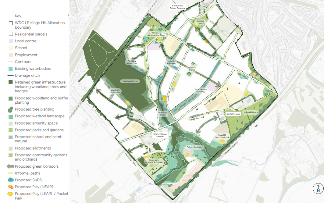
5.7.4 Green and Blue Infrastructure Strategy
The following pages describe the key landscape principles for each open space typology featured within the masterplan. The name of each open space is referenced on figure 91, Green and blue infrastructure framework and should be read with the framework plan
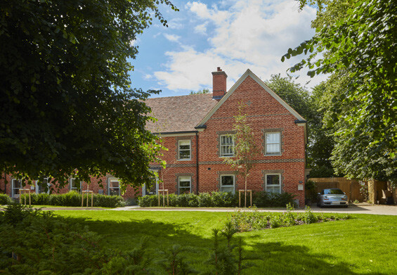
Wainbody Wood View
- Buffer planting.
- Nature rich planting and meadows.
- Birds Hides.
- Walking paths and boardwalks could be included for amenity and learning opportunities (within the buffer zone of woodland only).
- Education and Forest School.
- Nature Trails and educational signage.
- SuDs.
- Allotments and community growing.
- Low timber fencing to protect ancient woodland.
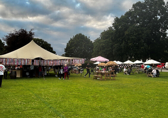
Finham Neighbourhood Green
- Inclusive play equipment should be designed to encourage movement, jumping, climbing, swinging and balance.
- Buffer from residential dwellings.
- Community/educational growing and sensory gardens.
- Duck ponds.
- Flexible Event space and lawns.
- Seating areas and pedestrian zones.
- Meadow planting.
- Street trees and hedges.
- Play for teenagers (table tennis, giant games such as chess).
- Cycle Storage.
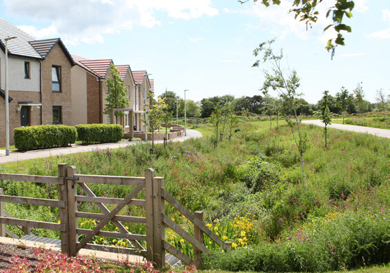
Watermeadow and Stivichall Green
- Tree planting and hedge
- SuDS should complement POS and not dominate it.
- Seating.
- Play-on-the-way, natural material play equipment.
- Meadow planting.
- Linear Trim Trails
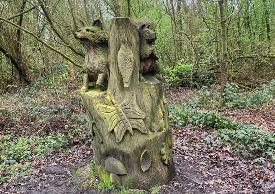
King’s Hill Lane Heritage Corridor
- King’s Hill Boulder Part LGS is a large glacial erratic boulder; historically important, it could inform and become a place-making feature within the heritage corridor
- Buffer planting - Low or medium-height shrubs closest to fencing
- Native hedgerows and specimen trees complement existing character.
- Scheduled ancient monument - deserted village, educational and heritage interpretation.
- Enhanced Tree planting
- Privacy distances from existing homes
- Boundaries - low brick walls and hedges
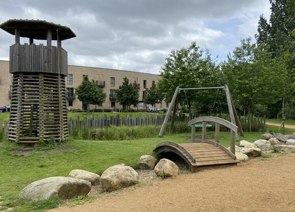
Green Lane/Stoneleigh Pocket Parks
- Inclusive play equipment should be designed to encourage movement, jumping, climbing, swinging and balance.
- Informal seating areas.
- Hedges combined with fencing to ensure a complementary park design
- Hedges and planting to screen from Green Lane.
- Sight lines and overlooking from nearby dwellings for natural surveillance.
- Cycle storage.
- Buffer from nearby residential dwellings.
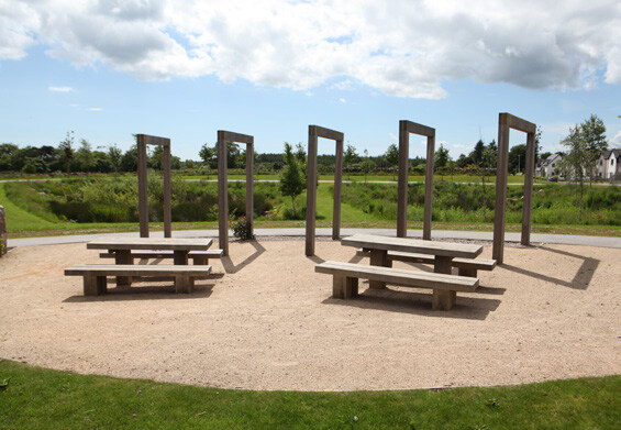
Waterside Green
- Inclusive play equipment should be designed to encourage movement including, jumping, climbing, swinging and balance.
- Informal seating areas
- Hedges and planting to screening from Green Lane.
- Sight lines and overlooking from nearby dwellings for natural surveillance.
- Cycle storage.
- Pedestrian crossing points should be demarcated using high quality surfaces and materials.
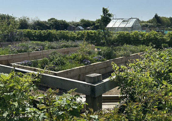
Stoneleigh Common and Orchards
- Orchards.
- Arboretum.
- Allotments and growing gardens.
- Sensory gardens.
- Meadow planting.
- Informal footpaths.
- Seating areas.
- Bird hides.
- New woodland, copse, or pocket parks could be created.
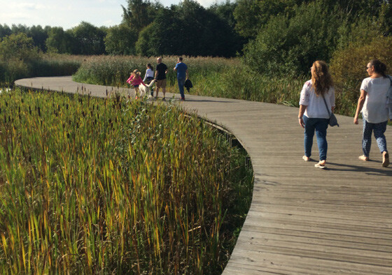
Finham Brook View
- Wetland areas.
- Bird hides.
- Walking paths, boardwalks, or dipping platforms could be included for amenity and learning opportunities.
- Nature reserve areas and planting.
- Low timber fencing to protect nature and wildlife.
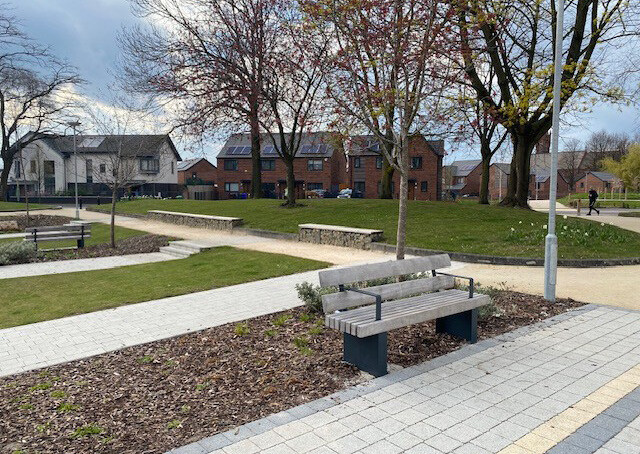
King’s Hill Lane Community Park
- LEAP/MUGA
- Teenager Play (interactive games, chess, table tennis)
- Neighbourhood Ponds
- SuDs
- Cycle Storage
- Lighting for safety during evenings, should be sensitive and consider nearby nature within Finham Brook.
Section A
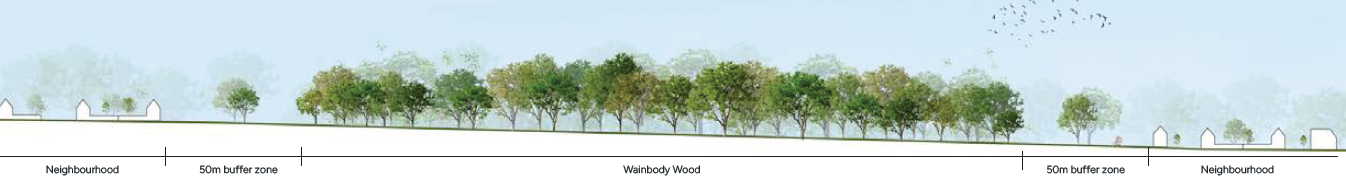
Section B
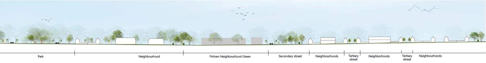
Section C
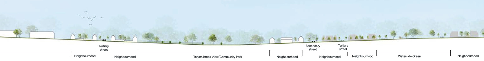
Section D
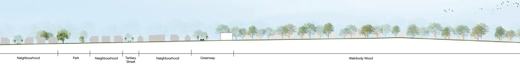
5.7.5 Public Realm and Landscape Design at Mixed Use Local Centres
- Streets trees proposed within pedestrian areas should be set within tree pits.
- Break up on-street parking with trees, low-level planting and rain gardens
- Enhanced with seating
- Way-finding and signage improves navigation and legibility.
- Surfaces and materials demarcate the pedestrian areas.
- Electric vehicle charging points.
- Cycle storage facilities.
- Bins and allowance for refuse collection.
- Hard surface materials that are complimentary to the context and setting, tarmac and concrete should be avoided.
- Pedestrian crossing points should be demarcated using high quality surfaces and materials.
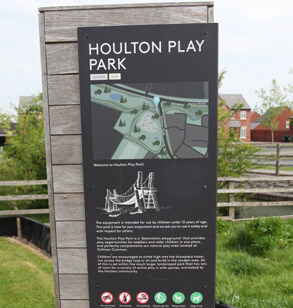
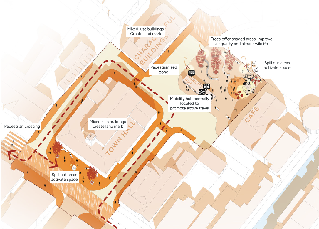
5.7.6 Sustainable Drainage Systems Design Codes (SuDS)
Objective
To manage surface water sustainably, reduce flood risk, enhance water quality, and deliver multifunctional green infrastructure that supports biodiversity, recreation, and landscape character at King’s Hill Lane.
S1 General SuDS Requirements
All new developments must incorporate Sustainable Drainage Systems (SuDS). which must:
- Reduce surface water runoff to greenfield rates where feasible,
- Protect downstream watercourses, including Finham Brook.
- Be integrated into the landscape design and public open space network.
- Support biodiversity and visual amenity through multifunctional design.
- Be designed for maintenance and long-term stewardship.
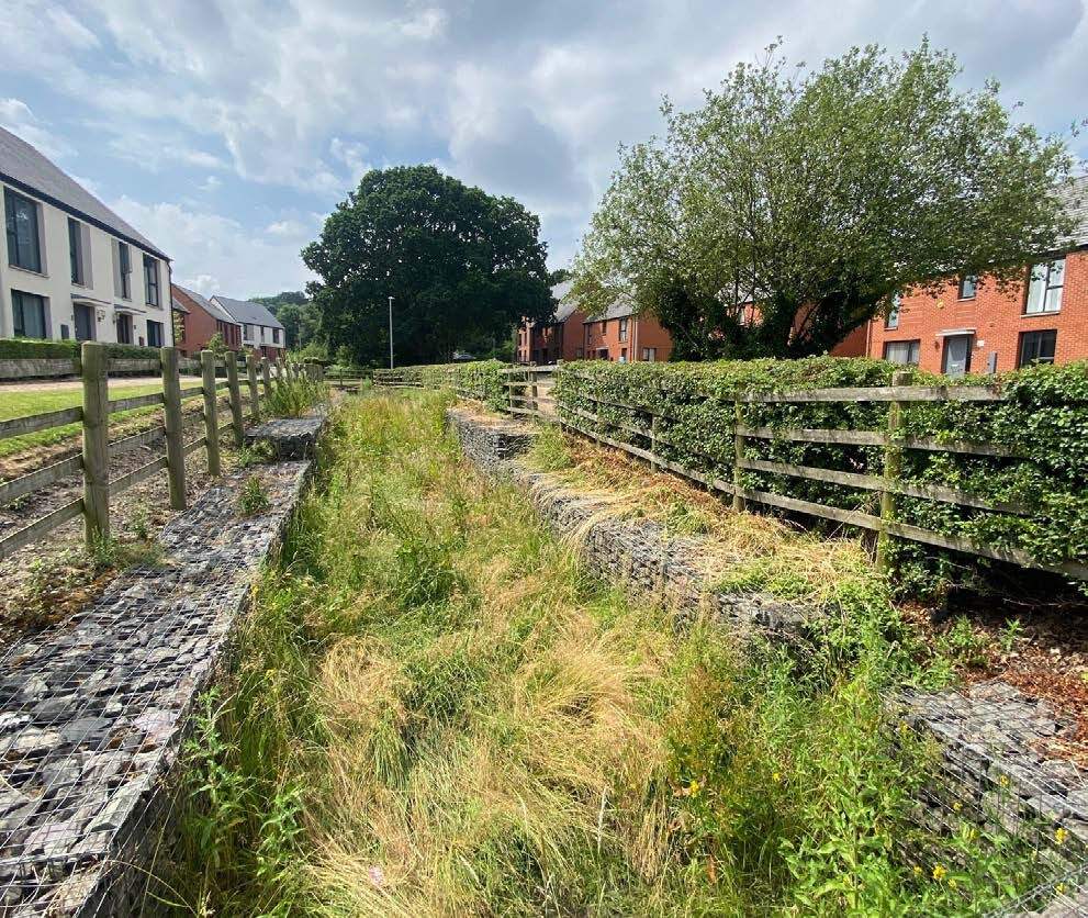
S02 Integration with Ecology
- Should be located outside ecological buffers, LWS, and ancient woodland buffers unless compatible designs are agreed with ecologists.
- Contribute to the Finham Brook corridor and green infrastructure network.
- Use native wetland and marginal species to enhance habitat.
- Include gentle slopes and naturalistic edges for amphibian, otter, and bird access.
- Edges could be irregular and natural in form, with marginal and aquatic planting.
S03 Heritage and Visual Integration
- Avoid visually intrusive engineering in views from heritage assets, including the Scheduled Monument and Wainbody Wood.
- SuDs should be integrated with open spaces, parkland, and amenity green spaces to enhance recreation, aesthetics, and place-making.
S04 Flood Risk and Maintenance
- Flood attenuation and storage features must not increase risk to third parties.
- A long-term management plan must be submitted.
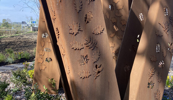
Figure 106 Precedents images of public realm inspired by heritage
Nature Policy and Guidance
Future development proposals should consider the following policy and guidance in relation to Nature and Public spaces:
- National Planning Policy (NPPF), Section 12, 14, 15, 16
- National Design Guide, Section 5, 6
- National standards for sustainable drainage systems (SuDS)
- Biodiversity Net Gain
- Building for a Healthy Life: Streets for All
- Warwickshire Design Guide, Annex 8
- Warwickshire Local Nature Recovery Strategy
- Flood Risk Guidance for Development
- Warwick District Council Local Plan, Policy NE1, NE2, NE3, NE4, NE7, CC1, FW1, FW2
- Residential Design Guide SPD
- Public Open Space SPD
- Biodiversity Action Programme
- Warwick District Council Tree and Woodland Strategy
5.8 Uses Design Codes
5.8.1 Uses Design Codes
Objective
Land uses have been distributed across the site to ensure that local facilities are accessible for everyone, encouraging walking and cycling, interaction and social cohesion.
Landmark
Growing
Spill out space
U01 Mixed Use Local Centres
The following potential uses could be accommodated within the local centres, subject to market assessment and commercial advice:
- Class E (Commercial, Business and Service).
- Retail: Shops, showrooms, post offices (formerly A1).
- Leisure: Indoor sports, fitness centres, gyms (formerly D2).
- Offices: Business (B1) uses.
- Community/Health: Health centres, clinics, day nurseries, crèches (formerly D1).
- Food/Drink: Cafes, restaurants (A3) where consumption is mostly on-site.
- Class F (Local Community & Learning): For more specific community needs.
- F2 (Local Community): Small local shops, community halls, indoor/outdoor sports (like pools/rinks).
- Sui Generis (Unique): Uses that don’t fit U02 other classes or are deemed special.
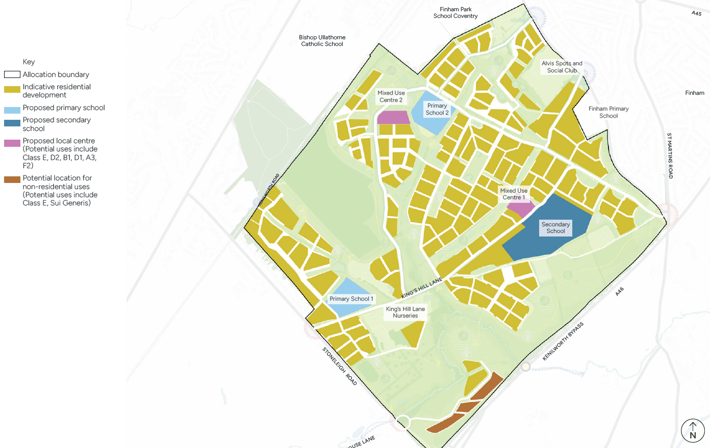
U02 Uses at A46 Gateway and Corridor
The area south west of the site adjacent to the at the A46 Gateway/corridor, has the potential to deliver non-residential uses, considering the noise, topography and visual impacts to residential development. Land in this area could be efficiently used for non-residential uses. The potential non-residential uses recommended include:
- Class E (Commercial, Business and Service).
- Offices: Business (B1) uses.
- Food/Drink: Cafes, restaurants (A3) where consumption is mostly on-site
- F2 (Local Community): Small local shops, community halls, indoor/outdoor sports (like pools/rinks).
- Sui Generis (Unique):
Non-residential use at the A46 gateway is subject to further technical assessment to consider the constraints such as flood zone, oil pipeline, noise and wildlife. Refer to section 4 for constraints. In addition, market and commercial advice should influence the proposed uses.
Uses to be avoided at the A46 Corridor:
The types of uses that should be avoided at the A46 gateway/corridor are B8 industrial. At the prominent part of the site, the gateway arrival and views must not be compromised.
U03 Building Frontages
Blank façades and inactive frontages should be avoided in future development, as active frontages are closely linked to safety due to there being more active surveillance. Blank frontage areas can feel dangerous as anti-social behaviour can take place out of sight. New development should seek to comply with the following design codes and recommended policy guidance.
U04 Mixed Use Centre Buildings
- At mixed-use local centres and hubs, a mix of building typologies should include mews, town houses and duplexes, apartments to ensure variety and visual interest, as well as delivering optimised densities.
U05 Interfaces Between Uses
- Location and design of various land uses should ensure compatibility between existing and proposed uses, taking account of noise, odour, lighting and operational characteristics.
- Community, commercial uses, schools and sports facilities should be designed to minimise environmental impacts on nearby sensitive receptors through layout, orientation and operations.
- Large scale development should establish a clear hierarchy of streets, integrated with the surrounding context.
Active Ground Floors
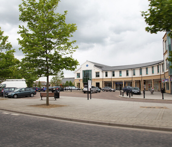
Community
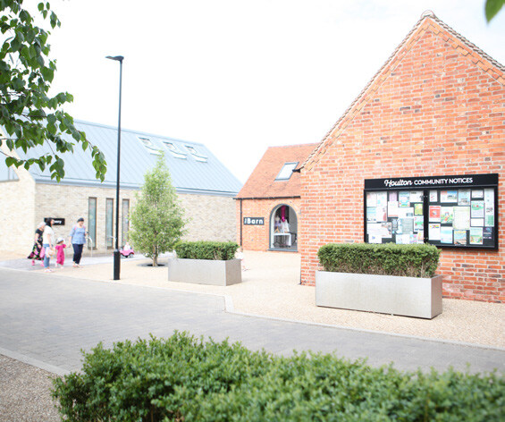
Landmark buildings
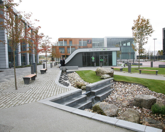
U06 Community Facilities
Community facilities should include a range of services which meet local needs, a mix of uses could include:
- Village halls, hubs or cultural facilities,
- Local shops, pubes/cafés
- Medical facilities, GP’s, dentists
- Places of worship,
- Home working hubs.
The masterplan should be designed to reduce opportunities for crime and anti-social behaviour through natural surveillance, clear ownership, active frontages, and safe movement networks.
Key design features for community facilities:
- GP’s must be prioritised in accordance with s106 associated with the planning application W/18/0643.
- Provide adequate vehicle and cycle parking provision for the community, visitors and staff.
- Orientation of the building to maximise any potential outdoor space. I.e., café with an outside space, activities and events being able to be held in an outside space.
- Facilities must be positioned where they are easily reached on foot and cycle, integrated with other daytime uses where appropriate.
- The s106 associated with outline application W/18/0643 sets the requirement for the community centre to be provided within the phase 3a land by the 1,525th occupation and for a Maintenance and Management Plan to be submitted to the Council by 100th dwelling and details of the specification to be provided and agreed by the 1st occupation. It is expected that the unpermitted areas will be required to pay s106 contributions towards the ongoing running and maintenance of the community centre.
- The detailed specification of the land use mix and quantum’s must be agreed with the Council.
5.8.2 Education facilities
These design codes set out the spatial, land, access, and delivery requirements for education provision to support the planned residential development. They are intended to inform masterplanning, site allocation, and detailed design.
U07 Pupil Yield and Form of Entry (FE)
- Based on current pupil yield multipliers, a development of approximately 4,000 dwellings is predicted to generate a total pupil yield of 5.6 Forms of Entry (FE) at primary level.
- U08 Education provision shall therefore be planned to ensure:
- Delivery of two primary school sites, each capable of accommodating a 2FE primary school at opening.
- Both primary school sites must be designed to allow future expansion to 3FE, should demand require.
U08 Primary School Requirements
Each primary school site shall:
- Support a 2FE primary school with:
- Nursery provision, and
- Specialist Resource Provision (SRP).
- Be capable of expansion to 3FE without compromising site functionality or educational standards.
- The indicative site area for each primary school shall be approximately 2.8 hectares, and the area shall be no less than 2.5 hectares.
U09 Secondary School Requirements
One secondary school site should be provided. The school shall:
- Open initially as a 6FE secondary school,
- Be capable of expansion to 8FE,
- Include a sixth form, and Specialist Resource Provision (SRP).
- The indicative site area for the secondary school shall be approximately 8 hectares.
- A reduced site area of 7 hectares may be acceptable, subject to detailed design and agreement with the education authority.
U10 Site Characteristics and Constraints
- All education sites (primary and secondary) shall meet the following criteria:
- Be relatively flat to facilitate efficient construction and safe use.
- Be free from public rights of way, major easements, and constraints such as overhead power lines.
- Not be located in areas prone to flooding.
- Be regular in shape, preferably square or rectangular, to enable efficient layout of buildings and outdoor space.
- Existing hedgerows and trees may be retained where appropriate, subject to their location and impact on site usability.
U11 Boundaries and Relationship to Housing
- All school sites shall be securely fenced.
- The location of schools in relation to surrounding dwellings should take into account safeguarding, noise and activity levels, and a clear definition between public and private space.
U12 Sports Provision and Community Use
Where public or community sports pitches are proposed, they may be delivered through shared use of school facilities, subject to the following:
- All pitches must be located within the school site.
- Community access cannot be guaranteed, as schools are expected to operate as academies, with ultimate control resting with the academy trust.
- Any shared-use arrangements shall be discussed and agreed in principle at the masterplanning stage.
U13 Access, Movement, and Safety
- School sites shall be designed to provide safe and direct pedestrian and cycle access for pupils.
- School safety zones shall be incorporated into the surrounding street network.
- Provision for parent parking shall be minimised, reflecting the expectation that most pupils will reside within the local area.
- Servicing and emergency access must be accommodated without conflict with pupil movement.
Ongoing collaboration is required to ensure that education provision is delivered in a timely, accessible, and policy-compliant manner.
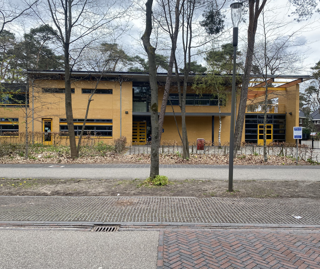
5.9 Homes and Buildings Design Codes
5.9.1 Homes and Buildings Design Codes
Objective
Homes and buildings shape the health and well-being of people's lives and should be adaptable over time. Functional, accessible homes should contribute positively to the environment.
H01 Space Standards
- Homes should be designed to meet the Nationally Described Space Standards (2015), in accordance with Warwick District Council Local Plan Policy H6 (or successor policy).
- Where deviations are proposed, these must be clearly justified having regard to site viability and the most up-to-date Warwick District Housing Needs Assessment (HNA).
H02 Inclusive and Accessible Homes
- Homes should be designed to support lifetime occupation, including step-free access where feasible.
- Buildings should address the Government’s Inclusive Mobility Guidance and align with Building for a Healthy Life principles.
- All residential development shall comply with Approved Document M. All homes shall be provided to a minimum of Building Regulations M4(2). A proportion of dwellings shall meet M4(3), comprising 2.5% of market homes to M4(3)(a) and 5% of rented affordable homes to M4(3)(b), informed by the Strategic Housing Market Assessment. Where suitable residents for M4(3)(b) cannot be identified, provision may revert to M4(3)(a), subject to agreement with the Local Planning Authority.
H03 Aspect and Daylight
- Development layouts should maximise opportunities for good daylight and sunlight in accordance with published standards”
- Main living spaces should face south or east–west wherever practicable.
- Apartments should be dual aspect where possible to maximise daylight, ventilation, and environmental quality.
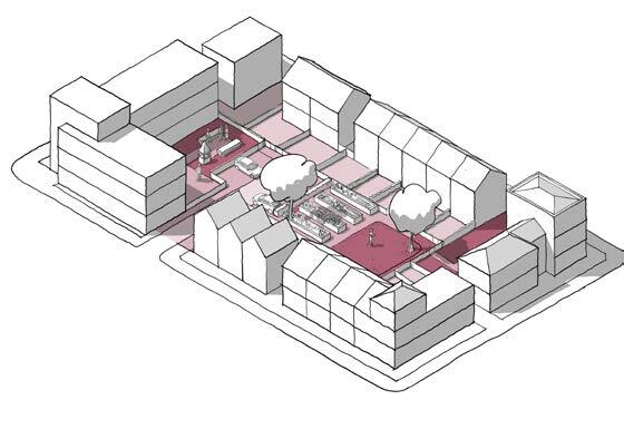
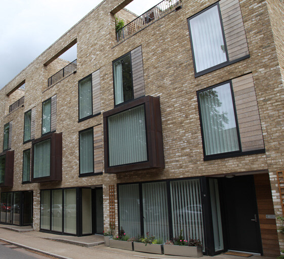
H04 Private and Communal Outdoor Space
- All dwellings should be provided with access to adequate private outdoor amenity space, consistent with published standards.
- Privacy distances for rear gardens and habitable room windows must comply with the WDC Residential Design Guide SPD, with a minimum separation distance of 21 metres between facing habitable room windows.
- Balconies must be of sufficient size to be genuinely usable and comply with guidance and Building Regulations, ensuring good levels of privacy, safety, accessibility, and residential amenity.
- Apartment schemes should provide communal outdoor amenity space in addition to private space, in accordance with published standards.
- Communal gardens should be accessible directly from surrounding dwellings or from shared circulation areas.
- Adequate consideration must be given to privacy, defensible space, and overlooking around the perimeter of communal gardens.
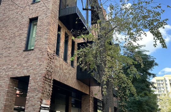
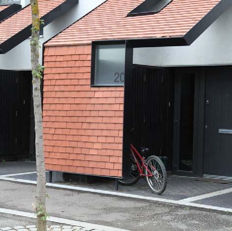
H05 Storage
- Cycle storage must be provided in accordance with Warwick District Council standards, the Residential Design Guide SPD, and Local Plan Policy TR2 (Parking).
- Refuse and recycling storage must be provided in convenient and accessible locations, in accordance with published standards.
H06 Adaptability
- Homes should be designed to allow for flexible internal layouts and future adaptation, supporting lifetime living and changing household needs, including step-free access in accordance with published standards.
H07 Lighting, Daylight, and Sunlight
Development proposals must demonstrate that internal daylight and sunlight have been considered at the masterplanning and layout stage, including step-free access in accordance with published standards”, taking account of:
- Building orientation
- Window positioning and size
- Glazing performance, including appropriate U-values
Generous levels of glazing should be provided where appropriate, while ensuring that overheating risks are mitigated through appropriate design measures.
Apartments should be dual aspect where feasible to enhance daylight, ventilation, and thermal comfort.
Good quality housing should provide a pleasant internal environment with:
- Adequate levels of natural daylight and sunlight
- Good quality ventilation
- Privacy from overlooking
- Minimal noise impact
- No reliance on permanently closed windows to achieve acceptable internal conditions
- Lighting associated with buildings must be designed to avoid unacceptable impacts on residential amenity.
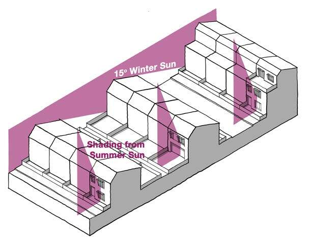
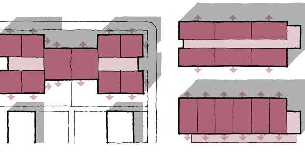
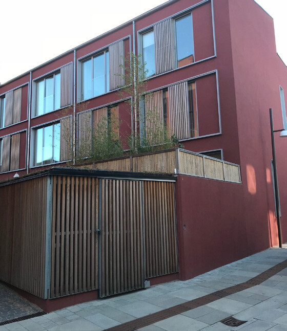
H08 Refuse and Recycling Requirements
- External storage for waste and recycling should be provided to the rear or side of properties and integrated sensitively so that it is not visually prominent from the street, including step-free access in accordance with published standards.
- Private drives should be designed to ensure that acceptable bin drag distances can be achieved, consistent with Warwick District Council waste collection requirements.
H09 Safety and Security
- Homes should be designed in accordance with Secured by Design principles and in accordance with published standards.
- Layouts should promote natural surveillance through appropriate orientation and overlooking of streets, footpaths, and communal spaces.
H10 Acoustics
- Homes should be designed to provide healthy internal and external living environments, with particular emphasis on acoustic comfort, in accordance with published standards.
- Acceptable noise environments must be achieved through good acoustic design and site layout, especially at the A46 Gateway and corridor where vehicle noise could impact homes.
- Closed windows is not an acceptable means of mitigation.
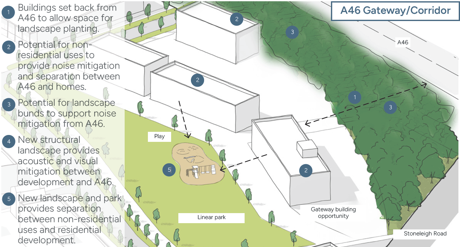
H11 Housing Tenure, Mix and Quantum
Up to 4000 homes should be provided within the allocation site.
Provision should be in accordance with the latest published assessment of housing need, such as the Housing and Economic Development Needs Assessment, or any documents that supersede it such as the emerging Strategic Housing Market Assessment (SHMA).
Residential development should provide a diverse mix of dwelling sizes, including:
- 1 bedroom homes for single-person and older households.
- 2 bedroom homes for couples, downsizers, and small families.
- 3-4 bedroom homes for families, with emphasis on affordability.
The housing mix may be reviewed at Reserved Matters stage to reflect updated evidence, subject to Council agreement.
H12 Affordable Homes
Deliver a policy compliant level of affordable housing, with priority given to social rent and affordable rent.
Provide a balanced mix of dwelling sizes, with particular emphasis on:
- 1 and 2 bedroom homes.
- Affordable family housing (3+ bedrooms).
- Affordable housing should be integrated throughout the site and be tenure-blind in design.
H13 Older Persons’ and Specialist Housing
- Provision should be made for older persons’ accommodation and/or specialist housing, informed by up-to-date local evidence.
- Older persons accommodations should be Integrated into the wider neighbourhood and located close to services, public transport, and open space.
- Development will need to plan for specialist provision for adults with disabilities and accommodation for old people, in line with the latest needs assessments. The level and type of provision should be determined in consultation with Warwickshire County Council’s Social Care and Health Commission team.
- The housing mix may be reviewed at Reserved Matters stage to reflect updated evidence, subject to WDC’s agreement.
H14 Housing Typologies
The masterplan should include an appropriate range of:
- Terraced housing.
- Semi-detached housing.
- Detached housing.
- Apartments.
- Bungalows and level-access homes.
The distribution of housing typologies should:
- Reflect the surrounding built context and settlement pattern.
- Support efficient land use, particularly through terraced homes and apartments.
- Respond to lifetime housing needs, with bungalows and level access homes contributing to older persons’ accommodation.
- Apartments and higher density typologies should be:
- Located in areas with access to public transport, services, and open space.
- Designed with high-quality internal and external amenity provision.
Lower density typologies, including detached and semi-detached homes should be:
- Be located towards site edges or where they respond positively to adjacent development.
- No single dwelling size should dominate more than 50% of total units, unless otherwise justified.
Apartments
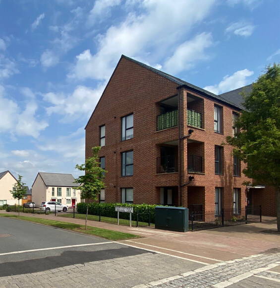
Detached houses
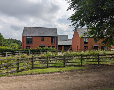
Terraced houses
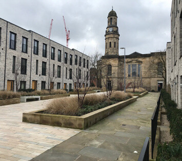
Barnstead
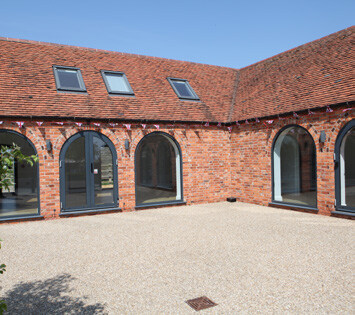
Homes and Buildings Policy and Guidance
Future development proposals should consider the following policy and guidance in relation to Homes and Buildings:
- The Building Regulations 2010
- National Planning Policy (NPPF), Section 8, 12,14
- Future Homes Standard
- The Nationally Described Space Standards (2015)
- National Design Guide, Section 8
- Building for a Healthy Life: Distinctive Places
- Warwick District Council Local Plan, Policy BE1, HS1, HS7, CC1
- Residential Design Guide SPD
- Coventry & Warwickshire Housing & Economic Development Needs Assessment (HEDNA)
5.10 Resources and Lifespan Design Codes
5.10.1 A Comprehensive and Visionary Approach to Sustainability
In a global context where the impacts of climate change are increasingly evident through extreme weather events, ecological decline and the declaration of Climate Emergencies by national and local authorities, it is essential that new development responds with a comprehensive, proactive and future-focused sustainability agenda.
Delivering this ambition requires more than policy compliance alone; it demands a clear vision and decisive action. As a significant development opportunity, King’s Hill has an important role in supporting the sustainability objectives identified within Warwick District Council policy, including the Net Zero Carbon Supplementary Planning Document, the transition to net zero carbon, biodiversity enhancement, climate resilience and the creation of healthy, inclusive communities. Unpermitted development areas within the site allocation for King’s Hill Lane should address the requirements of these policies and seek not only to meet these objectives but to establish a high-quality precedent for sustainable development.
5.10.2 The United Nations Sustainable
Development Goals (SDGs) provide an internationally recognised framework for addressing environmental, social and economic challenges. The King’s Hill Lane masterplan aligns with the principles of the UN SDGs and Warwick District Council’s sustainability priorities, while adopting a bespoke, site-specific approach that responds to local context, constraints and opportunities. This ensures that global and district-wide ambitions are translated into practical, place-based outcomes tailored specifically to King’s Hill Lane.

5.10.3 King’s Hill Lane Sustainability Goals
Net Zero Carbon
Climate Action - This objective supports Warwick District Council’s net zero ambitions through energy-efficient design, low-carbon construction, and the integration of renewable energy technologies to minimise both operational and embodied carbon.
Enhancing Biodiversity
A Life on Land - This goal responds to local ecological priorities by delivering biodiversity net gain through habitat creation, green infrastructure and long-term landscape management, contributing to nature recovery and ecological resilience.
Social Value
Sustainable Cities and Communities - The development seeks to foster inclusive, accessible and resilient communities, delivering social, cultural and economic benefits that reflect local needs and aspirations.
Sustainable Water Cycle
Clean Water and Sanitation - This objective promotes responsible water management through integrated drainage strategies, water efficiency measures and climate-resilient flood mitigation, protecting local water resources and downstream environments.
Sustainable Development
Responsible Consumption and Production - This goal supports compact, well-connected development, sustainable transport choices and efficient land use in accordance with Warwick District Council policy.
Health and Wellbeing
The masterplan prioritises environments that support physical and mental health through access to green space, active travel routes, high-quality public realm and opportunities for recreation and social interaction.
Aligning with UN Sustainable Development Goals and WDC’s policy Objectives
The King’s Hill Lane sustainability framework aligns with the UN Sustainable Development Goals and Warwick District Council’s policy objectives, while delivering a bespoke, place-led strategy that ensures sustainability is embedded throughout the design, delivery and long-term stewardship of the site.

Net-zero carbon
Active travel
- Promote active travel by enhancing and improving pedestrian and cycle crossings and access to facilities including university, airport, railway stations, centre.
- People focused - designed to prioritise pedestrians and cyclists.
- Create a safe and accessible environment for all.
- Sustainable and good quality materials in the built form and public realm.
- Promote circular economy
- Re-use and recycling, reducing waste and supporting a circular economy.
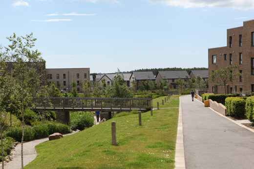
Enhancing Biodiversity
Green Infrastructure
- Provide functional amenity space such as pocket parks within the streets and spaces.
- Re-wilding and natural capital enhancement.
- Sustainable Urban Drainage Strategy (SuDS)
- A SuDS and swales create further stable natural environments to help reverse the loss of habitats for wildlife.
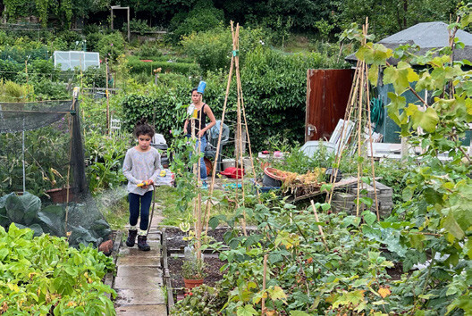
Social Value
Community Activator Projects
- Create community projects, involving the local communities.
- Opportunity to create a people focused development, engaging the new community.
- Opportunity for growing and food production (fruit, vegetables and food) for the community.
- Water stations for the community
- Sustainable lighting through the development sensitive to the surrounding wildlife and community, changing through the seasons to adapt to changes in natural light.
- Foster technology and innovation with smart technology where possible.
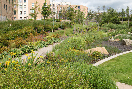
Sustainable water cycle
Slow, hold and filter
- Integrate a treatment train solution within the new development.
- Implement roof water storage and slowed run off, integrated into a filtration system, connected to the Mill Brook.
- Integrate water storage opportunities within the development to encourage grey water usage.
- Monitor water usage in homes.
- Finham Brook wetlands
- Opportunity for nature areas such as wetlands and meadows
- Implement nature education with forest schools., kitchens and nature reserve study.
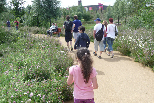
Intergenerational Living
Urban and social investment
- Mixed tenure homes for all (including affordable homes).
- Connect employment opportunities within the surrounding area, such as the Airport and University.
- Active routes towards the university, Coventry, Kenilworth and Finham and surrounding assets.
- Create a 20 minute neighbourhood.
- Implement school outreach into the community.
- Eliminate waste during all processes of development, throughout the development's lifetime.
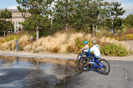
Health and wellbeing
Inclusive Play
- Inclusive and accessible to encourage outdoor activity and social cohesion.
- Opportunities for formal and informal play, such as formal sports pitches and kick around area.
- High-quality cycle and pedestrian routes, accessible for all
- Encourage people to walk or cycle to destinations, reducing reliance on the car.
- Interactive play for teenagers and adults.
- Natural play equipment and potential for recycling or re-use within designs.
Resources and Lifespan Design Codes
RL01 Air Quality
- Air quality mitigation should be planned and delivered through a coordinated, site-wide approach across all development parcels.
- Damage cost contributions and other mitigation funding should be directed to-wards agreed on-site and/or off-site mitigation measures through a collective strategy.
- Environmental mitigation measures should be embedded within the masterplan and design codes to ensure long-term protection of residential amenity.
RL02 Renewable and Low-Carbon Energy
- Development should demonstrate the integration of renewable and low-carbon energy technologies in line with the Future Homes Standard and best practice.
- Energy strategies should follow the energy hierarchy, prioritising demand reduction before on-site generation.
RL03 Solar Energy
- Buildings should incorporate solar photovoltaic panels on suitable roof areas where orientation, pitch and layout allow effective solar gain.
- Solar water-heating systems should be integrated where viable to reduce reliance on fossil-fuel-based heating.
RL04 Low-Carbon Heating and Cooling
- Ground-source and air-source heat pumps should be prioritised to minimise operational carbon emissions and support net-zero-ready homes.
RL05 Wind Energy
- Proposals for micro wind generation should be supported by an assessment of local wind conditions and potential impacts to ensure effectiveness and suitability.
RL06 Infrastructure and Coordination
Developers must engage early with utilities providers, highway authorities, tele-communications companies and other stakeholders to:
- Minimise disruption and energy consumption during construction; and
- Ensure adequate grid capacity to support renewable energy generation and electric vehicle charging infrastructure.
RL07 Construction and Phasing
- Construction phasing should be coordinated across development parcels to minimise environmental impacts on existing and newly occupied homes.
RL08 Orientation and Passive Design
Buildings should reduce energy demand through passive design measures including orientation, solar gain, shading, high levels of insulation and ventilation with heat recovery.
Layouts should:
- Orientate homes on a north–south axis where possible;
- Locate principal living spaces and glazing to the south to maximise winter solar gain;
- Minimise east–west glazing to reduce summer overheating; and
- Incorporate canopies and overhangs for shading.
RL09 Urban Cooling and Climate Resilience
- Urban cooling should be achieved through integrated landscape design including tree planting, shading, water features and the use of deciduous trees for seasonal comfort.
- Materials should be low-carbon, durable and climate-resilient, particularly within hard landscaping and public realm areas.
RL10 Water and Resources
- Homes should be net-zero ready and designed for long-term adaptability.
- SuDS should be integrated as multifunctional landscape features, with permeable paving prioritised (refer to Nature Design Codes).
- Fabric performance should exceed minimum Building Regulations standards where feasible.
- Water efficiency measures should be incorporated, including rainwater harvesting and water butts.
RL11 Innovation
- A site-wide or district heat network could be explored, subject to feasibility, given the scale of development.
RL12 Sustainable Neighbourhoods
- Development should support 20-minute neighbourhood principles, ensuring access to services, facilities and public transport.
RL13 Urban Greening and Electric Vehicles
- Mixed-use centres, schools and higher-density areas should maximise opportunities for urban greening, including rain gardens, green roofs and green walls.
- Electric vehicle charging provision should be delivered in accordance with the adopted Parking Standards SPD.
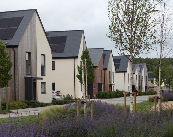
Sustainability Policy and Guidance
Future development proposals should consider the following policy and guidance in relation to Sustainability:
- National Planning Policy (NPPF), Section 2, 9,14
- Future Homes Standard
- National Design Guide, Section 9,10
- Building for a Healthy Life: Streets for All
- Warwick District Council Local Plan, Policy SC0, CC1, FW2
- Net Zero Carbon Supplementary Planning Document
- Warwick District Council NET ZERO CARBON
- DEVELOPMENT PLAN DOCUMENT
- Residential Design Guide SPD, Section 7