Preferred Options for Sites
(7) 9. Summary of Preferred Option Sites
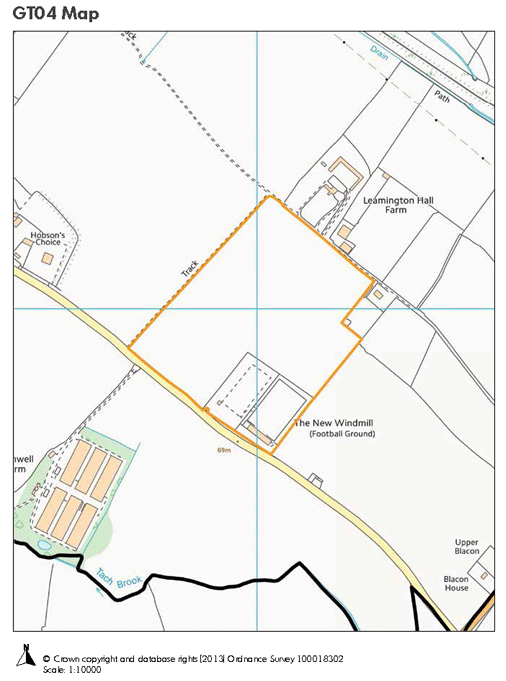
(197) GT04: Land at Harbury Lane/Fosse Way (Green)
The site is not in the Green Belt and is currently the home ground of Leamington Football Club. The Football Club could be amenable to the sale of the land for a Gypsy and Traveller site if they are able to relocate as part of a wider scheme through the Local Plan. It is unlikely that the site could connect to a public foul mains sewer, but could drain away from the south or be served by a non-mains solution. Access could be taken off Harbury Lane provided that any new access is not opposite an existing access and visibility splays can be achieved. The nearest school with places is likely to be Bishops Itchington Primary School although new schools built through new housing developments allocated in the Local Plan could also provide school places to children in this area. GP surgeries are located at Bishops Tachbrook (2.7 miles), Whitnash or Harbury (2.6 miles) and bus services are 77 bus service (2060m), 64 bus service passes site, 498 bus service (irregular).
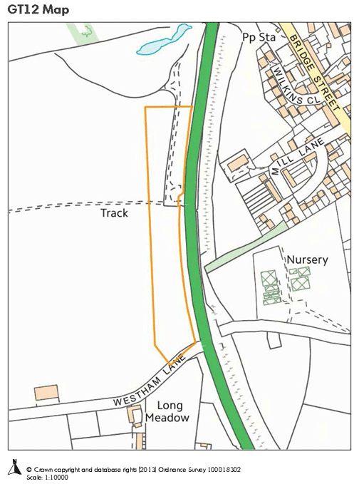
(116) GT12: Land north of Westham Lane, Barford (Green)
The site is not in the Green Belt. The original area of search consulted in summer 2013, has been reduced to allow for a viable agricultural use of the remainder and so avoiding areas in Flood Zone 3 which is the floodplain. The site is immediately adjacent to services and facilities in Barford village but there may be some safety issues in crossing the Barford by-pass to access these. The location is good in relation to the primary road network, being close to Longbridge and J15 of the M40 and A46 offering access to all major routes throughout the region. It is unlikely that the site could connect to the public foul mains sewer and would need a non-mains solution. This is likely to be acceptable subject to appropriate controls. The priority area school is Barford St Peter’s, which is 0.5 miles away. Some places at the school are taken by out of area children but children within the priority area will take priority and if new development raises the local numbers substantially, the school may be extended in the longer term. A GP surgery is located at Bishop’s Tachbrook (2.6 miles) or Hampton Magna (2.9 miles) and public transport provided by the 18 and 18a bus services (321m). The landowner is not willing to sell this site, so compulsory purchase powers would have to be used to bring the site forward.
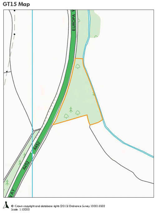
(76) GT15: Land east of Europa Way (Green)
This site is not in the Green Belt. The land belongs to Warwickshire County Council and was originally purchased to dump spoil from the excavation of the new road, now Europa Way. The land therefore slopes away from the road and is less visible because of this. In theory, it should be possible to deliver this site ahead of others as the land can be transferred easily. It is unlikely that the site could connect to public foul mains sewer and would need a non-mains solution. Access and visibility splays are achievable if some roadside vegetation is removed. The nearest school to this site is Kingsway (1.9 miles) which does have capacity. New schools built through new housing developments allocated in the Local Plan could also provide the opportunity for school places. Other existing schools are at Bishop’s Tachbrook, St Margaret’s and St Joseph’s. A GP surgery is located at Bishop’s Tachbrook (1.6 miles) and public transport provided by the 68 bus service (554m) and 77 bus service (554m).
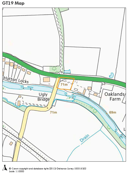
(288) GT19: Land off Birmingham Road, Budbrooke (Green)
The land is in the Green Belt but part of a larger use making it previously developed land. It is located adjacent to a petrol filling station and other houses and although faces open countryside currently, has an urban feel on this side of the Birmingham Road. Currently this part of the land is used as a site for the Camping and Caravan Club so services are already available. The site area has been reduced from that originally considered to avoid other existing uses and retain the viability of the remaining unit. The existing access points are already used for the Camping and Caravan Club caravans and fewer movements of large vehicles would take place on a permanent site.’This site could connect to the existing foul sewer. A habitat buffer would be required along the line of the watercourse which flows along the southern boundary. The land is Grade 3 agricultural land and therefore not of the highest quality. The Priority area school would be Budbrooke Primary School where numbers are falling. The school does currently take children from Warwick which is out of its catchment area. A bid has been made for funding to expand this school based on the knowledge that there could be more ‘in area’ children in the future when new village housing is developed. There is a GP surgery located at Hampton Magna (1.1 miles) and public transport is provided by the 68 bus service, the 60 bus service (irregular) and the 511 bus service (irregular) all of which pass the site. Subject to agreement with the landowner, this site could be delivered within 5 years.
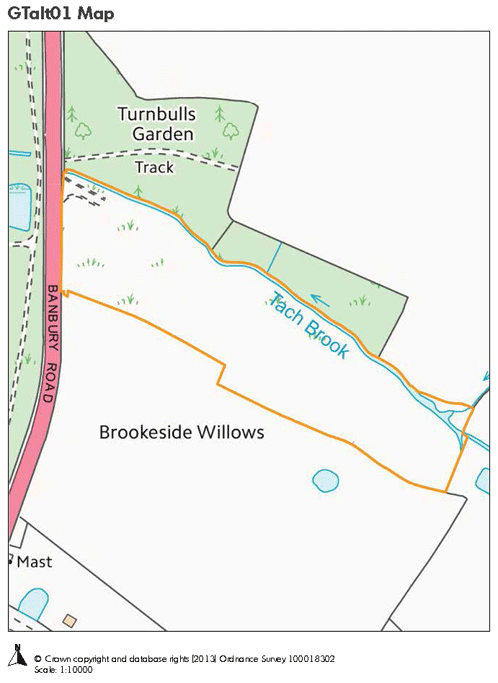
(118) GTalt01: Brookside Willows, Banbury Road (Green)
This site is not in the Green Belt. The site already has an extant planning permission for a holiday caravan site. It is located close to the edge of the urban area but well screened from the road. A new access has recently been created with a turning lane from Banbury Road to highway standards for a caravan park. Several local watercourses drain close to the site, but the water runs into the road rather than onto the site. Although a landfill site in the past, some research has been carried out in connection with the existing planning permission to identify the contaminants and planning conditions were attached to the permission to deal with these issues. This use is very similar to that proposed and if designed properly with the right approach to ventilation and erection of fixed buildings on floating slabs, the site could be developed for permanent use. There is pedestrian access along the roadside and it is close to the primary road network. If the site is developed it is recommended that a buffer should be retained with a wildlife corridor along the Tach Brook. Whilst opposite Castle Park, the site is set back, has a narrow frontage and is well screened from the road by an established tree belt which has been at this location for a long period of time and is part of the street scene. If necessary, this tree belt could be added to as part of a landscaping scheme at the time of a planning application. The principle of locating caravans here has been established by the extant planning permission. Schools are located in the south of Warwick and three new schools are to be delivered as part of the housing allocations in the Draft Local Plan. Places will be available here for children in this area.