Issues Paper
4. The key issues facing Warwick District
The following section now considers all of the main key issues affecting Warwick District for this Core Strategy. These have been set out under headings to reflect the sixteen key objectives set out in section 3 above. Overall, as with the key objectives, the issues have been grouped under four main headings of:-
- Maintaining a vibrant and prosperous district
- Protecting the District's key assets
- Securing a more sustainable district
- Meeting the needs of the district
The questionnaire which accompanies this Issues Paper has also been set out to mirror the format of the paper, with questions on each of the key issues discussed.
Maintaining a vibrant and prosperous district
Economic Growth
The economy of Warwick District is well above the average for the whole of Coventry and Warwickshire and 50% larger than the average local economy in the West Midlands. In terms of productivity Warwick scores above the national, regional and county averages and is ranked 92nd out of 408 districts in Great Britain.[1]
Traditionally, employment within Leamington, Warwick and Whitnash was dominated by heavy engineering, but is now primarily split between heavy/light engineering, high technology business and the service sector economy. The latter is still growing, in common with many other major towns throughout the country.
Unemployment in the district is low at 1.6% (March 2007) compared with a national figure of 2.6%. This level also compares well with the West Midlands percentage of 3.4%. Warwick District together with Stratford-upon-Avon has the highest household income levels in the county (£35,000)
Warwick District is a relatively affluent area overall, but in some parts of Leamington Spa there are pockets of deprivation. The Council together with various partners has done much to improve these areas over the last few years, with significant investment in economic, environmental and social projects in the Old Town area. There remain, however, a number of challenges as we seek to bring areas of land and buildings back into productive beneficial use. As our economy continues to change, new challenges will emerge and the Core Strategy will need to provide a framework for responding to these challenges and considering regeneration proposals.
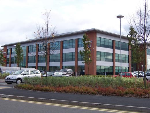
Although Warwick District has a generally good balance between homes and jobs, a large number of our residents commute to places of employment beyond our boundary, whilst those living outside the district commute in to work. This is partly due to high house prices in the district which are not affordable to those in lower paid jobs. In order to redress the balance, we need to provide jobs in the district which will utilise the skills of the local labour force. In order to do this, we need to provide sufficient land and attractive sites to draw in new employers. We also need to provide land for the expansion of existing businesses or for relocation within the district to prevent the loss of businesses to other areas.
The rural economy faces different problems in that the decrease in traditional jobs in agriculture places pressure on the farming community to diversify. Farmers need to find new ways of maintaining a livelihood in the countryside which is acceptable in planning terms and to others who live in the rural area. New ventures may include converting outbuildings as small starter units for new businesses, tourism, arts and crafts or leisure and recreation uses. We need to encourage people to remain in the countryside to allow them to make a living and ensure that there is good stewardship of the countryside which we all value.
We will be required to find new sites for employment uses for the period to 2026. The Regional Spatial Strategy review (see section 2 above) suggests that this could be as much as 35 hectares (86 acres) of additional land. In seeking to provide this land, the Core Strategy will need to consider:-
- Where this land should be found?
- What types of new employment should we be encouraging?
- How can we make sure that we can attract the right type of employment and at the same time persuade existing employers to remain here?
[1] 'The State of Warwick' June 2007
Town Centres
The district has three town centres at Leamington, Warwick and Kenilworth. Each performs a different function for the local population and visitors to the area. Each town has a town centre manager.
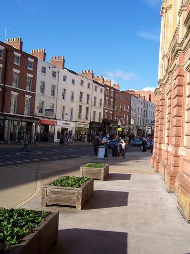
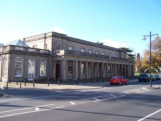
Leamington is the largest of the district's town centres with a total retail floorspace of over 101,000 sq. m. It is identified as a key strategic town centre within the Regional Spatial Strategy. Historically, Leamington developed to the south of the river where the first bath houses were built. Subsequently the town grew to the north of the river in the regency period as a fashionable spa town, gaining the status as a 'royal' spa town with visits from Queen Victoria. This part of the town is built on a grid pattern of streets and now forms the main part of the retail centre. There are a large number of specialist shops with concentrations along the streets at the very heart of the town. The majority of the town centre is within a conservation area.
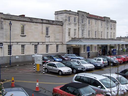
Other uses in the town centre include office accommodation, the civic offices together with the police station, magistrate's court and churches. The town has a railway station with services running to Stratford-upon-Avon, Birmingham, London Marylebone and the south coast. The parks and gardens are attractive and well utilised, including the award winning Jephson Gardens. There are also many homes within and immediately adjacent to the town centre.
Warwick town centre is of mediaeval origin and draws many visitors due to its proximity to Warwick Castle. This historic part of the town has developed into an area known for its antique shops, niche shopping and cafes and restaurants. It is also the county town and as such is home to the offices of Warwickshire County Council. As with Leamington, the centre of the town is largely within the conservation area and contains a large number of listed buildings.
Kenilworth town centre is smaller than the other two with a retail floorspace of just over 23,000 sq.m. The majority of the town centre is of linear form with the shops along the main street. Improvements to the town centre are currently underway and will provide further retail choice and a modern environment. Other town centre uses include a library and police station.
We are required, through the planning system, to enhance consumer choice by making provision for a range of shopping, leisure and local services to meet the needs of the whole community. We consider that it is important that the vitality and viability of our town centres is retained and enhanced as we do this. This means both protecting the character of our town centres and considering whether and where they should be allowed to grow. The Council is currently working with a developer to explore the potential for a major retail development on the Chandos Street car park in Leamington town centre and we may wish to consider where, if appropriate, further opportunities should be provided beyond this.
Sustainable tourism
The district is of particular interest to visitors with Warwick Castle, Kenilworth Castle, Stoneleigh Abbey and the many listed buildings welcoming visitors from home and abroad every year. In addition to the historic element of the tourist trade, there are other attractions in the district such as Hatton Country World and the Royal Showground with its various agricultural shows and exhibitions culminating in the annual Royal Show in July.
The district tends not to be a base for tourism however, but rather a stopping off point. For this reason, the district does not currently gain as much additional income from tourism as perhaps it could. There may be a need therefore for more tourist facilities within the district to encourage a longer stay. These facilities ideally need to be close to the attractions that they serve and to public transport routes. We have policies currently that direct tourist facilities to the town centres where sustainable tourism is easier to achieve, but we may need to examine whether this is the best place to locate such facilities. Primarily, we must avoid spoiling any of the attractions which visitors come to see.
Rural Communities
Beyond the towns of the district lies 25,400 hectares of non-urban land. This is about 90% of the district, of which some 81% is within the West Midlands Green Belt. Just 20% of the district's population live in this area. None of this land could be described as remote however since nowhere is more than 5 miles away from an urban area.
The majority of the rural area is in agricultural use. Communication links across the rural area are largely good with main roads and the M40 motorway linking the district with cities and towns beyond. The same cannot be said of the public transport system however which leaves some parts of the district poorly served. The lack of such a service leads to extreme isolation for some sectors of the rural community, particularly the elderly.
The rural area is rich in history with a large number of ancient monuments, listed buildings and a number of large historic houses which are open to the public bringing visitors into the rural area. The University of Warwick lies on the boundary of Coventry and Warwick District and Coventry Airport lies just within the district. Both are within the Green Belt.
A number of the district's villages offer a range of facilities and services including shops, a primary school, village hall and a pub. Some smaller villages have lost many of their facilities however, including shops and a post office. Whilst there are employment opportunities within some villages, these are limited and the majority of residents tend to commute to the West Midlands conurbation to work. If we are to protect the facilities offered in villages or encourage new ones, we need to consider how this can best be done. One way may be through ensuring that employment and home-working opportunities exist to offer local residents the chance to work near or at home and not have to commute elsewhere. Another way could be through allowing more housing within or adjacent to villages. The Local Plan currently takes a firm position on this, only permitting market and affordable housing where this meets clear local needs. In the case of market housing, this is further restricted to a very limited number of villages in the district.
The impact of these policies is to restrict the amount of new housing in the larger, sustainable villages where the need exists. Affordable housing, which is a major issue in rural communities, should assist in allowing local people to remain in their village where house prices are often out of reach due to those from the urban areas buying them as primary or second homes.
Employment is mostly small scale and involves working in the villages themselves, at home or at local farms. Any further development for employment will need to be sensitive to the rural environment which should be protected and enhanced. Identifying local skills and employment need will be necessary to ensure a balance is maintained.
With such a large area of Green Belt in the district, we are keen to protect it against inappropriate development. However, if there is pressure for new development, greenfield and green belt land may need to be considered. We will have to examine this more closely when looking at the options in a future consultation paper.
Protecting the District's Key Assets
Making the best use of land
Government planning policy strongly supports the principle of making best use of previously developed (brownfield) land to reduce pressure on green field sites. Within Warwick District, we have seen a substantial proportion of new development taking place on brown field sites. Between 2001 and 2007, 3,005 new homes and 17.36 hectares of new offices, factories and warehouses were built on brown field sites, representing 65% and 45% respectively of the total built within the district during that period. In the immediate future, a significant proportion of the further land which already has permission for housing and employment uses is also brown field.
There is clearly further capacity on brown field sites within the district beyond this, particularly within urban areas. The full extent of this is currently being investigated. In part, this capacity depends upon the density at which new development takes place. The Government encourages us to consider a range of densities across the district, however in line with its approach of making efficient use of land it believes that an overall density of 30 dwellings per hectare should be a minimum unless a clear justification can be given for a lower density. We need to consider in the Core Strategy the broad approach that we should be taking to the density of development in order to make efficient use of our land.
There are implications if we consider that a lower density of new housing should be supported, as this will directly affect the amount of green field land which we may have to consider releasing for development. In view of the amount of new housing and employment land that are likely to be required over the period to 2026 (considered elsewhere in this Issues Paper), the release of green field land - probably on the edge of our towns or in our villages - is inevitable. The extent of this will depend upon the approach that the Core Strategy takes towards development on existing brown field sites.
Green spaces and the natural environment
It is important to protect ecological, geological and geomorphological features, sites and species of importance in the district from the adverse impacts of development. There is concern that the diversity of habitats and species continues to be eroded and fragmented by development and there is therefore a need to safeguard the resources that remain. In Warwick District there are two types of nature conservation sites; statutory and non-statutory. Statutory sites include Sites of Special Scientific Interest (SSSIs), Ancient Woodlands and Local Nature Reserves. Non-statutory sites include Sites of Importance for Nature Conservation (SINCs) and Regionally Important Geological and Geomorphological Sites (RIGS). Both are important components of the District's ecological resources.
Changing agricultural practices have, in recent years, led to a reduction in the variety or quality of habitats and species in the district. Added to this are the pressures brought by new development, climate change and the extension or development of existing residential and employment areas. The loss of green spaces and habitats must be avoided as much as possible and protected for the enjoyment of future generations. It is also important now, for the health and welfare of the residents of our district. The loss of woodland, wetland, meadow, hedgerows and floodplain has a huge impact on the balance of the natural environment.
In considering where new development will take place it is imperative that we take into account the potential loss of such assets. We will need to balance this against the possible development of other areas which we now protect, such as land designated as Green Belt. This is not simply a question of green field versus brown field sites. Some brownfield sites, such as large mature gardens of houses, may be of a higher ecological value than some farmland in the Green Belt.
We must also consider how we can incorporate improvements to existing biodiversity and contribute to reducing our carbon footprint by providing tree planting, sustainable drainage systems (SUDS), green roofs and open space managed for wildlife. In doing this we have to take into account that these refuges should not stand alone, but must inter-connect allowing natural corridors to form along which species can travel.
Whilst we are keen to encourage the public to use our open spaces and enjoy the local countryside, this needs to be carefully managed so that we do not endanger that which we wish to preserve. As many areas of open space, particularly those that are informal, are publicly available for leisure and recreation, it is important that we strike the right balance and not upset the fragile nature of the ecology of an area. In addition, we need to examine closely the opportunities to introduce new ecologically important areas into new development, or replace any losses with new sites elsewhere. Overall we would like to see an increase in such natural and diverse sites within the district.
Our historic environment
In Warwick District we are particularly fortunate to have a great many historic buildings, features and landscapes of which we can be proud. From the grandeur of Kenilworth Castle to the hidden hedged gardens of Warwick's Hill Close Gardens, the district has a rich history which attracts visitors throughout the year.
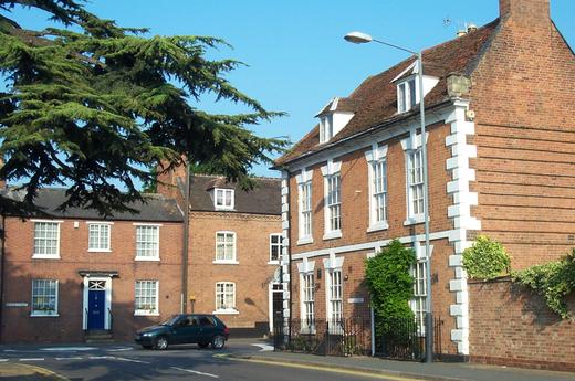
There are over 1,500 Listed Buildings in the district and 29 conservation areas. Old buildings and their settings are an important part of our local and national heritage. They are a social and historical record making up the core of many of our towns and villages. It is important that they are properly cared for, sympathetically repaired when necessary and not subjected to inappropriate alterations. At the same time, we need to recognise that the best way to ensure the long term protection and care of a historic building is to keep it in use. This may require a degree of flexibility when considering proposals provided this does not compromise the character of the historic building or its local area.
It is also true that with such a wealth of history in the district, there will be occasions when there is a sensitive relationship between protecting the historic environment and securing other objectives, such as regenerating our town centres. We need to make sure that as new development proposals are considered, proper regard is had to the impact on the historic environment. Within this, there should be a recognition that the historic environment is important not only for its own sake but also for its impact upon the overall appearance, character and, ultimately, economic well-being of the district.
We feel that it is important that the whole of the historic environment is safeguarded. Within this, particular care needs to be given to listed buildings which have fallen into a state of disrepair and to the role of historic buildings and areas which do not merit formal listing or designation but none the less are important to our heritage.
Current planning policies in the Local Plan seek to protect and enhance all aspects of the historic environment. We think that we need to ensure that this protection continues, and that a proper balance is struck between protecting the historic fabric and ensuring that historic buildings can be put to a productive use that will best support their continued good upkeep and help achieve other wider objectives for the benefit of the community.
Our landscapes and townscapes
Although Warwick District does not contain any nationally designated areas of high landscape quality (there are no Areas of Outstanding Natural Beauty or National Parks in the district), there is a distinctive local character to the district's rural landscape based upon it's topography, farming and settlement patterns. This is reinforced by a number of historic parks and gardens which have been scheduled by English Heritage including those at Warwick Castle Park and Stoneleigh Abbey and Deer Park. It is important to protect the character of this landscape which gives the district its character and provides a setting for its towns and villages.
Each of the district's towns has a distinct townscape, defined in large part by the design of its buildings and spaces and the history of how it has evolved. The character of Leamington, for example, is exemplified by its regency architecture and the grid-iron street pattern of its central areas.
We consider that it is important to conserve and where appropriate, improve these areas of high quality landscape and townscape which have distinctive characteristics that make them a unique asset to the district. The challenge within a growing district is to understand those features and characteristics which define our landscape and townscape, and ensure that when new development is permitted, it reinforces this character wherever possible.
High quality design
Good design is an integral part of creating successful places and environments in which people want to live, work and spend their leisure time. The appearance of development and its relationship with its surrounding built and natural environment can have a significant effect on the character of an area. There is an increasing emphasis on design, both at national and local levels. Government policy and advice directs us towards enabling the achievement of good design and quality environments.
We all want to see good design, however opinions can differ over what constitutes good design on any particular site. The Council has established in the Local Plan some criteria against which all new development proposals should be judged. As we take forward the Core Strategy we should be looking critically at this to see whether our approach is the best way of achieving high quality design.
- What should be the key criteria against which new proposals should be judged?
- To what extent can and should we be seeking to identify and foster locally distinctiveness in design?
- To what extent, and in what locations, should we be encouraging innovative modern designs?
Pollution
Preventing and minimising pollution are key objectives of sustainable development. The government attaches great importance to minimising pollution together with the associated risks and expects policies to be put into place to deal with it at a local level.
Whilst policies can be adopted to address the various forms of pollution, it is a wide ranging subject with many other outside bodies and agencies involved. Any policy which we may adopt will complement the statutory responsibilities of these agencies.
There are currently three Air Quality Management areas in the district. These are in Barford, Leamington and Warwick and are designated in relation to a likely breach of the Nitrogen Dioxide (annual mean) objective as specified in the Air Quality Regulations (England) (Wales) 2000.
The location of new development will be subject to an assessment of the impact of any existing or potential pollution resulting from the choice of that location. It is recognised that in some cases, identification of pollution on a site will present the opportunity to address the problem during development. Early discussions with developers regarding the remediation/mitigation measures required for individual sites are encouraged and welcomed. This is increasingly important as we utilise previously developed land.
Securing a more Sustainable District
Travel choices
A good transport system is key to underpinning a successful local economy and helping to make the district a place where people want to live and visit. Warwick District is well placed on the strategic road network, surrounded by motorways and major roads. Rail links are also good with five stations within the district and a further one planned for Kenilworth. Rail links connect the district with Birmingham, London Marylebone, Coventry, Stratford-upon-Avon, the South Coast and the North of England. Frequent bus services provide links between the larger towns in the area and to major towns beyond the district at Coventry, Rugby and Stratford-upon-Avon. Less frequent services run to the larger villages within the district.
Most of the district's cycle networks form part of the public highway, but dedicated cycle lanes have been provided on two major routes. Off road cycle routes along riverside and canal towpaths and bridleways have been complemented with routes through the parks in Leamington and sections of the key cycle route form part of the national cycle network.
Coventry Airport lies in the north of the district with cargo flights and passenger flights using the range of facilities provided there.
The district has a very high level of car ownership and the number of vehicles is likely to increase as the district grows. This will be a major challenge for the Core Strategy which will need to identify where new development will take place.
- If growth in the towns is encouraged, this is likely to add considerably to existing traffic congestion, however this would also be likely to encourage greater levels of walking, cycling and use of public transport.
- Growth on green field sites on the edge of our towns may also increase urban traffic congestion, and furthermore may directly impact upon the strategic road network. Large planned developments would offer the opportunity to provide for good access for walking, cycling and public transport, and for this to link back into existing urban areas.
- Any growth in villages and rural areas is likely to increase the number of journeys made by car. Even if public transport services can be expanded to cover those areas, it is expected that this is likely only to have a limited impact upon peoples overall travel patterns.
Climate change
"Climate change" has become a major topic of international debate in recent years, and there is now a significant body of scientific evidence that supports both the notion that climate change is a reality and that human activity plays an important role in this. There is evidence that our daily activities are having a profound effect on the climate and that we have to change our behaviour to moderate the impacts of climate change wherever we can. We are committed as a district council to reducing the causes and effects as far as we are able, to reduce the impact on our local residents and neighbours.
Since land-use planning is involved with providing new homes, jobs and infrastructure, and helping to shape the places where we live, the Government considers that planning has two key roles to play with regard to climate change. Firstly, it can play a major role in helping to tackle the causes of climate change by helping to reduce our generation of greenhouse gases and lowering our collective and personal carbon footprints. Secondly, it can help ensure that we can tackle the consequences of our changing climate. The Core Strategy will have a role to play in both of these areas.
The domestic use of gas and electricity is responsible for 25% of the UK's carbon dioxide emissions[2]. This is a major contributor to climate change. Building better insulated housing with energy efficient appliances will reduce a major contributor to the production of greenhouse gasses.
The Energy White Paper published by the government in May 2007 outlines four goals, one of which is to reduce CO2 emissions by 60% by 2050. The government has set a target to generate 10% of UK electricity from renewable energy sources by 2010. It advocates the encouragement of schemes that utilise renewable energy resources in tandem with energy efficiency measures, especially in new development. Biomass and wind power are two examples of this on a large scale and solar panels at a more domestic level. Energy efficiency reduces energy waste and can improve the quality of housing.
Warwick District Council is a signatory to the Nottingham Declaration on Climate Change and as such is committed to complying with the Kyoto Protocol (an international treaty signed in 1997 which included a binding commitment to reduce CO2 emissions). The Council has produced its own climate change strategy for reducing CO2 and other harmful emissions. We now have to decide how we can ensure that new development makes an adequate contribution to this initiative and what that level should be set at.
A very visible consequence of climate change has been experienced this summer with heavy and prolonged rain causing flooding in many parts of central and northern England. Parts of Leamington and the surrounding area were flooded resulting in a number of houses being affected and schools and roads closed, causing disruption to homeowners, traffic and businesses. This was not on the same scale as the 1998 floods which devastated parts of Leamington and Warwick, but could easily have become so, had measures not been taken after that event to increase the flood defences in these areas.
Flooding will have to be taken fully into account in future new development. The Environment Agency publishes flood zone maps which show areas at high risk of flooding and the Council has commissioned a Strategic Flood Risk Assessment to give us an even better understanding of those areas that could be at risk of flooding in the future. This information will be important to help determine those areas where new development should not be directed.
It is important to recognise that flooding is caused not only by rivers and streams overflowing, but by surface water run-off. Hard surfacing prevents water from being absorbed into the ground and slowly draining away. Where new developments are proposed, we can encourage the use of Sustainable Drainage Systems (SUDS). These include such measures as soakaways, rainwater recycling, porous paving and other surfaces, and balancing ponds which hold a large body of water until it can be released slowly and safely into the sewer system.
[2] DEFRA (July 2007)
Meeting the District's needs
Housing needs
Warwick District is an attractive area with a buoyant housing market where house prices are amongst the highest in the West Midlands Region. The location of the district with good access to local and national transport routes contributes to its popularity. This has led to a major problem of affordability with insufficient dwellings available to rent, both from Registered Social Landlords (RSLs) and privately. This is exacerbated in Leamington in particular by a high demand for private rental properties for students.
The West Midlands region is divided into "Housing Market Areas". These are areas which display common characteristics. Warwick District is part of the "South Housing Market Area", together with Stratford-upon-Avon and the six Worcestershire districts. This Housing Market Area is characterised by high house prices, high levels of owner occupation and low numbers of affordable housing. There are high levels of homelessness and high levels of affordable housing need.
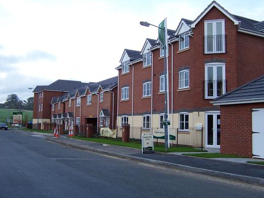
It is highly likely that we will be required to find significant new land for housing for the period to 2026. The Regional Spatial Strategy review (see section 2 above) suggests that we could be required to provide 10,800 new homes between 2006 and 2026. This is an annual figure of 540 dwellings.
To put this figure into context, it is worth noting two facts. Firstly, as of 2007, sites for 2,131 new homes had already been identified (either through allocations in the Local Plan or in development briefs, or through the granting of a planning permission). Secondly, over the period from 1996 to 2007, Warwick District has seen an average of 742 new homes built every year. It should be remembered, however, that this period saw the building of many homes on large greenfield sites (Warwick Gates, South West Warwick) and also an unprecedented number of homes on brownfield sites (for example the new homes at Cape Engineering and at the Emscote Lawn School in Warwick and at the former Hatton Hospital).
It is therefore almost certain that the Core Strategy will need to identify green field land, probably outside of our towns, for new housing. In seeking to provide this land, the Core Strategy will need to consider:-
- Where new sites could be located?
- What type of mix of housing should we encourage?
- How can we make sure that we can provide sufficient affordable housing to meet need?
- What sort of tenure of new housing should we encourage?
In terms of what mix of housing we need, assessments carried out in 2006 and 2007 have identified the following features:-
- There is a large unmet need for private housing, with shortages of two and three bedroom houses, a choice of housing types for older people and, to a limited extent, two bedroom flats for private rent. This can be partly explained by the high number of sales that are made to those moving into the area and therefore not releasing homes locally. Statistically, Warwick has one of the highest shares of one person households in the sub region. This can be partly explained by the high number of students in the district.
- There is a low level of activity in the local housing market, resulting in fewer lower priced homes coming onto the open market. This is partly due to the number of older people wanting to remain in their own homes longer. The market is failing to meet the needs of older people in the middle and lower end of the market. Meeting this need would release family housing. In turn this would allow families to move up the property ladder releasing smaller, more affordable homes for first time buyers and those on lower incomes.
In rural areas, market housing has only been allowed in the 'Limited Growth Villages' where there is up to date evidence of local need. The evidence is collected as part of a parish plan or full household survey of the village. Any new development has only been allowed for the type of housing shown to be required by the survey.
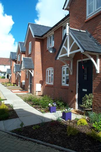
In terms of providing affordable housing, we need to identify what proportion of new developments should be affordable, what type of housing that should be, where it should be located within the development and what the tenure should be. The market assessments show a need for more rented accommodation and a reduced number of intermediate/joint ownership homes and low cost market housing. It is difficult to ensure, particularly with low cost market housing, how this can be maintained in perpetuity so that subsequent purchasers can continue to buy at below market value. We also need to establish a threshold for the size of development to which the affordable housing requirement will apply. Again this figure may need to be tailored to suit specific areas.*/ ?>In terms of providing affordable housing, we need to identify what proportion of new developments should be affordable, what type of housing that should be, where it should be located within the development and what the tenure should be. The market assessments show a greater need for social rented accommodation because other types of affordable housing, such as shared ownership housing, are no longer affordable to many households in housing need. We also need to establish a threshold for the size of development to which the affordable housing requirement will apply. Again this figure may need to be tailored to suit specific areas.
Poverty, social exclusion, crime and anti-social behaviour
The standard measure of deprivation and inequality in England is the Index of Multiple Deprivation (IMD). This measures different aspects of deprivation including disadvantage in education, employment, income, health and housing. Levels of deprivation in this district are very low, with Warwick ranked as 250th out of 354 in England. Housing deprivation is among some of the highest however and affordable housing must therefore be a key priority.
Overall levels of crime are low in Warwick with the district ranking 232 out of 354. The rate of offences per 1000 of the population stands at 27.7, which is much lower than the rate in England, the West Midlands, Coventry or Warwickshire as a whole. There has been a steady decrease in the crime figures over the period 2000 to 2005 for this district which has been falling at a faster rate than the overall national average.
Crime or fear of crime can come to dominate the lives of those people who are perceived as most vulnerable. This particularly relates to the young and the old, although statistically, the young are at greater risk from violent crime than the old. This can lead to a feeling of exclusion and isolation and encourages young people to go out in groups, which can then be perceived as 'threatening' and old people to stay in their homes during the hours of darkness.
With reference to anti-social behaviour, reports of anti-social behaviour incidents increased by 5% over the period 2002-2005 across South Warwickshire. In Warwick District however there was an overall reduction of 2% and reductions in all types of antisocial behaviour in Warwick District, with the exception of nuisance behaviour, which rose by 24%.
Planning can play a role in helping to support wider initiatives to reduce crime and the fear of crime. At the early stages of all planning applications for new development, the police are consulted to gain an expert opinion in respect of crime prevention. Certain factors can have a significant impact in reducing crime and anti-social behaviour in a development (for example by encouraging natural surveillance of public areas and making provision for appropriate security measures and lighting). 'Secured by Design' is a Police initiative supporting the principles of 'designing out crime' by encouraging these principles to be adopted in new developments. Research has shown that using the principles of 'Secured by Design' can 'reduce burglary and car crime by 50% and criminal damage by 25%.
The Core Strategy needs to consider how it can best support initiatives such as this. It also needs to consider whether planning can help address problems of crime and anti-social behaviour in existing areas, particularly identified "hot spots".
Health and well-being
In terms of health, Warwick is a healthy area, ranking 80th out of 408 districts in Great Britain. The average life expectancy in the district is 80.5 years with infant mortality rates at an average rate by national standards[3].
Community facilities including schools, shops, village halls, community centres, nursery and health facilities are at the heart of most communities. Health and community facilities that are well used and fulfil their function are a real local asset. Where these exist, we want to work with our partners to ensure that they are well managed and maintained as a valuable commodity in the community. We are keen to retain such facilities and need substantial evidence to support their loss if another use is proposed.
Where there is currently a lack of such facilities, we need to be made aware of the shortfall so that we can seek to address this. We also need to consider the needs of new communities that may be established as a result of major new development in the district. What needs for community facilities would these areas have? What is the most effective way of addressing these needs?
The district is well provided with a wide range of leisure facilities, however these vary in accessibility, quality and how well they are used. We will need to identify where improvements in such facilities can and should be made, and how such improvements should be brought about. As part of this exercise, we also need to assess whether under-utilised facilities would be better suited to a new use and what that would be.
We have recently undertaken a study of all the sizeable areas of publicly accessible open spaces in the district, whether these are managed by the District Council or by other organisations (such as Parish and Town Councils). We are now commissioning work to assess the need for such spaces across the district to identify, amongst other matters, those areas which may be underserved by certain types of open space. This will help us to understand how we can better match the provision of our open spaces in the district, with the needs of our local communities.
[3] The State of Warwick (June 2007)
Quality of life and access to services
National statistics indicate that the standard of local services in Warwick District is well above average with the district ranking 52nd out of 354 authorities across the country. School performance is above national and regional levels with good achievement results. The level of household recycling is in line with the national average and above that of the West Midlands and Coventry and Warwickshire. In terms of access to facilities the district performs well with good access to schools, GPs and supermarkets.
Warwick District is a very diverse area demonstrating the popularity of the district with residents and employers alike. Whilst we strive to ensure that we provide for everyone in the district, there will be some whose needs are not always met. These groups are likely to include the young, the old, gypsies and travellers, ethnic minority groups, refugees, disabled or physically isolated for example. These are not the only groups to fall into this category and some may even be surprising - for example those who work full-time with young families. As part of preparing our Core Strategy, we are working hard to reach those 'hard to reach' groups through our consultation processes.
We are seeking to meet with as many of these groups as possible. The meetings that we have held are showing us that each group has a distinctive set of issues which throw up particular challenges for the Core Strategy in particular, and public sector services more generally. Older people, for example, would like to be independent and stay for as long as possible in their own homes. Services are required to support this need in the right locations. The issue for the Core Strategy is whether land-use planning can play a role in helping to meet such needs, and if so, what this role should be.
The Arts and Culture
The Local Plan contains policies to protect existing cultural facilities and encourages developers to provide new facilities where appropriate. Currently the provision of museums, libraries, galleries and facilities for the performing arts are mostly located within the towns. We may need to consider in the Core Strategy, whether new facilities should continue to be located in the town centres as previously encouraged, or whether there is a demand elsewhere in the district which may indicate new provision.
