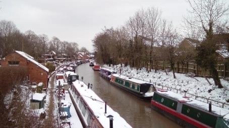
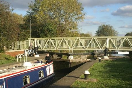
Canal Conservation Area
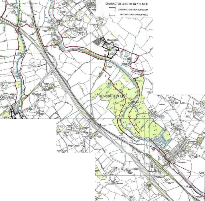
Character Lengths
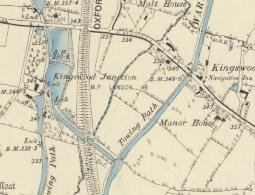
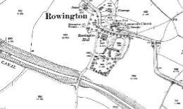
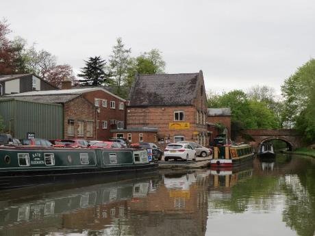
(1) 1 ROWINGTON
Grand Union Canal 1929 (Warwick and Birmingham 1793)
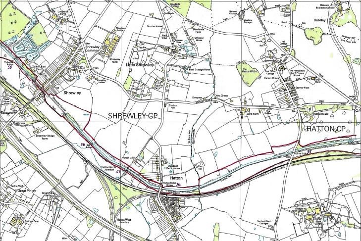
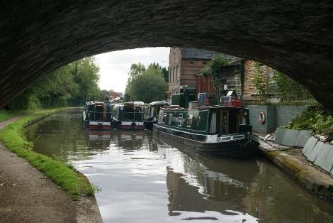
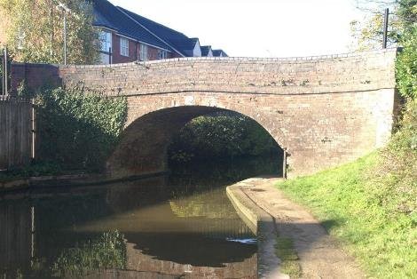
Netherwood Heath at bridge 67 to Shrewley Tunnel -396metre tunnel 9.5 km 6m
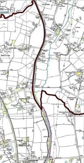

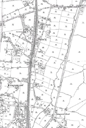
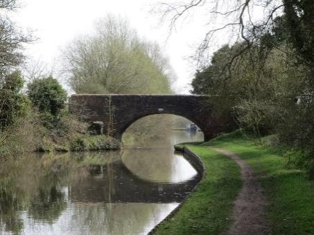
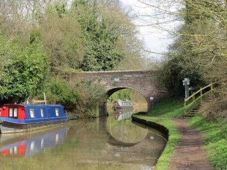
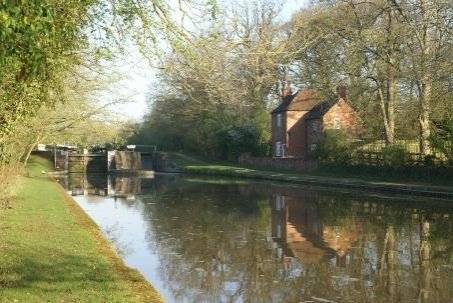
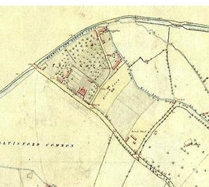
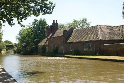
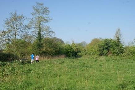
The Warwick and Birmingham Canal canal enters Warwick district at the edge of the Baddesley Clinton estate just after the turnover bridge 67, has moved the towpath to the west of the canal. The district boundary is denoted by a culvert for Rising brook that runs under the canal. This marked the estate boundary in the eighteenth century and is located to the east of Netherwood Heath farm listed grade ii. It is visible through the alders that fringe the canal edge.

This east bank of the canal opens out as views to Netherwood Lane and the skyline vegetation beyond, in contrast to the vegetation along the brook which largely contains the views to the west, valley farm being the closest building at 150 metres. The canal is perched on this edge of the Baddersley estate on embankment that varies from one to two metres above the meadows which fall towards the brook.

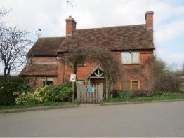
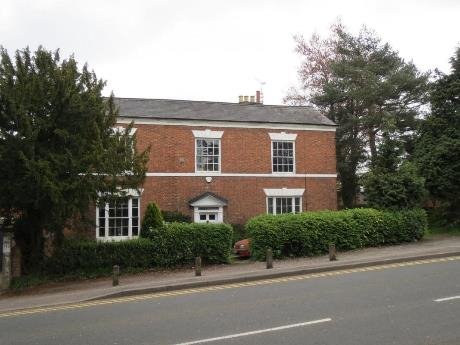
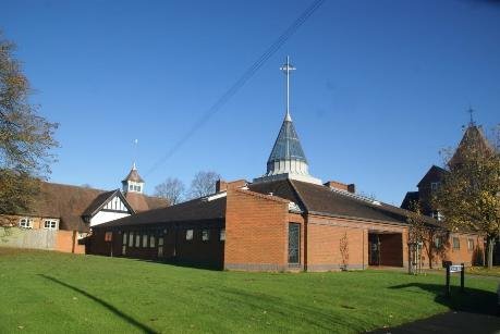
KINGSWOOD FARMHOUSE GRADE ii
Within the wider area there is the medieval moated manor house and garden, a timber framed Tudor manor house and garden, and individual timber framed farmhouses and barns that provide strong visual references to the small scale pastoral landscape synonymous with the Arden pastures.
The pylons striding across the landscape remind one that the seclusion is easily eroded, whilst the conduit that intruded over the canal undelines this. It is important to retain the screening at the edge of the kingswood settlement boundary to ensure that this part of the canal remains rural. The brook also takes the run off from the Baddersley estate meadows and will need to be free running to avoid potential damage to the canal structure.
Maintaining this integrity is fundamental however engineering work needs to ensure that the trees and vegetation at the back of the towpath and along the brook respects this aspect of the canal character right through to the Old Warwick Road.

There were formerly wharfs at Rising Lane , and Bakers lane bridge which is two kilometres to the north, that served this area. Rising Lane effecting a link between Baddesley and the other late medieval property now in the stewardship of the National Trust at Packwood. The obvious points of connection here at Rising lane and the Old Warwick Road could better recognise these nearby heritage assets and improve walking routes and wayfinding from the towpath at bridge 66 and bridge 65. The GWR station at Kingswood (renamed Lapworth to avoid confusion with Kingswood Surrey) is between the two canal bridges and thus would link in to encourage visits other than by car .

Rebecca Ferrers 1898 ref National Trust
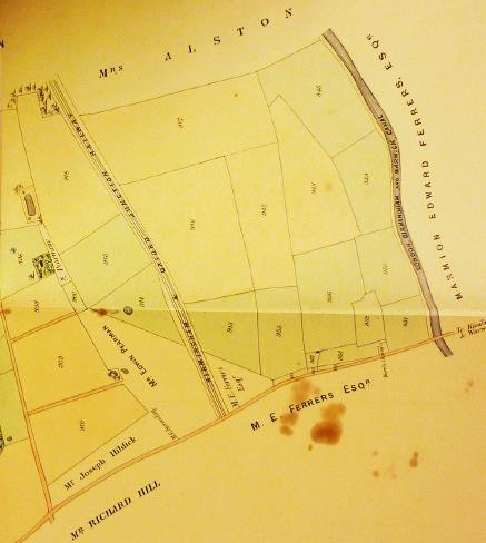
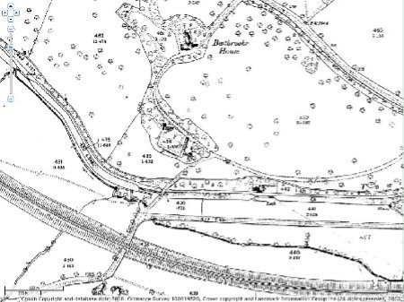
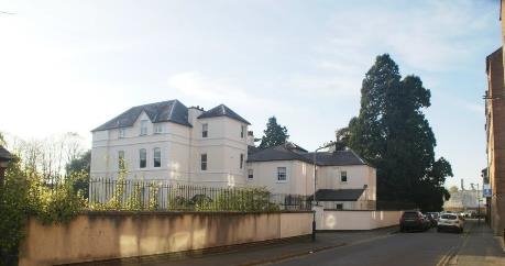
Baddersley Clinton house is a moated medieval house in a remnant of the Arden forest . The oldest parts were altered by John Broome a lawyer from Warwick between 1445 and 1458. Brome built much of the present house from stone quarried on the estate in a copse known as Badger's Dell, and created fishponds in the grounds. His son created a park on the site of the former village. When he died in 1517 he had sheep pastures in several villages. The house went to his daughter and her husband, Edward Ferrers, whose family retained it until it was offered to the National Trust. In 1940 the estate was the same as in 1699. There are significant views from the gardens north and south-east across the park and farmland, and from the northern park in a westerly direction across surrounding agricultural land towards Kingswood. The house is not clearly visible from the grounds due to plantations albeit some of the Taller trees can be picked out.. Refs Tyack; NT; listing
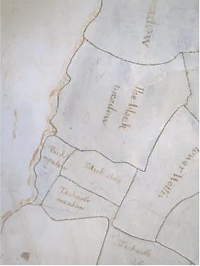
The 1699 estate map at Baddesley names the fields pat which the canal runs including great meadow and black meadow. NT
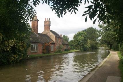
A number of 17th century houses, grade ii are part of the canal setting. Vine cottage on rising lane is west of the canal. A timber frame with plain tile roof are the traditional form here and at Netherwood Heath farmhouse which can be seen on the 1699 estate plan. The pattern of subsequent development has been shaped by the canal corridor and strategic rail and road routes.
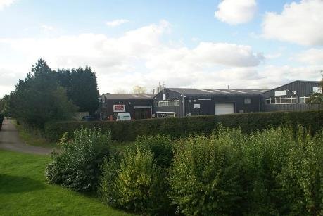
Kingswood is a ribbon development that follows roads and lanes but has an ill‐defined historic core . Some newer housing is clustered off Station Lane and at the junction with the B4439 there are nos 1-5 kingswood cottages and another Kingswood farmhouse both grade ii listed, Here there is a small group of local shops and businesses. Whereas there is continuous residential development backing onto the railway, the canal side of station road includes the primary school and pockets of development, with paddock fields leading up to rising brook and to the canal. The plots on this side are larger and less defined , so the green belt extends to a settlement boundary. Yew tree close and the preschool have replaced the malt house visible on the first edition.
Any future infilling should be mindful of not encroaching on the canal setting.

CULVERTS MANAGE STORMWATER UNDER CANAL WITHOUT INTRUSION
In view of the green belt designation and the presence of the National Trust, the conservation boundary is probably best kept to the thirty yards allowed for construction in the parliamentary act. This would allow planting to be kept to ensure that any future development of Station Lane does not visually intrude as it may well do further south of the main road at Kingswood. Here despite the local plan research identifying that the landscape boundary to the canal needs to be secure, there is a danger in the designated housing eroding this margin and adversely changing the character as a result.

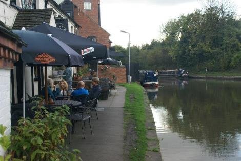
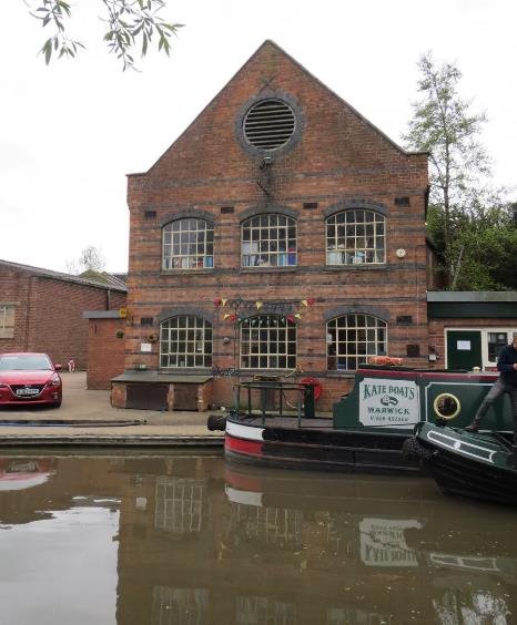
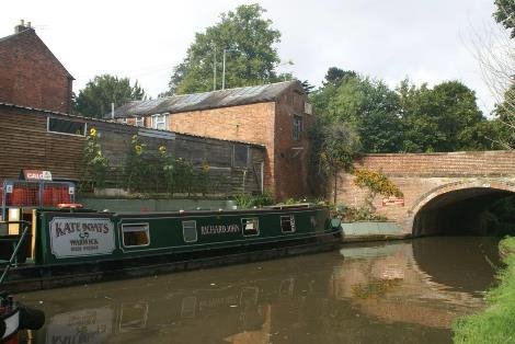
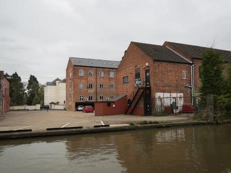
FORMER CANAL WHARF NOW A MOORING LOCATION
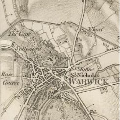
1889 ORDNANCE SURVEY
Field pattern is regular on a small to medium scale there are scattered hedge trees and thin wooded strips adjacent to the canal. There is a risk of flooding along the canal. A landscape buffer of native trees, a minimum width of 10m, needs to be maintained to the edge of the canal to retain its rural character Some recent infill development has encroached onto the field pattern, boundary vegetation and fencing and vegetation to the edge of the canal corridor. The condition of the internal field boundaries is generally poor with the remaining structure outgrown, although the small scale field pattern is still readable. The fields are still managed for pasture with cattle grazing giving a very strong rural character. There is a stream with scattered trees alongside, field pond(s) and small blocks of woodland together with the small scale field pattern provide the landscape setting to the Listed Building kingswood farm grade ii.
Archaeology check HER main event was a saxon axe head found here
NT PACKWOOD ESTATE PLAN 1868 SHOWS CANAL FOLLOWING THE BORDER
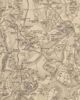
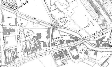
The earlier old series ordnance survey 1830 predates the arrival of the railway but shows the two major estates either side of the Warwick and Birmingham canal as it was called before incorporation in the Grand Union
EARLY SET OF ORDNANCE MAPPIING FROM 1830'S IS USEFUL IN SHOWING THE CANAL MANIA COVERAGE BEFORE THE ARRIVAL OF RAILWAY MANIA
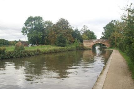
The long established Navigation Inn and the listed Manor House on the Old Warwick Road mark the start of the next part of this length going south around 3km. Both of these are on the offside, whilst housing is to replace the nursery that occupies the low lying field on the towpath side to the west.
Here is the arm that allowed the Stratford canal to connect to the Warwick and Birmingham and start trading whilst funds were raised to allow the length down to Stratford to be completed in 1815 at the end of the Napoleonic wars. The canals, along with navigable rivers and turnpikes were the infrastructure that facilitated the industrial revolution. The economic success of Britain enabled it to fund the war with France and following the success of Trafalgar and Waterloo trade its way to Empire. Constructing these links was as Professor Dyos identifies in his assessment of the economic significance of canals, a vital prerequisite to the boom of the 19thcentury.

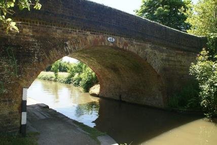
The junction bridge is a good example of the sinuous brickwork form that avoided snagging tow ropes and is a key element of The Functional Tradition celebrated by the work of Eric de Mare and JM Richards for the Architectural Press in the 1950's, that awoke interest in the significance of canal design and construction. Defined as 'that style of design which, though dominated by functional considerations, is remarkable for the wide range and subtlety of its aesthetic effects.' For example this18thC watermill for the weaver Samuel Courtauld.

HISTORIC ENGLAND EAA98/05239
The railway sailed over the canal arm, which itself has the brook channelled beneath it. Having skirted the edge of the Baddesley estate to this southern border with the road, and still with the landform falling to the west the canal avoids both the 17th century houses but cuts through the field boundaries, to the Manor. The line then sweeps round to turners green following closely the contour, in contrast to the Stratford which falls through five locks and to the railway built later, which is carried on embankment, between the two at a height that allows it to cross the canal arm and impact much more on the settlement. The noise still does echoe around the dip and impacting on the residential and overnight moorings at this popular location.
Moving south it is the noise of the motorway that is constant , whereas trains come and go. Depending on wind direction and when it is in cutting, the M40 traffic noise is a companion in the background as far as Hatton Station.
There are listed farm buildings along this rural stretch with 17c barn and 19c stables and farmhouse at Weston Hall farm east of bridge 64.

BRIDGE 64
The land is undulating and the canal follows contours so is on embankment at times three metres up, as land falls away towards the railway. Part of the delight here is that as the canal twists and turns, the views open and extend across to the railway and to beyond. The 18c windmill farmhouse is obscured by trees.
Turners Green bridge has a building beside it that has contemporary additions that add to the character and distract from the rudimentary bridge replacement it sits beside. Bridge 63.
The settlement is of warm red brick and plain tile buildings, some slate roofs and half timbered barns make this an attractive settlement.

MANOR COTTAGES C16 FARMHOUSE CONVERTED TO COTTAGES.WITH LATER ALTERATIONS
The historic core sits close to the canal and includes some 16c building at Manor cottages , Blythe cottage on the side of the towpath, built around 1800 at the time of the canal and some attractive farm buildings which add to the overall appearance.
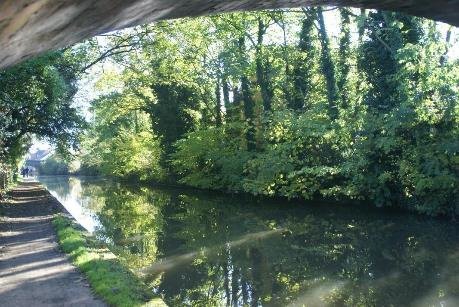
Beyond the settlement the canal is enclosed by vegetation and the cutting starts. The extent of material removed by shovel and transported beyond to support the embankment is now concealed by abundant vegetation. Part of a popular walk, the towpath has become narrow here and could do with widening.


Thomas Le Blanc owned much of the land on Rowington Hill. He was one of the original sponsors of the canal act but the valuers found him difficult to agree the land purchase with. He subsequently argued that the stone coming out of the works was his. The planned tunnel here became instead a cutting and the landowner was paid £500 in compensation.

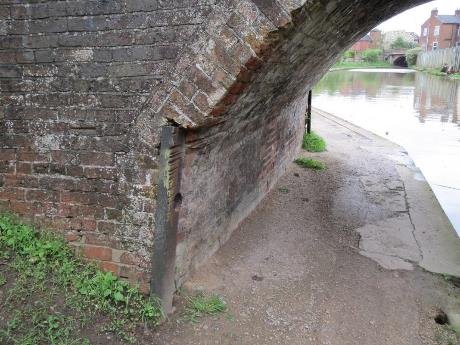
The guard is here to stop grit picked up by the towrope grinding away the masonry corner of this fine bridge in the days of horse drawn boats. The indents show something of the passage of boats before steamers took over. The bridge has stone at the base of the abutments before turning to brick. Rowington stone was quarried for use at Baddesley Clinton and St Phillips the cathedral church in Birmingham. The cutting was once designated an SSSI. The rocks consist of 12m of dark red silty mudstones with thin green silty bands, all of which belong to the Sidmouth Mudstone Formation, overlain by 6m of Arden Sandstone Formation of the Mercia Mudstone Group. The latter consists of white to pale buff and red sandstones with green mudstones and siltstones. The site has yielded significant fossils, notably fish including the type specimen of Dictopyge superstes (Egerton), but also fish spines and teeth, reptile footprints, bivalves, crustaceans, and derived plant material.
The cutting measures 700m in length and 18m in height.
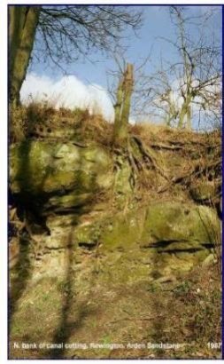
BRITISH GEOLOGICAL SURVEY P213237
In 1853, Brodie was appointed vicar of St. Laurence's Church, Rowington, He held this post until his death in 1897. A local celebrity, He Founded the Warwickshire Naturalists' and Archaeologists' Field Club in 1854. He joined the Warwickshire Natural History and Archaeological Society, and was elected Honorary Curator of Geology the following year. Rev Brodie was an enthusiastic collector, making new discoveries and adding to the collections of the Warwickshire Natural History and Archaeological Society. He left a legacy of publications and scientifically important fossils .Many were displayed at the Market Hall Museum in Warwick.
Buildings constructed of Arden Sandstone include churches at
Wootton Wawen, Rowington, Tanworth in Arden) and the manor house
at Baddesley Clinton.
In Warwick the columns of the tower of St. Mary's Church are constructed of Arden Sandstone from the Shrewley quarries .

It was improved transport by canals at the end of the 18th century which allowed stone to be transported economically over great distances; eventually leading to the closure of most local quarries. Today stones are imported from all over the world for use in new town and city developments The City of Birmingham is typical of many of the UK's large urban centres. The Cathedral Church of St Philip constructed in the early 18th century used Arden Sandstone from the Rowington quarries. However, as a result of its subsequent severe decay, it was almost completely replaced over the 19th and 20th century with Stancliffe Darley Dale sandstone (Millstone Grit) from Derbyshire, White Mansfield (Permian) from Nottinghamshire, White Hollington Stone (Triassic) from Staffordshire and Dunhouse sandstone (Pennine Coal Measures) from County Durham.

The road over the canal bridge leads up past Rowington Hall to St Lawrence church and the existing conservation area that runs 350 metres along the old Warwick road to its junction with Mill Lane.

Emerging from the confines of the hill the canal vista opens up to the road

The reason for the view is perhaps more obvious looking at the canal from the road. The waterway is perched on a substantial embankment that was constructed from the material taken out of the hills through which the canal has to cut.

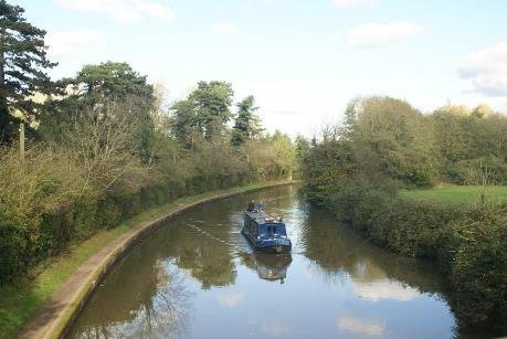
This hand made mound avoids the need for locking down and then back up, which would have cost water. It extends for over a kilometre on the west bank almost as far as the cutting at Shrewley. This whole edge is plantation.
A horse powered 'gin' was used for hauling spoil out of the Rowington cutting. There are drawings by Henry Witton, the company clerk, and later the engineer , recorded in fine detail of how the canal was built, and his accounts are available to research too, that give the costs for the various contracts, as well as the reduced workings whilst more funds to pay them were found. From this we know William Fletcher was awarded the contract for the Shrewley tunnel at £13.13 shillings per yard, but also that a Robert Pinkerton attempted to bribe the canal engineer to gain the Rowington contract.

RECENT PLANTATION OF CHRISTMAS TREES
Foxbrooke farm, barn and cottage are three listed properties within the setting of the canal. They are seen as part of a vista that rises on up to Mousely End. The character here is much more open and thus vulnerable to intrusive change. Recent agricultural use since the 1950's has seen a monoculture of xmas trees planted.
Cropping the plantations if done wholesale would bring about harmful consequence. A change to horticulture or solar panels would equally have visual considerations, although a return to the earliar field pattern would be more neutral as would mixed woodland. The nppf says 'When located in the Green Belt, elements of many renewable energy projects will comprise inappropriate development'…A function of the green belt is to protect the setting of historic place.

Much of the canal is in green belt and it is a function of their designation that they have permanence. The canals were established in the reign of George III and their siting was established as part of that act. They have taken on a wide range of functions beyond moving heavy goods, and as they are important early infrastructure they have even greater permanence than planning designations. They follow the line they do for reasons of topography. Water related development has to be connected to the system and therefore the green belt as a constraint needs to be balanced against the benefit of any enhancement in the use and enjoyment of the waterway network.
OS Old Series 1" to 1 mile, published 1831
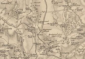
The old series map gives an indication of the undulating landscape that the canal passed through, hugging contours and constructing long embankments, cuttings and the tunnel at Shrewley as a way of securing a viable route. There were dwellings scattered through this landscape ande most of the localities have acquired extra plots during the last two hundred years, but it is still a rural low density morphology. The pattern has intensified at shrewley, Kingswood and at Turners Green which has retained its local distinctiveness. The original size of the buildings is important in the green belt and restricts extensions as well as replacement dwellings. Larger footprints where allowed should not be overscaled versions of the traditional pitched roof rural dwellings.
Areas of 'safeguarded land' to meet longer- term development needs stretching well beyond the current plan period need to bear in mind the impact on the setting of the canal as a heritage asset, and not undermine character or appearance.
Trading activity meant wharfs at Kingswood just north of the Navigation Inn, as well as Rising lane, a wharf was recorded at Turners Green north of the bridge on the offside One is called Rowington and one known as Rowington new wharf near the junction with the Stratford canal is identified in the Grand Union handbook post the 1930's improvements, but the exact location is not yet known and the land alongside this stretch of the canal does not suggest a location.

White Bridge no.61, north west of High chimneys court (formerly High House Farm)a listed building also served by bridge 60 castle meadow bridge below.

BRIDGE 60 CASTLE MEADOW BRIDGE
One of the issues with this length is the distance between Rowington Hill Bridge 62 and the Horse Tunnel at Shrewley for public access. Connections would help the 2.5 km length feel less remote, but paths were restricted by the railway and now the motorway . Prior to the infrastructure's arrival there is evidence of ridge and furrow and medieval open fields in the Historic Landscape Characterisation..

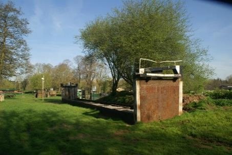
WEIR EAST OF BRIDGE 60
Sinks and overflow weirs are part of the canal structure here to manage flow from north of the cut to the south. The development Tunnel Barn Farm for fishing, with a series of large ponds, has increased recreational use.

WEIR CHANNELS WITHIN WOODLAND

TYTHE BARN BRIDGE 59

TUNNEL APPROACH
The cutting on the approach to the tunnel on the north side is a designated site of special scientific interest.
Sites of special scientific interest (SSSIs) are protected by law to conserve their wildlife or geology. The cutting exposes a sequence in Arden sandstone of the late Triassic period in which grey-green shales and siltstones with wavy and lenticular bedding pass into white fine-grained well sorted dolomitic sandstones. The facies (character of a rock expressed by its formation, composition, and fossil content), thus indicates marine (intertidal) deposition conditions.

CUTTING REVEALS GEOLOGY
Horses and pedestrians use the small tunnel to the right which rises from the NW west portal to the road. There is a section of ridged cobble paving in the towpath tunnel designed to give boots and hooves purchase in the wet. The horse then crossed the road to the horse path which leads to the SE portal of the tunnel.

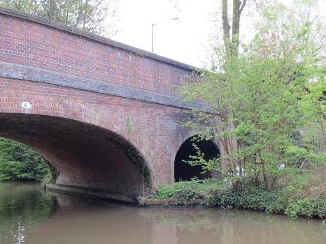
The Warwick and Birmingham canal committee decided to make the tunnel sixteen feet (4.88m), wide enough for two narrowboats, having changed their plans from tunnels to cuttings at Yardley and Rowington. This would otherwise have been an impediment to the 1930's modernisation to broad beam. The tunnel is 433 yards long (396m). A rare example of a separate towpath tunnel, it was probably designed by William Felkin, who had worked for Samuel Bull the engineer of the Birmingham Canal Company who had supported the canal, and Philip Henry Witton who took over in 1797 from Felkin after he was blamed for an aqueduct collapse over the River Blythe. Both portals have semi-circular arches, faced with blue- grey engineering bricks. The main portal has a brickband. Towpath tunnel is brick paved and vaulted, with coursed stone and brick walls.

HORSE TUNNEL LEADING UP TO RIDGE

SOUTHERN LISTED PORTAL
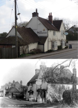
Like the 300 year old Case is Altered, the nearby public house the Durham Ox is said to have served the navvies at the time the tunnel was built.

DISCRETE ACCESS IS NOT WELCOMING
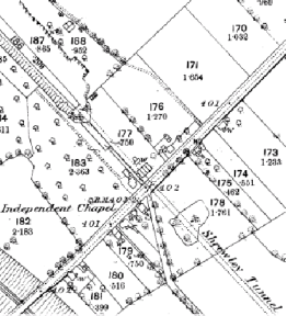
The appearance above the tunnel has changed in the intervening period and the idea of the horse crossing the road amongst the four by fours that populate the road is anachronistic. There are however some building close to the tunnel alignment that are of surviving significance. In the vicinity the chapel remains if altered for domestic use, as does Shrewley House, a former farm. The building is brick and colour washed render under a tile roof it is early 18c with later alterations. There is a timber frame cottage 120m north west of Shrewley House, that is listed as Shrewley Cottage., and a further historic core at Little Shrewley to the north east.
The 1880 ordnance shows both sides of the road over the tunnel divided into plots.
These have since been subdivided and more houses now line the street.
The contrast between the cutting and tunnelling at the end of the 1700's and the railway contractors much wider approach fifty years on, indicates the difference as techniques and contractor's practice evolved over this important period of change. The much greater intimacy that arises is partly a function of the scale of operation in forming the cut through hillsides. Deaths during construction, learning from disasters and mistakes are now concealed behind the veneer of age, and the rawness is concealed by vegetation.

(1) 2 HATTON
Shrewley Tunnel to Saltisford Arm- 21 broad locks 8km 5m Grand Union 1929 (Warwick and Birmingham 1793 )
2 Hatton length
Grand Union 1929 (Warwick and Birmingham 1793)
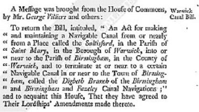
TAKEN FROM HOUSE OF LORDS JOURNAL MARCH 1793
Shrewley to Warwick is a largely rural length of 8km. This stretch of canal contains the listed southern portal of the Tunnel, runs alongside theGWR station which shares this route to Birmingham from Oxford, as does the nearby M40 motorway. For the Canal to descend to Warwick requires one of the nation's most impressive flights of 21 locks that steps majestically down to the Avon Valley. Originally narrow locks, they had broad locks built alongside them to stimulate the economy and improve infrastructure efficiency in the1930's.
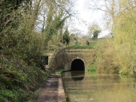
THE SOUTHERN PORTAL OF SHREWLEY TUNNEL
The Horse ramp runs steeply down to the towpath from the path over the tunnel, taking you away from the ribbon of houses either side of the street and village shop through fields. The only intrusion on this tranquil waterway is the noise of rail and motorway, the other transport infrastructure that has followed a similar route from Birmingham.
Part of the rural setting is the occasional bridge crossing the canal, Balls Bridge 58 served Great Pinley to the south original Cistertian Priory lands. The railway is a 120 metres away and the M40 300m further , all following the canal alignment
The settlement of Hatton Station is within a rural setting where development is contained around the station and canal area and forms a strong ribbon pattern along Station Road. Within the wider area there are individual farmhouses and barns (listed buildings) that have been incorporated within residential /commercial development and which provide visual references to the former small scale pastoral landscape synonymous with Ancient Arden. The skyline is generally well vegetated, formed by hedgerows and mature trees within, or immediately adjacent to, the canal. The land that separates Shrewley from Little Shrewley and Hatton forms a rural backdrop to these settlements. There are two listed buildings -former farmhouses that have been absorbed within more recent residential development as well as the listed canal tunnel
There has been some tree planting adjacent to the canal, the length is tranquil due to its quietness, and lack of urban views apart from around Hatton station and of course the rear of the linear development over the tunnel, visible from the horse path. The length is defined by road and rail corridors and is split by the railway and canal. The area immediately around Station Road, north of the canal consists of a small to medium scale field pattern more akin to the Ancient Arden Landscape.
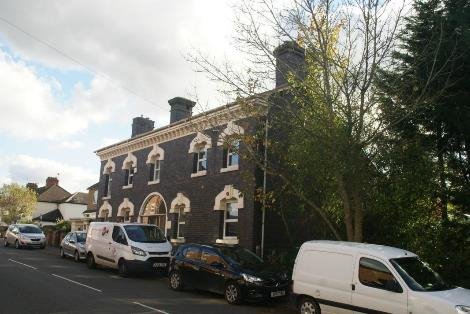
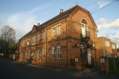
The station house is a two storey listed former canalside pub in brick with a plain tile roof.
East of Hatton station is essentially rural. As you approach Dark lane and Bridge 55, the canal makes a cutting that is wooded with moorings on the off side where there was a wharf. There is a stepped access that climbs 5 metres from the towpath at 103metres to 108 metres, making the crown of the bridge a good view point, albeit traffic to Hatton Country World makes taking in the view sometimes perilous. Hatton House and nearby cottage are perhaps appropriate for local listing
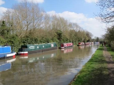
The domestic paraphernalia of moorings is often more prominent because of the lack of space within the boat fro storage. How this is provided for can determine whether the impact of moorings is harmful.
Looking east the top lock lock 46 is visible at the end of a broad well wooded cutting that makes it a good place to rest after or before navigating Hatton Flight.
The wooded cutting also conceals the canal from Hatton House, a Large early nineteenth century house in red brick with flared headers and stone dressings. Materials such as the slate for the hipped roof were probably bought by canal that opened in 1800.
The Hatton estate in Warwickshire was apparently purchased by
Peter Arkwright (1784-1866) the grandson of Sir Richard
Arkwright kt (1732-92), famous for his development of the
factory system of mass production was as significant as the
technical developments his cotton mill in Cromford.
The estate was bought by Peter Arkwright in 1830 for his second son, Edward (1808-50), and a new country house was probably built there in a designed landscape after his marriage in 1845.

When Edward died young in 1850, Hatton became the home of his youngest surviving brother, John Thomas Arkwright (1823-1906); who left the estate to his son, John Peter Arkwright (1864-1931), whose heir, John Brassey Arkwright (1912-41) was killed in action in the Second World War. The estate was taken on by his younger brother, Percy Frederic Arkwright (1915-89), and was handed over to his son, Andrew John Arkwright (b. 1953) in 1982. Mr. Arkwright and his wife have developed the redundant farm buildings on the estate in a number of business ventures, including a craft centre and a farm park that are now a popular visitor attraction.
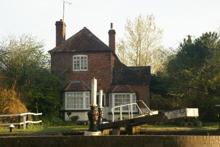
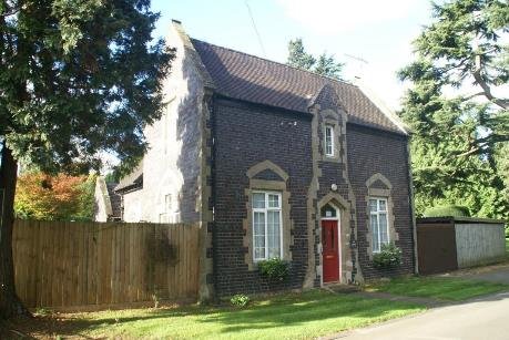
The lock cottage at the top of Hatton flight is little changed
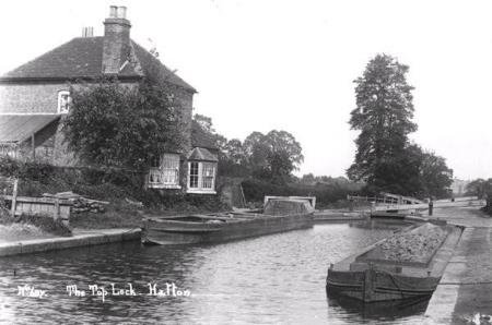
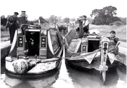
TOP LOCK HATTON 1900'S STILL NARROW LOCKS SOURCE WCRO
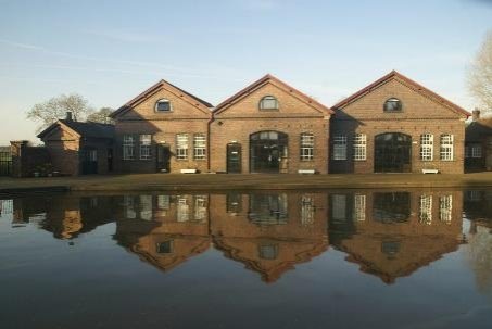
Hatton yard
The maintenance yard for the Grand Union Canal was at Hatton. There is a private dock above the turnover bridge, 54 and what were canal company tied canal houses, now in various ownerships, leading out to the main road. A footpath across the fields reached the public house known as the Hatton Arms, previously the Waterman. The former maintenance yard is now offices and meeting rooms for the Canal&River trust.
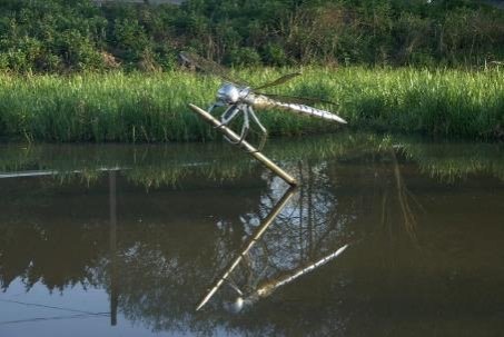
The small water area opposite the yard has had sculpture placed in it and a car park for visitors to the historic lock flight has been created. The development of a public art trail by Groundwork Coventry won an RTPI award and as an initiative for the waterways public realm through Warwick District, would sit well with the recognition of the Conservation Area.
It is important to recognise that this an engineered landscape no matter how natural these side ponds to the lock channels appear. Navigable rivers and canals rarely did such violence to the landscape that later rail and motorways did. Works like Hatton marching down the hillside were sometimes as spectacular, given the spade and barrow technology available when they were first constructed.
The lock flight engineer was Philip Henry Witton(1762-1838) who was employed by the Warwick and Birmingham Canal Company in 1793 as their Clerk/Accountant In 1795, his collection of drawings of "Utensils in Canal Work" survives and gives a fascinating insight into some of the fine detail of how the canal was built. In 1798 Witton took over the role of engineer and oversaw the completion of works up to the opening of the canal.
A copse could be planted to the north‐west of the Water Treatment Works to help to screen the engineered embankment and structures in views from the west. This would enhance the Wooded Estate lands character and improve the wildlife corridor along the stream line from the canal to the wider countryside to the north.
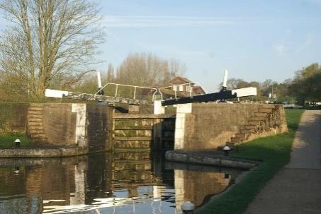
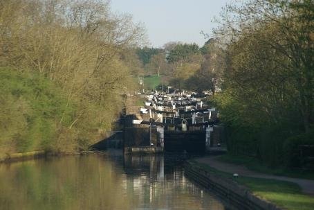
Hatton lock flight has 21 locks, numbered 26 to 46, over the next 2 miles. Work began to convert them into broad locks in 1932 and was completed in 1934 for a Royal opening.
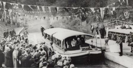
The Duke of York travelled down the flight in the Grand Union's experimental wide boat 'Progress ' specially fitted out for the occasion..
Modernisation included new paddle gear. Castings are inscribed Ham Baker and Co. Westminster SW . Whilst their London office was 70 Victoria Street SW1, the works were at Langley Green near Birmingham where they also made lock sluices as well as the operating gear installed in the reconstruction of the locks to the design of Sir Robert Elliot-Cooper and Son, consulting engineers. The patented design was approved by the engineers after extensive research and experimental work. The gear is intended to be opened in 30 seconds against a maximum head of 8'6"
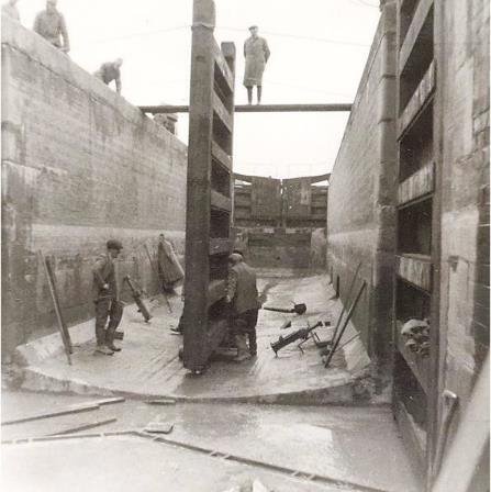
NEWLOCKGATE BEING FITTED IN BROAD LOCK BW1958
The works were a part of a an ambitious scheme of development of over £1,500,000 half of which was spent on new locks on the Warwick section of the canal to allow craft of 12'6" beam to complete the journey to Birmingham from London. About 1000 men who had been previously unemployed were engaged on the work to one of the chief commercial waterways in Great Britain.
New reinforced concrete bridges were needed for the increased
span these were formed as slab and T beam portals with beams
that were 600mm wide and 525mm deep.The parapets were cast in
situ to a pattern that is was used on the Hatton Hill, Middle
Lock and Ugly bridge with carriageways 4,1.8 and 6 metres wide
respectively. Welsh road bridge at the eastern edge of the
district has a 6metre wide bridge of the same pattern with a
span of 15.24 metres.
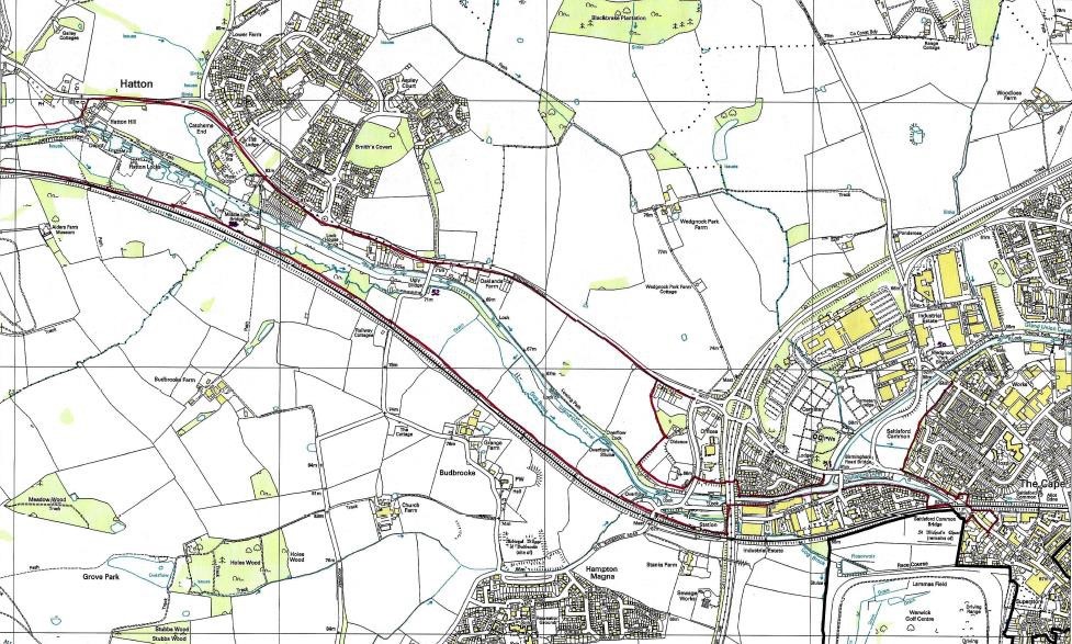
The land for the canal and later railway was at one time part of Wedgnock park. The canal runs parallel to the rail tracks of the Great Western Railway as they were before nationalisation and merger it into the British Transport Commission, along with the Grand Union Canal Co. The rail tracks run on embankments and through cuttings evolved from the navigators construction techniques as used on the canal. One of the difficulties of surveying canals in the 1790s was that it was done on horseback with only primitive survey equipment. So the alignment of lock fights like at Hatton, or tunnels such as Blisworth, also on the Grand Union, quite often made use of distant spires to plot a route across the countryside.


ref Warwickshire Industrial Archaeological society
A Key view, St Mary's Warwick, can be seen in the distance from the yard..

The former asylum wharf is on the north bank of the canal above bridge 53. The land having been given by the Earl of Warwick. In 1871 the canal company was supplying water to asylum for laundry and heating purposes. The rail station alongside the canal at Hatton is probably grander as it served the many visitors to the County Asylum. Nearby is the King Edward VII sanatorium, built during the First World War. Both of these are now part of a larger housing area that took advantage of the previously developed site to create dwellings in the countryside.
BIRMINGHAM ROAD HOUSING FOR ASYLUM STAFF
There is an older terrace of staff houses whose gardens back onto the canal, that were originally part of the institutions. Some of the houses that edge the flight have made garden accesses. So long as these are not excessive they bring a degree of personalisation. It is the group value of the locks, pounds, side weirs utilising the narrow locks decked over, the sluices, bridges and canal houses that together make the sense of place. The setting often extends at least to the railway to the south and the main road to the north across the field, but depending on the season this can appear contained by the trees and hedgerows, or more open to the hillside.
MIDDLE LOCK COTTAGE
Established woodland margins and views out to the railway to the
south, make walking down this majestic canal flight a very
popular local activity
The remains of a medieval village are recorded South of the canal, as is the church of St Michael at Budbrooke seen through the trees. The militia, originally near the canal at Clapham Terrace in Leamington, moved to barracks here in 1880. These have also now been redeveloped for housing as Hampton Magna.
A parkway station has been created close to the A46 alongside Hatton bottom lock 26. There is a small car park for canal visitors that could be further developed to compliment that at the top of the flight.
BOTTOM LOCK
Prior to the A46, Budbrooke house, a substantial property sat between the road to Birmingham and the canal in a park setting that the canal sweeps round. The House has gone but some of the buildings near the canal remain as housing and are considered positive features for local listing as is the lock cottage.

Passing under the dual carriageway of the Warwick bypass the urban area now extends to this elevated boundary with houses and employment units. The volume of traffic is considerable and windblown noise often accompanies this walk into Warwick. Development of an employment area on the offside of the canal has introduced a pathway on the southside of the canal and this links to Hampton Magna, but the access is unmarked and therefore relatively hidden in the industrial estate. The road to the estate crosses the canal, with gated access to the waterside, the main towpath being on the northside with a ramp down from the Birmingham road. The canal here could function as a safe route under the highway.
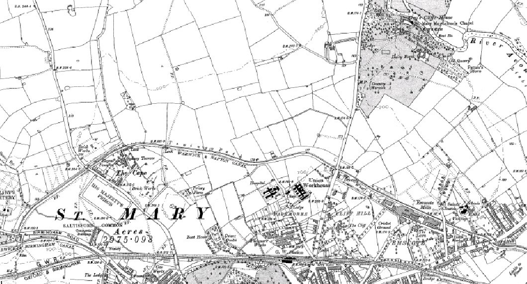
SOURCE EARLY BOUNDARY COMMISSION MAP
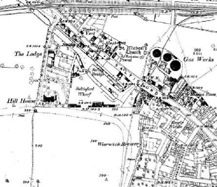
The original Warwick and Birmingham canal extended into the edges of the town,where it rises up to the church and the castle. What remains is known as the Saltisford Arm and was itself reclaimed during the recession of the 1970s using unemployed young people to successfully re-water and create a pocket park with moorings to fund its upkeep. The children's activity centre was never built and a temporary classroom was used until it fell apart. Recently a meeting room and activity base has been established and some 'features' introduced to the landscape.
South of the canal arm, a triangle of land with previous uses as a cold store and concrete batching plant, has been covered with housing but fails to make any real connection with the adjacent waterway.
The canal previously extended almost as far as the 1820s
gasworks with their octagonal gas holders. The railway was
allowed to infill the canal crossing and apart from the remnants
of a bridge, there is little evidence of the former terminal
buildings and basins.
1851
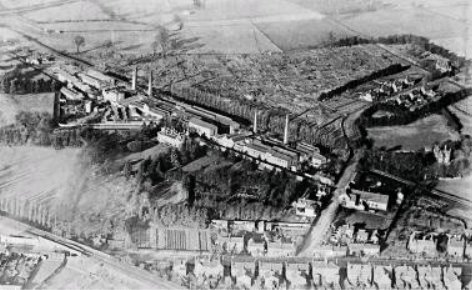
The expansion of the built area that came at the end of the 18th century occurred with the construction of the basin of the Warwick and Birmingham canal . In 1797.Parkes, Brookhouse and Crompton established a worsted spinning factory. The building was 28m long and six storeys. It was powered by the newly invented Boulton and Watt engine. Adjacent buildings held combing, drying and dyeing operation, and warehousing.
The ability of waterways to transport materials like coal and iron was a key part of industrialisation. The Victorian County history reveals that the factory employed five hundred people, a fifth of the population of Warwick at that time.
Until the end of the 18th century, Saltisford was little more than a line of houses on each side of the Birmingham Road, only St Michael's Hospital in two houses shown beyond the brook by Hollar's plan
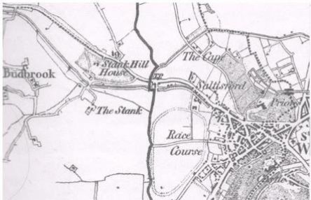
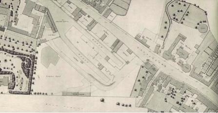
Sheet six of the 1851 board of health map gives a clear picture of the canal basins and coal wharfs as well as the canal companies warehousing and the large timber yard which backed on to the racecourse. In Warwickshire in the 1860s there were 16 coal mines yielding 678,000 ton whereas in s of coal. However the wool and cotton manufactory on the 1806 map was mostly discontinued. Now there's no real evidence of Eagle engineering as the land has become Sainsbury's supermarket and more housing.
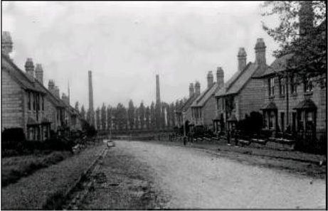
The canal led to the construction of a number of new streets and workers dwellings. Parkes Street and West Orchard appeared in the rate books in 1820 and Wallace Street in 1827. Courts and tenements were constructed behind already existing houses and approached through alleyways.
Employment came from Daniel and Henry Mallory then in drapers, Charles Pratt, corn, salt and coal merchant, victualer and maltster; John Burton carpet and worsted manufacturer.
There was a large timber yard between the canal basin and Hillhouse and two others near the gasworks, in Wallace Street stood the largest brewery Jaggard jaggard and hiorns, together with a number of malt houses nine public houses and Lambs hat manufactory
SALTISFORD WORSTED FACTORY THEN BREWERY.
The gasworks were built by the Barlow Bros and started producing gas in March 1822, providing street lighting. The gasworks were subsequently purchased by local residents, by subscriptions for £10,000, and became Warwick Gas Company. It was decided to extend a five inch main to the new town being constructive north of the river Leam with lamps at the top of Union Parade, even though Leamington had its own gasworks, also canal side.
PHOTO WIAS MARTIN GREEN
The 1851 map of Warwick shows the two enclosed octagonal gasometers with the retort house setback behind them. This rare early example of an enclosed type that were not built after 1840, because gas holders had become larger, and the practice was considered unsafe from 1840 onwards. The gas holders are grade ii listed structures, made of brick faced with Parkers Roman cement and painted white. A retort house that slightly predates this one in Warwick, and had an interesting cast and wrought iron roof, was found in Berkeley Street parallel to Gas St, in Birmingham. The link between gas making and canals is less obvious since the advent of North Sea gas, but both sides of the canal in Leamington between Tachbrook Road and Clement Street were used for coal gas production. A significant number of midland gas works relied on water transport.
FIELDS GUIDE TO CANAL SERVICES AT SALTISFORD 1815
1890

1851 WHARF
CANAL CIRCLES HIGHER GROUND OF WARWICK 1851 WCRO
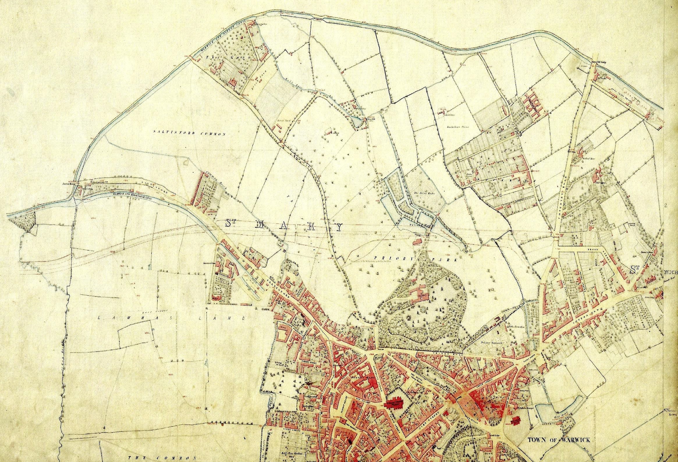
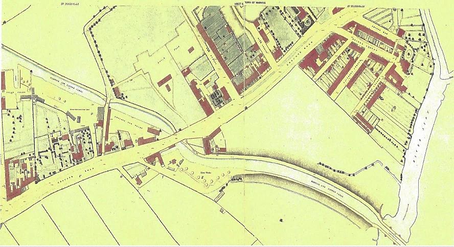
(1) 3 WARWICK
Birmingham Road junction bridge 51 to Emscote Road bridge 46 two locks 2.5 km 1.5m Grand Union Canal 1929 (Warwick and Napton 1794)
Cape Locks with the Cape of Good Hope Public House which dates from the Navvies construction of the Warwick and Napton Canal. There are brick yards that were sold off by the canal company after they had finished their building works and also a Foundry at this location. The road is now known as Cape Road. It ran from the town centre past Henry Wise's estate, now Priory Park.
3 Warwick
WARWICK BRAUNSTON ACT 1794- WARWICK NAPTON ACT
Those who promoted a canal from Warwick to Birmingham in autumn 1792 were also behind the survey in early 1793, for a canal South to Braunston. As well as many Birmingham banking names the main driving force seems to come from Warwick. Dr Walter Landor who had married an heiress and fathered Walter Savage Landor was prominent and later chairman. The Canal company's bankers and solicitor were in Warwick. John Tomes, solicitor, later became the town's MP. Other locals such as Lawrence and Greenway, treasurer from 1806 of both Warwick canals, were to be found also amongst other canal committees. Edward Ferrers whose Baddesley Clinton estate bordered Packwood estate, saw the Warwick and Birmingham line was set to the edge of both estates where they joined.
The Earl of Warwick was another of the proprietors with land on the route, as was Henry Wise at the Priory in Warwick, and Matthew Wise in Leamington. It was he who was eventually persuaded that the proposed tunnel in Malins Hill could be avoided by creating a cutting at the back of what is now Bury Road. Rev Edward Willes who owned the Newbold Comyn estate would benefit from the future development of the town. Bertie Greatheed whose land became the site of the Pump Rooms, Regent Hotel and Parade was also a signatory. So the genesis of what was to become Leamington can be seen in the promoters behind this Canal Act.
The Canal committee were at first unsure whether to promote a link with the Oxford Canal or go to the Grand Junction direct. The engineers: William Felkin, James Sheriff, Charles Handley and Samuel Ball carried out surveys and estimates. The proposals were a counter to the Stratford company with its' projected branch from their canal to the Oxford at Fenny Compton.
The company's first Act of 1794 eventually provided for the canal, nearly 18 miles long, to join the Oxford at Braunston. This was seen as a linking canal for long-distance traffic between Birmingham in the north of Warwickshire and London. William Felkin estimated the cost at £82,444. The authorised capital was £100,000 with power to raise £30,000 more.
The Warwick and Braunston had the same clerk and treasurer as the Warwick and Birmingham. Of the Warwick and Birmingham's committee of 15, 13 were also on the Warwick and Braunston 's committee of 20, and were given preference in subscribing shares.
Work had begun in 1795, when it was suggested that £50,000 would be saved if the line were varied from the Fosse Way at Offchurch onwards, so that the canal met the Oxford Canal at Napton, instead of at Braunston. Charles Handley one of the appointed valuers, described as a yeoman of Barford, was asked to accept 300 guineas for 'his indefatigable attention and perseverance in exploring… The line of the canal between the Fosse Road and Napton, and the practicability of executing the same'.
Felkin, the appointed engineer agreed, and the decision was taken in September, apparently without telling Lord Warwick, although he was a member of the committee.
The Grand Junction tried to persuade the committee to build their canal with broad locks and bridges, so that if the connection through Warwick was broad as far as Kingswood, they foresaw barge communication through to Worcester and the Severn; since at that stage the Worcester Birmingham was intended to be a barge canal and was built with broad tunnels. Perhaps unfortunately, the committee were focused on the Birmingham's and Dudley's narrow canal network trade.
The subsequent 1796 act to Napton explained that a tunnel over 800 yards long could be avoided by the change and that the original line through Bascote, Long Itchington, Birdingbury, Leamington Hastings, Broadwell, Grandborough, Woolscott, and Willoughby was 'incommodious for navigation'.
In March 1796, the company decided to replace Felkin with by an engineer who was not also employed elsewhere. The local Charles Handley was paid 350 guineas a year including valuation fees and offered five free shares if the work be completed satisfactorily. Work went on and a tunnel was avoided at Leamington by paying compensation to be allowed to deviate the line.
Instead of a reservoir, the company decided to buy its water from the Oxford at a charge of two shillings per boat passing the junction at Napton.
A difference of opinion with the Earl of Warwick led to him leave the committee. Further trouble over shortages of money, meant £4000 had to be borrowed, £2900 of it from John Tomes. The full cost of the canal when opened was about £75,000. This compares with the£160,000 the Warwick and Birmingham had cost, some six miles longer.
The eventual canal was just over 14 miles long from its junction with the Warwick and Birmingham to Napton. There were two locks down and the Avon was crossed by a three arched aqueduct, to a design by Henry Couchman, a long-standing member of the committee. The canal from Radford Semele on rose by 23 narrow locks to its junction at Napton. The company then decided to build a reservoir at Napton instead of buying water from the Oxford, subsequently enlarging it.
Later between 1807 and 1815, Boddington reservoir was built by the Oxford Company on its own line, but at the cost of the Warwick and Napton. This was enlarged again in 1833 at the joint cost to the Warwick canals. Dividends rose from 1 ½ a percent in the opening year, to 13% by 1814 and continued at around that level through to the 1840s.
Being of the opinion that all change was for the worse, the Warwick and Napton committee opposed almost every canal proposal in sight.
In 1819 the company agreed to a private cut from the bottom of Stockton locks to lime works and a quarry known as Kaye's arm. This was the work of Charles Handley and John Tomes, who were also behind the Navigation Mill at Emscote that used water from the canal to drive a 24' waterwheel. Tomes is a key figure, and was treasurer to the 'Leamington Building Society', a collection of investors who set up the development of plots in the new leamington north of the river.
1831 ORDNANCE OLD SERIES
In 1831 the Warwick company reduced its tolls to ward off the combined threats of the London and Birmingham canal and of the railway. As a canal for through traffic, the full weight of railway competition fell upon the Warwick canals. Dividends came down with a run from 15.5% in 1838 to 2% in 1845 and nothing for many years after 1851. Warwick and Birmingham Dividends went from 16½% in 1838 to 9% in 1845 to 2% in 1853 and then nothing.
The company received an offer from the London and Birmingham extension and Northampton Daventry, Leamington, Warwick railway to buy the Warwick canals. The railway promoters paid £10,000 deposit, then came back to say they were unlikely to get an act authorising conversion to a railway and suggested instead buying the Warwick and Birmingham and Warwick and Napton canals for £545,000, however the terms were refused.
Between 1838 and 1848 the tonnage carried reduced from 320.000 to 220,000 tons and the receipts were halved. Bondholders' pressure for repayment eventually meant a receiver was appointed for both canals and the companies were reconstructed with capital much written down in value.
Small dividends resumed later, such that in 1895, both canals made a conditional agreement to amalgamate with Grand Junction but the bill was withdrawn.
In 1903, the carriers Fellows, Morton and Clayton offered to lease both Warwick canals, 'with a view to providing Electric traction along the same'. Ideas such as this came forward, with the Regents canal at one stage considering building a motor road above the canal with the underside used to support cables for overhead electric traction of their craft!
Finally the three Warwick canals were sold to the Regent's Canal and on 1 January 1929 then became part of the new Grand Union.
In February, soon after coming into being, the company applied for a development loan from government to widen the locks between Braunston and Birmingham and increase the draught to 4.5 feet. The scheme was estimated at £881,000 and the enabling Grand Union Act was passed in 1931.
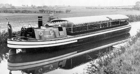
Old narrow locks were converted to weirs and 51 broad lock's 83.5' x 15' were built alongside. Lock sills were dropped and weir raised to give a depth of 5 ½ feet over the cills. Over 26 miles of walling was also carried out. A prototype timber craft, 'the Progress' was built at Tring to carry 66 tons. It was in this that the Duke of Kent travelled down Hatton locks on his way to lunch at Warwick after having opened the top lock of the flight on 30 October 1934.
By July 1939 there are one hundred pairs of narrowboats and during the war both men and women crews were trained, warehousing had been improved at Brentford, Tyseley and Sampson Road and other subsidiaries acquired including a road transport firm in Brierley Hill.
In 1948 the company was nationalised and incorporated in the British Transport Commission who then bought FMC's fleet.
The Saltisford arm. the length into Warwick beyond the junction of the two Warwick canals became disused in 1934
Sourced mainly from The canals of the East Midlands by Charles Hadfield. 1966. David and Charles Ltd.
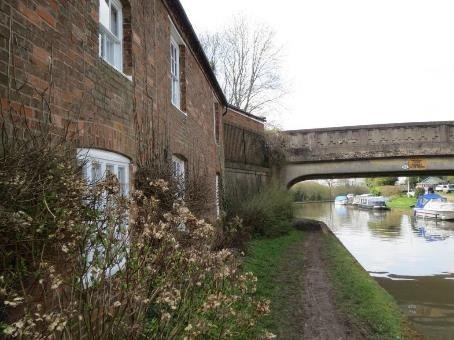
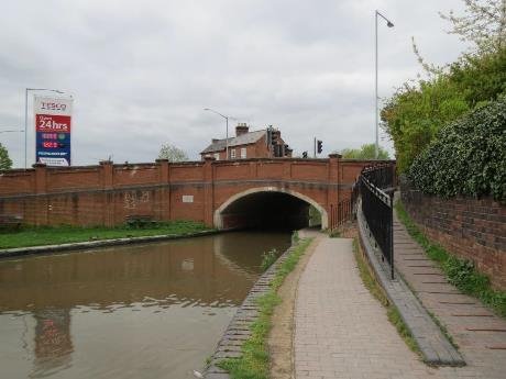
BRIDGE 51 THE BIRMINGHAM ROAD CROSSING RECONSTRUCTED IN 1992 A DISCRETE ENTRY TO A DIFFERENT WORLD.
THE VIEW FROM THE BRIDGE WITH THE VICTORIAN CEMETARY ON THE TOWPATH SIDE AND THE SALTISFORD COMMON
The Birmingham Road Junction at the start of the canal as it travelled eastward, lies between St Mary's Cemetary and the Saltisford Common. These are valuable open spaces which contribute to the setting as well as being important to the history of the town in themselves. The cemetery has regular plan with pair of chapels and a gatehouse, and was recommended for inclusion as a key site on Local List by Jonathan Lovie of the Garden History Society. 19th century planting of trees survives and there is an unusual drive from the east along the canal with topiary Irish yews.
THE BLUE BRICK USED ON THE BUILDINGS IS SIMILAR TO THAT USED ON THE WARWICK GAOL THAT USED TO BE ON CAPE ROAD
THESE FACTORIES ARE QUITE DISCRETE AND THE CEMETARY LANE SUPPLEMENTS THE NARROW TOWPATH
The green corridor at the back of the towpath is an important element right through to Coventry Road.
This is supplemented with a wooded margin between Wedgnock Lane and the canal.
WOODLAND WALK ALONG THE COMMON EDGE
Whilst the Common isn't as extensive as it was 100 years ago, this open space including the allotments contributes both to the setting of the canal and also to the quality of life for local people.
ON THE OFFSIDE AT WEDGENOCK PARKM BRIDGE ALLOTMENTS ALONGSIDE THE OLD PRISON DAIRY, NOW IN RESIDENTIAL USE.
THE CURRENT FENESTRATION LETS DOWN THE ORIGINAL DETAIL
Wedgenock Park Bridge Bridge 50 is where Cape Road crosses the canal. Visitors mooring here are encouraged to walk past the extant remains of the former Blue brick prison; the Dairy and the Governors house; either to get supplies at the local shops, including the successful conversion of a roadhouse pub to the Cooperative store, or further on to the market shops and other attractions in the centre of town.
A STUCCO TERRACE AMONGST OTHER GEMS
On the North side of Cape road there are a collection of vernacular dwellings including a former pub.
There were brickworks on the towpath side with kilns here and also further up Cape Road where the Cooperative store is now. Regent foundry which became part of Benford's, a local manufacturer of construction plant, has now been redeveloped as 'warehouse look' flats and named Chandley Wharf.
The land North of the Cemetery was contained by the A46 and in its Northernmost part it hosted the IBM business park – itself a good example of the more progressive approach to working environments that have become a key characteristic of creative industries. This should be the subject for local listing.
BUSINESS PARK SETTING WITH GOOD LANDSCAPE TREATMENT
In the medium term Harris Road, Broxall Close and the former Benford's site North of the canal may become valuable for redevelopment and therefore the canal corridor here needs to be treated with respect.
CAPE OF GOOD HOPE OVER 200 YEARS OLD
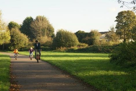
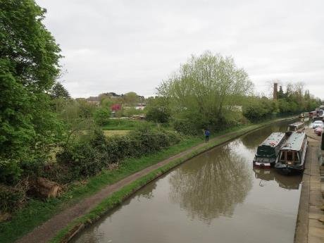
The length from the Cemetery to Cape Locks is already popular with people walking, cycling and jogging and will only become more so.
Improvements to widen the towpath and improve the surface along with better signage to highlight the canal as a linking element are some of the ways of enhancing the conservation area. This must also be done in such a way that doesn't damage the green corridor links, which make it attractive to use.
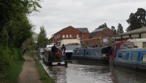
CAPE LOCKS
Cape Locks is a popular visitor attraction for people afloat and a local destination owing to the presence of the Cape of Good Hope built at the same time as the canal. Despite the limited road access the combination of open space and canal activity and a reason to visit for a meal or a drink makes this an important asset to the District.
LOCAL LISTING OF GROUP VALUE
ROUTES FROM TOWN TO THE CANAL WALKS ARE HIDDEN
Better signage at Lock Lane would help pedestrians navigate to the canal from the nearby housing and employment areas.
Local people will remember the carpet mill off Millers Road and there are a series of small and medium sized employers on the offside bank between Cape Bottom Lock and Scar Bank. A large proportion of the land between Millers Road and the canal is used for parking including staff parking for Warwick hospital.
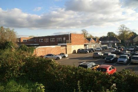
CAR PARKING ALONG FORMER EMPLOYMENT SITES
FOOTBRIDGE RATHER THAN PASSAGE OVER LOCK GATES
This is obviously an area in transition. Because this is offside land there are a range of ways in which any development can embrace the canal. Good pedestrian links across the canal into streets on North and south of the canal are important. Both the existing footbridges after housing was built and were installed as a result of the substantial number of children and others in the Woodloes development without access to cars. Canal crossings at Cape Road and Coventry Road were adequate when there was farmland to the North of the canal.
CANALSIDE MARGIN HAS RECREATIONAL AND AMENITY VALUE
Woodloes housing estate built in 1960's 70's lies to the north of the canal up to the Coventry Road. Fortunately, the canalside margin 30 – 50m wide formed part of the open space which wraps around the South and West edges of the estate, separating it from industry. The towpath therefore provides a good safe linking element to this and the other public space on the common. The absence of cars is a distinct benefit in a suburban area. If there is pressure for further housing we need to ensure that similar benefits are included so as to retain the essential character of the canal in this section. It would be very easy to forget that this is an historic asset not a natural phenomenon and as such it needs the relationship with what happens around it to be well considered.
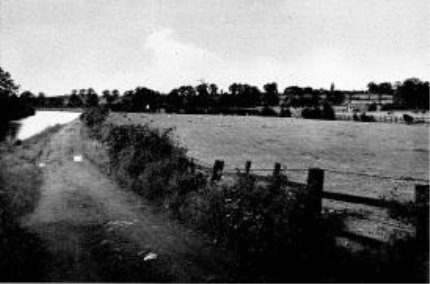
WOODLOES FIELDS CANALSIDE IN 1946
The school playing fields add to the sense of openness and the layout of much of the waterside housing being gable-on, is very permeable both visually and in terms of access.
Lakin Road with the former Union Workhouse and Hospital, now the site of Warwick Hospital, almost collides with the canal before swinging back to connect to Millers Road. Now that this area is more intensively developed an opportunity to connect into the towpath network of open spaces could be of considerable benefit to the health and wellbeing of those at the hospital.
POSSIBLE LINK TO HOSPITAL
On the approach to Coventry road, the offside is now the ends of gardens, with the large house closest to the bridge being more recently developed with detached properties. Much of the character of this edge is formed by the relationship between people's gardens and the water's edge.
ACCESS RAMP DOWN FROM COVENTRY ROAD INTO GREEN CORRIDOR
One function of the Conservation area is to afford protection to the substantial trees which are an important part of the character but also to remind people that the Waterway is a highway and therefore boundary fences will also need to be properly considered (everything over 1m high requires planning consent)
The rising ground on the Guys Cross Park approach to the Coventry Road encloses the canal corridor.
COVENTRY ROAD BRIDGE 49
For the next 1km to Emscote Road there have been a series of wharves along the offside which connected the canal to Warwick. The New Inn shown on the Thomas Webb Edge 1808 estate plan, listed now as Bridge House, probably gives its name to Brewery Wharf or Guys Cliffe Wharf.
LISTED FORMER BREWERY BUILDING
This is a collection of red brick buildings facing the Coventry Road boundary, screening the rather bland late 20th century office buildings behind. This wharf extended to Limekilns which are still shown active in 1889, but not ten years later. Whilst there is thriving water-based activity, inevitably there are pressures for change.
Nelson Lane is a narrow rat-run through the Cliff Hill residential area which has grown to meet it. The wharf margin which is 40m deep has been worked fairly intensively over the last century for employment purposes.
MONTAGUE ROAD INDUSTRIAL
This extended North of the canal, post the second world war, where a much deeper width was also developed for employment uses and home to larger footprint buildings of which one with a large chimney remain. These are relatively well screened by a well developed hedgerow particularly as the land here is lower than the canal.
LOOKING WEST WATERSIDE FACTORIES AT BACK OF TOWPATH. CHIMNEY LANDMARK
WCC OWN SITES IN AREA OF TRANSITION
There was a drawbridge across to the fields on the northern side and one of the names for the farm lane that ran NE from Coten End was Drawbridge Lane – later Wharf street. All along the back of the towpath was a line of tall poplars, of which one or two remain and beyond was a patchwork of allotments.
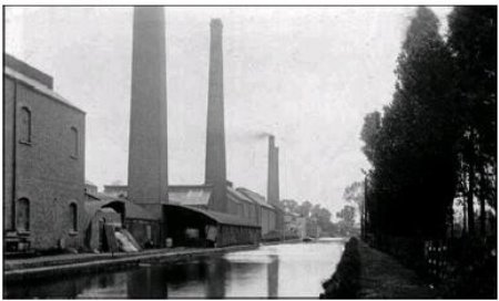
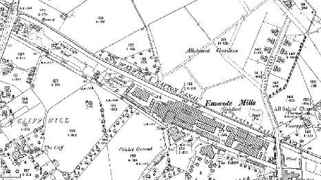
To the East of the drawbridge were the gelatine mills Thomas Nelson acquired in 1842 and developed as a multi-storey complex including 4 great chimneys that were set parallel to the canal. The canal was used to transport the carcasses to be prepared for the manufacture of gelatine.
NOT SO ELEGANT CLUTTER ON FORMER WHARF
1880 FIRST EDITION ORDNANCE SURVEY
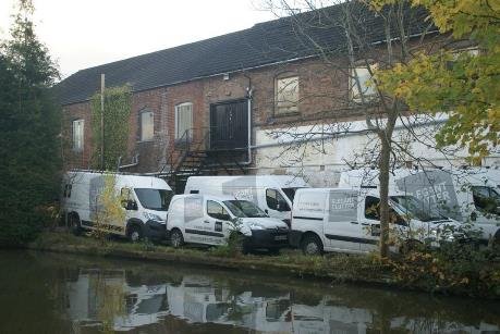
Some of the mill buildings still exist and have been turned to other uses including more recently residential. At the Eastern end the mill buildings became engineering works and then were demolished following use by English Rose Kitchens. Retail sheds have replaced these.
THE CANAL SIDE MARGIN IS JUST LEFT OVER LAND TO REAR OF RETAIL SHEDS
Future development needs to rise above this and perhaps recapture some of the enterprise that made this Warwick firm known worldwide. This was an extensive complex which included the extant Nelson Club a social facility provided by the Nelsons and also the development of twenty-three key worker houses with the extension of Charles Street Over the canal.
NELSON'S EXPERIMENTAL CAST STONE BLOCKS USED FOR MODEL WORKERS DWELLINGS.
NELSON CLUB ARCHITECT USE OF TERRACOTTA AND BRICK AS IN THE COFFEE TAVERN IN THE MARKET SQ. DALE THE OTHER PARTNER WITH NELSON, WAS ACTIVE IN THE TEMPERANCE MOVEMENT INCLUDING THE COFFEE TAVERN NEXT TO SHIRE HALL.
NELSON FAMILY HOUSE, EMSCOTE LAWNS BECAME A SCHOOL, AND IS NOW RESIDENTIAL
NELSON DALE BUSINESS GREW INTO A MAJOR LOCAL EMPLOYER
These drew on the family's other activities at Stockton, further
down the canal and were built from experimental concrete blocks
pressed to look like stone. At the head of Charles Street was
once a water tower supplying the works and the houses, and there
is a pair of substantial properties built for the Works
managers.
ref A Barnard 1899.
CHARLES ST 1899 MODEL HOUSING FOR STAFF
Thomas Nelson lived in the listed property called The Lawn, later becoming a private school and then developed for housing, successfully retaining the mature trees at the centre of the development.
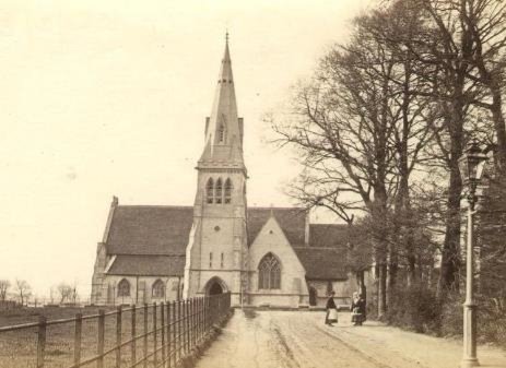
ALL SAINTS CHURCH 1854 DEMOLISHED 1968
To the east of Charles Street Bridge was All Saints Church a magnificent Victorian building, unfortunately subsequently demolished because of cracking in the tower. Alongside it were church schools and a hostel as well as the vicarage.
Subsequently the school was rebuilt alongside the canal along with a replacement vicarage and a new church was constructed with a delightful lantern illuminating the interior.
This should be considered for local listing.
The curates house and St Edith's hostel remain.
A footpath links Charles Street Bridge 48 with the Church and St Edith's Green. There is also a ramped access to the towpath here.
The length between Charles Street and All Saints Road Bridge is verdant with trees on both sides of the canal, so that what happens either side doesn't intrude on this attractive part of the length. Behind the Nelson Club there is a pocket of housing on what was briefly a DIY store site and before that a cattle market, with a wharf against the Charles Street Bridge which includes a second archway through to Emscote Mills. Whether this cattle market had any relationship to the canal or Emscote mills could be explored further.
CHARLES ST BRIDGE AND ARCH THROUGH TO FORMER WHARF
All Saints Bridge 47 is a narrow hump back bridge with no access point to the canal and a muted green pipe crossing.
Cast iron Rubbing strips are fixed to the corners of the abutment to prevent towropes rubbing the brickwork. Dogsbody cottage is the only older building remaining on this plot.
ALL SAINTS ROAD BRIDGE
Emscote Wharf with brick buildings with slate roofs around the perimeter remains in use as a car wash and car sales.
79 Emscote Road which stands at the side of Bridge 46 acts as a bookmark and as such could be locally listed.
In recent years the redevelopment of the towpath side has commemorated Austin Edwards, a local photographic manufacturer and councillor of the Borough of Warwick. The mission house which stylistically related to St Edith's hostel was demolished when the pie factory closed. In the 1930's this was allotment gardens having previously been a quarry.
1880 1:500 SHOWING EXTENSIVE WHARF ACTIVITY AND BOATYARD PRE ELECTRIC TRAM DEPOT TRACKS ALONG ROAD ARE FOR THE ORIGINAL HORSE DRAWN
EMSCOTE BRIDGE WIDENED FOR TESCO- CONTRIBUTED TO WATERWAYS UPKEEP.
If we look at the length from Coventry Road Bridge then certainly the Southern offside bank was very much canal related activity, with a series of wharves and waterside mills. Development spread by Nelson's model housing and post the Abercrombie assessment, this became where Warwick's urban borough sought to put much of the new accommodation. The margin along the canal at the rear of the towpath was utilised for larger employment uses, with the former Ridgeway school land abutting the Coventry Road. Godiva pumps recently celebrated 50 years of production at this location but this the South side of Montague road is an area for which a development brief would avoid some of the more piecemeal development of individual sites that have lacked any sense of place elsewhere along the canal in Leamington particularly. Re-establishing a footway near to the former drawbridge as part of the development framework of the canalside at this length would enable both the existing residents to the north of the canal and those living and working in any new development to connect more easily to the station and town centre.
ALLOCATED HOUSING SITE OFF MONTAGUE ROAD
The former school site has been marketed by the County Council as a potential housing location and identified as such in previous local plans. It does perhaps provide one of the best places to look for the much sought after extension of waterspace that some sort of marina or floating village could be create. It is an opportunity especially considering the proximity to Kate Boats.
ON THE CANAL WATCHING THE BOATS GO BY IS CALLED GONGOOZLING
The focus of views is currently moored boats along the offside edge and the buildings to the rear of this are relatively undistinguished. On the towpath side the views are generally contained by the larger factory units and a sturdy hedgerow. It is important to try and retain some water related activity in any redevelopment here, which is easier on the offside, without compromising safety and security.
(2) 4 AVON
Emscote Road bridge 46 to Tachbrook Road Bridge41 two aqueducts 2.5 km 1.5m Grand Union Canal 1929 (Warwick and Napton 1794)
Board of Health map 1851
4 Avo length
Emscote Road bridge 46 to Tachbrook Road Bridge 41 two aqueducts 2.5 km 1.5m
Grand Union Canal 1929 (Warwick and Napton 1794)
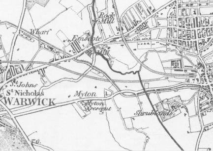
Character length 4 starts at bridge 46, Emscote Road bridge and stretches south and east to Leamington Spa, two and a half kilometres to bridge 41 at Tachbrook Road. Emscote Road runs west from the centre of Warwick to Leamington town centre.The original route forking up to go to Rugby.
Both north and south of the road were wharfs and basins, brickworks and a Mill. The development of the settlements mid nineteenth century saw lime works at the wharfs. Lime was also used by the gelatin works process, which also saw animal hides arrive by canal from places around the world. There were two coal merchants listed at Emscote Wharf in 1828 ( there were 18 using the basins that were infilled at Saltisford).
The fall of the land down to the river meant the canal had to be built on embankment, so that it crossed the rive some eight metres below. Beyond was farmland and the gap between the two towns has remained. Further on the length goes under the coaching route from Warwick Castle to Daventry, the turnpike as it had become in the eighteenth century, This turnpike west to east started from the Earl's new bridge on the Banbury Road, along past Myton Grange to Leamington where it crossed the town's spine of Brunswick Street, Clemens Street, Bath Lane (later street) and the Parade.
The towpath is on the north side of the canal throughout the
length. The bottom pound of the canal, it is five miles from
Cape Road to Radford bottom Lock. The first of 23 locks lifting
the canal out of the valley to join the oxford canal at Napton.
So surplus water discharges to the Leam and Avon, and the
company made use of this for the Navigation Mill.
EMSCOTE ROAD BRIDGE SE ELEVATION - WAS WIDENED FOR THE FOODSTORE. THE WHARF IS NOW USED BY VISITING BOATS.
Brickwork beneath arch shows evidence of at least two widenings, the first possibly for the tram at the end of the nineteenth century.
Warwick had not developed beyond Coten End until the construction of the Warwick and Napton Canal in 1800, though Messrs. Smart's cotton spinning factory was established on the far side of the Avon at Rock Mill in 1792. . Wharves on the canal were built for coal, slate, and timber yards and a lime works, and to serve Tomes and Handley's Navigation Mill (1805), later known as Kench and Cattell's Emscote Mill (1828), and for George Nelson, Dale and Co.'s Emscote Mills in Wharf Street (1837). Wharf street was called Drawbridge lane after the canal crossing, along it is a stone-built farmhouse, of the late 17th century originally with farm land fronting Emscote road. North west of the bridge wharves and a basin made this an important connection.
Beyond the canal to the north-east, Hill Street, at least down to 1840, was a private, gated road, leading to a brick yard and quarry. Humphris Street was developed by 1857 but the area was still surrounded by brick yards. East of the canal, Saunders Street, Chapman Street, Bridge Street, and Bridge Row had also been built by 1851 as can be seen on the Board of Health maps.
ref Victorian county history vch
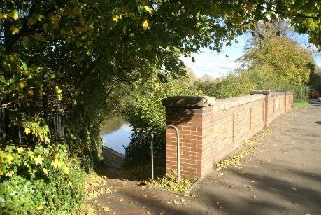
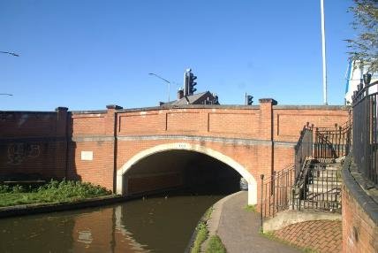
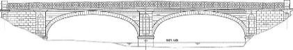
This part of the River Avon is where it is joined by the River Leam, just south of the Emscote road. Portobello Bridge, built in 1831 and then again in 1892, is Grade 2 listed. it forms part of the historic route from Warwick to Rugby and was joined by Warwick Street and Warwick New Road as part of the expansion of the new town in Leamington.
In 1857, at a cost of £15,000, water was started to be taken in from the Avon near Portobello bridge. A Pumping Station was built at Emscote in 1857 and at the start of 1858 water began to be pumped to the Water Tower on Market Street. Whilst this increased the supply of water to the Town its quality was described in 1870 as being 'scandalously filthy'. This was due in part to the towns of Leamington and Coventry allowing raw sewage to enter the river upstream.
A bore hole had previously been drilled near the canal in Packmore Lane(now Lakin Road) in 1854 and although plentiful, the water found there was "hard and full of lime".
Portobello view from north
The current road bridge over River Avon, dates from 1831 with further work of 1892 It is Ashlar faced with brick arches. It is a listed grade ii. The bridge has wide elliptical arches with rusticated voussoirs and tall niches in the piers. The arches spring from moulded plinths. It has late C19 wrought-iron pedestrian walk on north side with lattice parapet. Walkways were added either side in 1881 when the tramway was lain. The south side has a supported footpath added in the 1960's
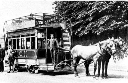
HORSE DRAWN TRAM FROM WARWICK TO LEAMINGTON STATION WERE REPLACED IN 1905 BY ELECTRIC TRAMCARS
Horse drawn buses started in 1829 in London and with trams there were about 25,000 in England in 1890. Electric trams first appeared in 1883. The horse drawn tramway opened in 1881 and included a loop around Eastgate to safeguard passengers on the top deck. The stables were in Coten End. The track was relaid for the electric trams in 1905 and ran until 1929.

Looking east from Emscote road canal bridge
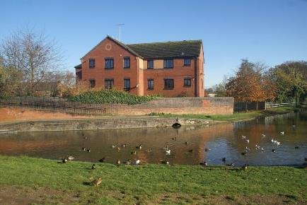
THE GABLE END OF THE WATER MILL IS ON THE RIGHT, WITH THE EXTRA STOREY ADDED IN 1868, ADJOINING IS THE STEAM MILL, WITH A NEW MILL BUILDING AND WATER TOWER ERECTED IN 1905. THE MILLERS HOUSE IS BEYOND.
WCRO
The Mill which stood on the northern side of the canal and was initially known as the Navigation mill opened shortly after the canal was completed. It had a water wheel 24ft in diameter and 7ft wide made in cast iron which took water off the canal to drive the mill stones. Water was fed back into the Avon. Field's 1815 account says water passed through nine semi circular arches under, what is still, a raised towpath, to a penstock 2'deep.
The Mill wheel was made of cast iron. It was 24' in diameter and 7' wide. The mill had five pairs of stones capable of grinding and dressing 300 bushels per day.

By the 1830's the miller, a lessee of John Tomes and Charles Handley from the canal company, was a P.Kench, milling flour. The Kench family bought it in 1856 for £3000.
Eventually wheat was being imported to supply local bakers from Russia, Canada, South America and Australia. The last two delivery horses were sold off in 1817 and their field alongside the embankment became allotments when the first lorry replaced them. Milling ceased in 1961 and in due course it was converted for the manufacture of Fleur de Lys pies, themselves having originated at the pub of that name at Lowsonford on the Stratford upon Avon Canal.
The buildings including the Georgian mill house were demolished in 1996. Housing association flats have been built on the site. ref Booth and Risworth.
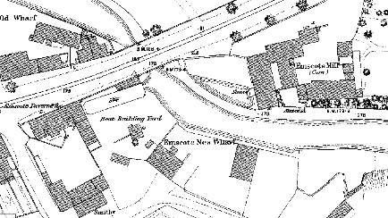
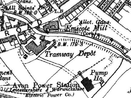
South of the bridge, on the offside of the canal to the rear of a Tavern, was the site of a basin, boat building yard, smithy and of Emscote New Wharf.
BRADSHAWS CANALS AND NAVIGABLE RIVERS ,in 1904 names
REYNOLDS WHARF probably north of the bridge and BLAYDON'S OLD WHARF and BUFFERY'S LIME WHARF as the south side.
1851 BOARD OF HEALTH PLAN
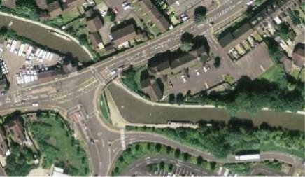
Current google aerial
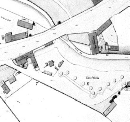
Following the switch from horse drawn to electric trams, a tramway depot was built here in 1904 with a pumphouse alongside the Avon, this supplied power for the tramway and local residents. Promoted by the Leicestershire and Warwickshire power company, It became an ac/dc convertor station, like the one in Wise street alongside the canal in Leamington.
Originally there was an agreement to supply coal and cooling water, The plan shows the Avon generating station, had its own rail link.
Nationalised in 1948 it closed in the late 60's. it was demolished in 1975. The site now contains the Tesco's store and High Voltage Electrical sub stations connected to the pylons that follow the canal. The canal infrastructure and the gas making plants using coal supplied by barge, and also electric power generation and telecoms were often linked.
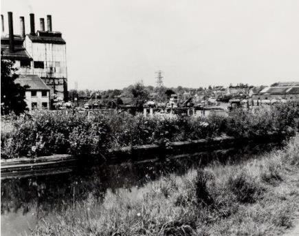
AVON POWER STATION

Aqueduct and former power station BW200
The tramway depot was built here in 1905. The Avon power station was built adjacent to the River Avon with its own rail link. The site now contains the Tesco's store and Electrical switching station.
One of the potential sites to link a broad waterway connection to the Avon would be at the side of the aqueduct. A number of devices from lifts, to inclined planes have been muted. Something with the engineering innovation and presence of the Falkirk Wheel would impact on the character of the area.
20th Century housing at Bridge Street has infilled the former allotment grounds. The canal is around 30ft above the River level at this point.
From the Emscote road to the aqueduct the canal sits on a wooded embankment.
NORTH ELEVATION FACING FLOW
SOUTH ELEVATION FROM RIVERSIDE WALK
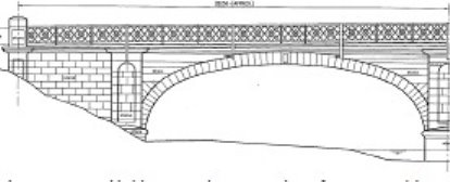
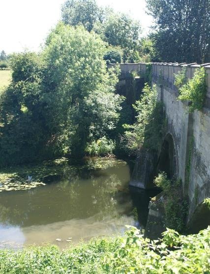
By April 1795 Thomas Hawkins was cutting the line between Warwick and Radford, but the Avon was the major challenge, along with the tunnel at Malins Hill (Bury Road). Invitations to tender for the aqueduct were issued in September 1795 in Aris's Birmingham Gazette, with foundations under construction in the river bed the following April.
The aqueduct over the Avon was built between 1796 and 1798, a three span stone arched structure in plain sandstone, quarried locally at Wooten Field. The piers are 9ft wide, the arches 42 feet and the canal is 16ft wide, the total length of the aqueduct being 230ft. It was built by Benjamin Lloyd, Mose .Wilson, Docker and T.Wilson. Designed by William Felkin and Charles.Handley, the canals engineers. They were advised by Henry Couchman- the county bridgemaster who was on the Warwick and Napton committee. It was he who rebuilt the bridge over the Leam to open up the land to the north in 1807-9. That bridge was replaced in 1840 by J G Jackson, Willes agent.
There is a solid masonry wall on the towpath side with the date 1908 inset and a modern imitation parapet rail on the offside, constructed in the 1980's.
A flight of steps linking the canal towpath with The Warwick and Leamington River Walk was constructed in the 1990's by British Waterways Architect/Planners. This links the series of open spaces starting at Newbold Comyn through to the former common land at St Nicholas Meadow.
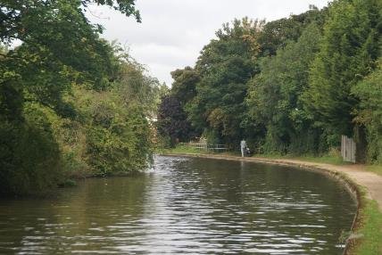
RIVER LEAM WALK THROUGH MEADOWS. CANAL SAILS OVER AND TOWPATH LINKS GREEN SPACES BETWEEN TOWNS
The aqueduct is considered suitable for listing.
Built three years after Eborall completed the Earl of Warwick's new castle ii* bridge, to a design by Robert Mylne, whose Blackfriars Bridge of 1769 is held to be the high point of masonry construction. The aqueduct is in a more hidden location, with a lesser span than the elliptical arch of the castle bridge, but it is an important contribution to the creation of the canal as through route by water to London.
From the aqueduct onwards the views open out to surrounding fields and the presence of the town seems quite distant. This gap is extremely important in preventing the urban areas of Warwick and Leamington from coalescing.
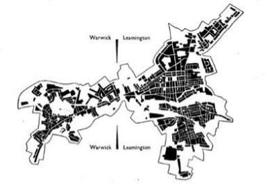
MORPHOLOGY OF DISTRICT AS MAPPED BY ABERCROMBIE'S PLAN IN 1946
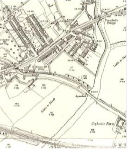
Jephson's Farm occupies the vestigial fields that separate the urban areas of the two townships, with Bridge 45 linking fields on either side and the farm pond emphasising this arcadian idyll; bit of countryside in the town.

THE TOWPATH ON THE 1960'S WITH THE POWER STATION JUST VISIBLE OVER THE FARMHOUSE
JEPHSONS FARM
JEPHSONS FARM GROUP SUITABLE FOR LOCAL LISTING
BRIDGE 45
The brick arched accommodation bridge connects the farm fields. It's simple unaffected form reminds us that such elegant simplicity is a key feature of the canals appearance, along with the use of materials that weather well.
Jephson's farm also has an enduring charm. Simple buildings around the central form, stepping up and back down with the roofs hipped. Tall chimney stacks and painted timber casements, here shielded from casual vandalism.
TOWPATH GOES THROUGH OPEN LAND AND IS A POPULAR WALK

VIEW OF THE CASTLE, ST NICHOLAS AND ST MARYS CHURCHES AS BACKGROUND TO A CANAL BREACH IN 1868.
Ref Source Illustrated London News
Just before the canal reaches the railway, a footpath from the towpath runs alongside the railway and back to Princes Drive provides the link to the open spaces in Leamington beginning with Victoria Park, and on to Spa Gardens and to Newbold Comyn, established in 1973, where reconnecting to the tow path is possible.
CANAL LINKS OPEN SPACES WITH NEIGHBOURHOODS
Spa Gardens is a Kilometre-long chain of riverside walks, gardens and parks. In 1862 the Local Board of Health created the New River Walk on completion of its works to speed the flow of the sewage-laden River Leam by raising and straightening its banks. The borough, using powers granted by the 1875 Public Health Act, extended New River Walk to the Pump Room Gardens. Additional Powers under the Leamington Spa Corporation Act 1896 enabled the acquisition of land for Victoria Park, as well as Eagle Rec further along the canal, as a 'people's park'.
West of Victoria Park is currently a sports ground, Edmondscote, edged by the river Leam and open fields reaching to St Nicholas Park, Warwick, the river avon flows on past the Castle to Warwick Castle Park, and then through National Trust estate to Stratford Upon Avon. A footpath link from Baginton to Stratford along the Avon was put forward in 1946.
The mainline railway is in a wooded cutting with the canal carried across in a metal trough, an alteration after the canal was built.
Along this length the Georgian Canal was temporarily diverted by Victorian railway engineers to construct their route which crosses the canal and town so intrusively. They installed a metal trough, a technique pioneered by Telford and his ironmaster at Longden in 1796 and Pontycysyllte on the Llangollen canal.
Canal is carried in a cast-iron trough which is supported by cast- iron arches, The towpath is supported by brick arches.
There are Four equal spans of 21ft. (skew), 15ft. (square) with a skew of 45°. The Total length (excluding wing walls) is 104 ft.
Trough Overall width 18ft. 9in. and is made up from five sections, each 3ft 9in wide. The trough carrying the canal is supported by six segmental arch ribs in cast-iron.
ref Roger Cragg ICE Panel for Historical Engineering Works
Built by the Birmingham & Oxford Railway to carry the
Warwick and Napton canal (now the Grand Union), over their new
line in 1851 In June of 1851 Peto and Betts, the railway
contractors made a short temporary canal to enable them to
construct the aqueduct.
ref Warwick and Napton committee minutes PRO Kew
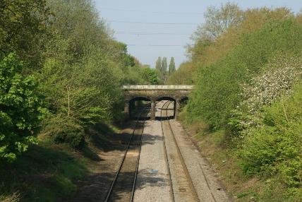
AQUEDUCT
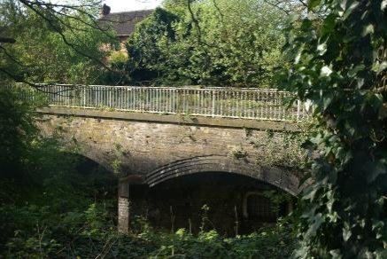
The rapid increase in transport infrastructure brought about the need for solutions, whilst not a grand project, the construction enabled the two primary infrastructure systems to co exist. This railway structure was part of the rapid expansion of railways post 1840's, it fits quite discretely into the landscape and is considered suitable for listing.

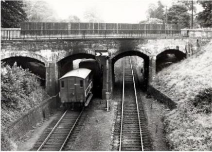
1930's
From the railway cuttinge up to Bridge 44 the canal on both sides is the rear boundaries of 20th century housing. On the towpath side this is reasonably well hidden by vegetation, whereas the offside is more recent.
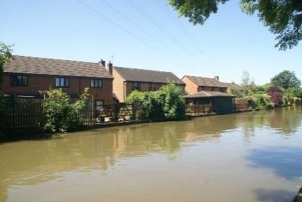
Canalside boundary treatments vary and either rebuff their surroundings or engage with the waterway. Thus the visual envelope that extends beyond the waterspace can intrude on the character and undermine the appearance of this historic asset.
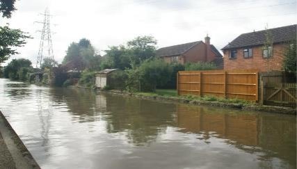
OFFSIDE TREATMENT OF GARDENS
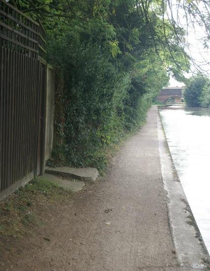
Intrusion into the towpath restricts use but needs to be managed in a way that does not introduce a standard uniform approach.
Ideally there should be a minimum 1500 to 2000mm of surface where the route is to have people in wheel chairs and buggies, passing others.

HOUSING HAS ENCLOSED HISTORIC CANAL
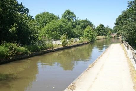
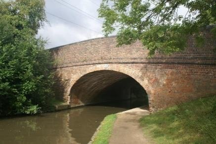
Leam Bridge - Bridge 44 on the Myton road has a link up to the roadway on the South eastern side There is an opportunity to improve this in the margins behind the Lidl store (formerly Clows garden Centre).
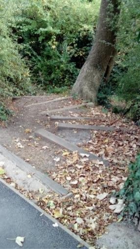
ACCESS MYTON ROAD
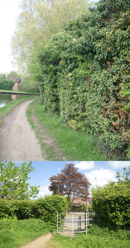
Despite the increased footprint the store itself is reasonably well screened by the existing hedgerow. There is another access point into the store's car park connecting with the Myton Road.

The canal was through open fields until this site was allocated for housing, the layout has kept some of that open quality with a green here that works with the canal to give a relaxed feel.
On the offside development off Aragon Drive has been orientated so that instead of backing onto the waterway housing is grouped to face onto shared spaces that are linked by a walkway alongside the canal.
The waters edge margin is an important element. A soft edge for mooring spikes when people stop to take on provisions, but also an appropriate green margin between the towpath walk and the water.


ARAGON DRIVE
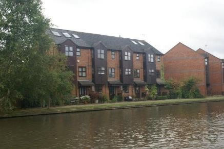
This helps to compliment the canal as an important part of the public realm. Towards the East, housing on the south of the canal rises to 3 or 4 storey and this is also the scale of the denser apartment development of The Moorings. The development has turned towards the canal and away from the larger areas of roadway and parking to the north and east.
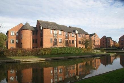
'THE LOCKS'
There is an opportunity for boats to turn in the winding hole, which diverts the towpath around the back of it. placing The Moorings Pub under the eaves of Europa Way could have resulted in somewhat awful relationship, but planting and the Southern aspect over the Waterway makes it an attractive terrace to sit and watch the world go by.
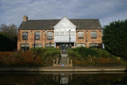
'MOORINGS'
This is the point on the South side of the canal where the cycleway comes back to the water's edge.

EUROPA WAY UNDERPASS

1946 IMPERIAL FOUNDRY MYTON ROAD PRINCES DRIVE JUNCTION
The Old Town Foundry was established in the 1860's by Radcliffe, Harrison and Blunt in Clemens Street and by the 1890's their company, The imperial Stove Company had built the imperial Foundry on old Warwick Road. Sidney Flavel purchased this in 1902, adding it the Eagle Foundry Works, producing cooking stoves. Ford purchase the Princes Drive foundry site in 1939 and closed it in 2007. It is now the headquarters and production base for Vitsoe UK a design led furniture company who have constructed an innovative building on the former foundry site.
This whole stretch from the Lidl car park through to the end of Bury Road was diverted away from the old Turnpike Road to enable the roundabouts of the southern extension to Europa Way to be constructed. The Old Warwick Road ran between Warwick and Northampton via Southam and was established in 1765.

This is particularly prominently located on the Southern approach to the town from the M40 and linked to the railway station will form a first impression of the town for many visitors. It is also where the Southern extension of the district attaches itself to the existing movement infrastructure, which as well as roads and rail, includes cycleways and footpaths and the canal network which directly link to the major centres of the district in Warwick and Leamington. An opportunity is therefore presented to make much more of the Bury Road recreation space as an entrance to the canal at this point.

A SPACE WAITING FOR SOMETHING TO HAPPEN
Saw mills were established between the railway and the canal in
the second half of the 19th Century. A cattle market
is also shown on the 1880's OS plans.
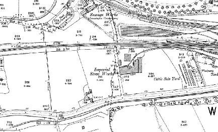
A tunnel was proposed at Mallins Hill through Mr Wise's land and what is now Bury Road and Kingsway. Mr Wise was on the canal committee until talks broke down. Wise was worried about potential interference with his mineral spring baths on the corner of High St and Bath St. Eventually after Charles Handley became the Companies engineer, the tunnel contractor was paid off and the canal became a cutting that runs to the south of the turnpike road
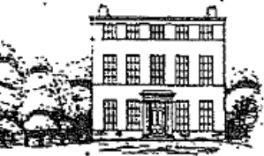
ONE OF SIX GRAND PROPERTIES MATTHEW WISE PROPOSED OVERLOOKING THE CANAL IN 1848
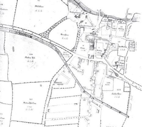
WISE ESTATE EARLY 1800'S
Shrubland House was started by Mathew Wise in 1822 on a hill overlooking the canal to the north. The architect was Henry Hakewill. Wise lived in the Manor House Hotel (now flats) having married the heiress of Thomas Prew of Leamington. The wise famil descendants of the monarchs gardeners owned property around the district, a cousin , the rev Henry wise living in Warwick Prioryhis grandfather, queen Annes gardener had bought.after the first world war the property became a girls school, but was demolished around 1939. The estate having been broken up into building plots.
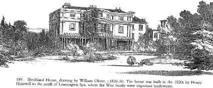
ref G Tyack also Cave RLS
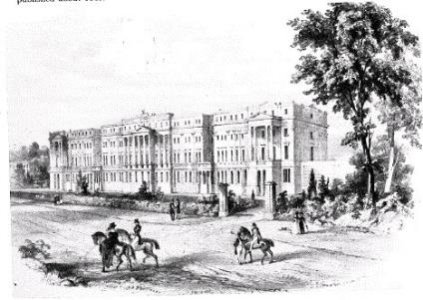
EASTNOR TERRACE WAS DEMOLISHED FOR THE RAILWAY LINE
Avenue Road Station opened in 1851. When this was joined by the Great Western Railway in 1852 a new station was built.
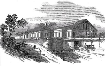
GWR reconstructed this in 1936 and the current station is essentially this one.
Trees that flourish on the embankment of this cutting are an important part of the character of this section of the waterway, that fronts the proposed Creative Quarter.

This is perhaps a length where activity on the water would enrich concepts such as The Creative Quarter, possibly introducing floating businesses cafes, galleries, retail and food outlets, for example a book barge or coffee shop or at the very least facilities to attract visiting boats.
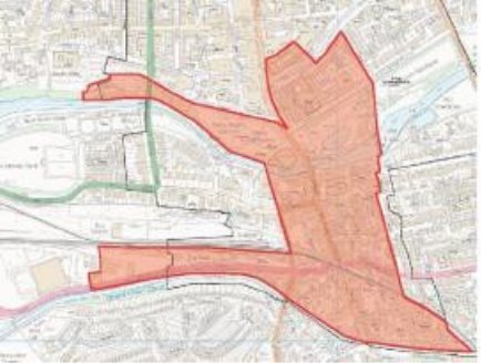
CREATIVE QUARTER FOLLOWS CANAL
The former omnibus garage opposite the station has recently been redeveloped for student housing with a robust use of modelling on the canalside -.a new build Pevsner commends


TACHBROOK ROAD BRIDGE 1910
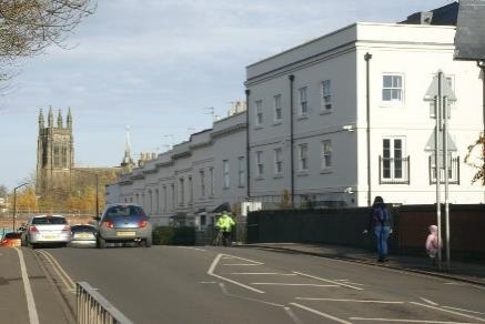
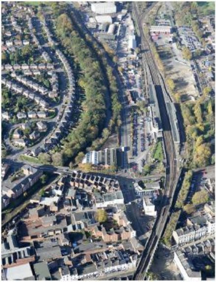
Avon
The length contains Emscote road bridge;
The location of the former Boatyard,
Tramway depot ;
Avon power station;
Portobello bridge
Emscote Mill Kenches (Pie factory)
Avon Aqueduct – constructed in 1798 in Warwick sandstone
Jephson's farm
Railway aqueduct over the Birmingham Oxford railway now the Chiltern mainline
Leam Bridge now Myton Road Bridge; Bridge 44
There was a Former footbridge near the winding hole at The Moorings
Further footbridge that replaced when the canal was diverted to create Europa Way
a cattle market – now the site of Morrisons
timber yard next to the Station
Warwick Daventry Road - the turnpike
Mr Wise's house Shrubland Hall South of the canal and the original Bridge 42 on the drive to it up Malins hill ( which was the site of the proposed tunnel)
Tachbrook Road Bridge 41
THE FIRST GASWORKS WERE BUILT BESIDE THE CANAL IN 1919

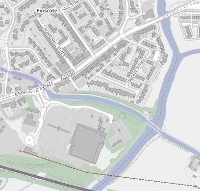
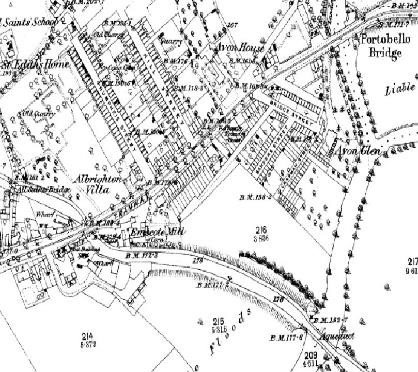
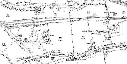
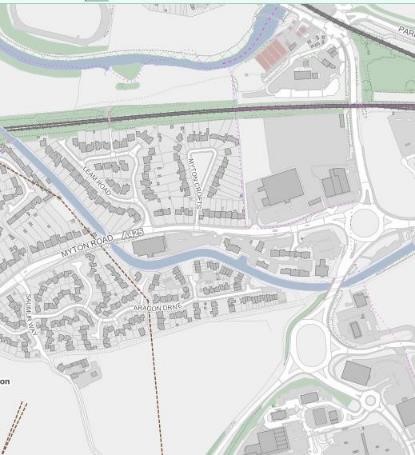
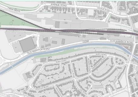
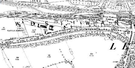
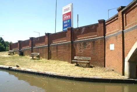
ORIGINAL BOAT DOCK IS UNDER ENLARGED ACCESS.
SUPERMARKET COULD PROVIDE SOME INTERPRETATION OF THIS PLACES FORGOTTEN PAST THE NAVIGATION WATERMILL,, BOAT BUILDING THE TRAMWAY, AVON POWER STATION ,KENCHES FLOUR MIL, FLEUR DE LYS PIES
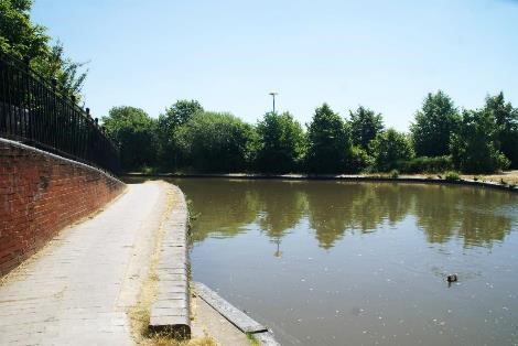
RAISED TOWPATH IS EVIDENCE OF THE NAVIGATION WATER MILL 1809
MOORINGS FOR BOATS TAKING ON PROVISIONS
PLANTING ON CANAL EMBANKMENT ENCLOSES VIEW AND IS A WINDBREAK
LAND FALLING TO RIVER 8 METRES BELOW
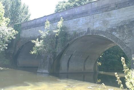
METAL STAIR CONNECTS CANAL TOWPATH WITH RIVERSIDE WALKS
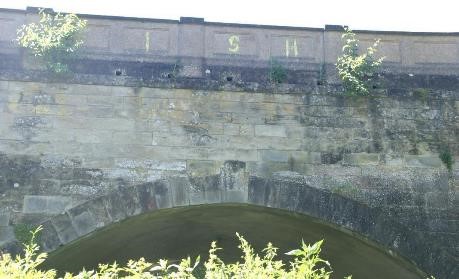
MAGNIFICENT STRUCTURE CARRIED WARWICK AND NAPTON CANAL SIX MILE BOTTOM POUND. FORMER MILL WATER FEED INTO AVON AT FOOT
PARAPET RECAST IN 1908 AND OFFSIDE HANDRAIL 1980'S
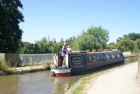
LEGACY OF INVESTMENT CANAL USED DAILY BY BOATERS,CYCLISTS,
RUNNERS
AND WALKERS OF ALL AGES
SIMPLE SURFACE TOWPATH, WATERS EDGE MARGIN, ENCLOSING HEDGE ALLOWS GLIMPSES OUT TO REMAINING COUNTRYSIDE IN THE TOWNS. INTENSIFICATION OF USE NEEDS TO RETAIN WHAT MAKES IT DISTINCTIVE, WHILST ALLOWING CYCLES/HORSES TO PASS – 1500MM PATH WHERE FEASIBLE. MAY INVOLVE REDUCING SOME ENCROACHMENT.
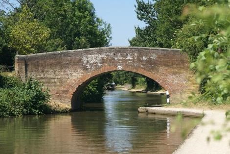
BRICKS WERE DUG AND BAKED LOCALLY TO FORM THESE SIMPLE BRIDGES THAT SPAN THE CANAL AND TOWPATH. RUBBUING STRAKE AT ABUTMENT PREVENTS GRIT IN TOW ROPE FROM ERODING BRICK ARRIS
METAL AQUEDUCT TROUGH SAILS OVER THE MAIN LINE RAILWAY THAT ALSO LINKS BIRMINGHAM WITH LONDON
ATTRACTIVE WATERSIDE SHARED SPACES FOR RESIDENTS
FOUR STOREY FLATS WITH ARBITRARY APPLIED CANAL FEATURES HAVE MISTAKEN THE LOGIC OF CANAL WAREHOUSES. WARM BRICK AND MODELLING HELP AND ADOPTING SOME OF THE RHYTHM OF SIMPLE BAYS. AND JOINERY SET BACK INTO OPENINGS. THERE IS A VERTICAL EMPHASIS
CANAL WAS DIVERTED FOR SOUTHERN EXTENSION ROAD, EUROPA WAY.
SPACE LEFT AFTER ROAD PLANNING IS AN OPPORTUNITY
NATURAL ENCLOSSURE MAKES AN ATTRACTIVE WALK NOW THAT THE OLD WARWICK ROAD IS NOT TREE LINED. CANALSIDE WALK NEEDS SOME WORK TO UNDERSTOREY AND TO LINKS. FLOATING GALLERY, CAFÉ,TRADING BOATS WOULD ESTABLISH A PRESENCE AND IDENTITY TO , MAKE IT FEEL SECURE
(1) 5 Old Town
Tachbrook Road Bridge 41 to Bridge 35 Radford Road
Grand Union Canal 1929 (Warwick and Braunston 1794 Act became Warwick and Napton 14th May 1796
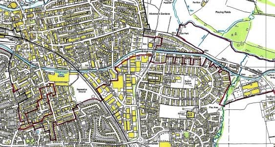
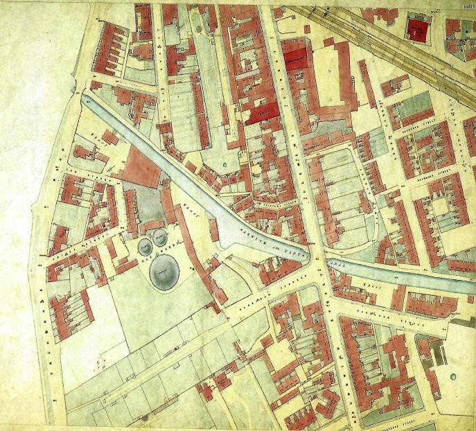
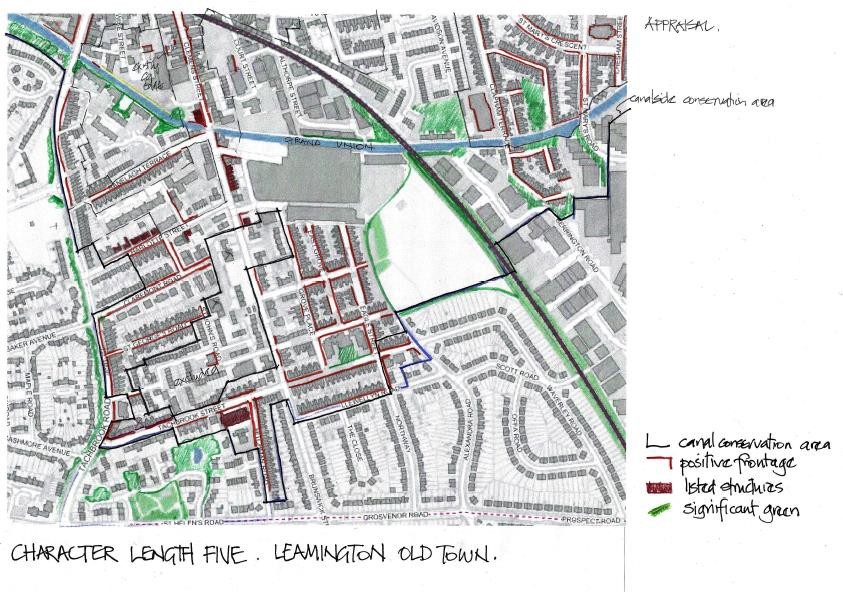
5 Old Town Leamington
Tachbrook Road bridge – Bridge 41 to Bridge 35 Radford Road Grand Union Canal 1929 (Warwick and Braunston 1794 Act to become Warwick and Napton Canal 14th May 1796)
The length between Tachbrook Road and the Radford Road bridge is about 2.5km of predominantly urban development, which has had a profound effect on the growth of Leamington as a settlement. As a consequence of this the conservation area joins that already designated. It is overlapping because the character and appearance is special both historically and in the opportunity a sense of place it provides for people to connect across the Southern part of the town.
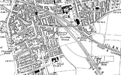
1900
On the towpath side the Canal Conservation Area extends up to the High Street and Radford Road in a series of blocks of around 150m deep. Brunswick Street stretches 700m South from the canal with lateral streets either side between Tachbrook road and the railway, the majority of which forms an important part of the old town of Leamington that developed around the canal.
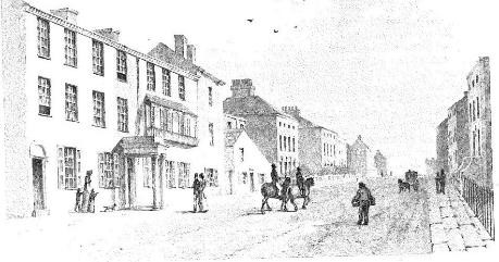
CLEMENS ST 1822
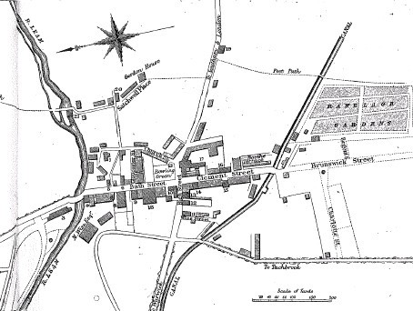
1813 PLAN OF SETTLEMENT AFTER CANAL OPENED – RANELAGH GARDENS BEFORE EAGLE FOUNDRY
Particular features are the former gas works, former Eagle foundry, Shrubland Street School and the residual grounds and mature trees of the former home for Incurables. In amongst this is a range of housing from the fashionable streets occupied by the likes of Lord Eastnor and others, that were rented for the season . to the workers housing around Eagle street, associated with Flavels as a major employer during the 19th & 20th Centuries
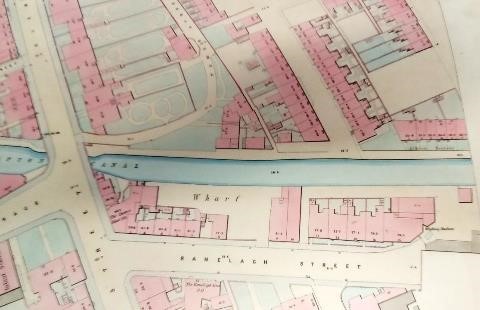
RANELAGH WHARF AND TERRACE IN RANELAGH STREET NOW CAR PARKING REF 1851 1:500 BOARD OF HEALTH MAPS LEAMINGTON LIBRARY
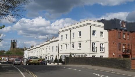
REPLACEMENT EASTNOR TERRACE IN TACHBROOK ROAD
The listed Eastnor Terrace forms the Western perimeter of the block to the West of Clemens Street; part of the central spine that runs right up through the heart of Leamington.
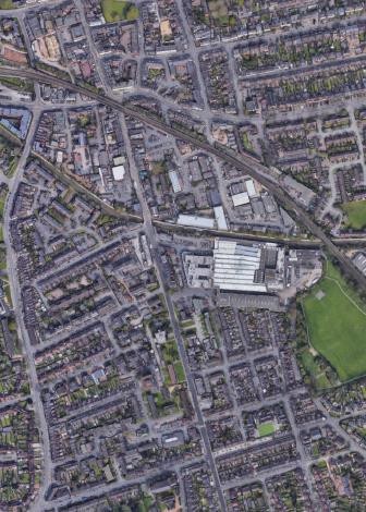
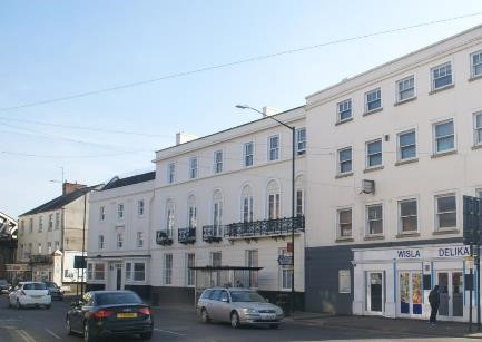
CROWN HOTEL
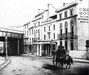
1860 AFTER RAILWAY ARRIVAL wcro
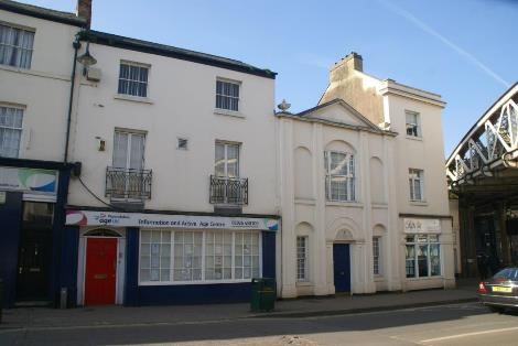
This block contained The Great Western and Crown hotels, Marble Baths, Theatre, Albion House and Albion Row; a terrace of smaller dwellings fronting the canal.
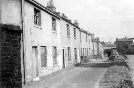
ALBION ROW TOWPATH FRONTAGE USED FOR ACCESS WCRO
Activity along this length and the connections into the town would have served the boating families as well as local people. Wise street and Wise Terrace were named after the Wise family who were considerable landowners in this part of town.
footnote WISE.
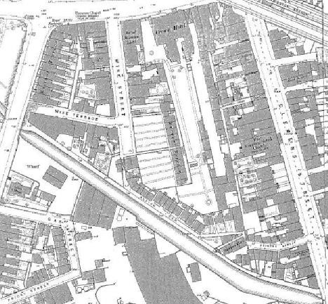
On the offside there was a wharf and the gas works developed from the 1820's onwards so that Ranelagh terrace which was intended to be laid out as an avenue leading to a villa at the West end, but was never completed.
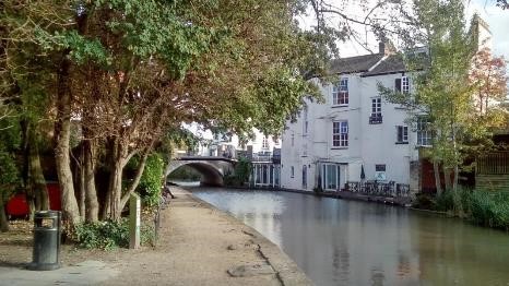
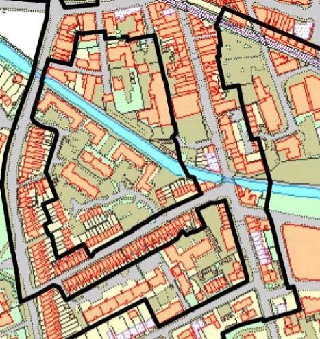
The form of the block to the north of the canal is shattered. Whilst Wise Street still exists, Wise Terrace no longer connects through to Tachbrook Road.
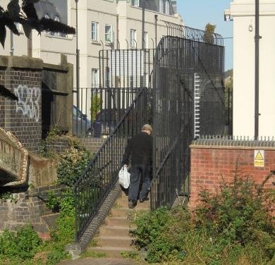
TACHBROOK ROAD ACCESS
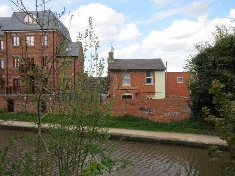
REMAINING WISE TERRACE PROPERTY
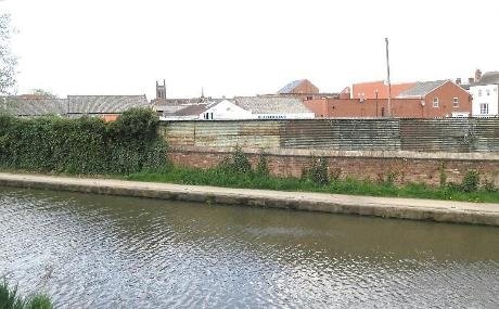
ORIGINALLY WISE STREET AND ALBION ROW, AREA NOW IN TRANSITION LACKS COHERENCE, PERMEABILITY CURTAILED, IMPACTS ON CHARACTER AND APPEARANCE OF CANAL CORRIDOR
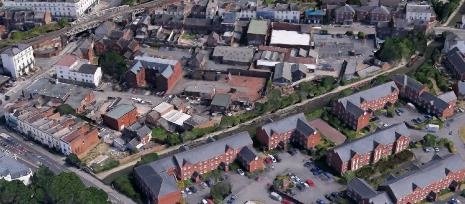
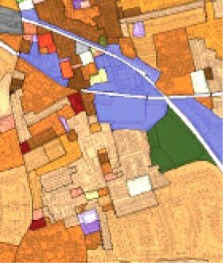

There are difficult elements such as the electricity transformer station, there are former works buildings used for both retail and there are some more recent housing blocks, but no real sense of urban form.
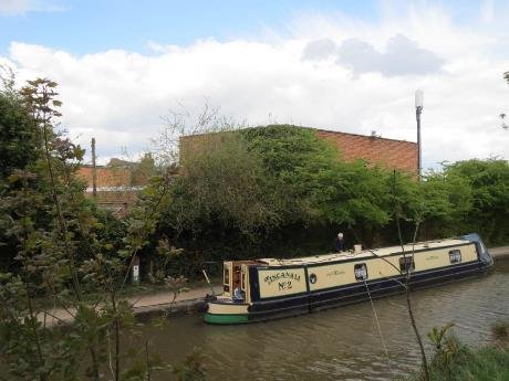
VISITOR MOORINGS LACK FACILITIES
A redevelopment of the Mercia metals site alongside the canal occupying the space originally known as Albion Row, could provide the opportunity to re-establish a more beneficial relationship with the canal as public realm. It should have an active edge to the canal, including some places where it is possible to stop and chat or sit in the sun, with views up and down the canal to watch the boats go by and to avoid presenting a hostile or bland façade to those people using the towing path and canal.
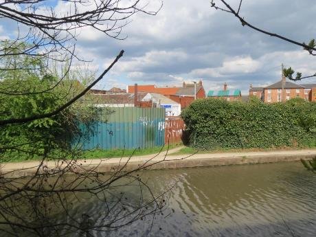
ALLEY LINKS BACK TO CLEMENS STREET
If the uses are gated to provide security then more positive links to the High Street and Clemens Street from the towpath will support the public realm. Ivy and small bushes have softened what is an currently an ugly boundary, but without the effective enlargement of the towpath margin the opportunity for a continuous green boundary is unlikely. Vegetation on the offside is a change from the former hard gas works use and provides a wildlife corridor for birds, bats and insects.
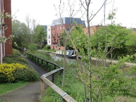
On the offside a mixture of 2 storey housing and 3 storey apartment blocks set out in a regimented layout aligned to the canal, has replaced the large gas cylinders. The lack of variety in building form, scale and detail has failed to take full advantage of the borrowed outlook across the canal, and one of the key considerations for redevelopment of the back of the towpath is that repeating this formula is at odds with the much more incremental way in which part of the town evolved with a north south alignment of buildings being more appropriate.
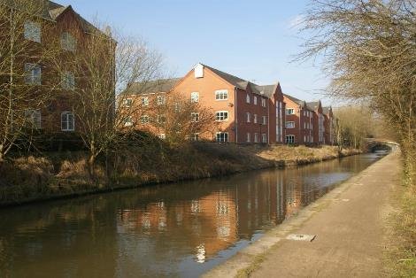
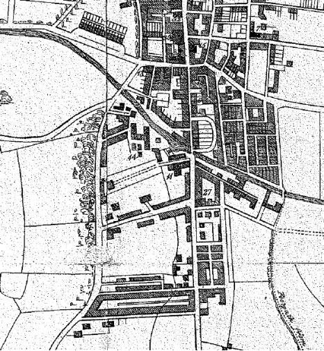
JOHN GEORGE JACKSON 1838
The street pattern running east to west follows the packets of the enclosure boundaries, Charlotte Street being the first of these. Either side of Brunswick Street the enclosure boundaries followed the line of Grove place to the east and a similar margin occurs on the west side. Charlotte Street was the first street laid out between Tachbrook road and Brunswick Street, again following the alignment of the east west hedgerows and this underlying pattern still exists.
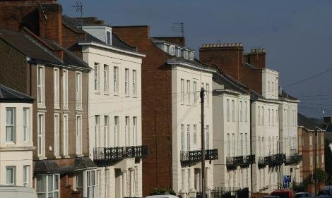
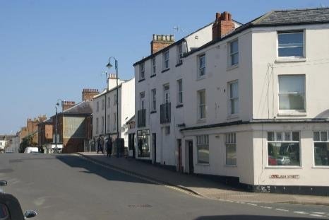
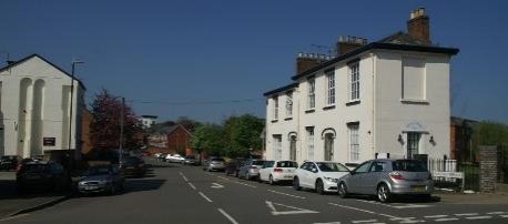
RANELAGH TERRACE SET OUT WITH TREES TO HAVE A VILLA AT TACHBROOK ROAD
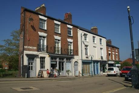
ACTIVITY IN LISTED STRUCTURE PROMOTES ENGAGEMENT WITH CANAL BELOW
West of Brunswick Street, the current conservation area boundary
picks up on the more obvious older buildings, particularly where
the joinery and roof materials have not been changed, but
ignores the overall character that makes up the area. There is
an argument that this restrictive designation approach suggests
that everything outside the boundary has little or no value,
whereas the sense of place is not quite so discriminatory, and
ignores the impact that inappropriate development can have on
the setting
A whole variety of different past activities, horticultural nursery, churches, workshops interspersed and enriched the residential grain.
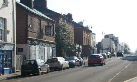
The area has grown up with parts of the streets being developed at different times and with different scale and pattern of building, which enriches the overall character of the area.
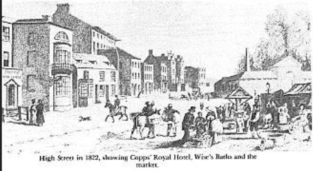
Where this has perhaps broken down is with the local authority housing built to replace sub-standard accommodation elsewhere, but particularly around Christine ledger Square and Radcliffe Gardens has disrupted the regular street pattern
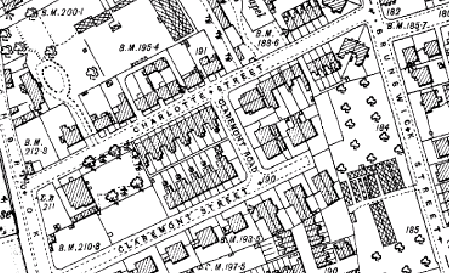
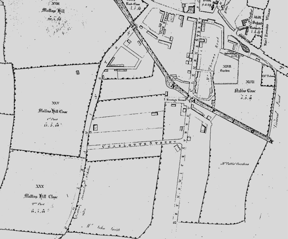
PATTERN OF STREETS FOLLOWS ENCLOSURE FIELD BOUNDARIES
Mr Cullis's Leamington Pleasure gardens were named after the
Ranelagh Gardens alongside theThames, where Georgian society
mixed.
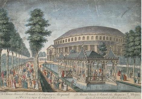
"The Vauxhall of Leamington," 1811-1846
In A Complete History of Royal Leamington Spa in 1901, Dudley wrote, "Under the care of Mr Cullis, the Ranelagh Gardens reached the zenith of their prosperity, and for years they were the resort of visitors, for whom a band was engaged, to discourse popular music. On gala days, they were the chief attraction, and in the evenings there were, after 1821, fireworks, balloons, etc." Ref Leamington History Group
At the south end of Leamington beyond the bridge over the Warwick and Napton canal are Ranelagh Gardens the property of Mr Cullis which consist of about ten acres laid out in fruit and pleasure gardens walks and shrubberies with hot and green houses These gardens furnish a delightful and agreeable recreation to the visitors of Leamington and on evenings when there is no performance at the theatre an excellent band of musicians attend and the walks arbours and seats are then crowded by a vast concourse of fashionable company. 1821 Francis Smith, Warwickshire Delineated.
THE RANELAGH GARDENS Are situate in the old town over the Canal bridge in Clemens street at the extremity of Ranelagh Street. Under the superintendence of their present proprietor Mr Cullis they have received every addition that taste or ingenuity could suggest and they cannot fail to impart pleasure to those who may be disposed to visit them The range of hot houses three hundred feet in length contain an excellent and extensive collection of exotics and the are classified in a similar manner to those in Jardin des Plantes at Paris There is also a conservatory attached. Becks Guide 1840 Ref Christine Hodgetts
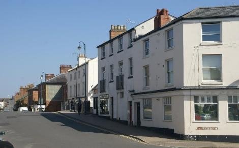
South of the canal, East of Brunswick street development of the first block up to Grove place, again responds to the enclosure field boundaries.
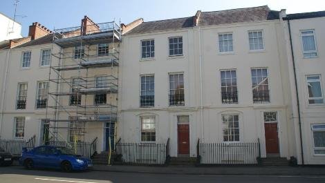
Moving south from the bridge, 3 storey town houses as far as Clarence Street are of a form and style that is familiar further up the spine, brick built with stucco fronts and taller first floors, the piano nobile, [listed ON PLAN AND IN GAZETTEER-] as was the West side prior to its redevelopment.
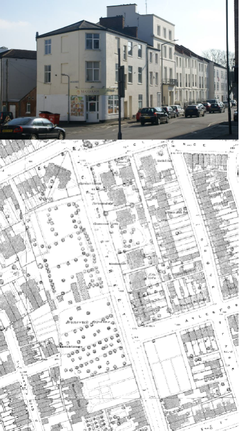
Between Clarence Street and Aylesford Street, Clarence Cottage, Erin villa, and Brunswick terrace remain whilst the rest of the block has been redeveloped post second world war. Between Aylesford Street and Shrubland Street, with exception of a few terraced houses, there is little older stock.
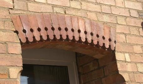
DETAILS OF HOUSING THAT CHARACTERISES CANAL CORRIDOR IN OLD TOWN
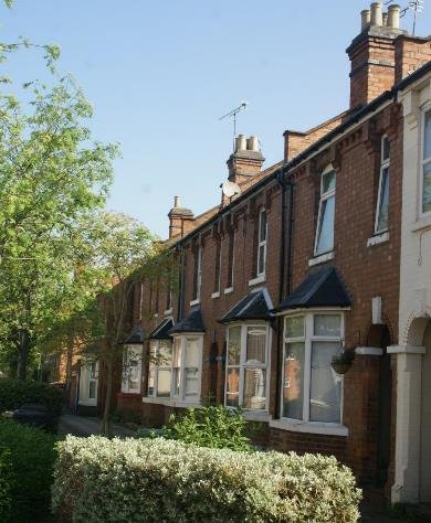
ALTHORPE STREET WAS CLEARED WHEREAS THIS COMMUNITY WAS LEAMINGTON'S FIRST GENERAL IMPROVEMENT AREA AND RECOGNISED THE VALUE OF THE PLACE
In the blocks East of Grove place; Eagle St and East Grove, the terraced housing remains in the form established in the Edwardian and Victorian times and is a coherent set of street blocks. Quite a lot of decorative detail; terracotta bricks, dentil & string courses, chimneys and bay structures, even where these have lost their timber joinery, are important characteristics of buildings of this time and scale. Measures to reduce the impact of the car, introducing street trees and places to sit and play, has changed the appearance of the public space, but as a result they are not dominated by cars like so many other terraced streets of this age.
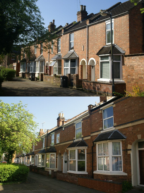
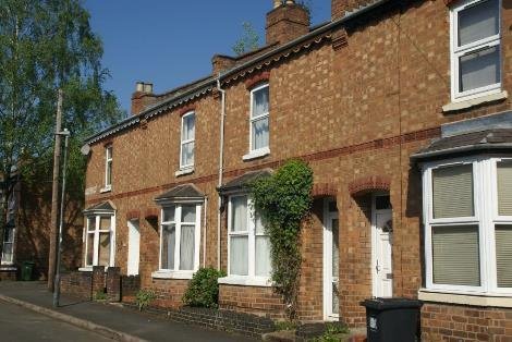
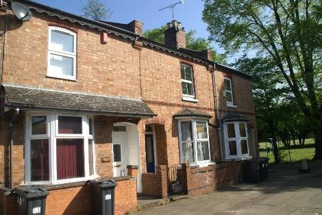
Shrubland Street retains its Victorian character as a Community School.
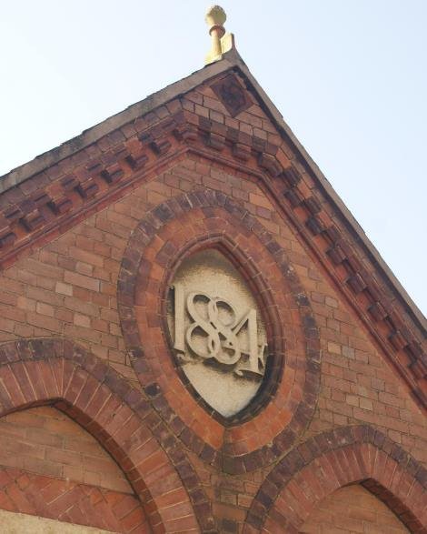
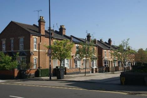
A typical block of pre first world war terraces lies between the school and Llewellyn Road.
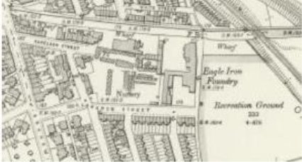
Ranelagh Street mixed large town houses with active waterfront wharfage. Most of this has now gone
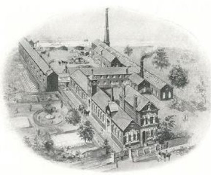
EAGLE FOUNDRY ALONGSIDE RANELAGH NURSERY GARDENS
At the end of the Street as far as the footpath that ran from Whitnash to Lillington, was Ranelagh gardens. Ranelagh gardens was 10 acres of pleasure gardens including greenhouses and hothouses for the botanical collection laid out in 1811. On gala days they were and attractive venue with fireworks, balloons, music, and attracted both the wealthy visitors to Leamington and local people. There were public walks and shrubberies, according to bisset's guide – see text box for details. The North eastern corner was developed by Mr Carter as a foundry in 1834 building up to the Whitnash brook. After Mr Cullis the nurseryman's death in 1849, the remainder of the waterside seems to have been more for wholesale nursery use and is marked on the 1880's plan as Ranelagh cake mills – presumably – cattle feed. Sidney Flavel expanded into the foundry in April 1856 and an illustration of the time shows the wharf cranes with his kitchener works and Flavel's boats, bringing materials to the site.
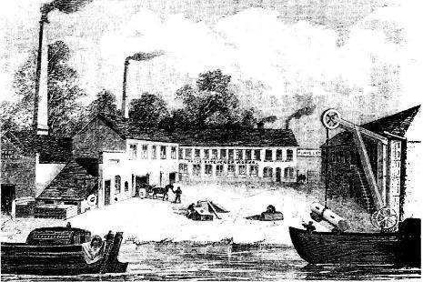
Housing on Eagle street and East Grove then takes up the rest of the gardens site and by the 1880's (first edition OS) the street pattern is established as far as Tachbrook Street.

This is ample reason to establish this as a Conservation Area,
based on its historical significant both in architectural form
and in relation to significant figures in the town's history.
This is not only the Flavels, who went on to provide both
leadership and employment to many local families, also Mr
Cullis, responsible for planting out the Jephsons and other
greening of the new town, but finally William Carter the iron
founder is also responsible for much of the decorative ironwork
that
dressed William Thomas's beautiful Leamington buildings. In addition John Hitchman moved from Banbury to Leamington in 1840 to parish Surgeon. He first lived in Clemens Street and was responsible for establishing an arboretum on Tachbrook Road as a public garden and nursery. He was a tireless personality, combining a desire to help the poor and beautify the town through trees and gardens. He with Cullis's help established a labourer's fund creating gravelled walk and planting trees in the gardens, streets and squares of the town whilst giving work to the unemployed.
[The story of Jephson Gardens and Mill Gdns C Hodgetts and R Stott]
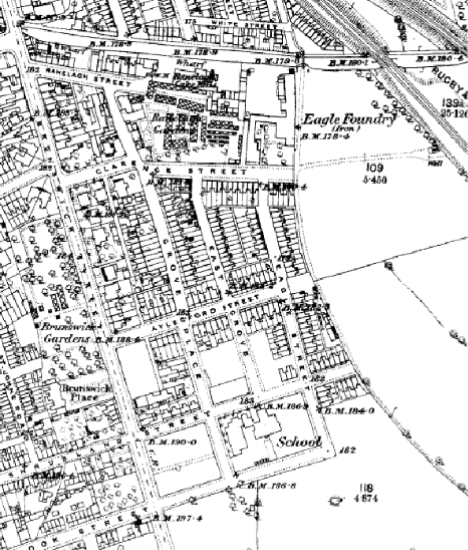
In 1898 the Eagle recreation ground was laid out by the Corporation as 5 acres of open space on the land up to the rail embankment. This was later extended as far as Shrubland Street.
The block between the High street and the canal, East of Clemens Street bridge 40, as far as the railway crossing, consists of a number of buildings of significance in the early development of the town.
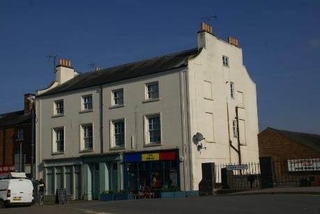
CLEMENS STREET ACCESS TO CANAL
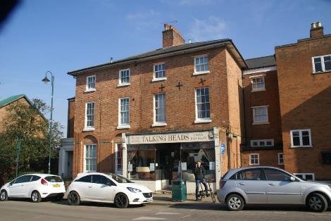
The Warwick Advertiser announced in 1808 that John Webb a Birmingham builder was to lay out a new street from the village to the canal. That brick kilns (in Court St and grove Place) were opening
nearby and that as the canal went through the land, 'building materials were easily conveyed to the site'. This recognises the benefit that canals brought to the movement of heavy goods. The first house in Clemens Street faced North at the junction with High Street. The east side of the street was built first with Booth's terrace adjacent to the canal built in 1813 and the whole street completed by 1818. Baths, hotels, chapel, library and residential properties fronted the street with shops and courts of dwellings, stables and mews adjoining. South of the canal were houses in upper Clemens Street- now Brunswick street and along the busy navigation, wharfage for coal. The arrival of the canal had facilitated the development of the fashionable spa.
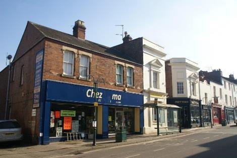
The land at the rear and to the East of Clemens Street, the Stoneleigh arms and other establishments was used for stabling to support visitors who first arrived to take the waters.
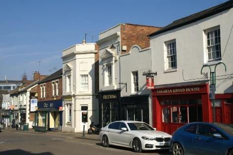
The Blenheim hotel in Clemens street opened first as the Oxford hotel when the street was one of the most fashionable in the Spa. It was renamed in 1822 when the Duke of Marlborough stayed there. The Stoneleigh arms was the tap room of the hotel, the rest being converted into houses and afterwards shops.
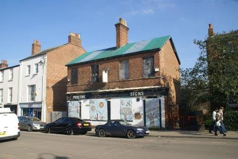
Proberts' Orange hotel was also in Clemens Street. Copps Royal hotel on the junction of Clemens St and High St, was visited by the Prince Regent in 1819, although subsequently demolished with the coming of the railway. This substantial hotel had 100 beds and stabling for 50 houses and 40 carriages. At the house warming dinner June 1827, 250 patrons sat down under the chairmanship of Mr John Tomes, chairman of the canal companies. None of these buildings are currently listed and so a full evaluation for local listing should follow.
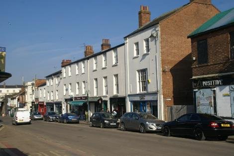
By 1831 the town had evolved from a small village on the canal and had risen to over 6000 people. Viscount Eastnor MP, Capt. Somerville and others led proposals for a Town Hall and petty sessions. Land was given by the Earl of Aylesford and by the Wise family. The builder was a Leamington man John Toone and the architect John Russell, a member of the Duke of Bedford's family, whose family interests in the developing town are reflected in the names including Tavistock Street and Covent Garden. The Town hall, on the High Street, continued to be used for over 50 years, then becoming the police station and is still in use today by the Polish community and others.
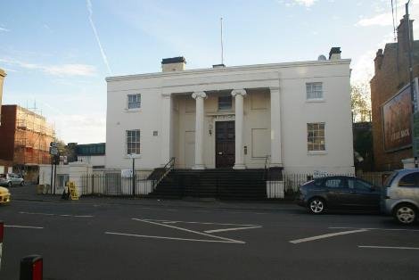
Between the Town Hall and the canal, Court street and Althorpe street were laid out parallel to Clemens Street as much smaller artisan dwellings, densely occupied, probably with workshop activity in amongst it. Terraced houses ran either side of Althorpe street, together with side streets, Moss Street, Wise Street, Neilston Street . The houses fronted directly onto cobbled pavements, at the rear were common 'courts' or yards shared by several houses, with an outside shared toilet in the 'court' with laundry being washed outdoors and a series of criss-crossing washing lines. 1841 Census (England and Wales) shows 250 men women and children living in Althorpe Street.
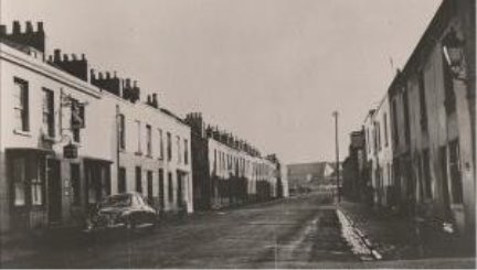
The railway to the district was first only permitted as far as Milverton, due to the opposition of landowners including the Earl of Warwick, who had been a supporter of the canal. To link back to the main line at Rugby involved extending the existing line to Avenue Road, not far from the centre of Leamington, and building a small station. A bridge was also needed over the junction of High st and Clemens st, which required the demolition of Copps' Royal hotel. in 1852 the Oxford and Birmingham junction railway built to link the Great Western railway at Oxford with Birmingham, constructed a second bridge as rival companies used different gauges. Leamington Station on this line opened in 1852 having been built on the site of Eastnor terrace.
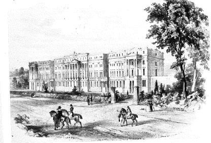
In sept 1935 GWR knocked down the old Brunel design and erected the present one. The railway was built on embankment to cross the canal as well as the High St. the Rugby route has since been partly removed, leaving an abutment on the south bank of the canal. According to Pevsner this railway route effectively separated the original town along the canal from the new town that was emerging North of the river Leam. The railway sweeping through on arches very much compromised the original orderly grid.
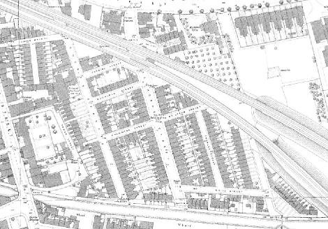
The railway incursion meant the block on the east of Althorpe St
from the Town Hall was disrupted and Moss St wedged in. Radford
villa occupied a generous plot with orchard. A substantial
terrace fronted the High St and subsequently Camberwell terrace
infilled behind on what was a sand pit.
Whilst on the High Street side of the railway, shops and residential uses are retained, the railway arches and post 2nd world war workshops are part of the deliberate planning intention to remove housing that was considered unfit. This changed both the character and appearance of the area.
Previously Court Street and Althorpe Street had opened onto the towpath, and Albion Terrace, Warneford terrace and Ashgrove place, had faced South, looking over the waterway and the former pleasure grounds and wharf activity. More recently a large new block of student housing for nearly 200 residents has been introduced on the canal frontage. This goes some way to restoring some of the qualities that the area previously enjoyed, although the necessary controlled access to a large block is quite different to having lots of front doors and activity on the street.
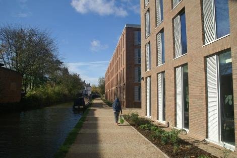
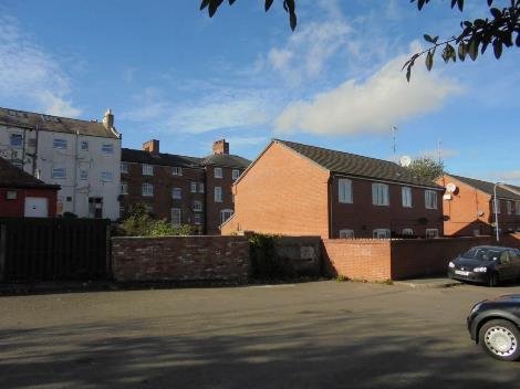
The land up to the High Street from the canal should all form part of this conservation area, recognising the impact of the 19th century railway on the evolution of the old town from its beginnings in the late 18th century. Visitors arriving by rail from London have an elevated approach that reveals the grain of this part of the original town more so than those arriving by water where over the past 60 years the town has turned away.
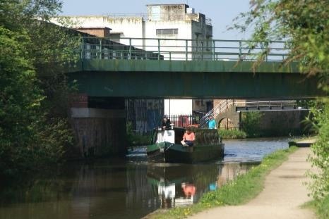
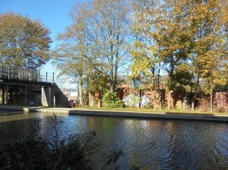
The ladder bridge marks the historic route from Lillington to Whitnash and can be followed under the railway arches to emerge in Camberwell terrace where crossing the high street it continues North up Forfield place. On John Taylors plan, dedicated to the Earl of Aylesford, lord of the manor, a canal crossing is shown which predates the current ladder bridge structure. This was an important route on foot, crossing the Leam at the Mill before the river was modified. Having survived over 250 years of change, this route needs to be kept.
REV FIELD 1815
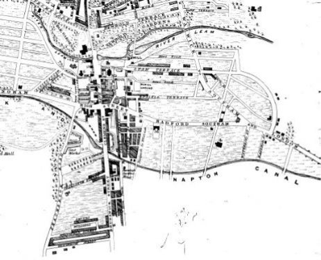
The railway girder bridge is a distinctive element on this stretch, whilst the abutments left by the former rail line to Rugby tell us something of the past infrastructure that served the town.

FORMER CROSSINGS BY CLAPHAM TERRACE SCHOOL
South of the canal a Malthouse sat between the former railway crossing and Clapham Terrace bridge facing the waterside. To the east of the bridge a pocket of land was subsequently developed as an enclave of two storey terraced housing; Clapham Terrace and Clapham Street and an inlet basin with wharves was introduced which remained until late 20c when St Mary's Road was extended with a new bridge to serve industrial development on what was allotment land and Sydenham farm further east. St Mary's bridge is a more modern structure and the leftover space on the southern side is perhaps an opportunity for enhancement.
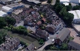
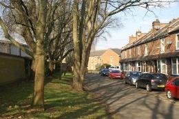
CLAPHAM TERRACE SOUTH OF CANAL
The proposed canal corridor conservation area should encompass this area and the residential enclave, Clapham Street and its communal green. This area is likely to respond to the uplift in value and it would be possible to explore whether a re- introduction of water space, to compensate for the missing basin, should be part of the change
The pattern of use on the south side has substantially changed. The land between the railway and Sydenham drive was infilled with industrial sheds. This area is currently in a state of change as the industrial sheds give way to new residential. The demand for housing has outstripped that of employment use, and there is a potential for further change in the medium term, bringing with it the need to address the new residents relationship with the waterway as an attractive edge. A creative approach to development here; particularly a better relationship with the canal would be beneficial.
The canal provides a greener, quieter route through town and has the potential to link open spaces on both sides. Eagle Recreation Ground; purchased as a People's Park by Leamington Corporation in 1900, would benefit from an improved relationship with the canal and there is scope for a waterside link under the railway embankment to land to the East.

There is an intimate canal side garden and barbecue space on the offside at Clapham Street. It sits opposite the playspace on Rushmore Street which includes a seating area facing south overlooking the canal.
The whole southern bank from here through to Sydenham Drive has established tree cover acting as a wildlife corridor, which presumably will be retained in the scheme for residential redevelopment currently underway.
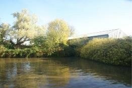
To the north of the canal up to the Radford Road the land is predominantly residential. The Map regression starting with the OS first edition shows development already established around St Mary's Church.
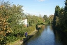

Looking south to canal over Warneford Hospital site
The cottage hospital and Warneford hospital had been built on the site of the former poor law institution, but this has now been redeveloped as housing. A gateway access from the canal towpath links to a green space. Traditionally this site was well planted and new suitable planting could add to biodiversity along the fine brick boundary to the school.
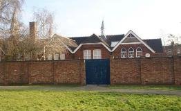
Listed structures set the tone of the area north of the canal. By the second edition Clapham Terrace school is built and the militia have gone from Clapham Square to Budbrooke. The avenue of trees stretching from Radford Road to the canal is thus curtailed and becomes hidden behind terraced houses on west side of Clapham Terrace

1838 PLAN FOR WILLES BY J G JACKSON
The other avenue; St Mary's Road, set out on Willes's land south from his Newbold Comyn house on the north side of the river towards Whitnash church, is populated by larger houses. Rushmore Street, Chesham Street and the first established street; Waterloo Street, have smaller dwellings and therefore a finer grain. This contrasts particularly with Eastnor Grove a series of much larger villa dwellings in substantial plots, whose boundaries reach the canal, but deliberately had no connection with it.
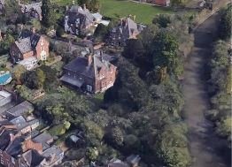
The prevalent roofing materials are slate, with some use of concrete tiles as a cheaper replacement. So far there is a small take-up of PV. The smaller houses are walled in brick, some painted and use of stucco. This is predominantly on the frontage elevations to St Mary's Crescent and St Mary's Road and those fronting the eastern side Chesham Street. Apart from the stoned up towpath surface most of the floorscape is tarmac.
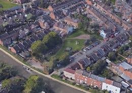
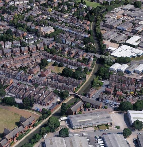
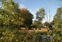
The Experience of moving along the canal corridor is essentially linear, with longer views being to bridge crossings and out between canal side dwellings or the enclosing trees, although generally the focus is on the canal and activity along it. Land either side is flat with the railway embankments and arches therefore quite dominant.

CLAPHAM TERRACE BRIDGE 38
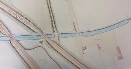
The canal by contrast acted as a linking element which complemented the turnpike route from Warwick and directly served numerous wharfs that have since been lost, as the activity on the water changed to leisure purposes. The canal in use for moving heavy goods by foundries like Flavels , timber, stone, coal and gasworks traffic would have had a different character to today, but the essential integrity of it as a historic structure remains. It is the uses that continue to evolve, including as a long distance walk and cycle path, as well as a waterway link to London. Evidence of the value to the local community is seen in the local groups who have adopted it and who help maintain its appearance; litter picking, planting and the like.

Use of the canal after dark introduces elements that could change the character. Some low-level lighting preferably of the face of buildings could be introduced to offset feelings of insecurity amongst some users, however care must be taken not to over illuminate as this has a deleterious effect on bats using the corridor as a route. Equally though the sparkle of individual lights dancing on the surface of even relatively still dark canal water can be part of the intrinsic charm as anyone who has been to Venice or Amsterdam will attest. Increasing activity is a key element in safety, so developing the connections and improving accessibility both physically and through greater awareness of the length as part of daily journey to work or school.

Access points to the towpath are limited to Clapham Terrace and Sydenham Drive on the south side. Some streets on the northside were cut off during General Improvement Area works towards the end of the last century and these might be revisited.

There is a lack of active edge apart from Rushmore Terrace in the lee of St Mary's roadbridge.
This length is not secluded, but apart from St Marys and Sydenham Road bridges, traffic noise is mainly from the Chiltern line trains.

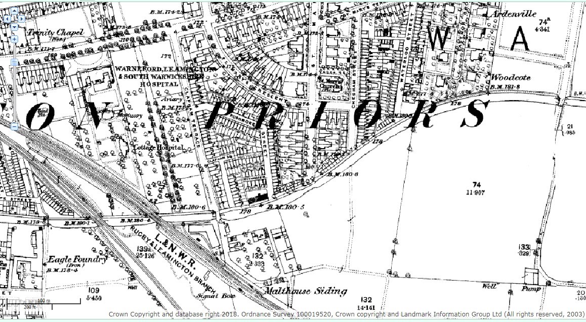
1880 1st edition ordnance survey
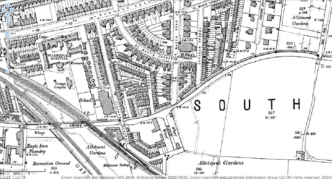
1906 2nd edition ordnance survey
EAGLE WHARF TO SYDENHAM DRIVE Wharfs along the canal on the north side gradually were built up. A new basin appears opposite Rushmore Terrace whilst Sydenham farm and allotments give way to sheds . The basin disappears along with the second railway infrastructure and that route east to the countryside is lost to development.
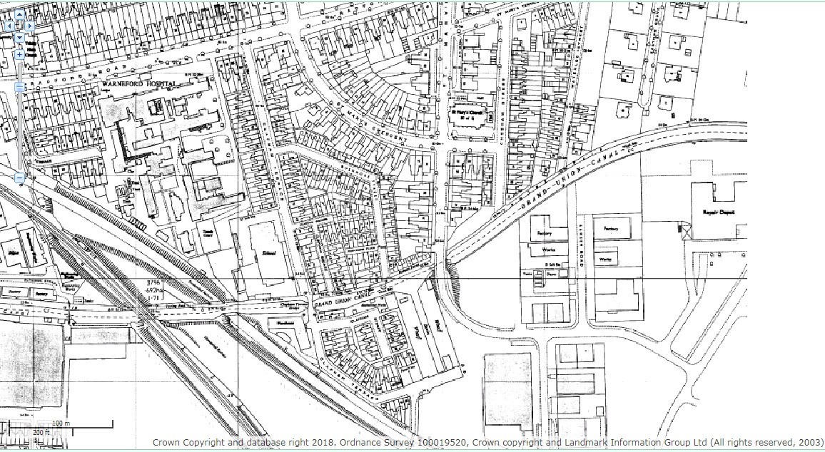
1980-92
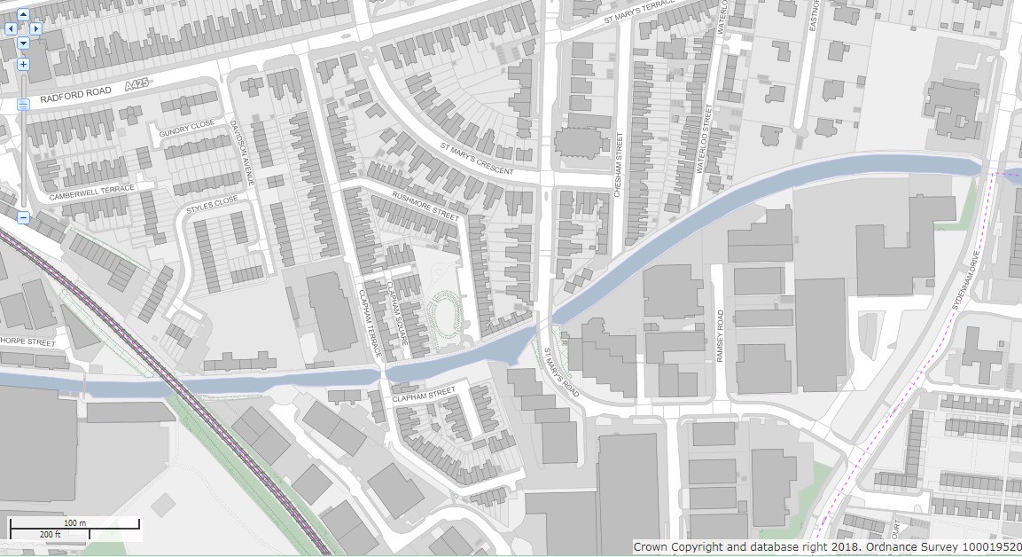
2018
Source Warwickshire Historical & Current Maps available on line
The 1850's Board of Health map shows the proposed streets across the canal that were initially laid out for development. Jackson designed St Mary's in the fields to encourage this growth to the east along the canal.
Rushmore Terrace which takes its name from the farm across the canal, is an example of some of the past waterside development at the end of St Marys Road. Old plans indicate something similar before the old peoples units were slotted in. Before the road was extended in the twentieth century, there was a basin opposite and then allotment gardens. The opportunity to recapture some waterspace in the future should be
considered along with the siting on the axis of St Mary's road, REF JG JACKSON 1841 PLAN a vista that originally stretched from Willes House to Whitnash Church.

1925 REVISION OS
Under the enclosure award of 1768, the Wise family of Shrubland Hall got 170 acres of land extending towards Radford Semele to the east of the settlement. This included the land for Sydenham farm, and the cottages which belong to the farm appear on 1887 Ordnance survey.
There is also a polo ground , established in 1884, that lasted
for 30 years, to the south of the farm. It was managed by the
farmer, Joseph Stanley, who leased the farm from the Wise family
until 1920's.
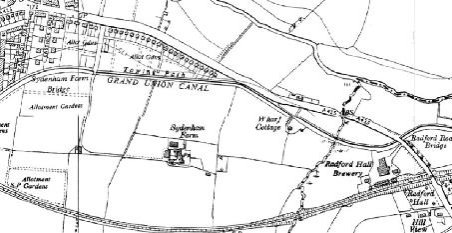
1950 EDITION OS

Ref Sydenham history group
The aerial view taken in the early 1970's is of the two principal roads with new bridge crossings over the canal and the line of the abandoned railway to Rugby. The employment land between St Mary's Road and what was originally planned as the town's eastern by pass, Sydenham Drive, ran alongside the canal. It included the Ford main dealer Soans who opened in 1967 and also in 1969 Elizabeth the chef's, an operation at its peak employing 350 people, supplying the supermarkets as well as shops throughout the district. 50 years on much of this is now being turned into housing land. The canal borders the current Leamington Conservation Area. The potential impact on the character and appearance on a Canal Conservation Area is considerable.
There have been at least seven wharfs and two basins along the old town stretch on this offside bank.
There was also a waterside facility for youngsters, named The Landing Stage, in what had been the Maltings. Space within one of the various redevelopments should be made available to support community use, particularly if it engages with the waterspace as well as enjoying the other benefits arising from the legacy of the construction of a canal.
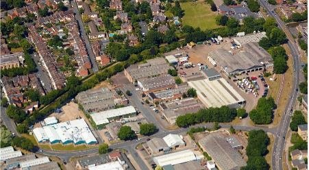
The employment sites on the offside of the canal that were part of the development of waterside allotments and Sydenham Farm in the latter part of the twentieth century had a screen of vegetation along an embankment that planting is to be largely retained now that they have become housing land .
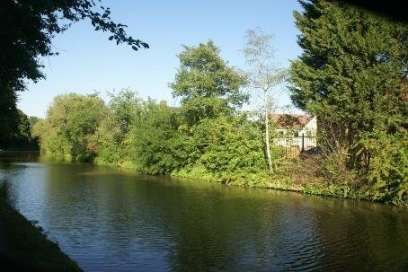
There is a margin for a sewer that sees the housing set back. The western block has balconies and openings facing the canal and the laying out of a wildflower grassed area between the apartment block and the canal as a communal amenity space. The retention of existing trees and planting of dogwoods, hawthorn and blackthorns, this should help to maintain an appropriate informal character adjacent to the canal.
The site sits higher above this stretch of the canal (53.8 water
level - land 54.5
survey levels - apartments 55ffl) as such it was not considered
by the developers to consider moorings -ref Design & Access
statement, as part of their proposal. Given the landscape margin
along the water edge a more active frontage onto the canal
offside might be suitable.
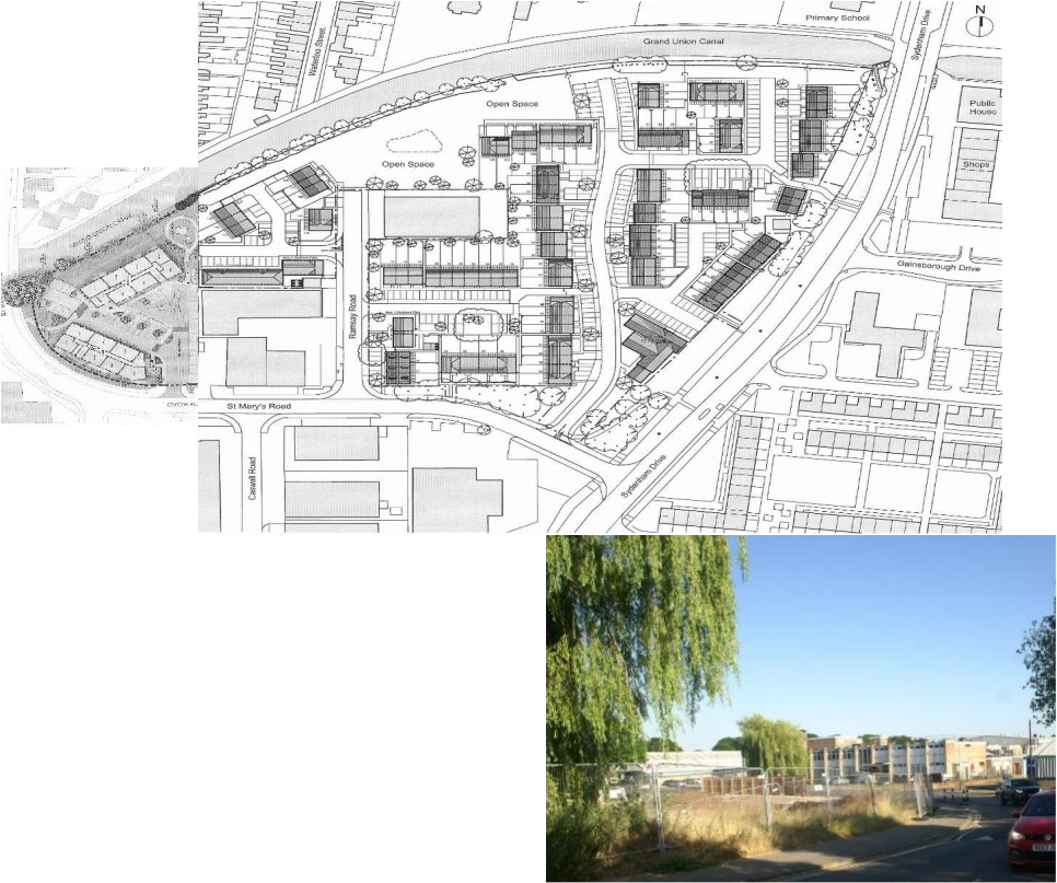
The open space is welcome alongside the canal and the layout supports movement to and through the space. However the western portion which has two blocks of apartments and the waterside margin is semi private space means that the pedestrian route is taken out to St Marys Road to go around this and then over the canal bridge, so is diminished in value as it loses connection. A mapping of the pedestrian movement framework along the canal corridor might have revealed this issue. There are still some residual employment uses including a kitchen retailer.
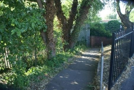
The pedestrian underpass route under the Sydenham drive canal bridge emerges alongside the new open space margin.
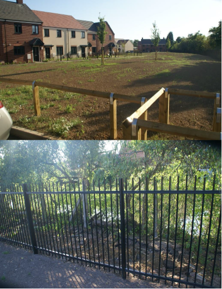
Discrete, safe and appropriate boundary treatment
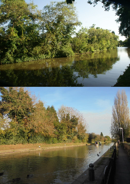
The rest of the length from Stanleys Bridge( rebuilt as Sydenham drive) was used to provide new housing for the town. The allotment gardens to the north of the canal were used for a school and Cowdray Close a strip of 14 semi-detached houses back onto the canal towpath poorly sited so that as the land falls towards the west the space between the towpath hedge and the private garden is reduced.
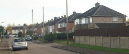
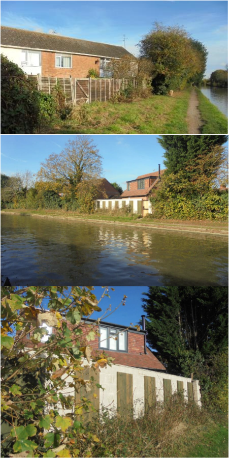
This has resulted in some unfortunate boundary treatment that harms the canal, particularly beyond the hammerhead.
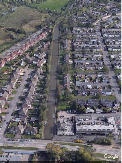
Numbers 1, 3, 5& 7 Sydenham Drive were built as cottages for farm labourers in 1950. The old bridge on Stanleys Lane was replaced and the new road named Sydenham Drive built in 1964, when work began on the new estate for 2500 people. Local builders AC Lloyd engaged the famous architect Frederick Gibberd at the behest of the Leamington Society, who were critical of inadequate and monotonous post-war developments in Lillington and Whitnash. Footnote Gibberd
Appointed in May 1962, Gibberd said, "I am not sure I am at all the right person to do this job for you because, being interested in urban design, what I would really like to see built is something as splendid as Old Leamington Spa; whereas what the public properly wants is rows of detached and semi-detached houses all of them different". By 1967 the estate having become established, he was able to say quote it was becoming a small neighbourhood and not just another housing estate." Sir Frederick was knighted in 1967, having set up his practice in 1930 and published books on town design and visual planning. He died in 1984.
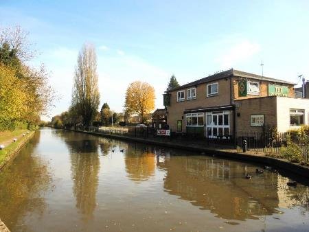
Offside east of Sydenham drive with neighbourhood pub and shops
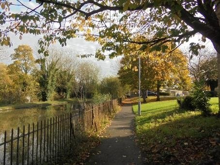
Gibberd's masterplans for places like Harlow gardens as here, demonstrate his appreciation of landscape in placemaking . The waterside walk is a benign route, fenced so that adults can rescue anyone in difficulty. The walk links to the green lanes that run between the housing blocks and extend the connection to the Historic Canal. The public realm embraces the water with vistas up and down the canal.
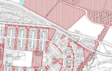
The estate is illustrative of the changes to urban areas wrought by increasing cars, crystalising in the Buchanan Report, Traffic in Towns. Radburn design housing is a concept for planned housing estates, derived from the English garden city movement and culminated in the 1929 Radburn estate New Jersey USA, a National Historic Landmark . When Clarence Stein was commissioned in 1929 to design a Masterplan for the Radburn estate he set out to build a 'garden city for the motor age'. The housing layout used at Radburn was to create a pedestrian circulation system that allowed people to walk to the local centre, park and the school without the need to cross a road. It did this by the simple expedient of super blocks 300m by 600m with a series of cul-de-sacs pointing into the
centre of each block. 'Traffic in Towns' called them environmental areas. These cul-de-sacs provide car access to the front of each home while a separate pedestrian network links to the back gardens via which residents can walk through a central area of open space to local facilities. The concept was turned inside out in Britain, whereas the houses in the original Radburn faced onto a street, British planners decided to turn them around so that they fronted onto the pedestrian network with cars relegated to rear parking courts beyond high 'rear' garden fences, these were seen as vulnerable to crime.
The estate is a good example of comprehensive design to address the impact of the increase in car ownership and the noise, fumes, severance and visual intrusion this brought. Not least it was in response to the risk to children of sharing movement frameworks at a time when fatalities were increasing.

The benefit of this design approach along the canal is that there is a public realm and activity alongside the waterway, as well as trees and bushes.
Anyone living there can make walking part of their daily activities. The number of dwellings with at least a partial view of the canal corridor is two to three times that of Cowdray Close on the towpath side, where back gardens abut the boundary hedge.
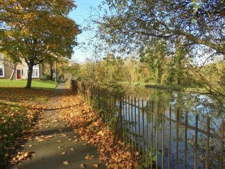
Bridge 36 linked the Radford Road to Wharf cottage on the offside and to the lime kilns, and is known as Gullimans Bridge. The Sydenham estate housing and Gullimans Way mark the eastern extent of Leamington Spa. The towpath here is a metre and a half above the road and there are vistas out to the comyn. Wharf cottage was demolished to make way for AC Lloyds development and the lime kilns disused.
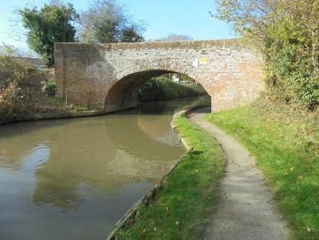
There is some further infill housing alongside Gullimans Bridge before the brook acts as a green boundary. The brook passes under a brick aqueduct on the canal, before passing under the road and feeding into the Leam.

At Wharf cottage, one occupant was Harry Godfrey who ran lime kilns using lime stone brought by boat from Stockton to Gullimans's Wharf, where it was burnt for use in building and to improve farmland. There were further lime kilns at Emscote and Guy Cliffe wharfs. Coal merchants were based in the town at Eagle and Ranelagh Wharf.

Radford Hall Brewery and a now dismantled railway completed the length to the east as far as Radford Road. There is now a modern engineering complex on the offside occupying the former brewery site, it with the wooded valley to the west.
Access to the towpath here could be beneficial. Radford Road Bridge 35

(1) 6 FOSSE
Radford Rd bridge 35 to Welsh Rd bridge 30 locks 23-18 7.5km
Grand Union Canal 1929 (Warwick and Braunston 1794 Act became Warwick and Napton 14th May 1796
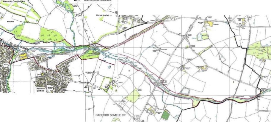
6 FOSSE
Radford Rd bridge 35 to Welsh Rd bridge 30 locks 23-18 7.5km Grand Union Canal 1929 (Warwick and Napton Canal 1794)
The A425 to Southam, the Radford Road crosses the canal and marks the start of this length. The road bridge is undistinguished, with metal parapets and crash barrier marking the transition from town to country . The wooded margins of Newbold Comyn register the amenity space to the North.
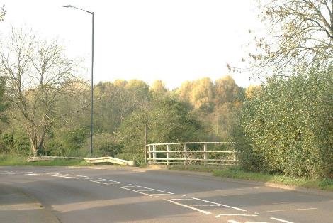
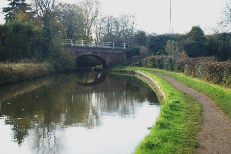
WEST TO BRIDGE
The bridge below the road deck retains the original red brick from 1795, when 20 men were taken on to dig clay to make bricks for the canal works.
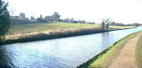
CHURCH AND HALL ON RIDGE
The land falls north toward the river and so the canal is banked up above on the towpath side. St Nicholas church and Radford Hall sit above the canal.
Radford Hall was built in the 17th century and remodelled in the 1800s by William Thomas, architect of some of Leamington's best buildings. The hall has since been converted into flats, with development in the grounds.
Together with the church of St Nicholas, restored following a major fire, and the former vicarage, the Glebe house, these form an attractive group of listed buildings. Newly developed houses at Church End and in the grounds of the Hall and Radford Hall farm complete this original part of the settlement . It is thought possible that a medieval village existed here.
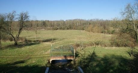
WEIR TO LEAM
This character length is the end of the five mile pound. As well as locks and bridges it includes weirs to take the surplus water to the river leam that is close by.
EAST FROM BRIDGE
Open views out in both directions accompany the move into the rural part of the district, with towpath hedge and soft margins to the water masking the concrete planks that retain the bank and protect it from the erosion from passing boats. A drawbridge some 300 metres from the road was here in the 1890's, but disappeared during the creation of a wider channel in the 1930's. A new footbridge across the leam from the towpath could provide access to the Comyn, subject to impact on the ecology, before the fall to the leam becomes too steep..
WDC NEWBOLD COMYN IN RED ADJACENT TO CANAL AND RIVER LEAM
North of the canal here is Newbold Comyn Park, part of the attractive landscape on the approach to Leamington from London, with to the east Offchurch Bury Park
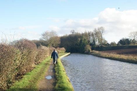
The remains of an embankment on the south side, formed for the railway loop back to Rugby is well wooded and was known as Ice House Spinney in the nineteenth century. There is a canal basin close up to the railway that may have been used for transhipment or in the construction in the 1850's.
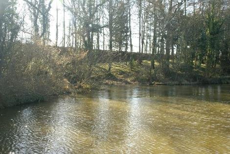
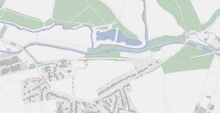

The 17th century Radford Hall remodelled in 1834-7 by William Thomas. The top drawing shows his survey before he remodelled it middle, and bottom his final design.

He also carried out modifications to the church of St Nicholas, now restored following a major fire. With the former vicarage, the Glebe house, these form an attractive group of listed buildings. Newly developed houses at Church End and in the grounds of the Hall and Radford Hall farm complete this original part of the settlement .It is set on higher ground than the canal which is built on an embankment as the land falls towards the leam. Radford became separated from the canal by the now dismantled railway. after Thomas's works in 1837. Thomas left the district following the bank crash and became one of Canada's most famous architects.

Radford was known for miles around for its beer. In 1900 a new brewery was constructed. Owing to a greatly increasing demand the building was extended in 1907. A malting kiln was constructed in 1911. The brewery had a boat for transport of coal. The majority of Radford Semele lies south of Southam Road, with 64 and 66 Southam Road timber framed buildings that are grade II listed, and the1622 listed White Lion former coaching inn and now public house a 17th-century building that was also altered in the 19th century and has suffered fire damage since. To the north of the main road is Offchurch Lane and the Manor House which is possibly 18th century, although subsequently altered in the 19th and early 20th century. Offchurch Lane leads back to the canal

THE MANOR HOUSE SOURCE - OUR WARWICKSHIRE
Offchurch Lane crosses the canal at bridge 34, Butt Bridge. Offchurch Wharf , mainly used for stone, is on the offside below the lock. Radford Bottom Lock. There was stabling for 11 horses along with a lock house. The lock keeper is said to have sold sweets, vegetables and corn, whilst boating families would stop here sometimes to have babies with help from the local mid wife, despite both Warwick and Warneford Hospital being canalside.
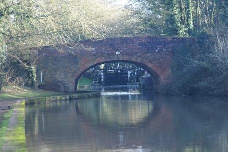
BRIDGE 34 FROM THE WEST
The locks allow the canal to climb the higher ground between
Offchurch and Radford Semele. It follows the line of a stream
that flows back west into the leam, and is fed from these hills.
This is the site of an ancient water mill, recorded as Quinton Mill on Yates Map of 1793, with the canal to the south of that. West and North of the canal is the entrance to Offchurch Bury. The Bury was remodelled in the mid 1790's by John Knightley following his marriage. He may also have had some influence on the alignment of the canal at this time. The lodge building is suitable for local listing. Offchurch is the burial place of Offa, the Saxon king of Wessex.

LODGE TO OFFCHURCH BURS
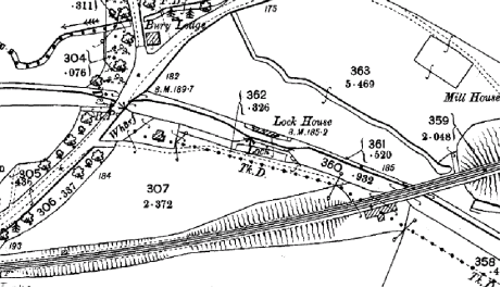
1900
Radford, lock 23, is the first of twenty locks that lift the canal 146' to join the Oxford Canal at Napton. Back pumps were installed here in 1942 to return water from the bottom level.
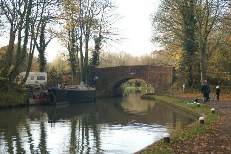
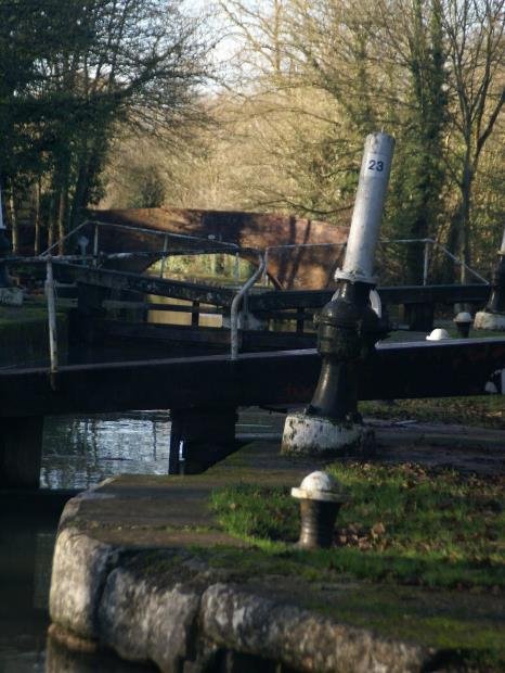
100 metres east of the Lock is a magnificent skew viaduct also suitable for listing. It is what remains of the rail link from Leamington Avenue station that looped back to the mainline at Rugby. Leamington to Rugby took 22 minutes and less than two hours to London Euston on this route.
There was a structure on the south side of the viaduct in 1900, there is now a world war two pill box, suitable for local listing. It, along with concrete restrictions at Longhole Bridge, is a reminder of how the canal infrastructure was regarded as part of the defences against invasion. The Ministry of War Transport took control of the canals in 1942. It was a precursor to nationalisation in 1948, under the Docks and Inland Waterways executive- becoming British Transport Waterways in 1955 and British Waterways Board in 1963. The government had previously assumed control in 1917, when many canal staff had enlisted or gone to work in the munitions factories.
Government control was phased out in 1920.
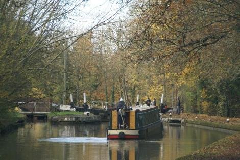
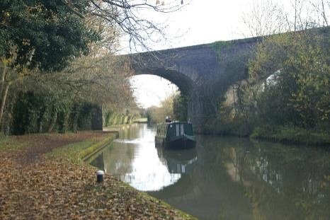
Charles Handley had revised the route from Offchurch to make it four miles shorter and to avoid an 800 yard tunnel at Leamington Hastings. Taking a more southerly route to Napton would save £50,000. The canal through Warwick and Leamington was largely finished apart from the Avon embankment by 1796 . It was 1799 before Handley started on the locks here near Offchurch yet they were opened for trade the following year in March 1800. An important contributor was John Tomes, providing £2900 to complete, as some of the shareholders had defaulted. John Tomes was a key figure in the development of Warwick and Leamington. He gave up his legal practice in 1815, but remained active on the canal committee and became MP for Warwick. He died in 1844, having been on the canal committees for fifty years and instrumental in facilitating the growth of Leamington through his advice to landowners and establishing consortia to develop.

A spectacular railway viaduct skews across the canal above the lock and now forms part of a footpath and cycle network. This is a fine example of Victorian prowess and forms an important element in the landscape corridor.
1844 was when the railway from Kenilworth arrived at Milverton, by 1851 the loop back to Rugby was open. It was a time of changing fortunes. Dividends on the Warwick and Napton in 1844 dropped to £3.50 from £7.50 the year before. By 1851 dividends ceased for the next twenty years. Pickfords the carriers, had made extensive use of canals with a regular service from Warwick Leamington to London and other cities on the extensive network of canals that had been put in place to link the navigable rivers. Pickfords had 116 boats and 400 horses before the railways came. By 1847 they had sold their boats. Some other carriers took over, such as Whitehouse and Crowley. The Grand Junction Company, fore runners to the Grand Union Company, also purchased boats and began carrying.
The Rugby & Leamington Railway was purchased by the London North Western Railway (LNWR) soon after its incorporation and built the line itself. The line from Rugby's LNWR station to Leamington (Avenue) was first opened on 1st March 1851 and was originally built as a single line throughout.
Birdingbury and Marton were the initial intermediate stations opening with the line and provided both passenger and goods services from the outset. Dunchurch was opened for passenger services on 2nd October 1871 and its goods yard from 1st February 1872.
Ralph Rawlinson wrote in LNWR Yahoo Groups, 'In 1863 there were six passenger trains on weekdays and one on Sundays the journey taking 40 minutes'. Ralph continued 'Most of the line was doubled by 1884 and traffic slowly increased until by 1922 eleven trains were run. In 1949 it was down to six trains on weekdays but these ran to and from Warwick. The passenger service was withdrawn in 1959 but the line remained open as far as Marton Junction until 1985 to serve the Portland Cement Quarry at Southam on the line to Weedon.'
Ref warwickshirerailways.com
In 2018 New housing is being developed on the urban fringe towards the viaduct , on the south side of Offchurch Lane. The landscape beside the canal is not part of the green belt, however it is part of the setting of the canal as a local and national asset, accessible on foot , cycle or boat and valued both for cultural and natural heritage significance..
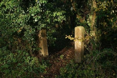
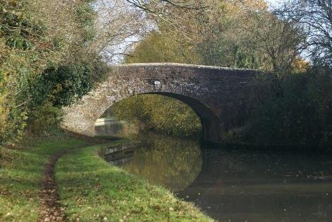
Bridge 33 Popes bridge is a little over 600 metres east of the viaduct, and connected the pump house and stream at the rear of the towpath to Leasowes farm.
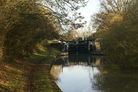
A further 200 metres is the bottom of the three Fosse locks. The bottom Lock, 22, originally had a house and stabling until demolished.
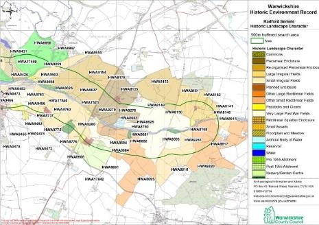
The historic landscape character is mapped as part of the Historic Environment Record. It is available from WCC along with archaeology.
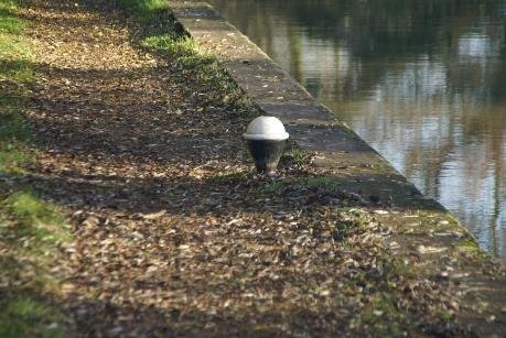
30'S META MOORINGL BOLLARDS WITH THAT MICHELIN STYLE LOOK
The middle lock is 320 metres further, followed by the wharf at the Fosse. The Fosse is part of the roman infrastructure going north to join the Watling Street. The wharf here had sheep pens for washing sheep at the east end.
Stone and sand were loaded here and there was a granary for corn. Wheat was loaded here by local farmers Staites and others, to be taken to Kenches Mill at Emscote for Milling. The Navigation Water Mills was another Tomes and Handley project shortly after the canal opened

The original narrow locks also function as weirs between the locks, which regulate the level, there is also back pumping up the flight to ensure water supply. Electric pumps were installed at Fosse, Woods and Welsh Road Locks. Small pump houses with barrel tops remain. In addition to the wharf buildings,
On the north side are a pair of cottages built in the 30's by the canal company. The cluster of buildings at these locations is something that recurs throughout the canal system.
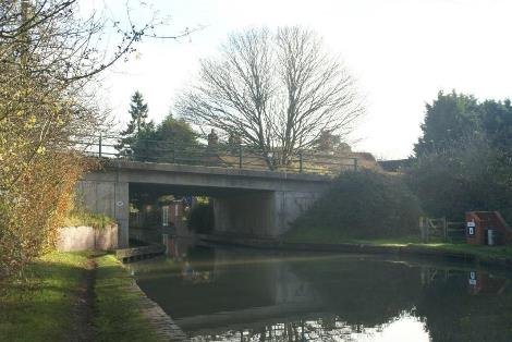
Fosse top lock is 250 metres north of the bridge crossing, which has been rebuilt as a concrete slab structure. The impact of vehicles is audible and visible. The lock by contrast is well enclosed by trees and hedgerows. This is also true of Wood lock, lock 19, that is well screened.
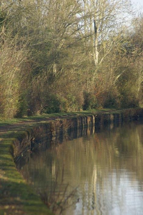
At the back of the length along this towpath is a large water storage facility, that has been screened by trees. A reminder perhaps of how changes need to be well considered if they are not too intrude on the character and appearance of the corridor.
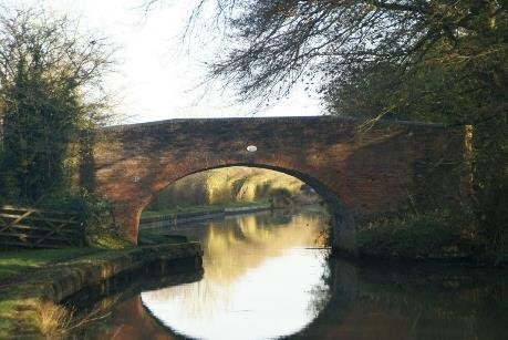
The ridgeway lane currently crosses the canal at Longhole bridge, bridge 31. There was a wharf here too. The canal carried lime which was used by farmers as well as builders.
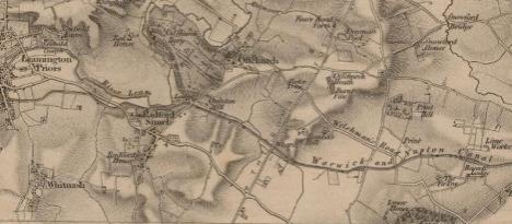
1831
HS2 will enter Warwick District from Stratford-on-Avon District
to the south, crossing over the Grand Union Canal. The proposed
Longhole Viaduct will be approximately 140m in length, followed
by an embankment up to 9.5m in height that will run for
approximately 825m up to Welsh Road to the north- west. As a
result Ridgeway Lane will be diverted under the viaduct to allow
for the viaduct and embankment construction and then to provide
access to agricultural land and a public right of way. To the
north, Welsh Road will be realigned over a length of around 750m
to pass under the railway line to the south of its current
alignment. A drainage balancing pond will be constructed to the
east of the route off Ridgeway Lane. The HS2 Act disapplies the
normal controls requiring conservation area consent and listed
building consent under the Planning (Listed Building and
Conservation Areas) Act 1990, for the demolition, alteration or
extension of listed buildings and unlisted buildings.
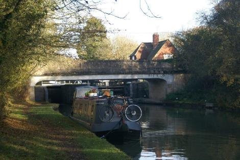
Bridge 30 at Welsh road overlooks lock 18 and the cottage one of six constructed by LG Speigh,t the 1930's contractors for the Locks and three bridges, two at Hatton and this one at Welsh Road.
The work of rebuilding bridges including Hatton Middle and Hatton Hill was done by AE Farr. Over 1000 men were employed, many previously unemployed on the project. Grand Union Staff did the works on the length including bank protection. The concrete piles are sometimes dated. A formal ceremony in 1934 by George the duke of Kent, younger brother of Edward VIII and George VI, followed by a six course lunch at Shire Hall marked the opening. Whereas originally the men employed on the Warwick and Napton canal were treated to dinner and beer at the Black Swan, George and Kings Head Inns in Warwick at the company's cost of 3 shillings(15p) per head.
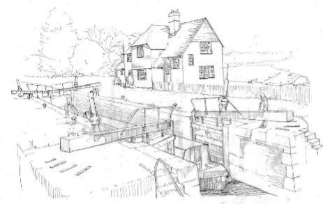

(1) 7 LAPWORTH
Hockley Heath bridge 25 to Yarningale bridge 34 locks 16 km 10m
Stratford upon Avon Canal initial Act of Parliament in 1793, and additional Acts in 1795 and 1799.
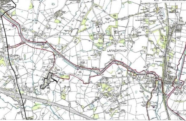
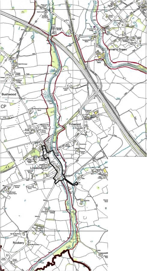
7 Lapworth Stratford upon Avon canal
Hockley Heath bridge 25 to Yarningale bridge 34 16 km 10m
In the 18th century the River's Severn and Avon provided water transport to Stratford , while coaches and wagons travelled the rudimentary roads between the towns of Birmingham, Warwick and Stratford. During the 18th century, improvements were madeto the river, and tolls charged on the increasing traffic of coal, agricultural produce, stone, manufactured goods, etc. to and from such towns and Stratford-upon-Avon. The limitations of river navigation were really felt with the watershed that separated the growing manufacturies from markets, and the reliance on packhorse and carts.
The Stratford upon Avon Canal was authorised by an initial Act of Parliament in 1793, and additional Acts in 1795 and 1799. Cutting began in November 1793 at Kings Norton on the Worcester and Birmingham Canal and went as far as Hockley Heath. The northern section was completed to Kingswood and connected to the Warwick and Birmingham by 1802. In 1809 a further act enabled the work to start again south in 1812 and the full canal was opened at its junction with the River Avon at Stratford on 24th June 1816.
As completed the canal was twenty five and a half miles long and had cost
£297,000 to build. The major constructions on the canal include 56 locks, a 352 yard 16 feet wide tunnel, a large single span brick aqueduct and three cast iron trough aqueducts, three high embankments and a reservoir. The Stratford canal company then extended their line further by Tramway built to Morton in the Marsh in 1826 with a branch to Shipston upon Stour in 1836.
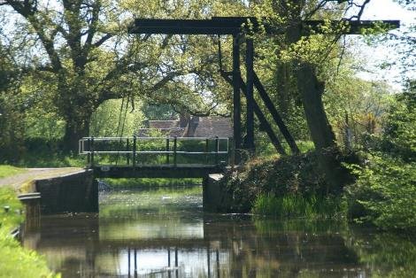
The northern part of the Stratford Canal was built first
and joined the Warwick canals at Kingswood. In the
early days, heavy goods were carried to here from industrial
Staffordshire and Worcestershire, using the Dudley canal and
along the Northern Stratford-upon-Avon canal heading south along
the Warwick Canals. The two Warwick canals were open to trade
from Birmingham to Napton on the Oxford Canal in 1800, the same
year the Grand Junction Canal opened from Braunston to Brentford
with a temporary railroad across Blisworth Hill. By
1805, when the Grand Junction was finally completed, the
county town of Warwick was at the heart of a major new
waterways from the industrial Midlands to London.
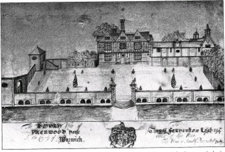
The canal edged the Packwood estate of Mr Featherstone to the north and that of Philip Martin largely to the south of Old Warwick Road. There are historic timber framed houses in the vicinity of the canal from the former Forest of Arden, with red clay being burnt for local brick and tile making.
Limestone was quarried locally, coal was needed. Trade on the canal steadily increased to a peak in 1838, with 181000 tons in that year ; 50,000 tons of it was coal, with agricultural produce malt and corn going up to Birmingham; but with the coming of the railways trade was gradually taken from the canal. The Stratford canal company sold out to the Oxford, Worcester and Wolverhampton Railway Co in 1856. Three years later the railway company also bought the Upper Avon navigation. Ownership passed to the Great Western Railway in 1865. Great Western Railway controlled all the water and rail routes to Stratford and the river navigation was allowed to gradually decay, as was the southern section of the Stratford-upon-Avon canal.
In the twentieth century, the Stratford-upon-Avon canal saw the GWR replace a collapsed bridge with a 'temporary' steel structure that prevented the passage of most boats. LTC Rolt, a trained engineer and the writer of Narrowboat(1944), and an enthusiast for industrial archaeology, wrote and publicised this in Parliament, and announced his intention to exercise the right of navigation. As a result the railway company had to lift the steelwork to allow passage.
The canals were nationalised in 1948 as part of the British Transport Commision. Then in 1958 Warwickshire County Council applied for the abandonment of the southern section of the canal to enable them to erect a new bridge at Wilmcote as part of road improvements. The Inland Waterways Association led opposition. Architect David Hutchings was appointed director of operations and, under his leadership, volunteers from various Waterways Societies, Boy Scouts, the Armed Services and later prisoners from Winson Green prison, carried out the restoration work from 1961 to 1964. The threatened closure was prevented and the southern section was restored and formally reopened in 1964. It became part of the National Trust .
A Lower Avon trust was formed in 1950, it acquired property navigational rights before restoring the River in 1962 from Tewkesbury to Evesham. The Upper Avon navigation trust followed in 1965 to finish the task and by 1974 the whole River up to Stratford was opened.
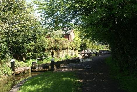
Of the fifty four locks on the Stratford canal, Lock 2 near Lapworth Hall to Lock 33 at Yarningdale are in Warwick District. All of these are narrow locks with single gates having ground paddles by the top gate and gate paddles at the bottom gates, some twin and some single . The lock chambers were originally brick lined with sandstone copings from the Forest of Dean. The integrity of the chambers and wing walls, particularly on the southern section, has survived despite patching and repairs with a wide variety of different materials, with the copings having also been repaired in a variety of brick, stone and concrete infilling.
Bridges run from Bridge 25 near Hockley Heath to Bridge 44A on the way down to Stratford at Yarningale Common; the numbers going south to Stratford, whereas the Grand Union is numbered north to Birmingham. The design of bridges, particularly the cast iron decks split to allow tow ropes to pass through are a distinct characteristic of the South Stratford. The sweeping brick parapets are a key element too. The Horseley Iron works aqueduct at Yarningale, dating from 1834, is the boundary of Warwick district. It is the smallest of the aqueducts, the others part of the 1813-16 works under Whitmore, are at Wootton Wawen and Bearley/Edstone. Cast Iron Aqueducts are rare. Yarningale was installed when the Grand union burst and flooded the stream running under the Stratford canal demolishing the original structure on July 28, the canal was reopened on the 23 August 1834 with this cast iron trough in place. The diamond shaped cast iron were signs added by Great Western Railway to proscribe weight limitations on some bridges.
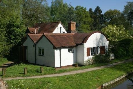
DICKS LANE LOCK 25
Also built as part of the 1813 works are six barrel vaulted lock cottages, including one at Kingswood Junction, where there is also a canal managers house with a polygonal front overlooking the canal; one at Dicks lane, lock 25; an isolated one at lock 28; the one at lock 31 at Lowsonford, with lock 34 at Yarningale being beyond the district boundary, as is the remaining barrel vaulted cottage at lock 37. Canal workshops at Kingswood in a brindle brick and plain tiled roof, are a good example of functional but not plain design.
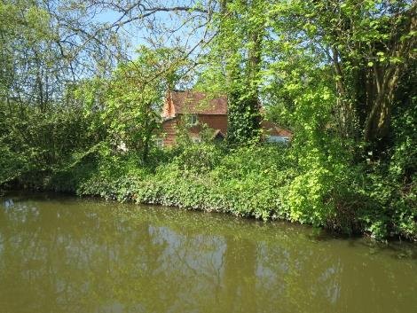
The character of this canal is rural despite its nearness to large settlements and at times the impact of traffic noise from the M40. It is desirable to maintain the historic bridge and lock and cottage structures, but also the treatment of the cut itself, in order to best preserve or enhance the character and appearance of the corridor.
The setting of these assets is part of the experience of passing along this early infrastructure either on the towpath or afloat. The tree and hedgerow margins and the open vistas are part of this.
New buildings introduced into this setting should be compatible
with what is there. Access can be improved, and surfacing
introduced which respects the rural character. Generally being
within an area of green belt introduces restraint. Designation
as a conservation area will protect the special character as a
historic asset from ill-considered development, without banning
all change. Enhanced use by local people, as well as visiting
tourists, will celebrate the value of this historic asset,
broaden understanding of its significance and how what is of
value may be maintained.
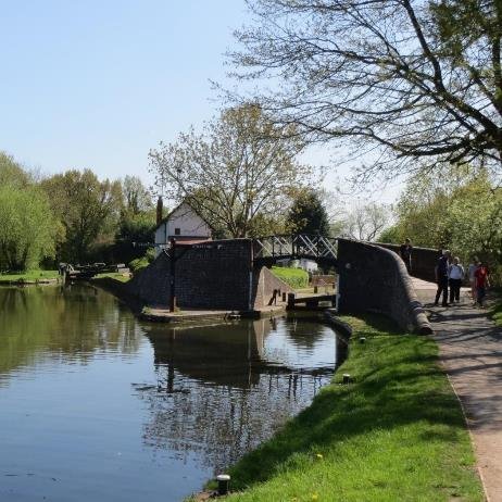
Stratford canal at the western boundary of the District.
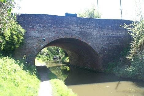
Construction of the Stratford upon Avon canal from the stop lock with the Worcester and Birmingham canal at Kings Norton, paused at Hockley Heath, which became a busy wharf, and is now a pub.
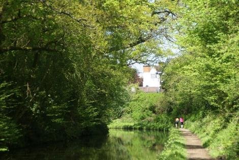
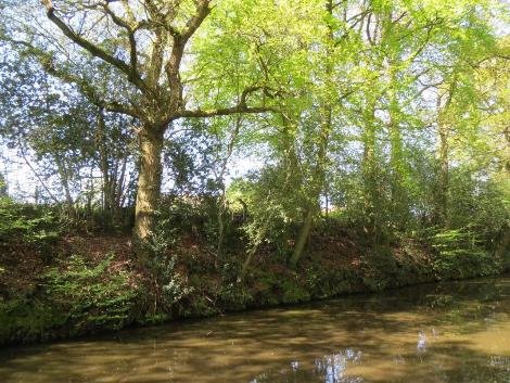
Canal bridge 25 under the A3400 is in Solihull, but at the edge of settlement lies the District boundary marked by an oak tree on the offside.
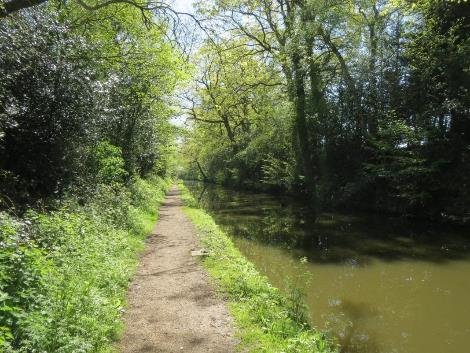
The canal is in a delightful wooded cutting here around one and a half metres below the old Warwick Road level, with an informal access down this bank.
As well as the towpath tree cover, the mature trees of the coppice on the far side of the road add to the character. Overnight moorings at the rings set in the towpath make this an attractive place for people to stop en-route.
The steel sheet piling along the water's edge is set just above the waterline creating a soft bank with wildflowers making it feel very natural.
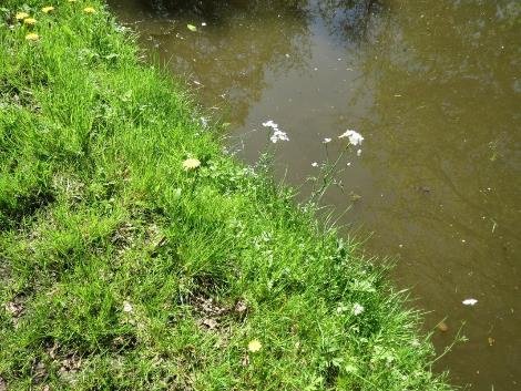
About midway between the bridges the tree cover has been lost making road more noticeable and the woodland on the North side of the road is more important still. Bluebells on the bank help celebrate the season.
Drawbridge 26 serves a public right of way and therefore has to be lifted by boat crews. The metal structure with counterbalancing weight, echoes the Van Gogh dutch style, unlike the Oxford style canal lift bridges further on.
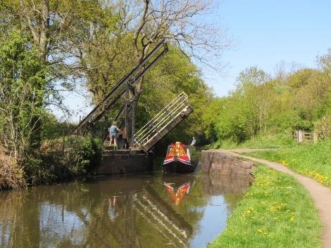
There is a gated access to the towpath for maintenance here and the road is visible. To the east of the bridge, the road is just above the canal grade and becomes more intrusive. This is exacerbated by a hedge which is manicured and lacks trees. On the offside bank there is currently a Christmas tree plantation with distant Oaks along the field boundary, extending the setting.
The eye is led on to the ribbon development on this part of the A3400, owing to the absence of hedgerows. The canal bends round to the South, possibly to avoid sandy material in what is known as Sands farm, the outbuildings of which appear above the towpath hedge.
On the offside of the curve there is a reed margin, and Swallow cruisers moorings with views through to Nuthurst and the cottages at the Wharf Lane.
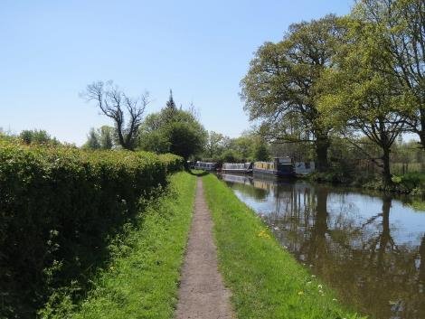
The paraphernalia associated with permanent moorings is largely concealed by the boats and the hedgerow behind. Boat servicing includes a fabric covered yard and large metal workshop.
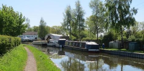
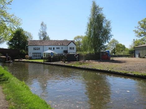
Next to the boatyard is a white painted Waterside house which has been extended including a large conservatory. Bridge 27 has a high arch, carrying Wharf Lane with a winding hole beyond, which is all that remains of the arm that followed the line of Wharf Lane to the West.
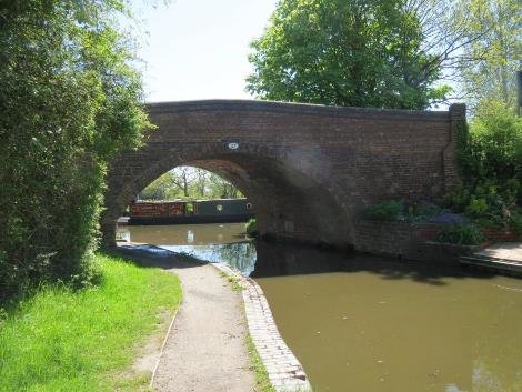
An old sign under the bridge records this as the boundary between the Severn River Authority and the Trent River Authority.
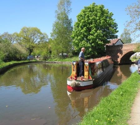
At this point the canal is at grade with paddocks beyond the towpath hedge and temporary moorings down the towpath.
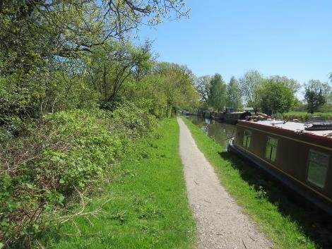
Swallow Cruisers moorings continue on the offside to bridge 28 and Lapworth church is visible in the distance to the South. The towpath hedgerow includes a lot of mature trees.
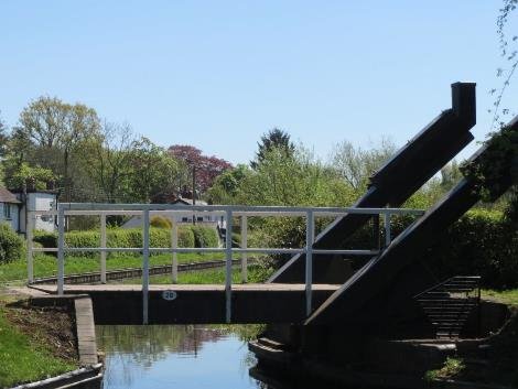
Bridge 28, an oxford style lift bridge provides the access to Drawbridge farm and enables a connection to the towpath from the Old Warwick Road, as well as the millennium way footpath.
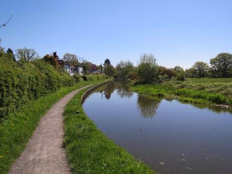
Cottages behind the towpath hedge have gardens sandwiched between the towpath and the road, and beyond the vista extends to ornamental trees.The roadside dwellings back onto the canal where a balcony provides a sunny sitting area above the towpath.
A residential mooring on the offside is the precursor to bridge 29.
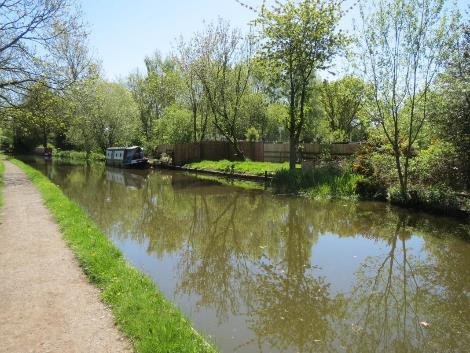
The setting includes individual houses which appear to have had money spent on them and this reflects the attractiveness of the setting.
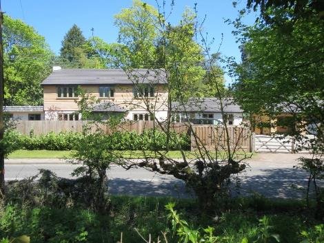
Bridge house appears to have been extended to the rear, It is stucco fronted with conservatory and sits behind an incongruous wall on the lockside.
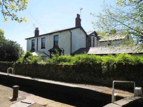
Lapworth top lock, lock no 2 on the canal, is 10 miles from the guillotine lock at Kings Norton, with a single top gate and a pair at the bottom. There are stone copings to the lock chamber with blue diamond brick copings on both the offside and towpath side. Access to the towpath is by the CRT compound, just west of the lock itself.
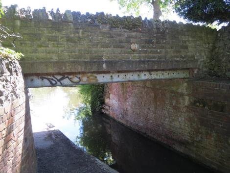
Church Lane connects the canal to the historic core of Lapworth and the fine church. The bridge itself has had a 1920's style stone parapet added above the metal beam.
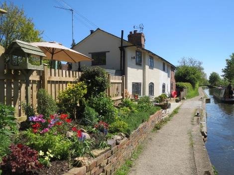
Immediately below the lock on the towpath side is Canal Cottage, whose outdoor terrace sits at the back of the towpath.
Lapworth church meadows lie immediately to the south west of the navigation. The existing conservation area is immediately around the listed St Mary's church and rectory and Broomfield house(1969-extended 2001) would thus now overlap with the canal CA setting.
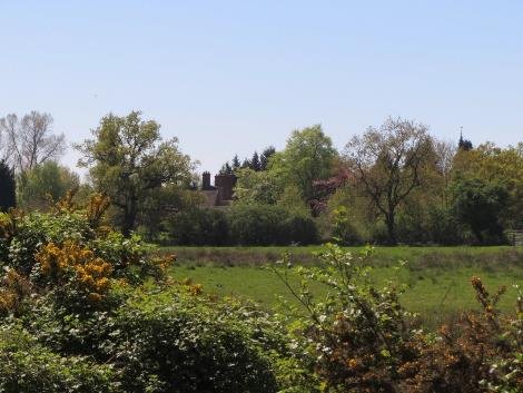
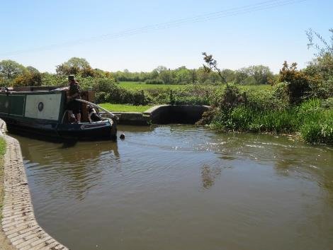
The spillweir to Lock 3 on the offside and the vista extends to the woodland, ponds, and meadow to the south. The narrow strip of land between the towpath and the road contains a timber yard, set against the towpath abutment but open to the passing traffic and is a distinctive element of the area, a reminder of when timber and stone wharves were much more open, without recourse to extensive perimeter fencing for security. The offside is a gorse bund. Much of the activity is hidden from the canal.
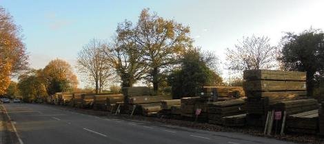
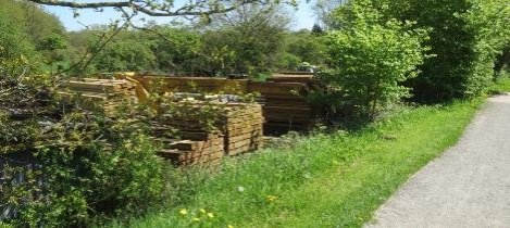
a gap in the neatly hedged garden strip exposes and modern home office building with a single house beyond.
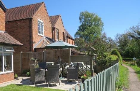
Leading up to Lock 4 there are a series of small dwellings with garden fences backing onto the towpath.
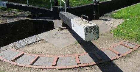
Lock 4 has brick copings and the heelgrip quadrants are in poor condition.
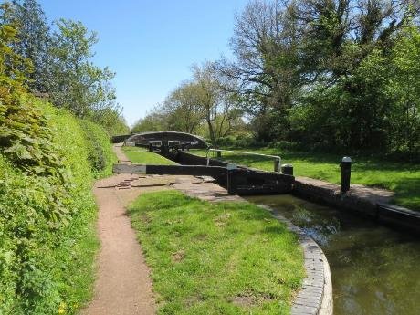
Jubilee cottage is largely hidden at road level and behind a generous hedge.
The turnover bridge has a footpath off to the South west that skirts the village cricket ground.
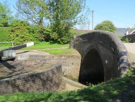
The elegant bridge curves on plan as well as elevation. The bridge appears to have had a concrete saddle to reinforce the deck. The copings sweep up to smooth the passage of the tow ropes over the saddleback copings as the towpath changes sides..
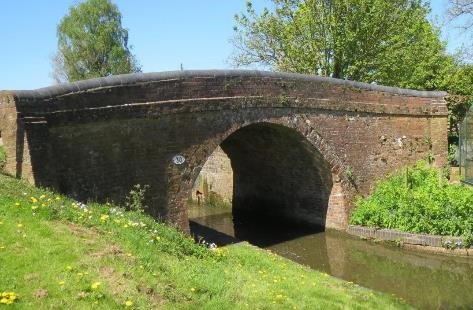
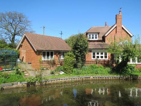
On what is now the offside, a red brick barn and house has been extended with terrace oriented towards the canal, whilst Ladysmith cottage beyond has been given a contemporary feel with waterside dining area.
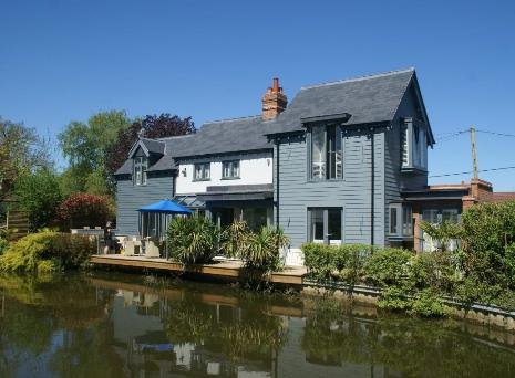
In contrasts at lock 5 an apparently new building has been constructed, which fails to respond to the setting and relies on a close boarded fence to separate it from the back of the lock.
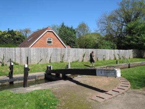
Below the lock the waterway wall on both sides is concrete piling, in some places with substantial trees growth out of it and as this is above the roadway will need renewing to keep the water in and can be treated in a more sensitive manner.
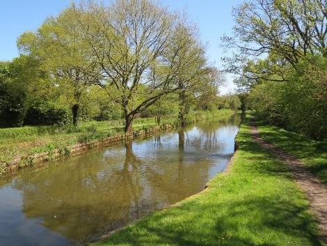
The towpath and canal are on embankment with intermittent views south through the hedgerow of parkland beyond leading up to bridge 31.
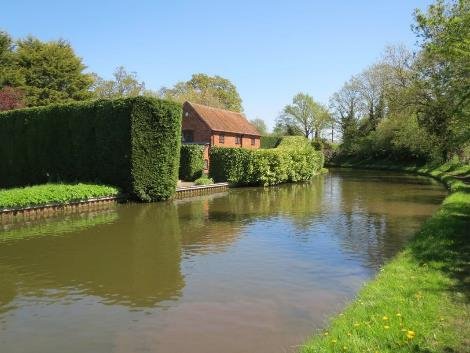
Pinners cottage; brick with a slate roof and conservatory extensions, together with its outbuildings of roughly the same age but with a tiled roof are let down by unfortunate fake lead double glazing. The garden is screened by a substantial laurel and conifer hedge. The canal sweeps around the property to pass North East under the Old Warwick Road at its junction with Packwood Lane and Lapworth Street. The Grand Union canal is nearby. located where the Packwood House estate met the Baddesley Clinton estate to the east, prior to the railway passing through the gap. There are a number of substantial houses to the north of the canal here.
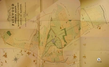
Lapworth Street travels south broadly parallel to the canal to rejoin it again at Lowsonford. It contains a number of listed buildings such as Tudor Farm, Catesby Farmhouse, and High Chimneys, all of which are between 600-800 metres west of the South Stratford Canal. There may be further buildings worth investigating for local listing along this attractive length of countryside, edged by Bushwood – a line of ancient woodland with a moated farmhouse – Bushwood hall.
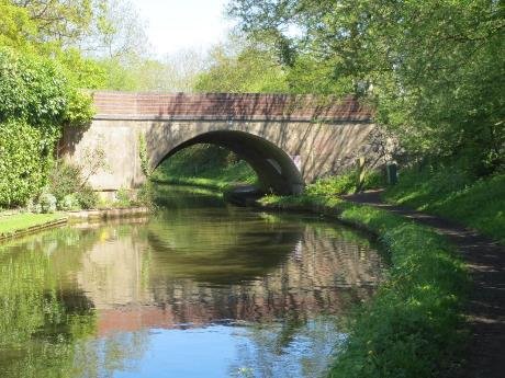
There is a ramped access on the west side.
Bridge 31 was widened on the West side where it has a concrete face and polychromatic parapet to both sides. The east side is red brick below the parapet with a keystone at the centre of a gracious arch.
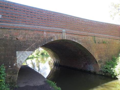
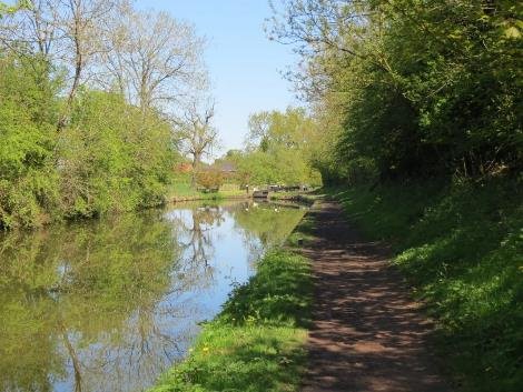
Passing under the bridge you enter a wooded cutting, with temporary moorings as the canal begins to curve back through 90 degrees. The curve takes the eye around the corner. At Lock 6 Lapworth Farm, a simple collection of red brick with slate and tile roofs, is nearby with more extensive vistas to the North and north west to the mature trees within the original Packwood estate.
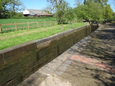
The lock chamber has mixed stone and brick copings and the chamber is deformed in alignment, with metal heel gates.
Lock seven is an ensemble with a split bridge at the heel and a
red brick cottage with slate roof that includes a false window
painted on the west elevation. The garden sits on the offside
and the conifer hedge and close board fence, crowd the lock
chamber.
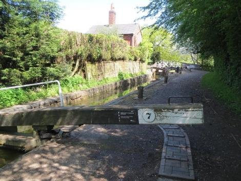
The chamber itself has a mixture of blue brick copings and a timber bollard, particular to this part of the canal. The cottage itself faces down the lockflight to the South East, with a tiled porch and extension.
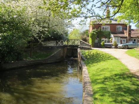
This is the first of the cast iron split heel bridges on the canal and as this is a turnover bridge it includes a spindle to avoid the towrope becoming tangled in the structure.
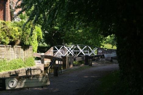
Descending from lock 7 the canal turns back to the South east and the flight of the next seven listed locks is laid out before you. Lock eight has a side pond above it and the pounds are brick edged, some of which are failing.
The side pounds to the south are wooded and enclose the view, whereas to the north and east views extend far into the distance.
Lock nine -the copings are a mixture of bricks and some convenient robust seats have been introduced facing the water. The towpath is surfaced with limestone. The heel quadrants will need to be reinstated in the medium term and could possibly be more sympathetically done without the contrasting brick colours and to minimise the trip hazards that have arisen from settlement. Lock 10 has large brick copings on the towpath side and smaller brick copings on the offside, as does lock 11.
Lock 12 has the larger blue copings with diamond anti-slip tread. those on Lock 13 identify W.Bennitt form Oldbury as the manufacturer.
The pound between Lock 12 and 13 has moored craft and includes an upright lock cottage, in need of care. A bridge over the bywash connects to a small shop and café on the offside. The much more commercial facility of the Boot inn with its extensive grounds and car park is fortunately not visible from the canalside. What does impact on the view is the twin pipe crossing belonging to Severn Trent below Lock 14., with pump chambers bookending it and what appear to be the remains of other structural bases around the Southern landing. unfortunately, this distracts from the original turnover bridge with its sweeping brick parapets and cast iron split structure. On the approach to the bridge is a diamond weight restriction plaque, the remnants of the Great
Western Railway's ownership of the canal prior to nationalisation in 1948.
Listed buildings Mill House to the north East and Packwood grange to the South are visible from the canal and there are long views to a wooded skyline to the north East towards Baddesley Clinton. The canal and road briefly meet before dividing again and the resulting piece land has been infilled with new housing to extend the Old bakehouse plot. A 1.8m brick boundary wall runs along a rear access lane from the parking to gardens. The external spaces do not really benefit from their waterside location and the elevated parking areas intrudes on the canal.
Mill lane bridge -bridge 34, unfortunately has pipes attached on the west face. the bridge as originally red brick but the parapets have been rebuilt with red bricks with blue header bricks every alternate course and a stone coping. Kingswood hollow, a traditional red brick house with clay tile roof and tile hung lean too side extension, is set in generous grounds and is possibly worth local listing. Mill Lane runs down to Mill House and Yew Tree cottage which has nice outbuildings with clay tiled roof is a tall dwelling, one room deep that has been extended. A deep plan dwelling at the back of the towpath below the bridge with a municipal post and chain boundary seems out of scale with the surrounding settlement.
Lock 15 still has late 20thC hydraulic paddles whereas most of the paddles have been restored. There is a Stop plank frame at the head of the lock and a groove to allow de-watering. The lockside is all brick paved and the towing path here has been surfaced by volunteers with materials provided by Warwick District Council. This is a popular place to walk. The brick walls to the pounds are needing repair. There are filtered views through the trees that border the side pounds. Lock 16 returns to grass locksides and normal mechanical ground paddles. Some of the boundary treatment to the back of the towpath could do with improvement. At Lock 17 there are a mixture of copings including the forest of dean stone and concrete planks to the pound below. The hedgerow on the towpath side is dense containing views. The bridge cottage is no longer a lock keepers residence and the grounds have had additional housing built in them.
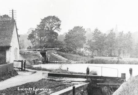
1910 LOCK COTTAGE AND LOCK 17 AHEAD. WARE COLLECTION. THE HOUSE,HAS SINCE BEEN ENLARGED, IT HAS DOUBLED IN PRICE IN THE LAST TEN YEARS, NOW VALUED AT OVER £520K.


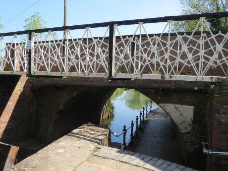
Bridge 35 which carries the Old Warwick Road over the canal has had a overly fussy footpath bridge added on the North side together with pipes. The south side of the bridge is equally damaged with pipe crossings outside of the structure which obscure the stone keystone to the arch and very poor patching to the brickwork. Alternative options are available for people with limited walking abilities and wheel chairs given the incline.
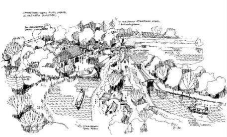
This length of canal opens out to feeder reservoirs on the offside, the top one being used for fishing and the lower one for mooring accessed by floating jetties. There is a walk around the perimeter and this is one of the sites popular with visitors.
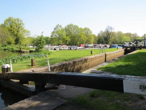
Lock 19 which sits between the two reservoir ponds has an additional timber truss bridge, No 35a at the heel which is need of repair.
At the back of the towpath in a wooded setting there is a car park and picnic area as this is a popular destination.
Discussions with the Warwick canals about a connection here broke off in 1793 as the Stratford company favoured its own canal link to the Oxford Canal. In 1795 an act authorising a 1.75 mile link here, was then amended to be much nearer. That link opened in 1802.
When the Stratford started constructing the southern section in 1812 the original junction lock was modified, which led to an argument about water. a new junction lock, number lock 20 was built off the lower reservoir to end an expensive legal dispute in 1818.
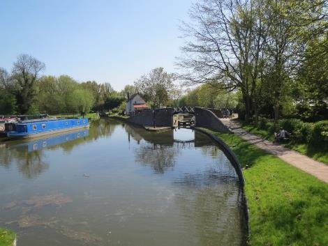
The line of the original lock has now been reopened and connects the pound below lock 21 . This means that to stay travelling down the Stratford the locks go from 19 to Lock 21.
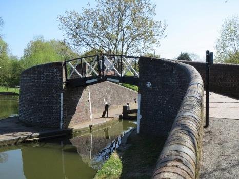
Lock 21 has single gates top and bottom and the lockside is block paved in Baggeridge brindle bricks.
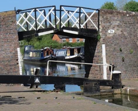
Bridge 36 is the first of a series of listed structures that cluster around Lock 21. This includes, two cottages, foreman's house workshop buildings, 2 lock chambers and a former maintenance office. Details of their listing are in the Gazetteer section. Bridge 36 is unusual in that it takes a towpath route over the canal at the top of the lock, therefore there is more brick abutment and parapets, however this is elegantly achieved with the characteristic cantilevered split deck.
Former canal maintenance office.
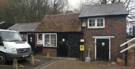
Canal workshop now Trust's volunteer base. Managers house below
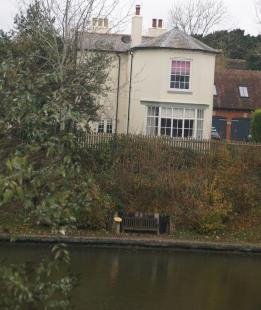
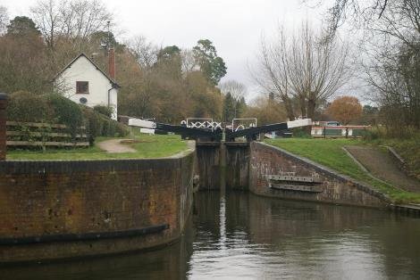
A short arm leads off from lock 20, the 1818 lock, to the Grand Union canal, having locked down from the Stratford, which was a requirement of the original canal companies agreement, that the Warwick and Birmingham canal should not lose any water.
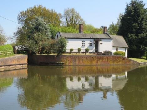
The first of the six barrel vaulted cottages sits alongside a link from the lower basin through to the arm. The roof is a mixture of brick rubble and lime mortar, covered in asphalt. The arch roof being an expedient reuse of some of the timber formwork supporting structures used to construct the brick bridges. Quite small they have often been extended not altogether sympathetically.
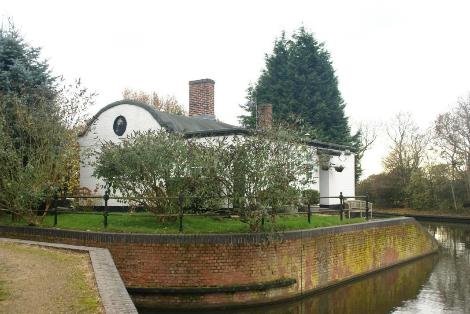
This am passes under the mainline railway, over Rising Brook and under the towpath bridge with a large housing extension site pending construction at the junction with the Grand Union. The planting that screens the site is to be retained and thickened, to avoid adverse impact on the charcter and appearance of the historic canal assets.
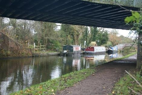
Transport infrastructure shared the same line through the landscape, with rail following the Warwick and Birmingham Canal toward Birmingham ,so that the canal and the rail are close, and the moorings here, both visitor and winter moorings suffer train noise, particularly freight traffic at night. It is a reminder that pictures of tranquillity are not always what they seem. This is also evident went after lock 26 the canal is oversailed by the M42 with the attendant intrusion audibly as well as visually..
At the end of the eighteenth century a network of waterways had covered the Birmingham area making it possible to send Birmingham goods, by canal, to many parts of the country. The success and usefulness of the Birmingham Canal Company Act 1768, stimulated other companies to obtain Acts, it was the period of canal mania.
An Act was passed in 1793 authorising the construction of a canal,to link Stratford-upon-Avon with Birmingham and the Black Country. It was envisaged coal from the Dudley area, firebricks, and salt would travel south, and agricultural produce, grain, and limestone would be carried back. a survey, , was made by John Snape,who proposed a route from a junction with the Worcester and Birmingham Canal at Kings Norton through to Stratford-upon-Avon via Hockley Heath. From Hockley Heath the proposed canal would follow the Old Warwick Road for a short way, then turn southwards, passing near to Lapworth church, and run parallel with Tapster Lane joining the valley of a little tributary of the Alne at Preston Bagot.
Capital of £120,0002 was raised for the Stratford-upon-Avon Canal from landowners and farmers along the route, outside interested parties and Stratford businessmen, who were keen to see their town drawn into the canal system.
Work, under the direction of engineer Josiah Clowes, began in 1793 at the northern end, and by May 1796 the canal had reached Hockley Heath.
Although no major engineering work had been done on the stretch, the money was exhausted.
The route of the canal was again changed to make it pass through the village of Lapworth including locks and to join the Warwick-Birmingham Canal by a link at Kingswood. A further Act was passed in 1799 authorising another
£50,000 to be raised and Fresh surveys were made and a new engineer, Samuel Parker, continued the work in 1800 and was complete by May 1802.
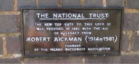
Competition between the Warwick and Birmingham Canal and the Stratford- upon-Avon Canal was very intense especially in the coal carrying business.
Despite that, trade on the Stratford Canal flourished for about 40 years. At the height of canal prosperity a Stratford trader, Richard Greaves, noted that 50,000 tons of coal arrived at Stratford, 16,000 tons of limestone being sent to Birmingham; 181,700 tons of merchandise giving receipts of over £l3,000 in 1838.
Despite this, the shareholders had never had a very good deal. In 1825 the Company's £75 shares were quoted at £16.50. In 1846 the Oxford, Worcester & Wolverhampton Railway Company offered £173,322 for the Stratford- upon-Avon Canal Company and the shareholders were happy to sell. The railway companies were obliged by statute to maintain the canals and the Stratford Canal continued to operate but made changes to save costs including losing staff.
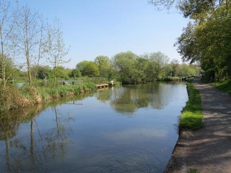
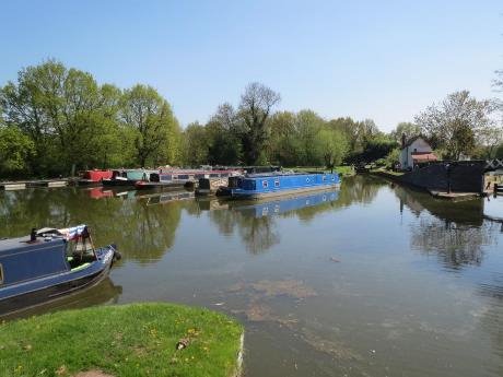
KINGSWOOD JUNCTION
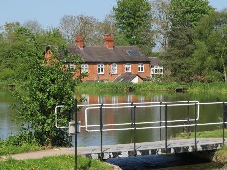
SIDE POUNDS CREATED AT THE JUNCTION 1800
The 1841 census gives the names and records actual occupations of the canal employees.
The canal manager was John Kershaw. He lived in a Georgian house beside the canal where, until the waterway was completed to Stratford, the 'Navigation Office', toll clerk, etc., had also been situated. Charles Allen, described as a 'writing clerk' was probably the toll collector and lived in a quite large house overlooking the Kingswood junction pool. The toll-collector checked the boat cargo, gauged the boats and collected the toll. The details of each boat using the canal, the tonnage carried at the depths marked on the boat's hull, were recorded in an official book which was issued to all toll offices. To gauge a boat the toll-collector simply checked the boat's freeboard, or area above the water line, against the book, worked out the toll which depended on the commodity, per ton per mile and collected the money. Such men were picked for their honesty and were usually well paid, £70 per annum plus a house being about average in 1840
Richard Soley, the canal carpenter, occupied the lock-house in the middle of Kingswood Basin and Edward Bayliss, the canal carpenter, the lock-house behind the Boot Inn.
The long flight of locks nearby was managed by lock-keeper James Robinson, who lived in a small cottage at the top of the flight.
There were five lock-keepers recorded at Lapworth in 1841 - Richard Smith, James Robinson, William Howse, Jacob Allen and Richard Rogers, paid about £50 pa.
Altogether there were 10 canal employees and their families living and working in Lapworth in the 1840's and 1850's. In later decades this was reduced to seven or eight employees, one or two of the craftsmen apparently doubling as lock-keepers. In 1871 and 1881 the five lock-keepers of 1841 had been reduced to two, one living in the cottage at the top of the long flight of locks behind the Boot Inn and the other beside Walter's locks No. 28 above Lowsonford.
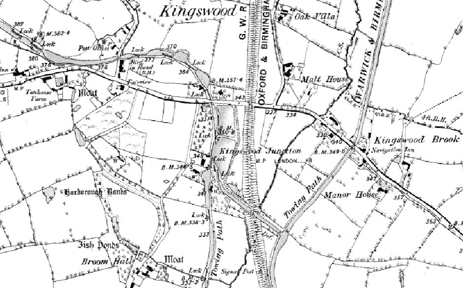
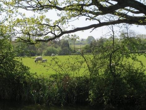
Of the fifty four locks on the Stratford canal, Lock 2 near Lapworth Hall to Lock 33 at Yarningdale are in Warwick District. All of these are narrow locks with single gates having ground paddles by the top gate and gate paddles at the bottom gates, some twin and some single . The lock chambers were originally brick lined with sandstone copings from the Forest of Dean. The integrity of the chambers and wing walls, particularly on the southern section, has survived despite patching and repairs with a wide variety of different materials. The chamber copings having also been repaired in a variety of brick,stone and concrete infilling.
Canal workshops at Kingswood in a brindle brick and plain tiled roof are a good example of functional but not plain design.
Bridges run from Bridge 25 near Hockley Heath to 44A on the way
down to Stratford at Yarningale Common; the numbers going south
to Stratford, whereas the Grand Union is numbered north to
Birmingham. The design of bridges, particularly the cast iron
decks split to allow tow ropes to pass through are a distinct
characteristic of the South Stratford.
The sweeping brickparapets are a key element too. The Horseley Iron works aqueduct at Yarningale, dating from 1834, is the boundary of Warwick district. It is the smallest of the aqueducts, the others part of the 1813-16 works under Whitmore, are at Wootton Wawen and Bearley/Edstone. Cast Iron Aqueducts are rare. There were diamond shaped signs added by Great Western Railway to proscribe weight limitations on some bridges.
The character of this canal is rural despite its nearness to large settlements and at times the impact of traffic noise from the M40. It is desirable to maintain the historic bridge and lock and cottage structures , but also the cut itself in order to best preserve or enhance the character and appearance of the corridor. The setting of these assets is part of the experience of passing along this early infrastructure either on the towpath or afloat. New buildings introduced into this setting should be compatible with what is there. Access can be improved, and surfacing introduced which respects the rural character.
Generally being within an area of green belt introduces restraint. Designation as a conservation area will also protect the landscape character and existing structures from ill-considered development, without banning all change.
Enhanced use by local people, as well as visiting tourists, will celebrate the value of this historic asset, broaden understanding of its significance and how what is of value may be maintained.
William James, an enterprising local figure saw the River Avon
navigation linked to a completed canal and later his proposed
railway to Paddington with branches to Coventry and Cheltenham.
More money was needed to complete the canal and in 1809, under a new Act, 2,000 new shares were offered at £30 each. There was no rush to buy and only 1452 shares had been taken up by February 1810. The southern section of the Stratford-upon-Avon Canal is l3 miles long and has 36 locks between Kingswood and the Avon. Work began in 1812 and was completed to Wootton Wawen in 1813. Another £30,000 had to be raised in 1814 plus
£35,000 more in 1815, but finally the canal was opened all the way through to Stratford in June 1816. Earlswood Lakes, north of the district, which supply the Stratford-upon-Avon Canal with water, were authorised in 1815.
The southern section has many features not found in the earlier northern part particularly, the unique barrel roofed lock houses and the heel bridges with a gap for the tow lines, designed by the engineer Josiah Clowes. The split bridges were built of iron, in two sections, so that the tow line could pass through the slot between them without casting off.
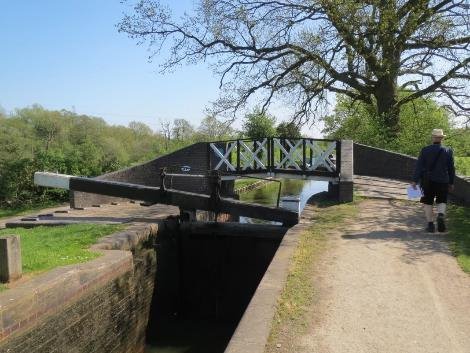
Lock 22 has had a heavy engineered bridge in the style of a split bridge added to take the towpath to east side of the canal, set in very blue brick abutments with sloping brick paving.
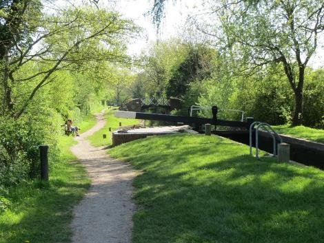
Lock 23 is a turf sided lock chamber with red brick and stone copings and single gates top and bottom There are views out in both directions and listed buildings; Broome Hall and Catesby Farmhouse clearly visible from the towpath.
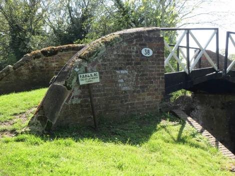
Bridge 38 is a traditional split bridge with metal deck topped with gravel. This is listed as a good example.
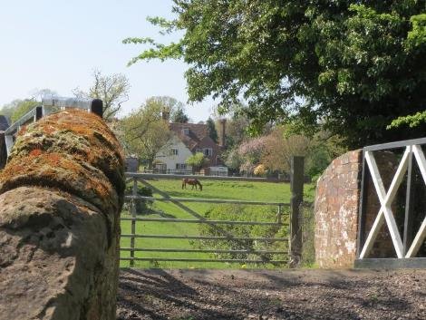
The towpath remains on the east with bridges serving farms as needed. This went to Brome manor , along with Kingswood and Lapworth one of the three manors in Lapworth Parish
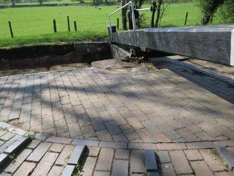
Lock 24 – the heel quadrants are well built but feel imposed as they sit above the level of the coping. Some of the first restoration work has been replace during the National Trusts stewardship, whilst more recent work was done by British Waterways and follows patterns used nationally. The Canal & River Trust are anxious to ensure that work carried out is researched and seeks to reinforce local distinctiveness.
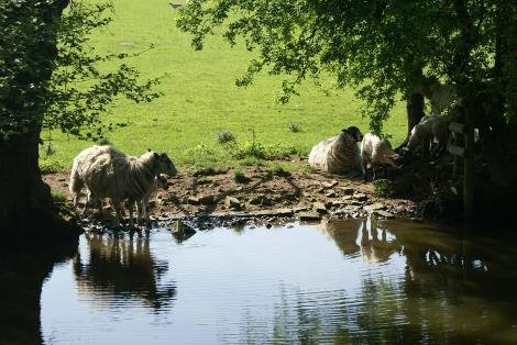
The towpath hedge is hawthorn with a tree lined offside where sheep are using the canal as a drinking place.
From kingswood to Dicks Lane the canal is enclosed within a tree lined corridor with vignettes out to the countryside beyond.
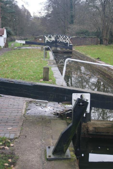
Here the motorway comes into view on the offside and substantial national grid cables cross the canal just above Dick's Lane Bridge. Seasonal changes clearly register on the appearance but also on the character of the area. The canal was designed to pass through this close landscape of undulating pasture and wetland and copses.
Originally the boat families lived ashore in canal side cottages but after the coming of the railway, pressures to keep the boats continually working forced many families to live wholly aboard. Of the boats tied up at Lapworth on census night 1861 five were the permanent homes of the families aboard the boats,
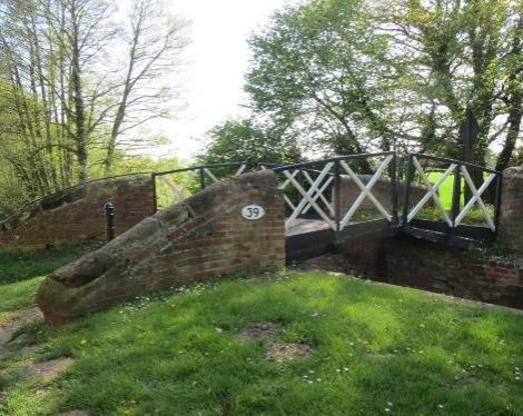
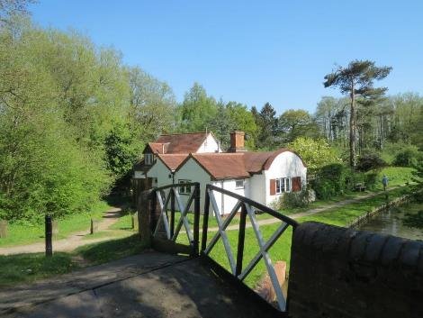
Lock 25 has a brick and cast iron heel bridge – bridge 39, GWR diamond plaques and some interpretation. Dick's Lane leads under the railway and back up to Turner's Green at the Grand Union canal. There is evidence of archaeology at Dick's lane, the site of a Roman tile kiln.
Dicks Lane Wharf was a major trading post, although nothing is now left but the pool. Here coal was landed and agricultural produce and lime loaded.
Nearby was another lime-kiln and there was road access to Rowington and to Lapworth and Bushwood. The purpose of the canal was, of course, the transportation of goods and here and there along its route were wharfs where commodities needed, or for sale by, the local community could be set down or picked up.
There were at least five wharfs for coal, lime, grain and other
goods to and from Birmingham and the black country as well as to
Stratford. The first wharf in Wharf Lane was beside the canal
bridge. The second wharf was specifically for coal and was at
the end of a branch canal, 250 yards long, which started beside
Wharf Lane Bridge and ran parallel to Wharf Lane. It crossed
Spring Lane by a drawbridge and ended at the rear of Dowdeswell
House, which was then the house and business premises of
successive coal dealers. The branch canal was closed and filled
in c.1870's .
The wharf at Pinner's Bridge also dealt chiefly in coal, the occupant of the adjacent house usually being a coal dealer. John Hannes who lived there in 1861 also dealt in lime, a small lime-kiln being set into the canal bank a little way from the wharf. Here limestone would be burnt to convert into lime; it was then suitable for use as a fertiliser, or in the making of mortar for building purposes. There was a wharf at Lowsonford just within the Lapworth parish boundary.
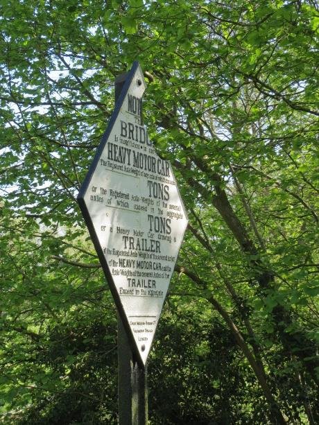
Trade on the canal steadily increased to a peak in 1838, with 181000 tons of coal in that year; but with the coming of the railways was gradually taken from the canal. The canal company sold out to the Oxford, Worcester and Wolverhampton Railway Co in 1856. Ownership passed to the Great Western Railway in 1865 and to the State on Nationalisation in 1948.
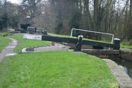
Lock 26
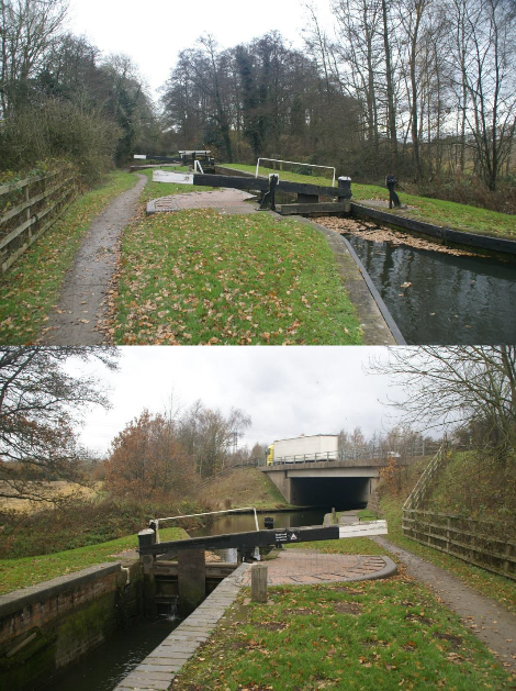
the motorway crossing is bridge 39a
whilst this little heel bridge at lock 27 is bridge 39
A November view of a wooded cutting after leaf fall. The man made structure looks as if it belongs in this landscape. The cut follows the brook that runs between Finwood and Bushwood. The more wooded margin is now on the west side. Both the canal and the shortlived rail connection are tree lined.
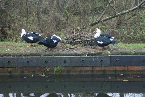
Lock 28 is an isolated home with plenty of wildlife
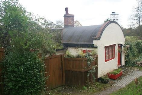
Also built as part of the 1813 works are six barrel vaulted lock cottages, as well as one at Kingswood Junction, where there is also a canal managers house with a polygonal front overlooking the canal; there is one at Dicks lane, lock 25; an isolated one at lock 28; lock 31 at Lowsonford, with lock 34 at Yarningale being beyond the district boundary, as is the remaining barrel vaulted cottage at lock 37
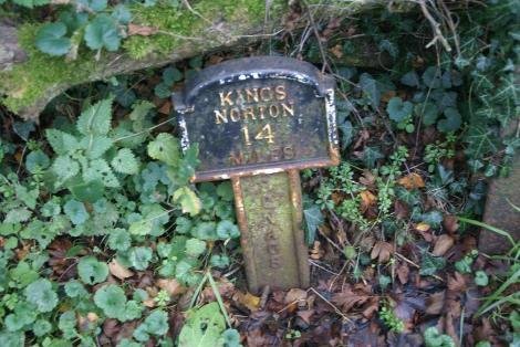
Canal society marker
North of Lowsonford, a single track railway from Henley in Arden joined the main line in 1894. The course can still be traced , as can the abutments seen alongside the Stratford upon Avon canal. The service only lasted 20 years. The line ran close to the road which crosses the railway and meets Dicks lane at Turner's Green. The canals are still less than half a mile apart until the GU heads East and negotiates Rowington Hill by cutting.
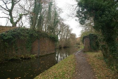
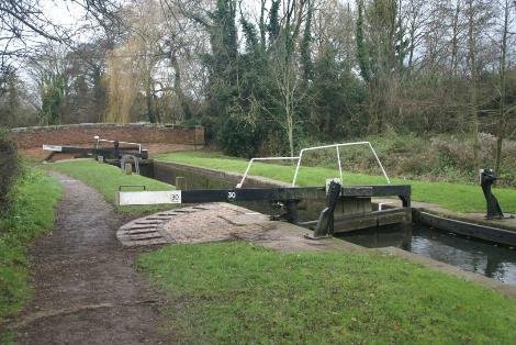
lock 30
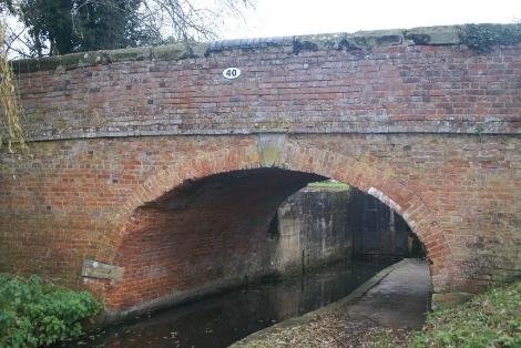
Bridge 40
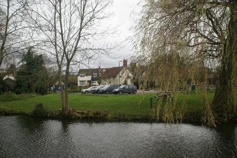
Fifteenth century grade 2Fleur de lys public house has been a popular eating place since Mr Brookes started making his pies. The operation moved and took over the former Navigation Mill at Emscote on the Grand Union in
Warwick in the late 1900's.
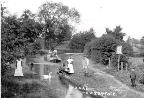
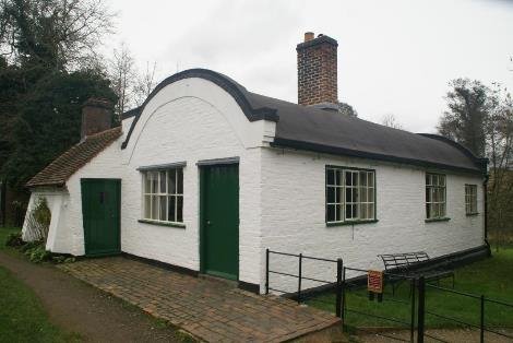
The landmark trust lock cottage lowsonford lock 31 ned's lock grade 2
The cottages' construction is described as four brick walls that enclose a space 14 ft. by 35 ft. Iron tie bars along the top of the brickwork are joined at the corners to make a flat rectangle and strengthened by cross bars. The brickwork was then continued upwards, curving over to form a roof as when constructing a masonry bridge.
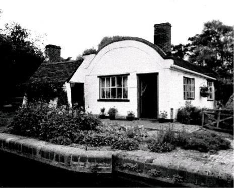
A view from Our Warwickshire
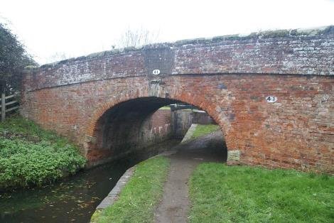
Bridge 41 grade 2
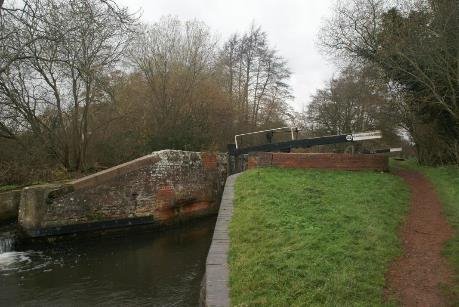
Lock 32
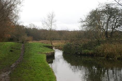
Former accommodation lift bridge no longer required
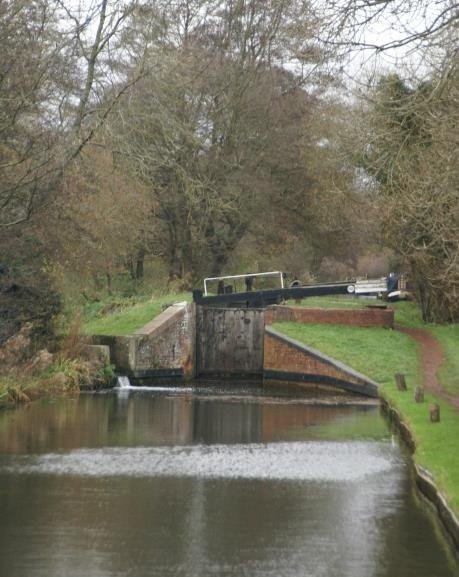
Lock 33
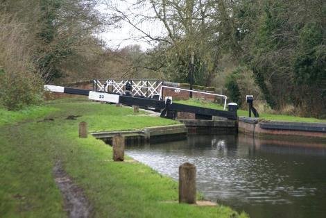
Lock 33
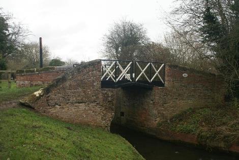
Bridge 44
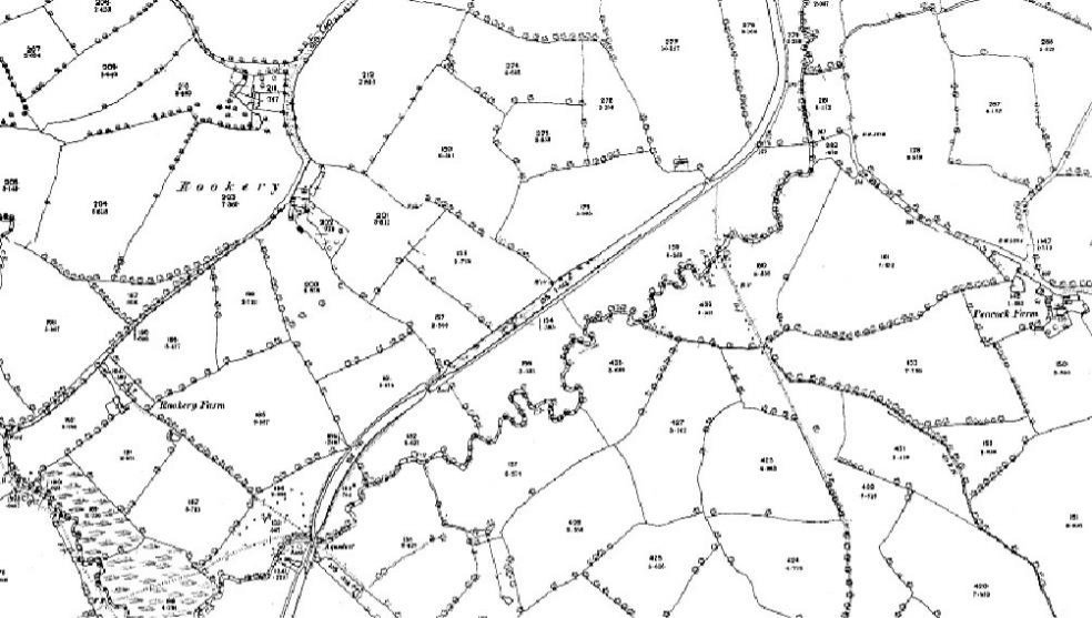
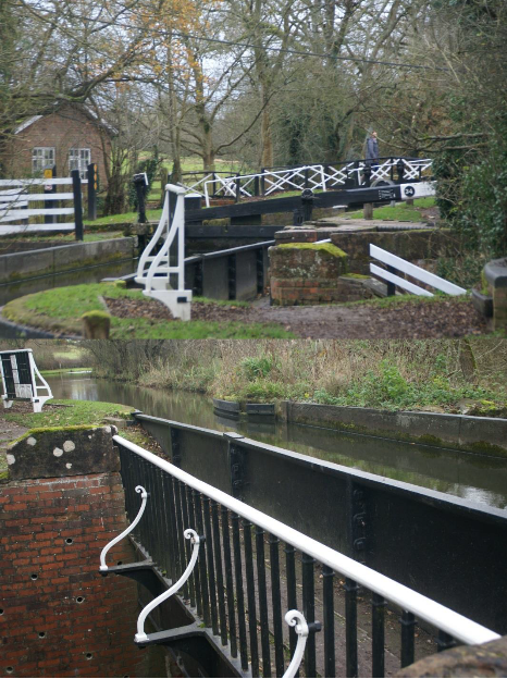
Kingswood to Stratford is the last phase of the canal to be built, 1812-16. Engineer William Whitmore with William James.
2* Yarningale Aqueduct (HEW 655) - one of three cast iron aqueducts on the southern section of the canal. Built 1834 (long after the opening of the canal in 1816) to replace an earlier structure washed away by a flood. This was the result of a breach on the Warwick and Birmingham
The other two aqueducts on the Stratford canal are large and located at Wootton Wawen and Edstone are in Stratford District. NGR SP 184664
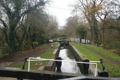
Lock 34
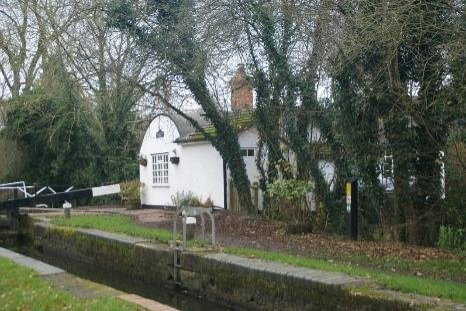
Lock 34 and cottage with large property attached
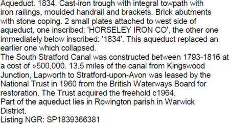
Listing description grade 2*
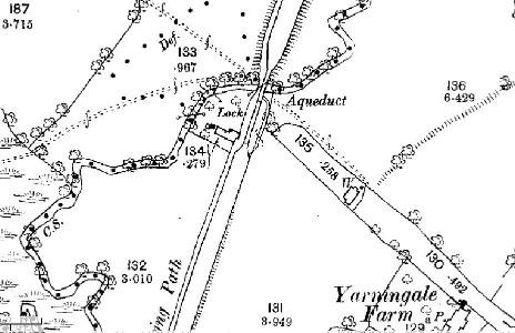
Plan of the lock side with the small aqueduct over the brook.
The Stratford upon Avon Canal was authorised by an initial Act of Parliament in 1793, and additional Acts in 1795 and 1799. Cutting began in November 1793 at Kings Norton on the Worcester and Birmingham Canal.
A stop lock had been installed at Kings Norton to control the flow of water from the Stratford to the Worcester and Birmingham canal. The company also had to pay compensation tolls for making the junction with the Warwick and Birmingham. It is not surprising that they had to raise additional capital in order to extend their line southwards from Kingswood the game of the descent to the Avon was heavily locked.
As completed the canal was twenty five and a half miles long and had cost £297,000 to build. The major constructions on the canal include 56 locks, a 352 yard 16 feet wide tunnel, a large single span brick aqueduct and three cast iron trough aqueducts, three high embankments and a reservoir.
The work progressed in various stages until the completed canal was opened at its junction with the River Avon at Stratford on 24th June 1816.