Bishop's Tachbrook NDP Regulation 16 Submission
6.0 Planning Policies
6.1 This section sets out the planning policies of the Bishop's Tachbrook Neighbourhood Development Plan. These will be used to help determine planning applications in the area and so shape the future of Bishop's Tachbrook as a place to live and work in, and to visit. The BTNDP's Policies have been prepared by the Steering Group on behalf of the Parish Council and following public consultation.
OBJECTIVE: 1. To protect, enhance and give greater access to the natural environment of the area, including its landscape, geological assets, archaeological sites and wildlife habitats.
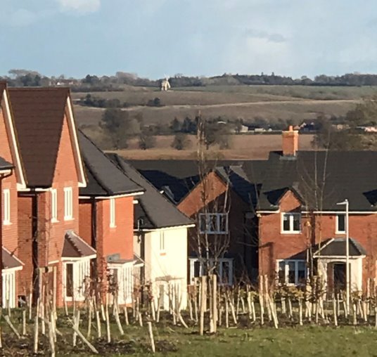
(4) Policy BT1 - Conserving and Enhancing Bishop's Tachbrook's Landscape Character
New development should conserve or enhance the area's landscape character to enhance the sense of place and history and to provide recreational opportunities within tranquil settings by:
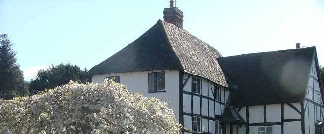
- Protecting the historic character and settlement pattern of the area. Particularly the distinct settlement of Bishop's Tachbrook, individual farmsteads and key heritage assets, especially Tachbrook Mallory;
- Retaining the network of water features of streams and ponds, especially the Tach Brook;
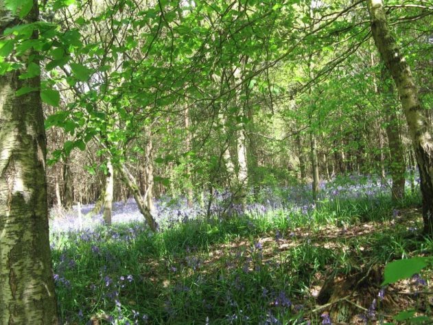
- Protecting the mosaic of woodland and hedgerows including the tree cover along the Tach Brook, Oakley Wood and High Down Hill Plantation;
- Planting new hedgerows and improving existing hedgerows through suitable planting of native plant species;
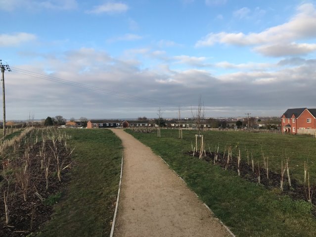
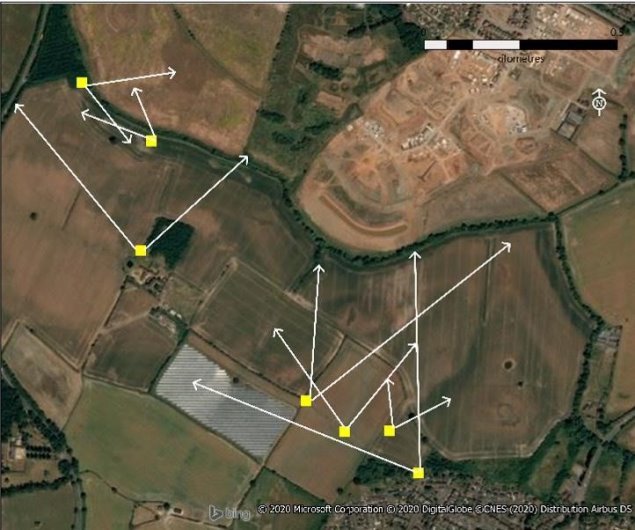
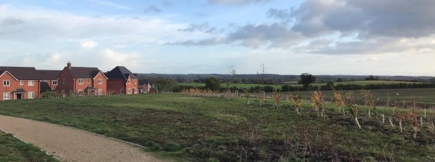
- Seeking to retain the quality and integrity of the views identified in Figure 7. Where necessary applicants should carry out a Landscape Visual Impact Assessment (LVIA) of the key attributes of these views. Where impacts are identified measures should be incorporated to minimise these impacts;
- Retaining, improving and supporting creation of new Public Rights of Way;
- Screening urban forms of development and having appropriate transitions form urban to rural areas; and
- In appropriate locations, to introduce new planting of coverts and tree belts to restore the Feldon Parklands character.
Figure 7. Protected Views
Background/Justification
6.2 Natural England produces profiles for England's 159 National Character Areas (NCAs). These are areas that share similar landscape characteristics, and which follow natural lines in the landscape rather than administrative boundaries, making them a good decision-making framework for the natural environment.
6.3 NCA profiles are guidance documents which can help communities to inform their decision-making about the places that they live in and care for.
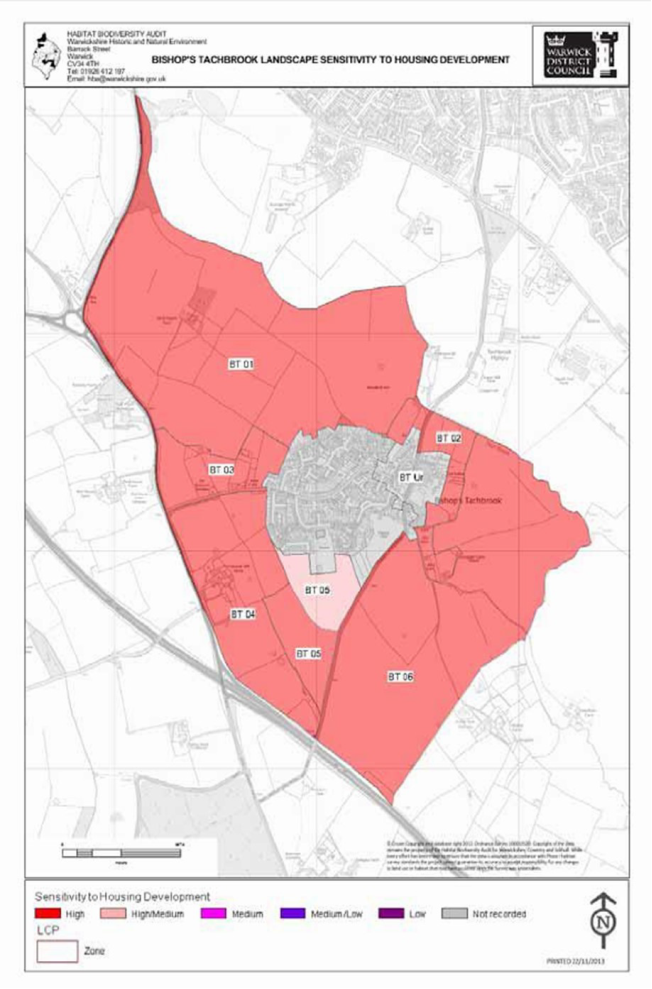
Map 6. Landscape Sensitivity (Source: Warwick District Council)
6.4 Each profile includes a description of the natural and cultural features that shape a landscape, how that landscape has changed over time, the current key drivers for ongoing change, and a broad analysis of each area's characteristics and ecosystem services. Statements of Environmental Opportunity (SEOs) are suggested, which draw on this integrated information. The SEOs offer guidance on the critical issues, which could help to achieve sustainable growth and a more secure environmental future.
6.5 Bishop's Tachbrook lies within NCA96: Dunsmore and Feldon.Natural England's NCA work has been used to inform the development of Policy BT1.
"The Dunsmore and Feldon NCA is a predominantly rural, agricultural landscape, crossed by numerous small rivers and tributaries and varying between a more open character in the Feldon area and a wooded character in Dunsmore. The name Feldon refers to the old English term feld meaning 'open cleared land' and expresses the contrast, in medieval times, with the more wooded Arden area to the north-west. The area is mainly within Warwickshire, with the southern boundary delineated by the steep limestone escarpment of the Cotswolds, and the northern boundary by the Leicestershire Vales. To the west lie the well-wooded pastures of Arden, together with the Severn and Avon Vales, while the undulating pastures and low hills of the Northamptonshire Uplands form the eastern border.
The NCA is an important food producing area and the agricultural expanse of large arable fields, improved pasture and small villages forms a transitional landscape between the surrounding National Character Areas (NCAs). The land to the north comprises the wedge-shaped area of low ridges and valleys lying between Leamington Spa, Coventry and Rugby, and is known as Dunsmore.
The historic character of this area is very important, in particular its ancient woodlands, enclosed fields, veteran trees, landscaped parklands and areas of archaeological interest, including deserted villages and numerous sites of remnant ridge and furrow.
The area is facing key challenges around how to protect and enhance its assets and recreational resource while accommodating the pressure for sustainable modern growth and development and the needs of the communities who live there.
The NCA includes 4 Statements of Environmental Opportunity (SEO) that may be relevant in the preparation of the NDP, in particular the development of any landscape related policies. These are:
SEO 1: Protect and appropriately manage the historic character, settlement pattern and features of Dunsmore and Feldon, in particular its areas of archaeological and heritage interest, including the deserted settlements and ridge-and-furrow sites, ancient woodlands, veteran trees, farmsteads, country houses and landscaped parklands, and enhance the educational, access and recreational experience for urban and rural communities.
SEO 2:Protect and appropriately manage Draycote Reservoir and the important network of natural and manmade rivers, streams, ponds, canals and other wetland habitats for their important role in water provision and water quality, for the species they support and for their contribution to recreation, sense of place and geodiversity. SEO 3: Protect and manage the mosaic of habitats including woodlands, hedgerows and heathlands, particularly ancient and semi-natural woodlands, together with sustainable management of agricultural land, and new planting of woodland and heathland, where appropriate, to ensure continued provision of food, to extend the timber and biomass resource and to contribute to pollination, biodiversity and carbon storage, and for the benefits to soil and water management.
SEO 4: Protect and manage the landscape character, high tranquillity levels and the historic settlement character to enhance sense of place and of history and to promote recreational opportunities; and ensure that new development is sensitively located and designed, integrate green infrastructure links into development, encourage new woodland planting to soften urban fringe developments and promote recreational assets such as the National Cycle Routes."
6.6 In addition,the NCA work at the wider landscape level has been supplemented by work at a local undertaken by Warwickshire County Council in their parish level Landscape Study (Map 6, page 32). In this study the focus is on the characteristics that make this part of the Feldon Parklands Landscape Character Area.
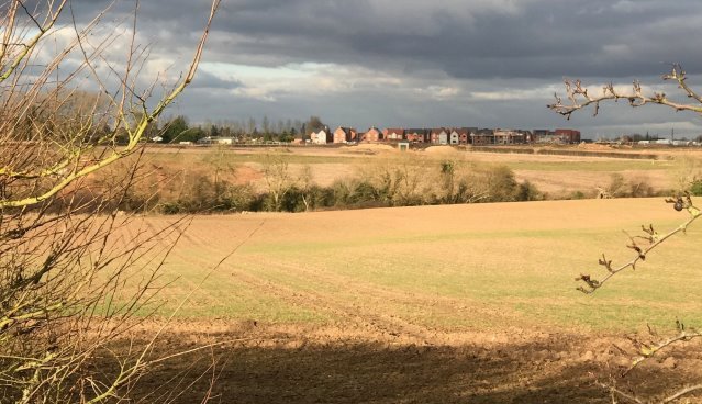
6.7 Since this work was published development within many of the areas such as BT 16, BT08, BT15, BT01 will change the summary findings from "tranquil rural setting with few people and open landscape' to "areas of urban development".
6.8 This impacts on the local landscape and it will be important to manage and mitigate this change, through:
- Management of hedgerows and hedgerow trees e.g. filling gaps along road edges;
- Increasing the number of hedgerow trees using native species such as oak and field maple;
- Managing the Tach Brook with new planting and other measures to increase its biodiversity potential;
- Additional planting as necessary of tree belts and woodland e.g. on rising ground; and
- Managing small woodlands and spinneys by coppicing.
(3) Policy BT2 – Tach Brook Country Park
The Tach Brook Country Park will be protected in order to provide a recreational resource for residents of the Parish. It will act as a green link, an area of both connection and separation, between the historic, established and developing settlements within the community. Development for outdoor countryside and recreation uses and for infrastructure and small buildings associated with outdoor recreation, will be supported. In particular, the following will be encouraged:
- Connections to the Country Park, particularly from existing residential communities and local facilities, such as schools;
- Outdoor sport and recreation uses compatible with the use of the area as a Country Park;
- Protection of existing and creation of new habitats; and
- Signage, interpretation and information infrastructure.
An area south of Tach Brook has been identified as an area of search for a possible southern extension to Tach Brook Country Park, this is shown on the Policies Map North (Map 2, page 10). The Parish Council will work with Warwick District Council, and other interested parties, to develop a masterplan for the defined Country Park area.
Background/Justification
6.9 The Warwick Local Plan allocates land to the north of Tach Brook as a Country Park. The Green Infrastructure Study 2010 and Green Space Strategy 2012identified gaps in Accessible Natural Green Space in the district. This was particularly the case in the southern part of the Warwick, Leamington and Whitnash urban area. This area is also more limited in terms of pedestrian access to the wider network of footpaths in the countryside. To address this deficiency, particularly given the scale and location of development in this part of the district, Tach Brook Country Park (Map 5, page 23) will provide a substantial and permanent landscape buffer and recreation asset between the edge of the urban area and Bishop's Tachbrook.
6.10 Tach Brook Country Park will be a multifunctional green infrastructure asset to:
- Provide a strong 'green buffer' between the northern parts of Bishop's Tachbrook and the southern edge of the new development sites off Harbury Lane. This will include minimising the visual impact of development and softening the edge of new housing schemes.
- Promote ecology and habitat diversification in a landscape that has historically been associated with modern farming and other uses.
- Play a role in flood alleviation, particularly considering the close proximity of a significant numbers of new houses.
- Provide a functional park facility that is well-connected to new developments, in terms of access and walking and cycling infrastructure. While the park may have a defined character, it is also part of a wider brook valley / green corridor.
- Provide park facilities of an appropriate scale to support informal leisure activities for people living within the wider area south of Leamington / Warwick, who currently have limited access to nearby natural green space and the wider countryside."
6.11 The Warwick District Local Plan proposal only allocates land to the north of Tach Brook. The Parish Council are of the view that this concept should be extended to cover land on the south side of Tach Brook. This will help to create a more coherent outdoor recreation resource that serves both the needs of residents of Royal Leamington Spa, but also provides a resource for residents of Bishop's Tachbrook village (Map 2, page 8).
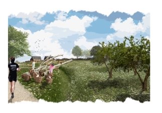
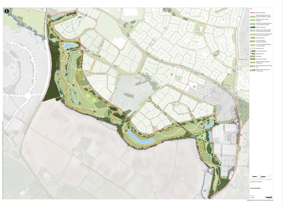
6.12 Work has started on the multi-million-pound development of Tach Brook County Park. The park and its running over the next 13 years is set to cost between some £2.5million and £9million, which will be covered by neighbouring housing developers who will pay nearby £800 per property towards the park. After 13 years the cost will fall to Warwick District Council. Bishop's Tachbrook Parish Council will own the freehold of the Country Park and lease it back to Warwick District Council (Map 7. Tach Brook Country Park Masterplan, page34 )
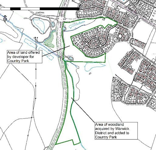
6.13 The Country Park only includes land to the north of the Tach Brook. The BTNDP proposes that this area should be extended to the south of Tach Brook. This will help integrate and link the Country Park to Bishop's Tachbrook, in turn, helping link the different communities in the neighbourhood area; it will also make planning for the access and environment of the Country Park more comprehensive by including the whole of one of the Country Park's key features: the Tach Brook. Extending the Country Park south of Tach Brook also offers up opportunities to connect to the existing public right of way network and the opportunity to create stronger links from Bishop's Tachbrook village to this new green infrastructure asset. Areas to the south of the Brook also offer potential opportunities to make connections with the area's past e.g. Windmill Hill. A southern extension of the Country park also helps to ensure a substantial green buffer remains between Bishop's Tachbrook and Leamington Spa, particularly given that the originally land allocated as Country Park north of Tach Brook will now be used for a new school.
6.14 As well as the area of search shown on the Policies Map for a southern extension to the Country Park, the boundary for the Country Park north of Tach Brook has changed as development proposals have been brought forward. To the west as a result of the proposed new schools. To the east, land that has been offered to Warwick District Council as a result of the Lower Heathcote development. This is a larger area than originally proposed and takes the boundary of the Country Park up to Europa Way. Secondly, Warwick District Council have acquired an area of woodland from Warwickshire County Council. This land was available after the construction of Europa Way (Map 8, page 35). This area forms a natural extension to the Country Park and will also allow pedestrian and cycle access from the Asps development
Consultation on the emerging boundary of the Country Park, north of Tach Brook is began in March 2020 (https://www.warwickdc.gov.uk/info/20311/major_parks/1483/tach_brook_country_park). The BTNDP is being used to progress the consultation on the area of search for an extension south of Tach Brook. Over time, these two strands of work will be brought together to define a final boundary for the Country Park.
Map 7. Tach Brook Country Park Masterplan (Source: Warwick District Council)
Map 8. Tach Brook Country Park - changes from the Local Plan
(1) Policy BT3 – Green Infrastructure
The network of paths, fields, watercourses and water features, woodland, grassland and other green infrastructure features within the parish should be maintained and enhanced for their recreational, tourism and ecological value. Development proposals should seek to maintain this green infrastructure network and, where possible, encourage the enhancement of the green infrastructure network by creating new connections and links in the network; restoring existing green infrastructure; or by introducing features that enhance the existing green infrastructure network.
Background/Justification
6.15 To ensure that other Green Infrastructure (GI) resources (footpaths, streams, ponds, woodlands etc.) are protected and remain as an inter-connected network the area's GI will be protected. These areas will be also be important reservoirs for carbon capture and help to combat climate change.
6.16 Proposals to improve or enhance these areas will be supported, as will proposals that seek to create new GI.
6.17 Warwick District Council's Green Infrastructure Study 2010 identifies the Tach Brook as part of the District's strategic Green Infrastructure (Map 9, page 36).
Map 9. Strategic Green Infrastructure (Source: Warwick District Council)
OBJECTIVE 2. To promote healthy living and encourage sustainable transport (such as walking and cycling) to reduce demand on the local highway network and improve road safety.
(2) Policy BT4 - Traffic Management and Transport Improvements
To improve health, road safety and reduce traffic impacts the following transport proposals will be encouraged:
- Measures to provide safer travel to Bishops Tachbrook CE Primary School, Heathcote Primary School and future school;
- Improved car parking in the village centre, including at the St Chad's Centre, where this is in line with County standards;
- Improvements to the junction of Mallory Road / Banbury Road (A452);
- Provision of a pedestrian crossing and traffic calming measures on Mallory Road;
- Provision of suitable pedestrian/cycle crossing (Toucan) at the A452 providing connections to The Asps and beyond;
- Traffic calming measures on Oakley Wood Road (southern approach into the village); and
- Measures to improve bus travel to key local centres, including Leamington and Warwick.
Background/Justification
6.18 Amongst residents' key concerns are the impact of traffic and congestion. These concerns are heightened by the prospect of further car use arising from the planned new developments in Bishop's Tachbrook parish and surrounding areas. Policy BT4 suggests a range of measures to reduce car dependency and improve road safety.
6.19 Improvement to the junction of Mallory Road / Banbury Road (A452) will be pursued, possibly via developer contributions, to improve safety, road markings, lighting, visibility and capacity at the junction of Mallory Road and Banbury Road from housing allocation H49 at Seven Acre Close.
6.20 In order to improve road safety and calm traffic, proposals to introduce a formalised pedestrian crossing on Mallory Road in the vicinity of Church Lees and the bus layby will also be sought.
6.21 As well as pursuing transport improvements through the planning system the Parish Council will also seek to encourage non-planning improvements to the local highway network e.g. 20mph speed limits through the village of Bishop's Tachbrook, residential areas within Heathcote and to all new residential development areas within the Parish.
6.22 Similarly, other improvements will be sought to promote sustainable connectivity between existing and new urban areas within the Parish. These could include upgraded/improved footway provision on/at the A425 (Banbury Road), near Spinney Farm, this would contribute towards better connectivity into Warwick; and better footpath provision along Harbury Lane to link the development at The Asps, Heathcote and Oakley Grove.
(3) Policy BT5 - Improving Accessibility for All
Proposals which improve accessibility for existing and future residents of Bishop's Tachbrook will be supported including accessibility and transport improvements:
- Provision of safe cycle routes within the design of new and existing roads.
- Inclusion of appropriate covered bike storage at community and retail facilities.
- Inclusion of appropriately surfaced cycle routes and footpaths through green spaces to assist cyclists and pedestrians to use these routes in adverse weather.
- Signalling improvements, environmental enhancements and improved signage to promote increased use of walking and cycling routes to local schools, neighbourhood centres and open spaces.
- Integration of any new green routes into existing off-road networks, such as Oakley Wood Road and from Banbury Road and Europa Way.
- Improvements to local bus service provision, where routes and services are related to new development.
- Creation within the neighbourhood area of a circular network of off-road footpaths and cycleways.
- A foot bridge over Europa Way to link The Asps to the Country Park.
Background/Justification
6.23 The Strategic Transport Assessment, 2011 includes the following vision:
The proposals for transport in relation to the Local Plan must support the vision for the District. In this respect, transport should:
- Contribute to the area being a place where people want to live, work and visit;
- Support the economy of the main towns and surrounding rural areas, thus stimulating growth and prosperity;
- Mitigate, where possible, the negative impacts of growth;
- Help achieve connectivity between new and existing neighbourhoods, community facilities and public spaces; and
- Ensure that communities can access heath and local services by sustainable means.
6.24 The Local Transport Plan for Warwickshire 2011 – 2026 (LTP3) has the following objectives:
- To promote greater equality of opportunity for all citizens in order to promote a fairer, more inclusive society;
- To seek reliable and efficient transport networks which will help promote full employment and a strong, sustainable local and sub‐regional economy;
- To reduce the impact of transport on people and the [built and natural] environment and improve the journey experience of transport users;
- To improve the safety, security and health of people by reducing the risk of death, injury or illness arising from transport, and by promoting travel modes that are beneficial to health;
- To encourage integration of transport, both in terms of policy planning and the physical interchange of modes;
- To reduce transport emissions of carbon dioxide and other greenhouse gases, and address the need to adapt to climate change.
6.25 The County Council will secure improvements to walking, cycling and public transport through the planning process, along with contributions towards the strategic highway infrastructure improvements identified in the Warwick District Local Plan Strategic Transport Assessment. Other improvements will be funded as budgets and priorities allow, either from the County Council's own capital resources or through external funding from Government and others (e.g. Sustrans). Improvements to local bus services should be discussed directly with the operator where these are provided commercially. The Parish Council will work with all these bodies to secure such improvements.
OBJECTIVE: 3. To ensure the parish has the appropriate open space, recreation and community facilities to support present demand and future projected growth.
Policy BT6 – Designated Local Green Space
The following local green spaces as shown on the Policies Map (Maps 2 and 3, pages 10 and 11) are designated when consistent with paragraphs 99 and 100 of the NPPF as Local Green Spaces:
- The Meadow
- The Village Green
- St Chad's Road
- The field north of Croft Close
- Park Homes site open space
Development of these sites will only be permitted in accordance with national Green Belt policy.
Background/Justification
6.26 Paragraph 99 of the National Planning Policy Framework (NPPF) advises that "The designation of land as Local Green Space through local and neighbourhood plans allows communities to identify and protect green areas of particular importance to them. Designating land as Local Green Space should be consistent with the local planning of sustainable development and complement investment in sufficient homes, jobs and other essential services. Local Green Spaces should only be designated when a plan is prepared or updated, and be capable of enduring beyond the end of the plan period.
6.27 Paragraph 100 of NPPF goes on to state Local Green Space designation should only be used where the green space is:
- in reasonably close proximity to the community it serves;
- demonstrably special to a local community and holds a particular local significance, for example because of its beauty, historic significance, recreational value (including as a playing field), tranquillity or richness of its wildlife; and
- local in character and is not an extensive tract of land.
6.28 A separate analysis of all the key green and open spaces identified in the neighbourhood area has been undertaken. From this, those meeting the NPPF criteria set out in paragraph 6.27 have been potentially designated as Local Green Spaces. One area raised by residents at the "Your Parish - Today and Tomorrow" consultation events was the open area opposite the Leopard public house at the northern entrance to the village (Appendix 2). Whilst valued by many this space is not considered, when assessed against the designation criteria in NPPF, to meet the tests for Local Green Space designation. The full assessment of Local Green Spaces is available separately in the Local Green Space Assessmentreport.
Policy BT7 Protecting Other Open Spaces
The open spaces identified on the Policies Map (Maps 2 and 3, pages 8 and 9) will be protected.
Development of these areas for built development will only be supported when:
- There is clear evidence the open space is no longer used by the local community; or
- When the space is still used by the local community, alternative provision of equal or better community benefit is provided elsewhere within the local area; or
- The development is for alternative sport and recreation facilities the need for which clearly outweighs the loss of the existing facility.
Background/Justification
6.29 As well as those spaces considered to be the most demonstrably special the neighbourhood area also has a number of other open spaces that are worthy of protection. The full assessment of open spaces in the neighbourhood area is available separately in the Local Green Space Assessment report.
6.30 These spaces provide important opportunities for informal recreation and play or contribute to the amenity of the area. These spaces will be protected using Policy BT7.
Policy BT8– Protection of Community Facilities
There will be a presumption in favour of the protection of existing facilities. Where permission is required, the change of use of local community facilities, as listed below, will only be permitted for other health, education or community type uses (such as village halls, local clubhouses, health centres, schools and children's day nurseries), unless one of the following conditions is met:
- The proposal includes alternative provision, on a site within the locality, of equivalent or enhanced facilities. Such sites should be accessible by public transport, walking and cycling and have adequate car parking; or
- Satisfactory evidence is produced (including active marketing locally and in the wider area) that, over a minimum period of 12 months, it has been demonstrated that there is no longer a demand for the facility.
The facilities are listed as follows and shown on the Policies Maps 3 and 4 (pages 8 and 9)
- The Leopard
- St Chad's Church
- St Chad's Centre
- Bishop's Tachbrook Sport and Social Club
- Tachbrook Stores
- Croft Medical Centre
- Bishop's Tachbrook School
- Heathcote Primary School
Proposals that would enhance the appearance, improve access and accessibility to these facilities will be supported when they are in accordance with other development plan policies and the policies of the BTNDP.
Where new open spaces are created planning applications affecting those spaces will also be subject to policy BT8
Background/Justification
6.31 Community facilities, such as the two schools, The Leopard Public House, the local churches and shops are part of the essential glue that helps bind and bring the local community together. Policy BT8 identifies the essential of community facilities in the neighbourhood area and, in line with national planning policy, seeks to guard against the unnecessary loss of these valued facilities. Policy BT8 supports improvements and enhancements to these assets.
(1) Policy BT9 – Healthy, Inclusive Community
To ensure that the neighbourhood area is a healthy, inclusive community where appropriate, feasible and viable, development proposals should include the following:
- Well-designed roads and streets that are accessible to all and offer people places and spaces to meet;
- Footpaths, cycleways and bridleways that link to existing networks and offer opportunities to make connections between geographically separate communities;
- Links to Tach Brook Country Park; and
- Parish noticeboards and other signage
Background/Justification
6.32 National Planning Policy in the NPPF (paragraph 91) acknowledges that planning has a role to play in facilitating social interaction and bringing people together.
6.33 Given the level of change proposed in the neighbourhood area, through the Warwick District Local Plan, the neighbourhood plan aims to ensure that such change results in a healthy and inclusive community.
6.34 All the developments south of Harbury Lane will result in a new residential community in the north of the neighbourhood area. To a degree this area will have its own community, recreation and shopping facilities. The residents in this area, just as many residents in Bishop's Tachbrook village do, will also look to Royal Leamington Spa for key services and employment. Equally, the new development will provide new facilities for existing Bishop's Tachbrook residents to use.
6.35 The risk is that the new community becomes purely a suburb of Royal Leamington Spa, with residents commuting to and from work, and having little opportunity to become involved in wider community activity and life. The neighbourhood plan seeks to avoid this outcome by encouraging development proposals, where feasible and viable, to include measures that offer the opportunity to bring the residents of the neighbourhood area together. These measures can include:

- Footpaths
- Access to Tach Brook Country Park
- Meeting places and spaces
- Recreation resources
OBJECTIVE 4: To protect and enhance the historic village centre of Bishop's Tachbrook by ensuring that any development within the Conservation Area is sympathetic with current buildings and landscape.
Policy BT10 – Development within Bishop's Tachbrook Conservation Area
All new development within and affecting the setting of the Bishop's Tachbrook Conservation Area (Map 9, page 45) will be expected to maintain and, where possible, enhance the positive attributes of the Conservation Area and its setting. In particular development proposals should:
- Maintain the historic pattern of development by respecting the open dispersed form of settlement and the historic street pattern;
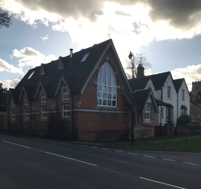
- Retain and enhance any non-designated heritage assets, such as the former village school;
- Ensure that any development on key gateways, such as The Leopard Public House are designed to a high quality;
- Retain trees, tree belts, banks and open spaces;
- Ensure that any development on key road junctions respects the character of the area and is suitable to this sensitive setting, avoiding clutter, over- engineered traffic management solutions and inappropriate signage; and
-
That the following important views are protected:
- Views at the Oakley Wood Road/Church Hill junction;
- Views at the Church Hill/Mallory Road junction
- Views from The Green to the Parish Church;
- View down Oakley Wood Road past the tree belt to the Manor House grounds.
Map 9. Bishop's Tachbrook Conservation Area (Source: Warwick District Council)
Background/Justification
6.36 The area designated as a Conservation Area in Bishop's Tachbrook is shown on Map 9. The Conservation Area in Bishop's Tachbrook was designated in 1969 and extended in 2001.
6.37 Bishop's Tachbrook is a village which was extended significantly in the 1960's and 1970's and the Conservation Area gives protection to the core of the original village. It is characterised by a number of road junctions at which there are significant groups of buildings. On entering the village from Leamington, the Leopard Public House and its grounds and car park form part of the Conservation Area corridor leading to the junction with Church Hill and Oakley Wood Road. At this junction is the former village school which, although not listed, is a significant building. Church Hill rises steeply past Bishop's Close and the timber framed listed buildings at the junction. The junction with Mallory Road and Church Hill is characterised by cottages on the southern side and the Parish Church and churchyard rising up on the north side. Adjacent to the churchyard is The Green which is now surrounded by mid-20th Century developments which, although outside the Conservation Area, do impact on this area. Mallory Road which follows round from The Green leads to the termination of the Conservation Area.
6.38 Savages Close leads to the Manor House and a number of small cottages which, together with the Manor House grounds, form a distinctively separate part of the village separated from the rest of the Conservation Area by the tree belt along Oakley Wood Road. It is important that the character of Savages Close is maintained with its steep banks and mature trees with only minimal access points leading to various houses in the Close. Oakley Wood Road forms an attractive approach road to the village being largely tree-lined in a slight depression. It is important for the maintenance of the character of Bishop's Tachbrook Conservation Area that the quality of the various road junctions is maintained and where possible, enhanced in order to maintain and strengthen the unity of this part of the village which is distinctively different from the twentieth century additions to the village.
6.39 There are some important views in the Conservation Area, these relate largely to the various road junctions within the Conservation Area, these being the junction with Oakley Wood Road and Church Hill, and Church Hill and Mallory Road. There are important views across The Green towards the Parish Church and down Oakley Wood road past the tree belt in the Manor House grounds
Policy BT11 – Protection of Non-Designated Heritage Assets and Locally Listed Historic Assets
Development proposals affecting the significance of Locally Listed Buildings and other non-designated heritage assets identified in the Warwickshire Historical Environment Record will only be supported in the following circumstances:
- Where renovation or alteration of non-designated heritage assets require planning permission, such changes are designed sensitively, and with careful regard to the heritage asset's historical and architectural value and pay appropriate regard to the asset's setting; or
- Where a development proposal would result in the total loss of, or substantial harm to, the significance of a non-designated heritage asset, such development will only be supported when the public benefit of the proposed development outweighs the total loss of, or substantial harm to, the significance of the asset and its setting. Where such development is permitted, this will be conditioned in such a way that appropriate recording of the heritage asset takes place prior to any loss or harm occurring.
Background/Justification
6.40 As well as the designated heritage assets such as the Conservation Area and Listed Buildings that have statutory protection, the neighbourhood area also has a number of non-designated heritage assets. National planning policy define such assets as "A building, monument, site, place, area or landscape identified as having a degree of significance meriting consideration in planning decisions, because of its heritage interest". Such assets can include locally listed buildings.
6.41 Warwick District Council is launching a Local List of Historic Buildings and Structures to give a level of recognition to these buildings and structures. The aim is to give recognition to the wide variety of historic buildings in Warwick district with a view to recognising their intrinsic qualities where development is proposed.
6.42 To be included in the Local List of Historic Buildings and Structures a candidate must fulfil at least one category from of either: Architectural and Design Merit, Historical/Social Interest, Survival and Originality.
6.43 Consultation on the Regulation 16 Draft of the BTNDP presents an opportunity for local people to put forward suggestions for local listing. Further information can be found here.
6.44 Policy BT11 will be used to assess planning applications that affect Locally Listed Buildings and other non-designated heritage assets identified in the Warwickshire Historic Environment Record.
OBJECTIVE 5. To ensure that new housing is in a suitable range of sizes, types and tenures, to meet assessed local needs for market and social homes.
(4) Policy BT12 – Securing a Suitable Mix of House Types, Tenures and Sizes in New Development
In meeting District-wide planning policies H2 and H4, development proposals for new housing should also be informed by and demonstrate how they have met the needs identified in the most up to date Parish Housing Needs Survey.
Background/Justification
6.45 Warwick District Local Plan Strategic Policy DS2: Providing the Homes the District Needs seeks to ensure that the district's housing needs are met. Similarly, the Parish Council wish to see local needs met, particularly for those who wish to downsize and those who wish to access their first home. In line with Policy DS2 development should provide a mix of new homes to meet different needs.
6.46 Policy H4 of the Warwick District Local Plan "Securing a Mix of Housing" sets out policy for securing a mix of housing on development sites:
"The Council will require proposals for residential development to include a mix of market housing which contributes towards a balance of house types and sizes across the district including the housing needs of different age groups, in accordance with the latest Strategic Housing Market Assessment."
6.47 Policy H2 Affordable Housing of the Warwick District Local Plan sets district wide affordable housing policy.
"Residential development on sites of 11 or more dwellings or where the combined gross floor space is more than 1,000 sq. m will not be permitted unless provision is made for 40% affordable housing."
6.48 A Housing Needs Survey (July 2019) has been undertaken by Warwickshire Rural Community Council for the Parish, this concluded that there was a need for:
- 5 x First time buyer properties;
- 13 x Housing association properties of all sizes
- 3 x Owner occupied bungalows;
- 12 x Owner occupied houses
- 3 people expressed an interest in self-build.
6.49 The needs identified in the Housing Needs Survey are expected to be met from the current housing allocations although the provision of bungalows and self build plots is not expected to be met if the expected housing mix is not altered to reflect these needs.
6.50 In the future, planning applications should take into account local evidence of housing needs as well as the SHMA produced by Warwick District. This will help to ensure new development is more responsive to the needs of people in the neighbourhood area. Policy BT12 should, therefore, be read in conjunction with new Local Plan Policies H2 and H4.
6.51 When considering housing mix, we will use the definition of a bungalow used in the English Housing Survey Housing Stock Report, prepared by the Department of Communities and Local Government: A house with all of the habitable accommodation on one floor. This excludes chalet bungalows and bungalows with habitable loft conversions, which are treated as houses.
6.52 The Parish Council will work with Warwick District Council to ensure that the Housing Needs Survey is up to date, preferably on a two-yearly cycle.
OBJECTIVE 6.
To protect the environment, ensure sustainability and tackle climate change by reducing greenhouse emissions to as close to zero as possible by 2030. A commitment that is incorporated in Warwick District Council's "Declaration of a Climate Emergency Action Plan"
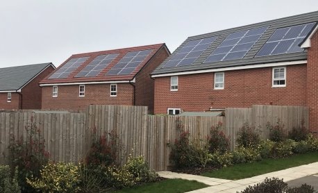
(3) Policy BT13 – Responding to Climate Change
Development proposals should incorporate features that contribute to reducing greenhouse gas emissions and increasing resilience to the impact of climate change.
New builds
-
All new buildings should be designed to be carbon neutral. Proposals will be supported where they take account of the following:
- Building and roof orientation maximise opportunities for harnessing solar energy for renewable energy generation and passive solar gain.
- Heating systems are carbon neutral incorporating such technology as Ground/Air Source Heat pumps or community heating systems
- Water saving technology and waste water recycling are incorporated
- All properties have vehicle charging points
- Sustainable standards of resource consumption and recycling have been applied ensuring that there is an appropriate balance between innovation and respecting and harmonising with the local quality and character of the surrounding development.
- Building for Lifestandards, or an equivalent assessment framework, have been met.
- All new buildings should contribute to environmental resilience. Proposals will be supported where they take account of the following:
- The vulnerability of the site, and the wider area to flooding, especially during extreme weather events, have been identified and mitigated for in the proposal's design;
- The incorporation of buffer strips to protect streams, trees and hedgerow rooting zones;
- Extensive tree planting and landscaping using native species to increase carbon sequestration and ensure biodiversity is connected to the plan; and
- Surfaces that increase groundwater infiltration and reduce run-off will be used.
The Parish Council will not support new developments that it considers does not meet these criteria.
Other issues
- In addition to the design of new buildings, proposals that contribute to the issues listed below will be supported:
- The decarbonisation of existing private homes
- Improving air quality
- More effective waste management
- The creation of renewable energy infrastructure including the building of community solar famrs and wind turbine electricity generation
- Carbon free transport including the installation of public charging points
Background/Justification
6.53 Warwick District Council and Warwickshire County Council have declared climate emergencies that aims to ensure that the whole of Warwickshire is as close to carbon zero by 2030 as possible. The UK parliament recently pledged that the whole country will reach carbon net zero by 20150. Policy BT13 seeks to support these aims.
6.54 NPPF paragraph 148 identifies that planning supports shaping places to secure radical reductions in greenhouse gas emissions, minimising vulnerability and providing resilience to the impacts of climate change. Development in the neighbourhood area should make a contribution to this important objective.
6.55 Policy BT13 should be read alongside national policy and other development plan policy, including that in the Local Plan, to ensure that new development does not have a significant adverse impact on climate change and its impacts.
6.56 The Warwick Local Plan through Policy BE1 Layout and Design sets a framework for assessing the design of planning proposals. This includes all the key features and attributes of what would be considered good design. Policy BT13 does not need or seek to repeat these but seeks to add further policy detail and requirements. These are intended to ensure that new development in the Bishop's Tachbrook neighbourhood area achieves well designed places and good design.
6.57 National policy is clear that the "creation of high-quality buildings and places is fundamental to what the planning and development process should achieve. Good design is a key aspect of sustainable development, creates better places in which to live and work and helps make development acceptable to communities." Local plan and neighbourhood plan design policies should seek to ensure that all new development in Bishop's Tachbrook is good design.
6.58 National planning policy is also clear that "Permission should be refused for development of poor design that fails to take the opportunities available for improving the character and quality of an area and the way it functions" (paragraph 64, NPPF)
6.59 Policy BT13 should also be read in conjunction with the Warwick District Council Residential Design Guide Supplementary Planning Document.
6.60 Paragraph 129 of the NPPF advises that local planning authorities should "ensure that they have access to, and make appropriate use of, tools and processes for assessing and improving the design of development. These include workshops to engage the local community, design advice and review arrangements, and assessment frameworks such as Building for Life."Policy BT13 identifies Building for Lifeas the most appropriate assessment framework to be used for schemes put forward in the neighbourhood area, however equivalents can be used. Whatever assessment framework is adopted, as stressed in NPPF, these are of most benefit if used as early as possible in the evolution of schemes.