Cubbington Neighbourhood Development Plan - Regulation 16 Submission
Appendices View responses
Appendix 1 – Local Businesses
Rovertherapy – Ledbrook Hall, 1 High Street
Hyam Construction Limited – 2 The Grange
Barchester – Cubbington Mill, Church Lane
MC Hadley Upholstery – 39 Offchurch Road
D J O'Donnel Builder – 5 Brookfield Road
Balti Vhjon Takeaway Food – 50A Queen Street
Best One – Grocers, Convenience – 44 Queen Street
Hollies Tearoom – 53 Queen Street
Branching Out Garden Services – Price Road
The Queens Head –PH - 20 Queen Street
The Warwickshire Beer Co. Wine, Beer, Spirit suppliers – Queen Street
Norris Studios – sound recording – 29 Ladycrift
Element Tree Care – tree surgeons – Price Road
J Arthurton – Foot health – 28 Price Road
Sophie's Beauty - Beauty Salon – 17 Cross Lane
JM Electrical – electrician – 30 Price Road
A List Hair Extensions mobile – 30 Price Road
Domestic Gas Services – 9 Queen Street
Katy's beauty salon – High Street
Ultimate Nails – 21 High Street
JEH Plastering – 21 High Street
4 Seasons Mowers – gardening equipment – 37 Price Road
SPG Fitted Bedrooms – 11-13 High Street
Thwaites Ltd – Plant & Machinery – Welsh Road Works
Charles R Andrews – Surveyor & Valuers – 17 Cross Lane
School of Fish –driving school – 19 Cross Lane
RJ Autotrading – Hill Farm, Offchurch Road
OTFM Productions Ltd – 28 Ledbrook Road
Crystal Clear Cleaning Solutions – window cleaning - 75 Broadway
O'Brien Contractors – civil engineers – Church Lane
RM Healy, flooring – Boddington Close
Tom Stanley Carpentry – New Street
W Stacey Plastering- New Street
B2B Cleaning and Carpet Cleaning – Church Terrace
Cubbington Karaoke – Broadway
Bungalow Farm B&B – Windmill Hill
Cubbington CofE School –Church Hill
Cubbington Sports & Social Club – Windmill Hill
Kings Head PH – Church Hill
R&B Heating Services – Stonehouse Close
Gemma King Hypnotherapy – The Grange
Our Lady & St Teresa's Primary School – Windmill Hill
Lake Contracts – flooring – The Grange
Andy Veal Plumbing & Heating – Rugby Road
Acupuncture – Kiki Hogg – Rugby Road
Plant Waste Removal – Kinross Road
Limoux Furniture – Stonehouse Close
MC Garden Services – The Grange
IW Plumbing – Broadway
Development Engineering & Enterprise – Glebe Farm, Welsh Road
Motum Simulation Uk – Glebe Farm, Welsh Road
Bradley Builders – Broadway
PSL Distribution Ltd – Disco Equipment – Broadway
Dogwashers – Church Lane
SM Easterlow – Plasterers – The Grange
Paws at Pennys Dog Grooming – Pinehurst
Greg Prosser Guitar Tuition- Windmill Croft d
CJR Welding and Fabrication – Coventry Road
Metcalfe Timber Merchants – Rugby Road
Claire Harrison-Ray – Chiropodists – Kelvin Road
George Sullivan Painter & Decorators – Pinehurst
Cubbington Mowers – Rugby Road
Shell Service Station Budgens & Subway – Rugby Road
Compton Garage Services – Rugby Road
Cubbington Garage Services – Coventry Road
New Blossom Court – Takeaway Food – Rugby Road
Cubbington Plaice – Takeaway Food – Rugby Road
Logan’s Barber Shop – Rugby Road
Evolve Hair Salon – Rugby Road
Winebox – Grocers & Convenience – Rugby Road
A1 Electrical Services – Rugby Road
Rugby Tavern PH – Rugby Road
Town & Country Landrovers – Rugby Road
Rise & Shine Aircraft Valet Services – Willow Sheets Meadow
JP Restoration – Stirling Avenue
Avonvale Veterinary Practice – Rugby Road
Sainsburys’ Local - Rugby Road
Launderette - Rugby Road
Furzen Hill Farm Holiday Cottages – Coventry Road
Appendix 2 – National Heritage List for England
Accessed from https://historicengland.org.uk/listing/the-list/advanced-search 18/10/22
CHURCHYARD WALL AND GATES TO SOUTH AND SOUTH EAST OF CHURCH
List Entry Number: 1035199
Heritage Category: Listing
Grade: II
Location: CHURCHYARD WALL AND GATES TO SOUTH AND SOUTH EAST OF CHURCH, CHURCH HILL, Cubbington, Warwick, Warwickshire
CUBBINGTON CHURCH OF ENGLAND SCHOOL
List Entry Number: 1035200
Heritage Category: Listing
Grade: II
Location: CUBBINGTON CHURCH OF ENGLAND SCHOOL, CHURCH HILL, Cubbington, Warwick, Warwickshire
MANOR COTTAGE
List Entry Number: 1035201
Heritage Category: Listing
Grade: II
Location: MANOR COTTAGE, CHURCH LANE, Cubbington, Warwick, Warwickshire
THE OLD MANOR HOUSE
List Entry Number: 1035202
Heritage Category: Listing
Grade: II
Location: THE OLD MANOR HOUSE, HIGH STREET, Cubbington, Warwick, Warwickshire
54, QUEEN STREET
List Entry Number: 1035203
Heritage Category: Listing
Grade: II
Location: 54, QUEEN STREET, Cubbington, Warwick, Warwickshire
HAM FARMHOUSE
List Entry Number: 1035204
Heritage Category: Listing
Grade: II
Location: HAM FARMHOUSE, WELSH ROAD, Cubbington, Warwick, Warwickshire
THE VICARAGE
List Entry Number: 1115539
Heritage Category: Listing
Grade: II
Location: THE VICARAGE, RUGBY ROAD, Cubbington, Warwick, Warwickshire
19, HIGH STREET
List Entry Number: 1320362
Heritage Category: Listing
Grade: II
Location: 19, HIGH STREET, Cubbington, Warwick, Warwickshire
HAM BARN
List Entry Number: 1320390
Heritage Category: Listing
Grade: II
Location: HAM BARN, WELSH ROAD, Cubbington, Warwick, Warwickshire
BARN AND STABLE RANGES 15 YARDS TO NORTH WEST OF HAM FARM HOUSE
List Entry Number: 1320392
Heritage Category: Listing
Grade: II
Location: BARN AND STABLE RANGES 15 YARDS TO NORTH WEST OF HAM FARM HOUSE, WELSH ROAD, Cubbington, Warwick, Warwickshire
CHURCH OF ST MARY
List Entry Number: 1364926
Heritage Category: Listing
Grade: I
Location: CHURCH OF ST MARY, CHURCH HILL, Cubbington, Warwick, Warwickshire
2, 4, 6 AND 8, CHURCH LANE
List Entry Number: 1364927
Heritage Category: Listing
Grade: II
Location: 2, 4, 6 AND 8, CHURCH LANE, Cubbington, Warwick, Warwickshire
THE MANOR
List Entry Number: 1364928
Heritage Category: Listing
Grade: II
Location: THE MANOR, CHURCH LANE, Cubbington, Warwick, Warwickshire
OFFCHURCH BRIDGE (PARTLY IN OFFCHURCH PARISH)
List Entry Number: 1364929
Heritage Category: Listing
Grade: II
Location: OFFCHURCH BRIDGE (PARTLY IN OFFCHURCH PARISH), WELSH ROAD, RIVER LEAM, Cubbington, Warwick, Warwickshire
FORD FARMHOUSE
List Entry Number: 1364930
Heritage Category: Listing
Grade: II
Location: FORD FARMHOUSE, WELSH ROAD, Cubbington, Warwick, Warwickshire
Cubbington War Memorial
List Entry Number: 1438972
Heritage Category: Listing
Grade: II
Location: Churchyard of the Church of St Mary, Church Lane, Cubbington, Leamington Spa, Warwickshire, CV32 7JT, Cubbington, Warwick, Warwickshire
Appendix 3 – Previous planning history of call for sites suggestions
In his evidence to the November 2016 Public Examination Session the WDC representative said that he was minded to remove the northern field from H50 and restrict development to the southern field, but retaining the allocation at 95 dwellings.
The Government's Examiner discusses the proposal to develop site H50 (now known as 202) in paragraphs 373 to 376 of his subsequent report (note 3). In paragraph 373 he records the change made by the WDC representative:
"Whilst the site [H50] was shown as covering land both to the north and south of Rugby Road, the Council clarified at the hearing session that only land to the south of Rugby Road was intended to be developed and that the proposed site allocation should reflect this. This was on the basis of significant concerns regarding the landscape impact of development to the north of the road. The estimated capacity remained at 95 dwellings, however. I have considered the site on this basis."
In paragraph 374 the Government's Examiner considers the impact that redrawing the Green Belt boundary, as would be required to allow the site to be developed, would have:
"There is currently a distinct and well-defined edge to the built up area formed by housing on either side of Rugby Road. Beyond this housing there is open countryside on both sides of the road. Development of the site (south of Rugby Road) would result in a prominent and substantial encroachment of housing into this open countryside along one side of the road. It would have a substantial impact on the openness on the Green Belt in this locality. Housing on the site would be poorly related to the existing pattern of development and would significantly alter the scale and form of the village. Despite the potential for landscaping and the proximity of the route of HS2 to the east, development would have a substantial adverse effect on the character and appearance of the village and the surrounding area. Whilst it would make a significant contribution to the supply of housing, the adverse impacts of development would outweigh the benefits."
In paragraph 376 the Government's Examiner concludes:
"In the light of constraints that apply to potential sites, the estimated supply of 119 dwellings in Cubbington is reasonable and justified. It is not necessary to allocate the site on land east of Cubbington (H50) in order to ensure sufficient housing growth in the village or to meet the overall housing requirements for the District. The adverse impacts of development would outweigh the benefits and exceptional circumstances for altering the Green Belt do not exist in this case."
The Government's Examiner required that site H50 be deleted from the Warwick District Local Plan.
In paragraphs 377 to 381 of his report the Government's Examiner considers two further sites in Cubbington that have been identified as possible candidates for future development and rules them out on similar grounds to his decision on H50.
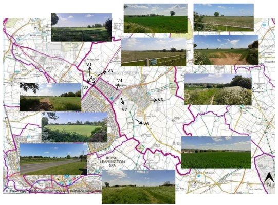
V2 & V8 – Leicester Lane – Cubbington – Lillington parish boundary
V1 – Views from Westhill Road / nr junction Stoneleigh Road
V3 - Views – Westhill Road then towards Leicester Lane – Kenilworth Road
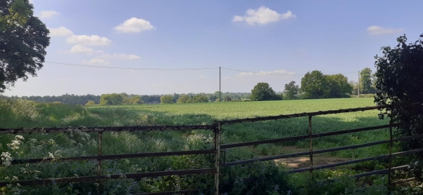
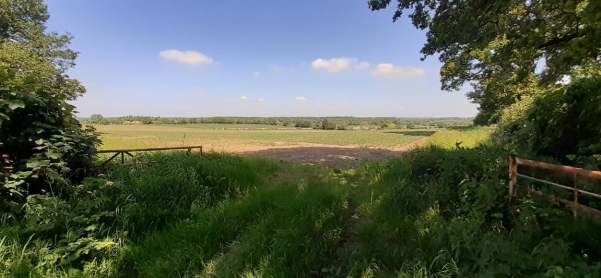
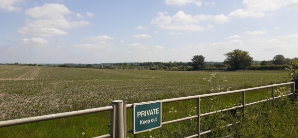
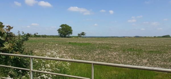
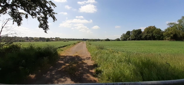
V4 - Views – Kenilworth Road
V5 - Views – Austen Court – The Grange
V6 - Views – Offchurch Lane – Public Footpaths towards Offchurch – River Leam – Newbold Comyn
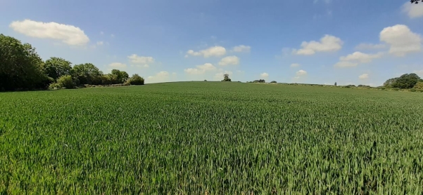
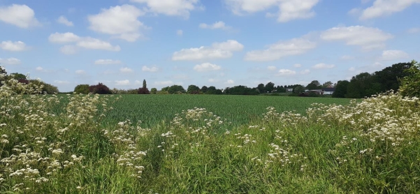
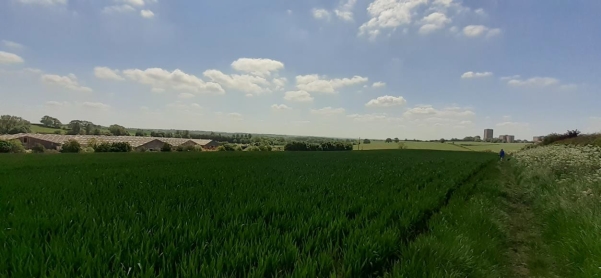
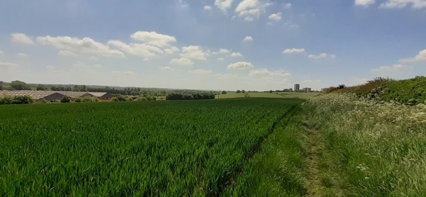
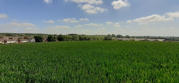
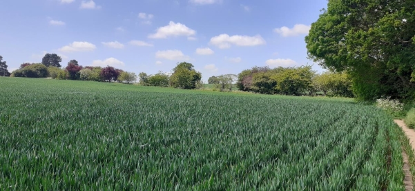
V7 - Views – Offchurch Lane towards Rugby Road
Appendix 5 – Resident's comment on flooding issues
I wish to take advantage of the informal consultation on the February 2023 draft of the Cubbington Neighbourhood Plan to submit my comments to the NPSG.
My primary concern is that, apart from a mention in passing (note 1), the subject of flooding is not currently addressed in the Plan. I am sure that members of the NPSG will be aware that flooding from surface water run-off caused a major incident in Cubbington in 2007.
The source of this flood water was the farmland that lies on the higher land to the north and east of the village. Surface water run-off from this farmland found its way into the Pingle Brook, which overflowed its banks and this overflow ran into low-lying streets in the old village core resulting in more than forty homes being inundated. This flooding of homes occurred despite the Pingle Brook Flood Alleviation scheme having been in operation since 2002; this scheme having been designed to protect against such an occurrence.
In 2014 a new flood alleviation scheme was brought into service. As members of the NPSG will be aware, this new scheme collects surface water in a balancing pond on Mill Lane and feeds it into a buried pipe which takes it away from the village and discharges it outside its southern edge. To date, there have been no incidents of flooding since this scheme has been in operation. However, as had proved the case in 2007, no flood alleviation scheme can provide total protection and it is prudent to avoid making changes in the hydrography that risk increasing the amount of run-off.
The effects of climate change, which has been observed to have the effect of increasing the frequency and intensity of extreme weather events, should not be disregarded either.
In 2013 Warwick District Council commissioned a report on flood risks in its area from Mouchel Consulting (note 2). This report singles out Cubbington, in section 7.5, as a "sensitive development location" where "development would significantly increase flood risk elsewhere". The recommendation of this report is that "future development [in Cubbington] is avoided". This recommendation was ignored by Warwick District Council in developing its Local Plan 2011 – 2029 which made provision for a minimum of 110 new houses to be built in Cubbington up to 2019.
I suggest that, in view of the changes that have taken place in our village and its immediately surrounding countryside since the Mouchel Consulting report was published – the new flood alleviation scheme, HS2 construction and significant housing development – the time is right for a new expert review of the risk of flooding in Cubbington. I feel that the development of the Cubbington Neighbourhood Plan offers the ideal opportunity for this new review and would hope that grant funding would be available to the Parish Council to enable the work to be commissioned. The results of the review could then be summarised in the Plan and, frankly, it seems that the Plan would be deficient without this inclusion.
I note that the draft plan also makes reference to the emerging South Warwickshire Local Plan, which identifies site 202 as one having the potential for future housing development. This site and its possible development have a history of which I have personal knowledge as I represented Cubbington Parish Council at the Local Plan Public Examination Session that was heard by the Government's Examiner in November 2016 at which the Parish Council opposed the inclusion of this site in the Warwick District Council Local Plan. The site was brought into the scope of the Local Plan by the changes that were made to the proposals in the plan in February 2016. It was then identified as H50 and its inclusion had the effect of increasing the proposed allocation of new housing for Cubbington from 100 to 195 dwellings. This addition was made by WDC without prior discussion with, or giving notification to, Cubbington Parish Council.
Early in his evidence to the November 2016 Public Examination Session the WDC representative said that he was minded to remove the northern field from H50 and restrict development to the southern field, but retaining the allocation at 95 dwellings.
The Government's Examiner discusses the proposal to develop site H50 (now known as 202) in paragraphs 373 to 376 of his subsequent report (note 3). In paragraph 373 he records the change made by the WDC representative that is noted I my previous paragraph:
"Whilst the site [H50] was shown as covering land both to the north and south of Rugby Road, the Council clarified at the hearing session that only land to the south of Rugby Road was intended to be developed and that the proposed site allocation should reflect this. This was on the basis of significant concerns regarding the landscape impact of development to the north of the road. The estimated capacity remained at 95 dwellings, however. I have considered the site on this basis."
In paragraph 374 the Government's Examiner considers the impact that redrawing the Green Belt boundary, as would be required to allow the site to be developed, would have:
"There is currently a distinct and well-defined edge to the built up area formed by housing on either side of Rugby Road. Beyond this housing there is open countryside on both sides of the road. Development of the site (south of Rugby Road) would result in a prominent and substantial encroachment of housing into this open countryside along one side of the road. It would have a substantial impact on the openness on the Green Belt in this locality. Housing on the site would be poorly related to the existing pattern of development and would significantly alter the scale and form of the village. Despite the potential for landscaping and the proximity of the route of HS2 to the east, development would have a substantial adverse effect on the character and appearance of the village and the surrounding area. Whilst it would make a significant contribution to the supply of housing, the adverse impacts of development would outweigh the benefits."
In paragraph 376 the Government's Examiner concludes:
"In the light of constraints that apply to potential sites, the estimated supply of 119 dwellings in Cubbington is reasonable and justified. It is not necessary to allocate the site on land east of Cubbington (H50) in order to ensure sufficient housing growth in the village or to meet the overall housing requirements for the District. The adverse impacts of development would outweigh the benefits and exceptional circumstances for altering the Green Belt do not exist in this case."
The Government's Examiner required that site H50 be deleted from the Warwick District Local Plan.
In paragraphs 377 to 381 of his report the Government's Examiner considers two further sites in Cubbington that have been identified as possible candidates for future development and rules them out on similar grounds to his decision on H50. These two sites are the allotments and equestrian centre/riding school site off Coventry Road, which is currently being developed for housing, and land adjacent to Bungalow Farm off Windmill Hill, which has been identified as an available site for development by the Call for Sites for the South Warwickshire Local Plan and given the site number 191.
I have given this potted history as many current councillors were not members of the Parish Council when the events, I have referred to took place. I hope that the observations of the Government's Examiner will prove useful to the Parish Council in any discussions with, or submissions made, to WDC regarding sites 202 and 191. My hope is that the Parish Council will see fit to oppose the inclusion of these two sites in the South Warwickshire Local Plan in the event that either or both of these sites are carried forward into future drafts of the Local Plan.
Resident.
Notes
1. "Flood defences" are included in a list of community infrastructure examples on page 39.
2. Level 1 Strategic Flood Risk Assessment (SFRA), Mouchel Consulting for Warwick District Council, volume 1, April 2013 (https://www.warwickdc.gov.uk/downloads/file/1536/volume_1_-_report_and_appendices)
3. Report on the Examination of the Warwick District Local Plan, The Planning Inspectorate, July 2017 (https://www.warwickdc.gov.uk/downloads/file/4479/inspectors_report_final)
Appendix 6 – Summary of feedback from initial residents' questionnaire
South Warwickshire Local Plan
Issues and Options Consultation
Submission and Summary on behalf of Cubbington Parish Council
QV 3.1 V 3.2 Vision and Strategic Objectives - Whilst the key principles are sound there is no mention of prioritising developments that also ensure the protection of the most vulnerable green belt land between conurbations to both prevent urban sprawl and the loss of community identities. A recognition that major infrastructure schemes currently in progress
i.e. HS2 should also not lead to the redefinition of green space boundaries. Links to current reviews 'Masterplan' focusing on South Coventry.
Community Infrastructure Levy (CIL)
Option I3b: Each District Council to produce its own Levy
Separate Levies could have the potential to better respond to different conditions in different areas of South Warwickshire, with the potential that reviews could be undertaken more easily to react to changing circumstances.
Reasoning – impact on existing or the lack of assets and services will be unique to different areas.
QV-S1 Green & Blue Corridors - Option S1a: Identify Strategic Green and Blue Corridors in advance of the Local Nature Recovery Strategy being produced.
Utilising Information from the soon to be updated, Sub-Regional Green Infrastructure Strategy and additional evidence obtained in consultation with Green Infrastructure Stakeholders, should the South Warwickshire Local Plan identify Green Infrastructure corridors which can be used to help determine the growth strategy.
QV S3.1: Using Brownfield Land for development - Strongly support the development of brownfield sites over green belt. Cubbington Neighbourhood Plan survey results - 99% surveyed wanted open spaces preserved and a significant majority wanted to protect existing nature, environment and open land, and landscape views. With potential pressures i.e. In-fill post HS2 between Cubbington and new railway line, there is need to protect the natural environment and protect what is left of the green belt buffer and landscape views. Brownfield development should also reduce traffic, noise and air pollution when situated next to amenities, schools, etc.
S4.1: Do you think that growth of some of our existing settlements should be part of the overall strategy?
Cubbington is currently identified as a Growth Village but with little brownfield sites and has several flood and surface water flood risks. The Cubbington Neighbourhood Plan survey identified that 84% wanted no new housing but if there were to be any then the development should be assessed on its impact on the whole village and not in isolation.
Appropriate development must serve the whole community. Cubbington's population is relatively static, only 5% of those surveyed had family that had moved out because the area was unaffordable – 7% of respondents have relatives who want to move back to the area.
The majority of respondents were over 59, have lived in Cubbington over 10 years and were working full time or retired. Cubbington is well served by schools and any housing needs to consider smaller new energy efficient homes to potentially free up larger family homes, if residents wish to downsize but remain in the community.
Q-S5.2: Do you think new settlements should be part of the overall strategy?
Yes – optimising railway and motorway corridors. Major new settlements should not be in green belt and definitely focused on long term sustainability (infrastructure, cleaner transport- trains and local employment). This strategy can also protect the green belt between North Leamington and Coventry, comply with the majority of people's view on green belt protection and avoid overburdening existing communities and services. A significant risk if a policy of growth village expansion or dispersed developments were to be encouraged.
Q-S7.2: - Refined Spatial Growth Options
Cubbington is identified in several options due to or on the basis of Sustainable Travel, Economy and Dispersed development opportunities i.e. expand the existing settlement / village.
Within Cubbington the CNDP survey stated 84% wanted no new housing but if there were to be any then the development should be assessed on its impact on village, not in isolation.
Focus on short-term economy and sustainable travel may well steer the SWLP to a Dispersed development approach. The Cubbington Neighbourhood Plan recognises the potential impact of employment growth within neighbouring areas. For example from South Coventry, Warwick University, Coventry Airport re-development, etc this could lead to pressure for housing growth in Cubbington and would, therefore, impact on Cubbington's natural environment , infrastructure, utilities, schools and transport and Cubbington's very identity if subjected to urban sprawl and loss of green belt protection. Outcomes from the Warwickshire District Council Master Plan project are key.
Cubbington Parish Council supports both neighbouring Weston Under Wetherley and Old Milverton and Blackdown parish council's submissions.
South Warwickshire Local Plan – Old Milverton and Blackdown Joint Parish Council (ombparish.org.uk)
Q-S8.1 – Settlements falling outside the chosen growth strategy:
A standard threshold approach to small scale development is not appropriate and definitely should not apply to greenbelt areas. CNDP survey highlighted 84% wanted no new housing but if there were to be any then the development should be assessed on its impact on the village, not in isolation.
Small scale in-fill non green belt of the right type of housing should benefit the whole community i.e. affordable, energy efficient small 1-2 bedroom homes to allow downsizing for residents, release family size homes, close to existing schools, less traffic, 20 min rule.
Q-S10 – Any other comments:
The Cubbington Neighbourhood Development Plan CNDP survey strongly highlights that the majority of those who responded 99% want existing open spaces and green belt preserved, protect existing nature, environment and open land and landscape views.
84% wanted no new housing but if there were to be any then the development should be assessed on its impact on the whole village, not in isolation and accompanied with the necessary infrastructure and services improvements. New housing should be limited in number to protect the separate identity of Cubbington.
The construction of HS2 within and adjacent to the parish has the potential to impact on the local environment and pressure for changes to the Green Belt boundary and this must be resisted.
Any significant development North Leamington, Blackdown, Leicester Lane will materially affect the residents of Cubbington and its sustainability and impact on existing schools, local amenities, roads and infrastructure.
Windmill Hill junction and key roads, Kenilworth Road, Rugby Road are now subject to increased volumes of cars and heavy goods vehicles as more traffic from Southam and surrounding villages access the A46 at peak times. Many of these roads and junctions were never designed for this situation with risks to local residents increasing in terms of road safety, pedestrians and noise and air pollution increasing.
Supporting the above statement the current objectives of the draft CNDP are :-
OBJECTIVE 1– To protect and enhance green spaces.
OBJECTIVE 2 – To ensure any new development creates high quality, beautiful and sustainable buildings and places that reinforce the identity of Cubbington and the surrounding countryside.
OBJECTIVE 3– To conserve and enhance the natural environment and built heritage assets of the area.
OBJECTIVE 4– To protect and enhance local community facility provision.
OBJECTIVE 5 – To ensure any new development is of a proportionate scale and supported by sufficient infrastructure so that it minimises impact on Cubbington's existing communities.
Q-C12: Please add any comments you wish to make about water management or flood risk in South Warwickshire
Cubbington has historically been prone to flooding to the south west of the village and extensive flood alleviation work was undertaken at the Pingle Brook. Any development of land within this catchment, particularly in the green belt between Thwaites and Offchurch should not take place and is questionably unsustainable with significant obstacles to overcome.
https://www.mcphillips.co.uk/projects/cubbington-flood-risk-management-warwickshire/
In addition, existing surface water flooding risks in the Kenilworth Road / Balmoral Way vicinity will be intensified with any development in the fields behind the Rugby Road or opposite Kenilworth Road.
https://flood-warning-information.service.gov.uk/long-term-flood-risk/postcode
https://flood-warning-information.service.gov.uk/long-term-flood-risk
